Caldwell County Working Sketch 13

Print $20.00
- Digital $50.00
Caldwell County Working Sketch 13
1987
Size: 40.3 x 34.3 inches
67843
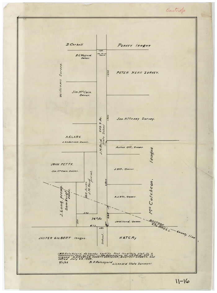
Bastrop County Rolled Sketch 2

Print $20.00
- Digital $50.00
Bastrop County Rolled Sketch 2
1979
Size: 26.3 x 18.4 inches
5123
Caldwell County Working Sketch 12

Print $20.00
- Digital $50.00
Caldwell County Working Sketch 12
1979
Size: 47.7 x 44.2 inches
67842
Caldwell County Working Sketch 11

Print $20.00
- Digital $50.00
Caldwell County Working Sketch 11
1979
Size: 21.6 x 26.6 inches
67841
Caldwell County Working Sketch 10

Print $40.00
- Digital $50.00
Caldwell County Working Sketch 10
1977
Size: 46.2 x 50.5 inches
67840
Caldwell County Working Sketch 9

Print $20.00
- Digital $50.00
Caldwell County Working Sketch 9
1968
Size: 33.5 x 30.7 inches
67839
Caldwell County Working Sketch 8

Print $20.00
- Digital $50.00
Caldwell County Working Sketch 8
1964
Size: 29.1 x 22.8 inches
67838
Travis County Working Sketch 53

Print $40.00
- Digital $50.00
Travis County Working Sketch 53
1964
Size: 42.7 x 53.0 inches
69437
General Highway Map, Caldwell County, Texas

Print $20.00
General Highway Map, Caldwell County, Texas
1961
Size: 18.3 x 24.6 inches
79394
Caldwell County Working Sketch 6

Print $20.00
- Digital $50.00
Caldwell County Working Sketch 6
1958
Size: 21.8 x 26.3 inches
67836
Caldwell County Working Sketch 7

Print $20.00
- Digital $50.00
Caldwell County Working Sketch 7
1958
Size: 29.7 x 37.2 inches
67837
Caldwell County Rolled Sketch 1

Print $20.00
- Digital $50.00
Caldwell County Rolled Sketch 1
1953
Size: 20.2 x 30.4 inches
10673
Bastrop County Sketch File 9

Print $40.00
- Digital $50.00
Bastrop County Sketch File 9
1943
Size: 46.5 x 20.6 inches
10320
Caldwell County Working Sketch 5

Print $20.00
- Digital $50.00
Caldwell County Working Sketch 5
1940
Size: 19.9 x 27.4 inches
67835
General Highway Map, Caldwell County, Texas

Print $20.00
General Highway Map, Caldwell County, Texas
1940
Size: 18.5 x 25.2 inches
79034
Bastrop County Working Sketch 8

Print $20.00
- Digital $50.00
Bastrop County Working Sketch 8
1937
Size: 23.9 x 43.1 inches
67308
Caldwell County Working Sketch Graphic Index

Print $20.00
- Digital $50.00
Caldwell County Working Sketch Graphic Index
1935
Size: 36.7 x 41.3 inches
76483
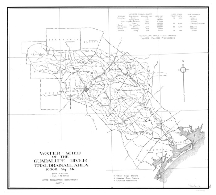
Guadalupe River, Watershed [of the Guadalupe River]
Print $6.00
- Digital $50.00
Guadalupe River, Watershed [of the Guadalupe River]
1925
Size: 30.1 x 33.4 inches
65059
Water-Shed of the Colorado River

Print $40.00
- Digital $50.00
Water-Shed of the Colorado River
1925
Size: 37.1 x 79.8 inches
65261
[Plat showing connecting lines for the purpose of locating 4.3 acres in Caldwell County]
Print $2.00
- Digital $50.00
[Plat showing connecting lines for the purpose of locating 4.3 acres in Caldwell County]
1923
Size: 7.4 x 10.2 inches
90220
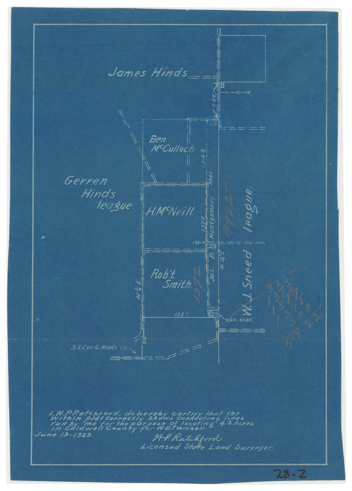
[Plat showing connecting lines for the purpose of locating 4.3 acres in Caldwell County]
Print $2.00
- Digital $50.00
[Plat showing connecting lines for the purpose of locating 4.3 acres in Caldwell County]
1923
Size: 7.0 x 10.0 inches
90221
[Subdivision surveys of the McCutcheon League near the Bastrop-Caldwell County Line]
Print $20.00
- Digital $50.00
[Subdivision surveys of the McCutcheon League near the Bastrop-Caldwell County Line]
1923
Size: 12.5 x 16.9 inches
90148
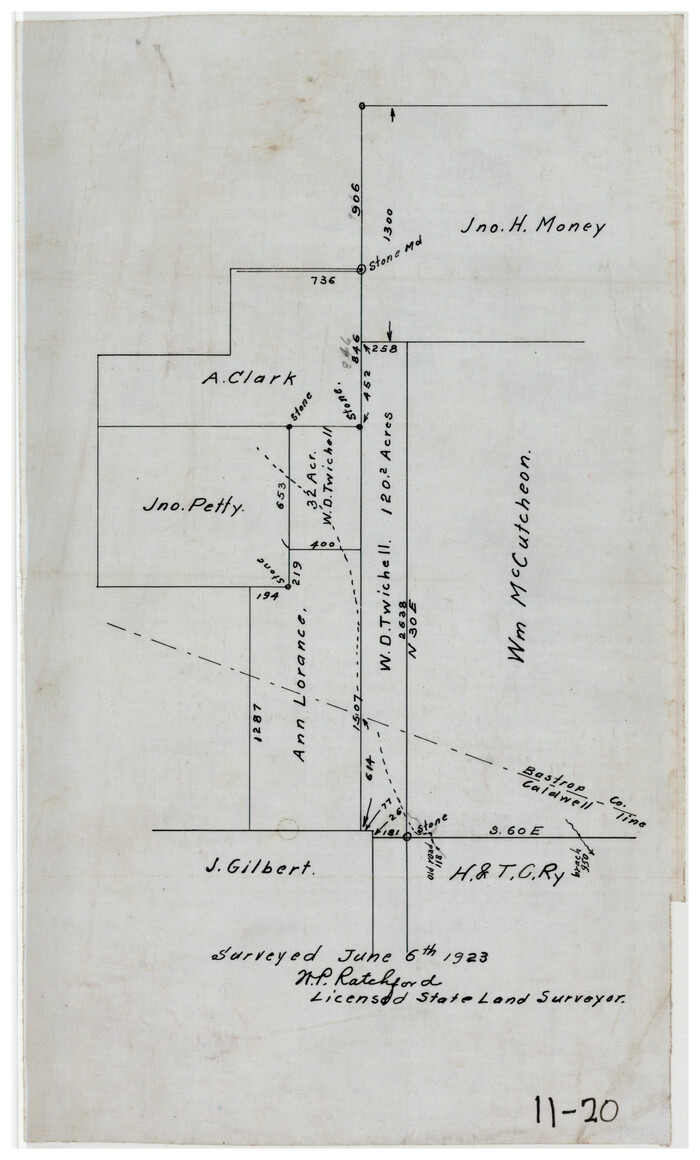
[Sketch showing vicinity of Wm. McCutcheon League near the Bastrop-Caldwell County Line]
Print $2.00
- Digital $50.00
[Sketch showing vicinity of Wm. McCutcheon League near the Bastrop-Caldwell County Line]
1923
Size: 7.7 x 12.9 inches
90144
Caldwell County Sketch File 6

Print $8.00
- Digital $50.00
Caldwell County Sketch File 6
1922
Size: 14.1 x 8.1 inches
35847
Caldwell County Working Sketch 4

Print $20.00
- Digital $50.00
Caldwell County Working Sketch 4
1922
Size: 46.1 x 43.5 inches
67834
Working Sketch in Caldwell County

Print $20.00
- Digital $50.00
Working Sketch in Caldwell County
1922
Size: 41.1 x 44.4 inches
89722
Caldwell County Working Sketch 13
Print $20.00
- Digital $50.00
Caldwell County Working Sketch 13
1987
-
Size
40.3 x 34.3 inches
-
Map/Doc
67843
-
Creation Date
1987
Bastrop County Rolled Sketch 2
Print $20.00
- Digital $50.00
Bastrop County Rolled Sketch 2
1979
-
Size
26.3 x 18.4 inches
-
Map/Doc
5123
-
Creation Date
1979
Caldwell County Working Sketch 12
Print $20.00
- Digital $50.00
Caldwell County Working Sketch 12
1979
-
Size
47.7 x 44.2 inches
-
Map/Doc
67842
-
Creation Date
1979
Caldwell County Working Sketch 11
Print $20.00
- Digital $50.00
Caldwell County Working Sketch 11
1979
-
Size
21.6 x 26.6 inches
-
Map/Doc
67841
-
Creation Date
1979
Caldwell County Working Sketch 10
Print $40.00
- Digital $50.00
Caldwell County Working Sketch 10
1977
-
Size
46.2 x 50.5 inches
-
Map/Doc
67840
-
Creation Date
1977
Caldwell County Working Sketch 9
Print $20.00
- Digital $50.00
Caldwell County Working Sketch 9
1968
-
Size
33.5 x 30.7 inches
-
Map/Doc
67839
-
Creation Date
1968
Caldwell County Working Sketch 8
Print $20.00
- Digital $50.00
Caldwell County Working Sketch 8
1964
-
Size
29.1 x 22.8 inches
-
Map/Doc
67838
-
Creation Date
1964
Travis County Working Sketch 53
Print $40.00
- Digital $50.00
Travis County Working Sketch 53
1964
-
Size
42.7 x 53.0 inches
-
Map/Doc
69437
-
Creation Date
1964
General Highway Map, Caldwell County, Texas
Print $20.00
General Highway Map, Caldwell County, Texas
1961
-
Size
18.3 x 24.6 inches
-
Map/Doc
79394
-
Creation Date
1961
Caldwell County Working Sketch 6
Print $20.00
- Digital $50.00
Caldwell County Working Sketch 6
1958
-
Size
21.8 x 26.3 inches
-
Map/Doc
67836
-
Creation Date
1958
Caldwell County Working Sketch 7
Print $20.00
- Digital $50.00
Caldwell County Working Sketch 7
1958
-
Size
29.7 x 37.2 inches
-
Map/Doc
67837
-
Creation Date
1958
Caldwell County Rolled Sketch 1
Print $20.00
- Digital $50.00
Caldwell County Rolled Sketch 1
1953
-
Size
20.2 x 30.4 inches
-
Map/Doc
10673
-
Creation Date
1953
Bastrop County Sketch File 9
Print $40.00
- Digital $50.00
Bastrop County Sketch File 9
1943
-
Size
46.5 x 20.6 inches
-
Map/Doc
10320
-
Creation Date
1943
Caldwell County Working Sketch 5
Print $20.00
- Digital $50.00
Caldwell County Working Sketch 5
1940
-
Size
19.9 x 27.4 inches
-
Map/Doc
67835
-
Creation Date
1940
General Highway Map, Caldwell County, Texas
Print $20.00
General Highway Map, Caldwell County, Texas
1940
-
Size
18.5 x 25.2 inches
-
Map/Doc
79034
-
Creation Date
1940
Bastrop County Working Sketch 8
Print $20.00
- Digital $50.00
Bastrop County Working Sketch 8
1937
-
Size
23.9 x 43.1 inches
-
Map/Doc
67308
-
Creation Date
1937
Caldwell County

Print $20.00
- Digital $50.00
Caldwell County
1935
-
Size
37.8 x 42.0 inches
-
Map/Doc
73095
-
Creation Date
1935
Caldwell County

Print $20.00
- Digital $50.00
Caldwell County
1935
-
Size
38.7 x 42.7 inches
-
Map/Doc
95444
-
Creation Date
1935
Caldwell County

Print $20.00
- Digital $50.00
Caldwell County
1935
-
Size
39.6 x 43.7 inches
-
Map/Doc
1791
-
Creation Date
1935
Caldwell County

Print $20.00
- Digital $50.00
Caldwell County
1935
-
Size
36.1 x 40.3 inches
-
Map/Doc
77227
-
Creation Date
1935
Caldwell County Working Sketch Graphic Index
Print $20.00
- Digital $50.00
Caldwell County Working Sketch Graphic Index
1935
-
Size
36.7 x 41.3 inches
-
Map/Doc
76483
-
Creation Date
1935
Guadalupe River, Watershed [of the Guadalupe River]
Print $6.00
- Digital $50.00
Guadalupe River, Watershed [of the Guadalupe River]
1925
-
Size
30.1 x 33.4 inches
-
Map/Doc
65059
-
Creation Date
1925
Water-Shed of the Colorado River
Print $40.00
- Digital $50.00
Water-Shed of the Colorado River
1925
-
Size
37.1 x 79.8 inches
-
Map/Doc
65261
-
Creation Date
1925
[Plat showing connecting lines for the purpose of locating 4.3 acres in Caldwell County]
Print $2.00
- Digital $50.00
[Plat showing connecting lines for the purpose of locating 4.3 acres in Caldwell County]
1923
-
Size
7.4 x 10.2 inches
-
Map/Doc
90220
-
Creation Date
1923
[Plat showing connecting lines for the purpose of locating 4.3 acres in Caldwell County]
Print $2.00
- Digital $50.00
[Plat showing connecting lines for the purpose of locating 4.3 acres in Caldwell County]
1923
-
Size
7.0 x 10.0 inches
-
Map/Doc
90221
-
Creation Date
1923
[Subdivision surveys of the McCutcheon League near the Bastrop-Caldwell County Line]
Print $20.00
- Digital $50.00
[Subdivision surveys of the McCutcheon League near the Bastrop-Caldwell County Line]
1923
-
Size
12.5 x 16.9 inches
-
Map/Doc
90148
-
Creation Date
1923
[Sketch showing vicinity of Wm. McCutcheon League near the Bastrop-Caldwell County Line]
Print $2.00
- Digital $50.00
[Sketch showing vicinity of Wm. McCutcheon League near the Bastrop-Caldwell County Line]
1923
-
Size
7.7 x 12.9 inches
-
Map/Doc
90144
-
Creation Date
1923
Caldwell County Sketch File 6
Print $8.00
- Digital $50.00
Caldwell County Sketch File 6
1922
-
Size
14.1 x 8.1 inches
-
Map/Doc
35847
-
Creation Date
1922
Caldwell County Working Sketch 4
Print $20.00
- Digital $50.00
Caldwell County Working Sketch 4
1922
-
Size
46.1 x 43.5 inches
-
Map/Doc
67834
-
Creation Date
1922
Working Sketch in Caldwell County
Print $20.00
- Digital $50.00
Working Sketch in Caldwell County
1922
-
Size
41.1 x 44.4 inches
-
Map/Doc
89722
-
Creation Date
1922