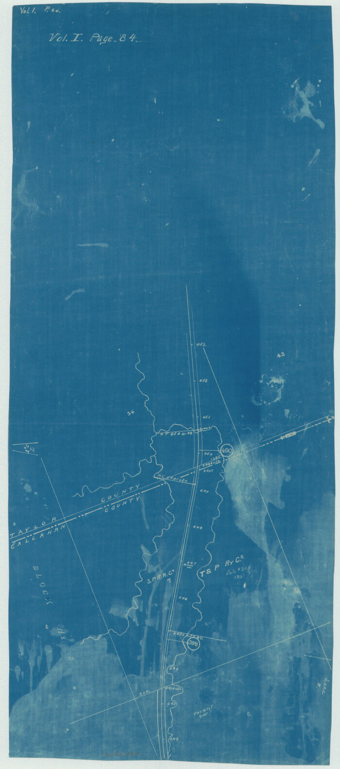
[Texas Central Railway through Callahan County]
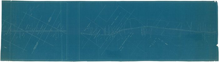
Print $40.00
- Digital $50.00
[Texas Central Railway through Callahan County]
Size: 24.6 x 86.3 inches
64240
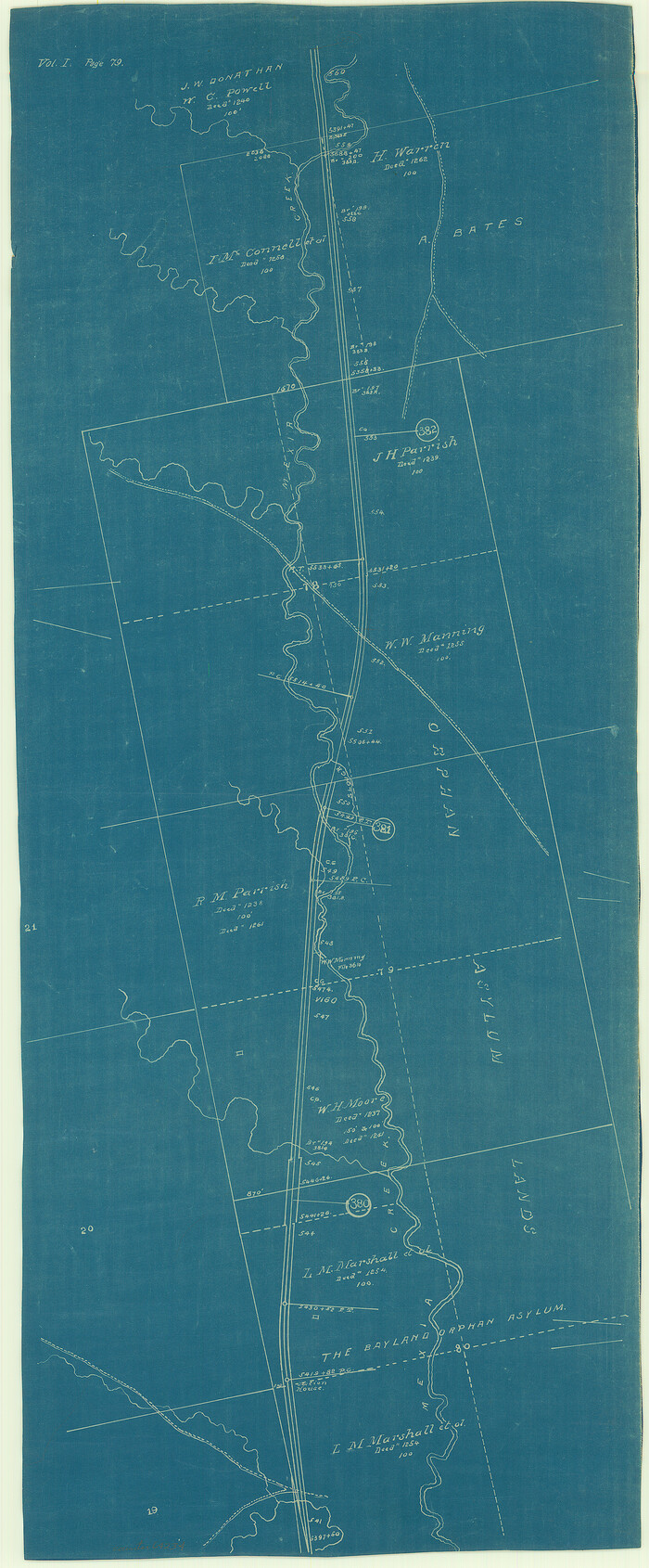
[Texas & Pacific Railway through Callahan County]
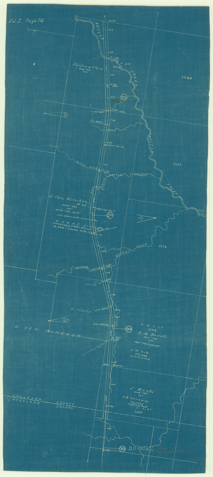
Print $20.00
- Digital $50.00
[Texas & Pacific Railway through Callahan County]
1918
Size: 21.2 x 9.5 inches
64231
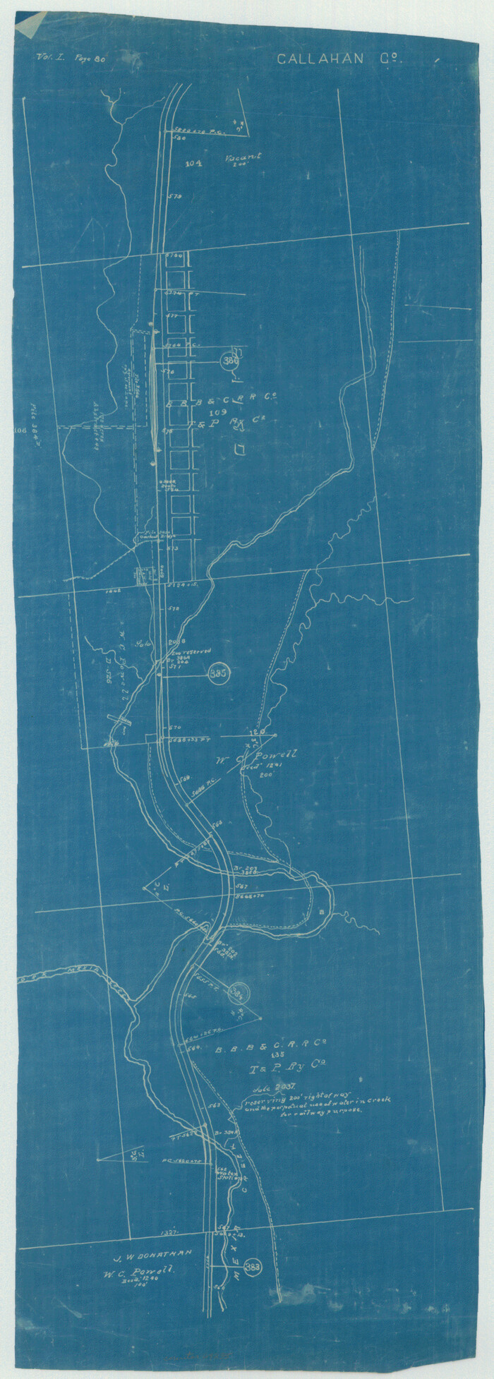
[Texas & Pacific Railway through Callahan County]
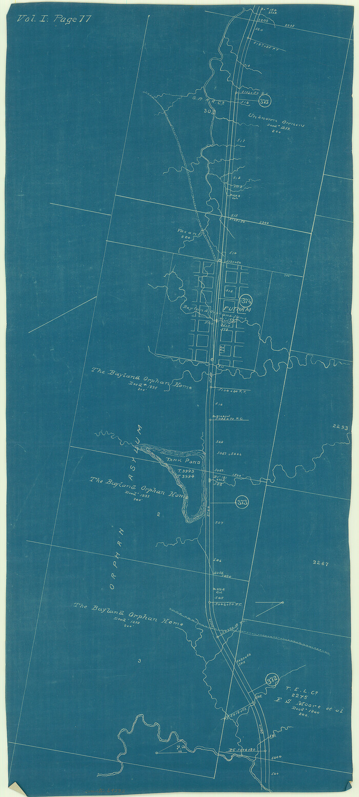
Print $20.00
- Digital $50.00
[Texas & Pacific Railway through Callahan County]
1918
Size: 20.8 x 9.4 inches
64232
[Texas & Pacific Railway through Callahan County]
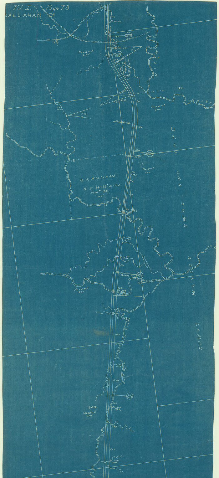
Print $20.00
- Digital $50.00
[Texas & Pacific Railway through Callahan County]
1918
Size: 20.5 x 9.4 inches
64233
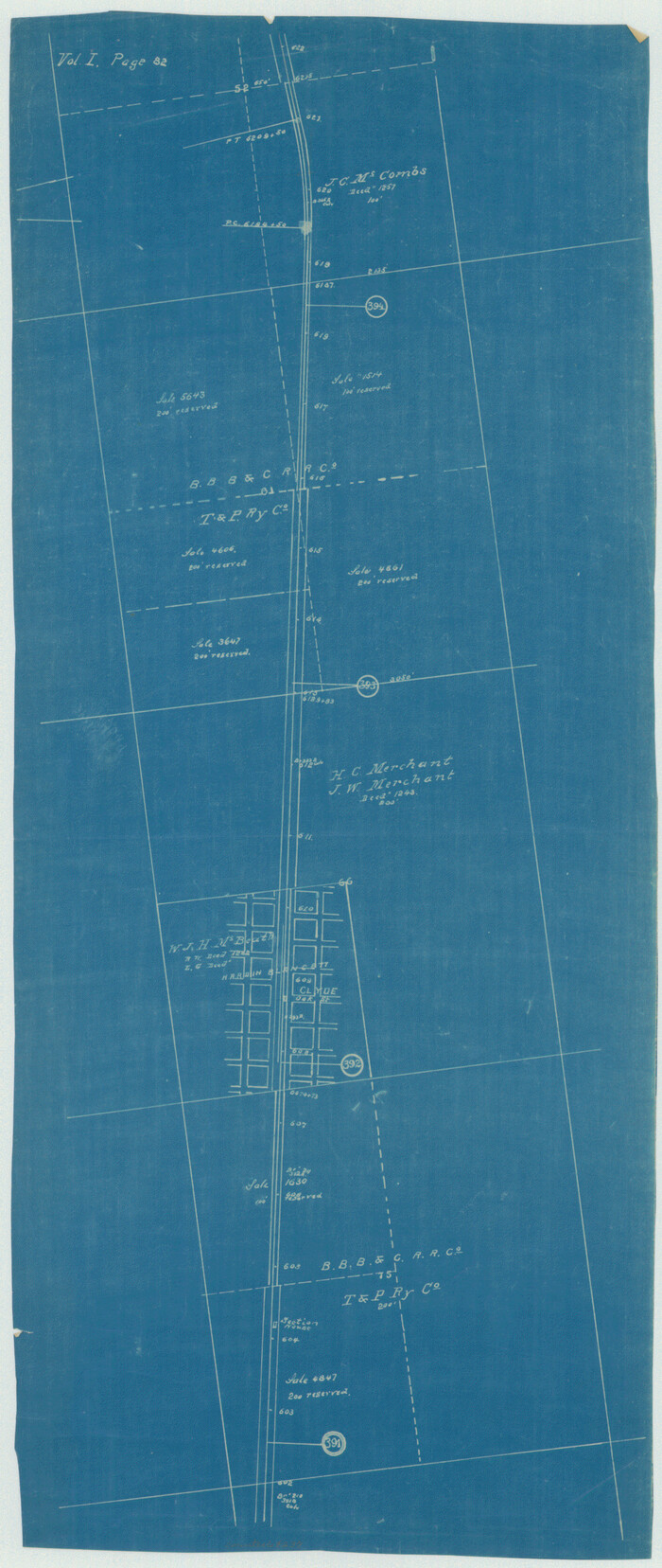
[Texas & Pacific Railway through Callahan County]
Print $20.00
- Digital $50.00
[Texas & Pacific Railway through Callahan County]
1918
Size: 21.3 x 8.8 inches
64234
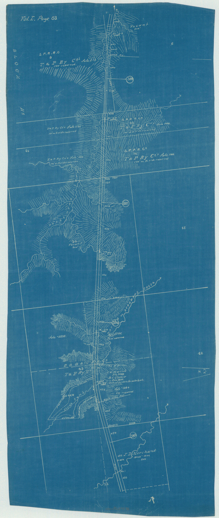
[Texas & Pacific Railway through Callahan County]
Print $20.00
- Digital $50.00
[Texas & Pacific Railway through Callahan County]
1918
Size: 23.2 x 8.3 inches
64235
[Texas & Pacific Railway through Callahan County]

Print $20.00
- Digital $50.00
[Texas & Pacific Railway through Callahan County]
1918
Size: 22.9 x 8.8 inches
64236
[Texas & Pacific Railway through Callahan County]
Print $20.00
- Digital $50.00
[Texas & Pacific Railway through Callahan County]
1918
Size: 21.8 x 9.2 inches
64237
[Texas & Pacific Railway through Callahan County]
Print $20.00
- Digital $50.00
[Texas & Pacific Railway through Callahan County]
1918
Size: 22.4 x 9.4 inches
64238
[Texas & Pacific Railway through Callahan County]
Print $20.00
- Digital $50.00
[Texas & Pacific Railway through Callahan County]
1918
Size: 21.1 x 9.3 inches
64239
[Sketch of expeditions, trails in Jones, Taylor, Shackelford, Callahan, Buchanan/Stephens and Eastland Counties]
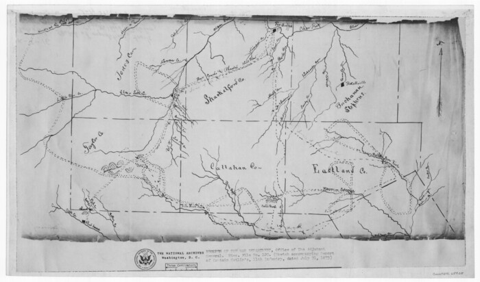
Print $4.00
- Digital $50.00
[Sketch of expeditions, trails in Jones, Taylor, Shackelford, Callahan, Buchanan/Stephens and Eastland Counties]
1873
Size: 10.8 x 18.3 inches
65405
[Map of a portion of Bexar and Travis Districts]
Print $20.00
- Digital $50.00
[Map of a portion of Bexar and Travis Districts]
Size: 47.5 x 47.2 inches
16943
[Map of Texas and Pacific Blocks from Brazos River westward through Palo Pinto, Stephens, Shackelford, Jones, Callahan, Taylor, Fisher, Nolan and Mitchell Counties]
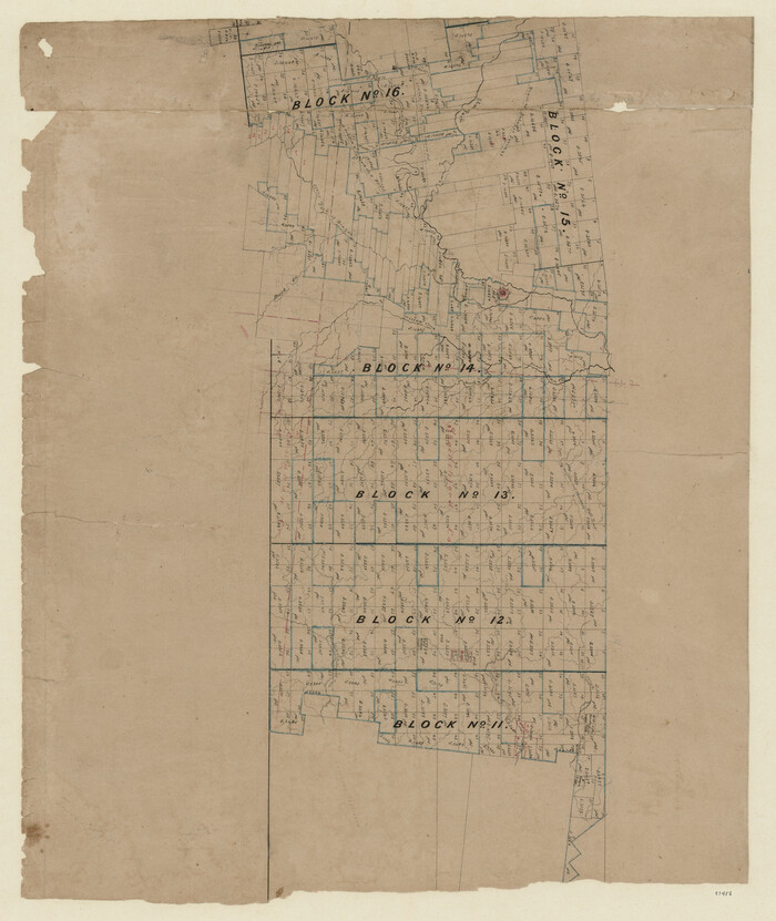
Print $20.00
- Digital $50.00
[Map of Texas and Pacific Blocks from Brazos River westward through Palo Pinto, Stephens, Shackelford, Jones, Callahan, Taylor, Fisher, Nolan and Mitchell Counties]
Size: 22.0 x 18.5 inches
93456
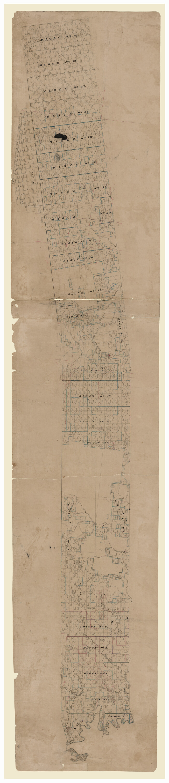
[Map of Texas and Pacific Blocks from Brazos River westward through Palo Pinto, Stephens, Shackelford, Jones, Callahan, Taylor, Fisher, Nolan and Mitchell Counties]
Print $40.00
- Digital $50.00
[Map of Texas and Pacific Blocks from Brazos River westward through Palo Pinto, Stephens, Shackelford, Jones, Callahan, Taylor, Fisher, Nolan and Mitchell Counties]
Size: 87.1 x 18.8 inches
93460
[Area to the West and North of the Abraham Winfrey survey 11]
Print $20.00
- Digital $50.00
[Area to the West and North of the Abraham Winfrey survey 11]
1920
Size: 25.7 x 22.5 inches
90222
[Area to the West and North of the Abraham Winfrey survey 11]
Print $20.00
- Digital $50.00
[Area to the West and North of the Abraham Winfrey survey 11]
1920
Size: 23.2 x 24.1 inches
90228
[Area to the West and North of the Abraham Winfrey survey 11]
Print $20.00
- Digital $50.00
[Area to the West and North of the Abraham Winfrey survey 11]
Size: 16.9 x 14.7 inches
92117
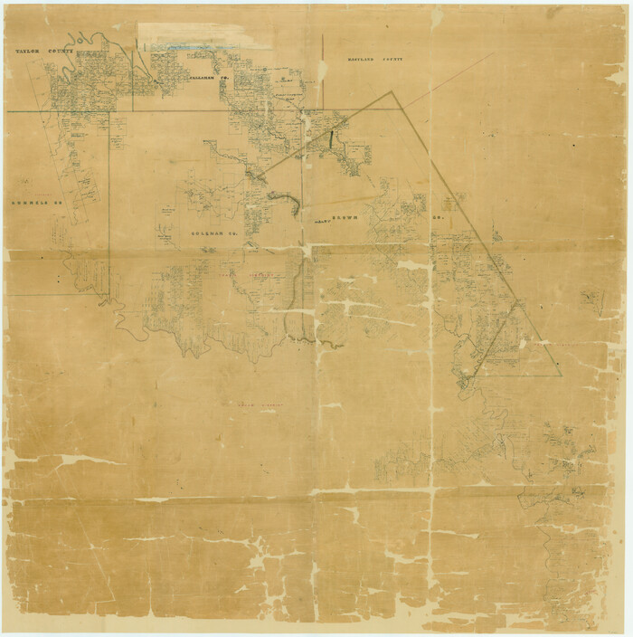
Water-Shed of the Colorado River

Print $40.00
- Digital $50.00
Water-Shed of the Colorado River
1925
Size: 37.1 x 79.8 inches
65261
Taylor County Working Sketch 7

Print $20.00
- Digital $50.00
Taylor County Working Sketch 7
1953
Size: 41.3 x 16.1 inches
69617
Taylor County Sketch File A1

Print $40.00
- Digital $50.00
Taylor County Sketch File A1
Size: 12.8 x 14.3 inches
37774
Shackelford County Sketch File 4

Print $40.00
- Digital $50.00
Shackelford County Sketch File 4
Size: 38.5 x 53.7 inches
10600
Shackelford County Sketch File 2

Print $4.00
- Digital $50.00
Shackelford County Sketch File 2
1870
Size: 9.3 x 9.0 inches
36572
Pecan Bayou Travis District

Print $20.00
- Digital $50.00
Pecan Bayou Travis District
1852
Size: 25.8 x 20.5 inches
4518
Map of the Texas & Pacific Railway from Fort Worth to El Paso

Print $40.00
- Digital $50.00
Map of the Texas & Pacific Railway from Fort Worth to El Paso
Size: 24.0 x 76.5 inches
64511
Map of University Land in Shackelford and Callahan Counties

Print $20.00
- Digital $50.00
Map of University Land in Shackelford and Callahan Counties
1905
Size: 33.4 x 25.3 inches
2435
Map of The Surveyed Part of Peters Colony Texas

Print $40.00
- Digital $50.00
Map of The Surveyed Part of Peters Colony Texas
1854
Size: 53.5 x 65.9 inches
1967
Map of Callahan County, Texas

Print $20.00
- Digital $50.00
Map of Callahan County, Texas
1879
Size: 24.6 x 19.6 inches
4337
Map of Callahan County

Print $20.00
- Digital $50.00
Map of Callahan County
1859
Size: 24.5 x 19.4 inches
3360
Map of Callahan County

Print $20.00
- Digital $50.00
Map of Callahan County
1878
Size: 23.0 x 18.8 inches
3361
Map of Callahan County

Print $20.00
- Digital $50.00
Map of Callahan County
1896
Size: 22.9 x 19.0 inches
3363
[Texas Central Railway through Callahan County]
Print $40.00
- Digital $50.00
[Texas Central Railway through Callahan County]
-
Size
24.6 x 86.3 inches
-
Map/Doc
64240
[Texas & Pacific Railway through Callahan County]
Print $20.00
- Digital $50.00
[Texas & Pacific Railway through Callahan County]
1918
-
Size
21.2 x 9.5 inches
-
Map/Doc
64231
-
Creation Date
1918
[Texas & Pacific Railway through Callahan County]
Print $20.00
- Digital $50.00
[Texas & Pacific Railway through Callahan County]
1918
-
Size
20.8 x 9.4 inches
-
Map/Doc
64232
-
Creation Date
1918
[Texas & Pacific Railway through Callahan County]
Print $20.00
- Digital $50.00
[Texas & Pacific Railway through Callahan County]
1918
-
Size
20.5 x 9.4 inches
-
Map/Doc
64233
-
Creation Date
1918
[Texas & Pacific Railway through Callahan County]
Print $20.00
- Digital $50.00
[Texas & Pacific Railway through Callahan County]
1918
-
Size
21.3 x 8.8 inches
-
Map/Doc
64234
-
Creation Date
1918
[Texas & Pacific Railway through Callahan County]
Print $20.00
- Digital $50.00
[Texas & Pacific Railway through Callahan County]
1918
-
Size
23.2 x 8.3 inches
-
Map/Doc
64235
-
Creation Date
1918
[Texas & Pacific Railway through Callahan County]
Print $20.00
- Digital $50.00
[Texas & Pacific Railway through Callahan County]
1918
-
Size
22.9 x 8.8 inches
-
Map/Doc
64236
-
Creation Date
1918
[Texas & Pacific Railway through Callahan County]
Print $20.00
- Digital $50.00
[Texas & Pacific Railway through Callahan County]
1918
-
Size
21.8 x 9.2 inches
-
Map/Doc
64237
-
Creation Date
1918
[Texas & Pacific Railway through Callahan County]
Print $20.00
- Digital $50.00
[Texas & Pacific Railway through Callahan County]
1918
-
Size
22.4 x 9.4 inches
-
Map/Doc
64238
-
Creation Date
1918
[Texas & Pacific Railway through Callahan County]
Print $20.00
- Digital $50.00
[Texas & Pacific Railway through Callahan County]
1918
-
Size
21.1 x 9.3 inches
-
Map/Doc
64239
-
Creation Date
1918
[Sketch of expeditions, trails in Jones, Taylor, Shackelford, Callahan, Buchanan/Stephens and Eastland Counties]
Print $4.00
- Digital $50.00
[Sketch of expeditions, trails in Jones, Taylor, Shackelford, Callahan, Buchanan/Stephens and Eastland Counties]
1873
-
Size
10.8 x 18.3 inches
-
Map/Doc
65405
-
Creation Date
1873
[Map of a portion of Bexar and Travis Districts]
Print $20.00
- Digital $50.00
[Map of a portion of Bexar and Travis Districts]
-
Size
47.5 x 47.2 inches
-
Map/Doc
16943
[Map of Texas and Pacific Blocks from Brazos River westward through Palo Pinto, Stephens, Shackelford, Jones, Callahan, Taylor, Fisher, Nolan and Mitchell Counties]
Print $20.00
- Digital $50.00
[Map of Texas and Pacific Blocks from Brazos River westward through Palo Pinto, Stephens, Shackelford, Jones, Callahan, Taylor, Fisher, Nolan and Mitchell Counties]
-
Size
22.0 x 18.5 inches
-
Map/Doc
93456
[Map of Texas and Pacific Blocks from Brazos River westward through Palo Pinto, Stephens, Shackelford, Jones, Callahan, Taylor, Fisher, Nolan and Mitchell Counties]
Print $40.00
- Digital $50.00
[Map of Texas and Pacific Blocks from Brazos River westward through Palo Pinto, Stephens, Shackelford, Jones, Callahan, Taylor, Fisher, Nolan and Mitchell Counties]
-
Size
87.1 x 18.8 inches
-
Map/Doc
93460
[Area to the West and North of the Abraham Winfrey survey 11]
Print $20.00
- Digital $50.00
[Area to the West and North of the Abraham Winfrey survey 11]
1920
-
Size
25.7 x 22.5 inches
-
Map/Doc
90222
-
Creation Date
1920
[Area to the West and North of the Abraham Winfrey survey 11]
Print $20.00
- Digital $50.00
[Area to the West and North of the Abraham Winfrey survey 11]
1920
-
Size
23.2 x 24.1 inches
-
Map/Doc
90228
-
Creation Date
1920
[Area to the West and North of the Abraham Winfrey survey 11]
Print $20.00
- Digital $50.00
[Area to the West and North of the Abraham Winfrey survey 11]
-
Size
16.9 x 14.7 inches
-
Map/Doc
92117
Water-Shed of the Colorado River
Print $40.00
- Digital $50.00
Water-Shed of the Colorado River
1925
-
Size
37.1 x 79.8 inches
-
Map/Doc
65261
-
Creation Date
1925
Taylor County Working Sketch 7
Print $20.00
- Digital $50.00
Taylor County Working Sketch 7
1953
-
Size
41.3 x 16.1 inches
-
Map/Doc
69617
-
Creation Date
1953
Taylor County Sketch File A1
Print $40.00
- Digital $50.00
Taylor County Sketch File A1
-
Size
12.8 x 14.3 inches
-
Map/Doc
37774
Shackelford County Sketch File 4
Print $40.00
- Digital $50.00
Shackelford County Sketch File 4
-
Size
38.5 x 53.7 inches
-
Map/Doc
10600
Shackelford County Sketch File 2
Print $4.00
- Digital $50.00
Shackelford County Sketch File 2
1870
-
Size
9.3 x 9.0 inches
-
Map/Doc
36572
-
Creation Date
1870
Pecan Bayou Travis District
Print $20.00
- Digital $50.00
Pecan Bayou Travis District
1852
-
Size
25.8 x 20.5 inches
-
Map/Doc
4518
-
Creation Date
1852
Map of the Texas & Pacific Railway from Fort Worth to El Paso
Print $40.00
- Digital $50.00
Map of the Texas & Pacific Railway from Fort Worth to El Paso
-
Size
24.0 x 76.5 inches
-
Map/Doc
64511
Map of University Land in Shackelford and Callahan Counties
Print $20.00
- Digital $50.00
Map of University Land in Shackelford and Callahan Counties
1905
-
Size
33.4 x 25.3 inches
-
Map/Doc
2435
-
Creation Date
1905
Map of The Surveyed Part of Peters Colony Texas
Print $40.00
- Digital $50.00
Map of The Surveyed Part of Peters Colony Texas
1854
-
Size
53.5 x 65.9 inches
-
Map/Doc
1967
-
Creation Date
1854
Map of Callahan County, Texas
Print $20.00
- Digital $50.00
Map of Callahan County, Texas
1879
-
Size
24.6 x 19.6 inches
-
Map/Doc
4337
-
Creation Date
1879
Map of Callahan County
Print $20.00
- Digital $50.00
Map of Callahan County
1859
-
Size
24.5 x 19.4 inches
-
Map/Doc
3360
-
Creation Date
1859
Map of Callahan County
Print $20.00
- Digital $50.00
Map of Callahan County
1878
-
Size
23.0 x 18.8 inches
-
Map/Doc
3361
-
Creation Date
1878
Map of Callahan County
Print $20.00
- Digital $50.00
Map of Callahan County
1896
-
Size
22.9 x 19.0 inches
-
Map/Doc
3363
-
Creation Date
1896