Land Grant Map of Comal County

Print $20.00
- Digital $50.00
Land Grant Map of Comal County
2006
Size: 33.3 x 41.0 inches
83601
Comal County State Real Property Sketch 1

Print $134.00
- Digital $50.00
Comal County State Real Property Sketch 1
2006
Size: 23.8 x 35.4 inches
88635
Comal County Working Sketch 19

Print $20.00
- Digital $50.00
Comal County Working Sketch 19
2006
Size: 18.8 x 29.0 inches
83094
Comal County Working Sketch 18

Print $20.00
- Digital $50.00
Comal County Working Sketch 18
2000
Size: 32.0 x 31.7 inches
68182
Hays County Working Sketch 22

Print $20.00
- Digital $50.00
Hays County Working Sketch 22
2000
Size: 47.1 x 36.9 inches
76051
Comal County Working Sketch 15

Print $20.00
- Digital $50.00
Comal County Working Sketch 15
1994
Size: 44.6 x 31.0 inches
68181
Comal County Working Sketch 14

Print $40.00
- Digital $50.00
Comal County Working Sketch 14
1992
Size: 25.4 x 49.9 inches
68180
Comal County Rolled Sketch 6

Print $4.00
- Digital $50.00
Comal County Rolled Sketch 6
1988
Size: 25.0 x 19.1 inches
5541
Comal County Working Sketch 13

Print $20.00
- Digital $50.00
Comal County Working Sketch 13
1988
Size: 32.6 x 21.3 inches
68179
Comal County Working Sketch 12

Print $20.00
- Digital $50.00
Comal County Working Sketch 12
1987
Size: 31.1 x 29.6 inches
68178
Comal County Rolled Sketch 5

Print $20.00
- Digital $50.00
Comal County Rolled Sketch 5
1985
Size: 30.6 x 26.7 inches
5540
Comal County Rolled Sketch 4

Print $20.00
- Digital $50.00
Comal County Rolled Sketch 4
1981
Size: 18.8 x 24.5 inches
5539
Comal County Working Sketch 11

Print $20.00
- Digital $50.00
Comal County Working Sketch 11
1978
Size: 33.2 x 35.2 inches
68177
Comal County Rolled Sketch 3

Print $20.00
- Digital $50.00
Comal County Rolled Sketch 3
1977
Size: 19.0 x 17.3 inches
5538
Comal County Rolled Sketch 2

Print $20.00
- Digital $50.00
Comal County Rolled Sketch 2
1974
Size: 21.8 x 13.3 inches
5537
Comal County Working Sketch 10

Print $20.00
- Digital $50.00
Comal County Working Sketch 10
1974
Size: 28.8 x 27.9 inches
68176
Comal County Rolled Sketch 1

Print $20.00
- Digital $50.00
Comal County Rolled Sketch 1
1972
Size: 24.2 x 19.6 inches
5535
Comal County Working Sketch 9

Print $20.00
- Digital $50.00
Comal County Working Sketch 9
1972
Size: 29.0 x 30.4 inches
68175
Comal County Working Sketch 8

Print $20.00
- Digital $50.00
Comal County Working Sketch 8
1971
Size: 41.6 x 25.6 inches
68174
General Highway Map, Comal County, Texas

Print $20.00
General Highway Map, Comal County, Texas
1961
Size: 18.2 x 25.0 inches
79417
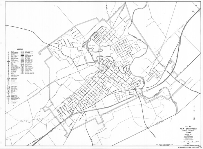
General Highway Map. Detail of Cities and Towns in Comal County, Texas. City Map [of] New Braunfels, Comal County, Texas
Print $20.00
General Highway Map. Detail of Cities and Towns in Comal County, Texas. City Map [of] New Braunfels, Comal County, Texas
1961
Size: 18.1 x 24.6 inches
79418
Guadalupe County Sketch File 22

Print $20.00
- Digital $50.00
Guadalupe County Sketch File 22
1957
Size: 16.2 x 16.5 inches
11591
Comal County Sketch File 21

Print $21.00
- Digital $50.00
Comal County Sketch File 21
1950
Size: 9.1 x 11.4 inches
19041
Comal County Working Sketch 7

Print $20.00
- Digital $50.00
Comal County Working Sketch 7
1950
Size: 42.1 x 31.8 inches
68173
Comal County Working Sketch 5

Print $20.00
- Digital $50.00
Comal County Working Sketch 5
1950
Size: 19.0 x 21.4 inches
68171
Comal County Working Sketch 6

Print $20.00
- Digital $50.00
Comal County Working Sketch 6
1950
Size: 25.1 x 24.2 inches
68172
Comal County Working Sketch 4

Print $20.00
- Digital $50.00
Comal County Working Sketch 4
1950
Size: 38.3 x 24.3 inches
68170
[Plat of Boundary Line between Comal and Hays Counties]
![65328, [Plat of Boundary Line between Comal and Hays Counties], General Map Collection](https://historictexasmaps.com/wmedia_w700/pdf_converted_jpg/qi_pdf_thumbnail_19768.jpg)
Print $20.00
- Digital $50.00
[Plat of Boundary Line between Comal and Hays Counties]
1947
Size: 11.4 x 17.7 inches
65328
Hays County Boundary File

Print $120.00
- Digital $50.00
Hays County Boundary File
1947
Size: 33.6 x 20.8 inches
65496
Texas Hill Country Trail Region

Texas Hill Country Trail Region
2017
-
Size
18.2 x 24.3 inches
-
Map/Doc
96871
-
Creation Date
2017
Land Grant Map of Comal County
Print $20.00
- Digital $50.00
Land Grant Map of Comal County
2006
-
Size
33.3 x 41.0 inches
-
Map/Doc
83601
-
Creation Date
2006
Comal County State Real Property Sketch 1
Print $134.00
- Digital $50.00
Comal County State Real Property Sketch 1
2006
-
Size
23.8 x 35.4 inches
-
Map/Doc
88635
-
Creation Date
2006
Comal County Working Sketch 19
Print $20.00
- Digital $50.00
Comal County Working Sketch 19
2006
-
Size
18.8 x 29.0 inches
-
Map/Doc
83094
-
Creation Date
2006
Comal County Working Sketch 18
Print $20.00
- Digital $50.00
Comal County Working Sketch 18
2000
-
Size
32.0 x 31.7 inches
-
Map/Doc
68182
-
Creation Date
2000
Hays County Working Sketch 22
Print $20.00
- Digital $50.00
Hays County Working Sketch 22
2000
-
Size
47.1 x 36.9 inches
-
Map/Doc
76051
-
Creation Date
2000
Comal County Working Sketch 15
Print $20.00
- Digital $50.00
Comal County Working Sketch 15
1994
-
Size
44.6 x 31.0 inches
-
Map/Doc
68181
-
Creation Date
1994
Comal County Working Sketch 14
Print $40.00
- Digital $50.00
Comal County Working Sketch 14
1992
-
Size
25.4 x 49.9 inches
-
Map/Doc
68180
-
Creation Date
1992
Comal County Rolled Sketch 6
Print $4.00
- Digital $50.00
Comal County Rolled Sketch 6
1988
-
Size
25.0 x 19.1 inches
-
Map/Doc
5541
-
Creation Date
1988
Comal County Working Sketch 13
Print $20.00
- Digital $50.00
Comal County Working Sketch 13
1988
-
Size
32.6 x 21.3 inches
-
Map/Doc
68179
-
Creation Date
1988
Comal County Working Sketch 12
Print $20.00
- Digital $50.00
Comal County Working Sketch 12
1987
-
Size
31.1 x 29.6 inches
-
Map/Doc
68178
-
Creation Date
1987
Comal County Rolled Sketch 5
Print $20.00
- Digital $50.00
Comal County Rolled Sketch 5
1985
-
Size
30.6 x 26.7 inches
-
Map/Doc
5540
-
Creation Date
1985
Comal County Rolled Sketch 4
Print $20.00
- Digital $50.00
Comal County Rolled Sketch 4
1981
-
Size
18.8 x 24.5 inches
-
Map/Doc
5539
-
Creation Date
1981
Comal County Working Sketch 11
Print $20.00
- Digital $50.00
Comal County Working Sketch 11
1978
-
Size
33.2 x 35.2 inches
-
Map/Doc
68177
-
Creation Date
1978
Comal County Rolled Sketch 3
Print $20.00
- Digital $50.00
Comal County Rolled Sketch 3
1977
-
Size
19.0 x 17.3 inches
-
Map/Doc
5538
-
Creation Date
1977
Comal County Rolled Sketch 2
Print $20.00
- Digital $50.00
Comal County Rolled Sketch 2
1974
-
Size
21.8 x 13.3 inches
-
Map/Doc
5537
-
Creation Date
1974
Comal County Working Sketch 10
Print $20.00
- Digital $50.00
Comal County Working Sketch 10
1974
-
Size
28.8 x 27.9 inches
-
Map/Doc
68176
-
Creation Date
1974
Comal County Rolled Sketch 1
Print $20.00
- Digital $50.00
Comal County Rolled Sketch 1
1972
-
Size
24.2 x 19.6 inches
-
Map/Doc
5535
-
Creation Date
1972
Comal County Working Sketch 9
Print $20.00
- Digital $50.00
Comal County Working Sketch 9
1972
-
Size
29.0 x 30.4 inches
-
Map/Doc
68175
-
Creation Date
1972
Comal County Working Sketch 8
Print $20.00
- Digital $50.00
Comal County Working Sketch 8
1971
-
Size
41.6 x 25.6 inches
-
Map/Doc
68174
-
Creation Date
1971
General Highway Map, Comal County, Texas
Print $20.00
General Highway Map, Comal County, Texas
1961
-
Size
18.2 x 25.0 inches
-
Map/Doc
79417
-
Creation Date
1961
General Highway Map. Detail of Cities and Towns in Comal County, Texas. City Map [of] New Braunfels, Comal County, Texas
Print $20.00
General Highway Map. Detail of Cities and Towns in Comal County, Texas. City Map [of] New Braunfels, Comal County, Texas
1961
-
Size
18.1 x 24.6 inches
-
Map/Doc
79418
-
Creation Date
1961
Guadalupe County Sketch File 22
Print $20.00
- Digital $50.00
Guadalupe County Sketch File 22
1957
-
Size
16.2 x 16.5 inches
-
Map/Doc
11591
-
Creation Date
1957
Comal County Sketch File 21
Print $21.00
- Digital $50.00
Comal County Sketch File 21
1950
-
Size
9.1 x 11.4 inches
-
Map/Doc
19041
-
Creation Date
1950
Comal County Working Sketch 7
Print $20.00
- Digital $50.00
Comal County Working Sketch 7
1950
-
Size
42.1 x 31.8 inches
-
Map/Doc
68173
-
Creation Date
1950
Comal County Working Sketch 5
Print $20.00
- Digital $50.00
Comal County Working Sketch 5
1950
-
Size
19.0 x 21.4 inches
-
Map/Doc
68171
-
Creation Date
1950
Comal County Working Sketch 6
Print $20.00
- Digital $50.00
Comal County Working Sketch 6
1950
-
Size
25.1 x 24.2 inches
-
Map/Doc
68172
-
Creation Date
1950
Comal County Working Sketch 4
Print $20.00
- Digital $50.00
Comal County Working Sketch 4
1950
-
Size
38.3 x 24.3 inches
-
Map/Doc
68170
-
Creation Date
1950
[Plat of Boundary Line between Comal and Hays Counties]
Print $20.00
- Digital $50.00
[Plat of Boundary Line between Comal and Hays Counties]
1947
-
Size
11.4 x 17.7 inches
-
Map/Doc
65328
-
Creation Date
1947
Hays County Boundary File
Print $120.00
- Digital $50.00
Hays County Boundary File
1947
-
Size
33.6 x 20.8 inches
-
Map/Doc
65496
-
Creation Date
1947