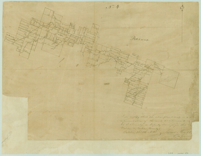
[Surveys in the Milam District along the Leon River]
Print $20.00
- Digital $50.00
[Surveys in the Milam District along the Leon River]
1845
Size: 12.0 x 15.4 inches
272
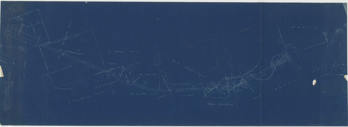
[Fort Worth & Rio Grande Ry.] Map, Tracings of Located Line, Dublin to Comanche
Print $20.00
- Digital $50.00
[Fort Worth & Rio Grande Ry.] Map, Tracings of Located Line, Dublin to Comanche
Size: 15.3 x 41.6 inches
64353
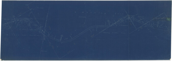
[Fort Worth & Rio Grande Ry.]
Print $20.00
- Digital $50.00
[Fort Worth & Rio Grande Ry.]
Size: 15.2 x 43.0 inches
64354
Surveys in the Milam District at the fork of the Yegua and Brazos Rivers and on the Leon River

Print $2.00
- Digital $50.00
Surveys in the Milam District at the fork of the Yegua and Brazos Rivers and on the Leon River
1846
Size: 9.2 x 16.0 inches
254
Plat of 39 7/10 Acres of Land Owned by W. D. Twichell

Print $2.00
- Digital $50.00
Plat of 39 7/10 Acres of Land Owned by W. D. Twichell
Size: 7.1 x 8.1 inches
92089
Mills County Sketch File 9

Print $20.00
- Digital $50.00
Mills County Sketch File 9
Size: 36.0 x 29.5 inches
10544
Mills County Sketch File 5

Print $4.00
- Digital $50.00
Mills County Sketch File 5
Size: 11.5 x 8.3 inches
31652
Mills County Sketch File 1

Print $8.00
- Digital $50.00
Mills County Sketch File 1
1853
Size: 11.6 x 12.7 inches
31641
Map of Portions of Eastland, Brown and Comanche Counties

Print $20.00
Map of Portions of Eastland, Brown and Comanche Counties
Size: 21.7 x 16.7 inches
88926
Map of Lands surveyed for the Deaf & Dumb Asylum on the head waters of the Leon River

Print $20.00
- Digital $50.00
Map of Lands surveyed for the Deaf & Dumb Asylum on the head waters of the Leon River
1857
Size: 13.3 x 17.1 inches
2209
Map of Comanche County

Print $20.00
- Digital $50.00
Map of Comanche County
1856
Size: 22.5 x 29.8 inches
3432
Map of Comanche County

Print $20.00
- Digital $50.00
Map of Comanche County
1884
Size: 20.9 x 26.5 inches
3434
Map of Comanche County

Print $40.00
- Digital $50.00
Map of Comanche County
1895
Size: 47.5 x 50.0 inches
4735
Map of Comanche Co.

Print $20.00
- Digital $50.00
Map of Comanche Co.
1896
Size: 41.5 x 44.9 inches
4918
Map of Comanche Co.

Print $20.00
- Digital $50.00
Map of Comanche Co.
1896
Size: 39.3 x 43.1 inches
66782
Hamilton County Working Sketch 22

Print $20.00
- Digital $50.00
Hamilton County Working Sketch 22
1955
Size: 41.6 x 19.0 inches
63360
Hamilton County Sketch File 13

Print $40.00
- Digital $50.00
Hamilton County Sketch File 13
1876
Size: 12.0 x 16.7 inches
24935
Hamilton County Sketch File 10

Print $24.00
- Digital $50.00
Hamilton County Sketch File 10
1874
Size: 12.8 x 8.5 inches
24919
General Highway Map, Comanche County, Texas

Print $20.00
General Highway Map, Comanche County, Texas
1940
Size: 25.3 x 18.4 inches
79056
General Highway Map, Comanche County, Texas

Print $20.00
General Highway Map, Comanche County, Texas
1961
Size: 24.7 x 18.2 inches
79419
Erath County Working Sketch 7

Print $20.00
- Digital $50.00
Erath County Working Sketch 7
1921
Size: 15.8 x 16.1 inches
69088
Erath County Working Sketch 46

Print $40.00
- Digital $50.00
Erath County Working Sketch 46
1983
Size: 49.6 x 43.1 inches
69127
Erath County Working Sketch 44

Print $20.00
- Digital $50.00
Erath County Working Sketch 44
1981
Size: 29.7 x 30.4 inches
69125
Erath County Working Sketch 40

Print $20.00
- Digital $50.00
Erath County Working Sketch 40
1977
Size: 26.2 x 14.9 inches
69121
Erath County Working Sketch 4

Print $20.00
- Digital $50.00
Erath County Working Sketch 4
1919
Size: 31.7 x 28.6 inches
69085
Erath County Sketch File 15

Print $4.00
- Digital $50.00
Erath County Sketch File 15
1872
Size: 6.2 x 7.6 inches
22292
Erath County Sketch File 11

Print $4.00
- Digital $50.00
Erath County Sketch File 11
1871
Size: 12.8 x 8.1 inches
22279
Erath County Sketch File 10a

Print $4.00
- Digital $50.00
Erath County Sketch File 10a
1871
Size: 8.0 x 12.8 inches
22277
Erath County Sketch File 10

Print $4.00
- Digital $50.00
Erath County Sketch File 10
1871
Size: 8.1 x 10.3 inches
22275
[Surveys in the Milam District along the Leon River]
Print $20.00
- Digital $50.00
[Surveys in the Milam District along the Leon River]
1845
-
Size
12.0 x 15.4 inches
-
Map/Doc
272
-
Creation Date
1845
[Fort Worth & Rio Grande Ry.] Map, Tracings of Located Line, Dublin to Comanche
Print $20.00
- Digital $50.00
[Fort Worth & Rio Grande Ry.] Map, Tracings of Located Line, Dublin to Comanche
-
Size
15.3 x 41.6 inches
-
Map/Doc
64353
[Fort Worth & Rio Grande Ry.]
Print $20.00
- Digital $50.00
[Fort Worth & Rio Grande Ry.]
-
Size
15.2 x 43.0 inches
-
Map/Doc
64354
Surveys in the Milam District at the fork of the Yegua and Brazos Rivers and on the Leon River
Print $2.00
- Digital $50.00
Surveys in the Milam District at the fork of the Yegua and Brazos Rivers and on the Leon River
1846
-
Size
9.2 x 16.0 inches
-
Map/Doc
254
-
Creation Date
1846
Plat of 39 7/10 Acres of Land Owned by W. D. Twichell
Print $2.00
- Digital $50.00
Plat of 39 7/10 Acres of Land Owned by W. D. Twichell
-
Size
7.1 x 8.1 inches
-
Map/Doc
92089
Mills County Sketch File 9
Print $20.00
- Digital $50.00
Mills County Sketch File 9
-
Size
36.0 x 29.5 inches
-
Map/Doc
10544
Mills County Sketch File 5
Print $4.00
- Digital $50.00
Mills County Sketch File 5
-
Size
11.5 x 8.3 inches
-
Map/Doc
31652
Mills County Sketch File 1
Print $8.00
- Digital $50.00
Mills County Sketch File 1
1853
-
Size
11.6 x 12.7 inches
-
Map/Doc
31641
-
Creation Date
1853
Map of Portions of Eastland, Brown and Comanche Counties
Print $20.00
Map of Portions of Eastland, Brown and Comanche Counties
-
Size
21.7 x 16.7 inches
-
Map/Doc
88926
Map of Lands surveyed for the Deaf & Dumb Asylum on the head waters of the Leon River
Print $20.00
- Digital $50.00
Map of Lands surveyed for the Deaf & Dumb Asylum on the head waters of the Leon River
1857
-
Size
13.3 x 17.1 inches
-
Map/Doc
2209
-
Creation Date
1857
Map of Comanche County
Print $20.00
- Digital $50.00
Map of Comanche County
1856
-
Size
22.5 x 29.8 inches
-
Map/Doc
3432
-
Creation Date
1856
Map of Comanche County
Print $20.00
- Digital $50.00
Map of Comanche County
1884
-
Size
20.9 x 26.5 inches
-
Map/Doc
3434
-
Creation Date
1884
Map of Comanche County
Print $40.00
- Digital $50.00
Map of Comanche County
1895
-
Size
47.5 x 50.0 inches
-
Map/Doc
4735
-
Creation Date
1895
Map of Comanche County

Print $20.00
Map of Comanche County
1876
-
Size
28.0 x 24.1 inches
-
Map/Doc
88919
-
Creation Date
1876
Map of Comanche Co.
Print $20.00
- Digital $50.00
Map of Comanche Co.
1896
-
Size
41.5 x 44.9 inches
-
Map/Doc
4918
-
Creation Date
1896
Map of Comanche Co.
Print $20.00
- Digital $50.00
Map of Comanche Co.
1896
-
Size
39.3 x 43.1 inches
-
Map/Doc
66782
-
Creation Date
1896
Hamilton County Working Sketch 22
Print $20.00
- Digital $50.00
Hamilton County Working Sketch 22
1955
-
Size
41.6 x 19.0 inches
-
Map/Doc
63360
-
Creation Date
1955
Hamilton County Sketch File 13
Print $40.00
- Digital $50.00
Hamilton County Sketch File 13
1876
-
Size
12.0 x 16.7 inches
-
Map/Doc
24935
-
Creation Date
1876
Hamilton County Sketch File 10
Print $24.00
- Digital $50.00
Hamilton County Sketch File 10
1874
-
Size
12.8 x 8.5 inches
-
Map/Doc
24919
-
Creation Date
1874
General Highway Map, Comanche County, Texas
Print $20.00
General Highway Map, Comanche County, Texas
1940
-
Size
25.3 x 18.4 inches
-
Map/Doc
79056
-
Creation Date
1940
General Highway Map, Comanche County, Texas
Print $20.00
General Highway Map, Comanche County, Texas
1961
-
Size
24.7 x 18.2 inches
-
Map/Doc
79419
-
Creation Date
1961
Erath County Working Sketch 7
Print $20.00
- Digital $50.00
Erath County Working Sketch 7
1921
-
Size
15.8 x 16.1 inches
-
Map/Doc
69088
-
Creation Date
1921
Erath County Working Sketch 46
Print $40.00
- Digital $50.00
Erath County Working Sketch 46
1983
-
Size
49.6 x 43.1 inches
-
Map/Doc
69127
-
Creation Date
1983
Erath County Working Sketch 44
Print $20.00
- Digital $50.00
Erath County Working Sketch 44
1981
-
Size
29.7 x 30.4 inches
-
Map/Doc
69125
-
Creation Date
1981
Erath County Working Sketch 40
Print $20.00
- Digital $50.00
Erath County Working Sketch 40
1977
-
Size
26.2 x 14.9 inches
-
Map/Doc
69121
-
Creation Date
1977
Erath County Working Sketch 4
Print $20.00
- Digital $50.00
Erath County Working Sketch 4
1919
-
Size
31.7 x 28.6 inches
-
Map/Doc
69085
-
Creation Date
1919
Erath County Sketch File 15
Print $4.00
- Digital $50.00
Erath County Sketch File 15
1872
-
Size
6.2 x 7.6 inches
-
Map/Doc
22292
-
Creation Date
1872
Erath County Sketch File 11
Print $4.00
- Digital $50.00
Erath County Sketch File 11
1871
-
Size
12.8 x 8.1 inches
-
Map/Doc
22279
-
Creation Date
1871
Erath County Sketch File 10a
Print $4.00
- Digital $50.00
Erath County Sketch File 10a
1871
-
Size
8.0 x 12.8 inches
-
Map/Doc
22277
-
Creation Date
1871
Erath County Sketch File 10
Print $4.00
- Digital $50.00
Erath County Sketch File 10
1871
-
Size
8.1 x 10.3 inches
-
Map/Doc
22275
-
Creation Date
1871