[W. C. RR. Co. Blks. 1 & 2, I. & G. N. RR. Co. Blk. 1, in southeast part of County]
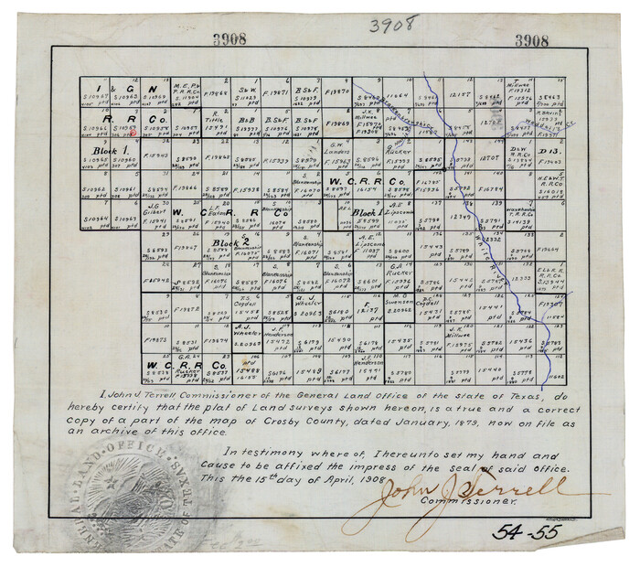
Print $2.00
- Digital $50.00
[W. C. RR. Co. Blks. 1 & 2, I. & G. N. RR. Co. Blk. 1, in southeast part of County]
1879
Size: 6.5 x 5.8 inches
90487
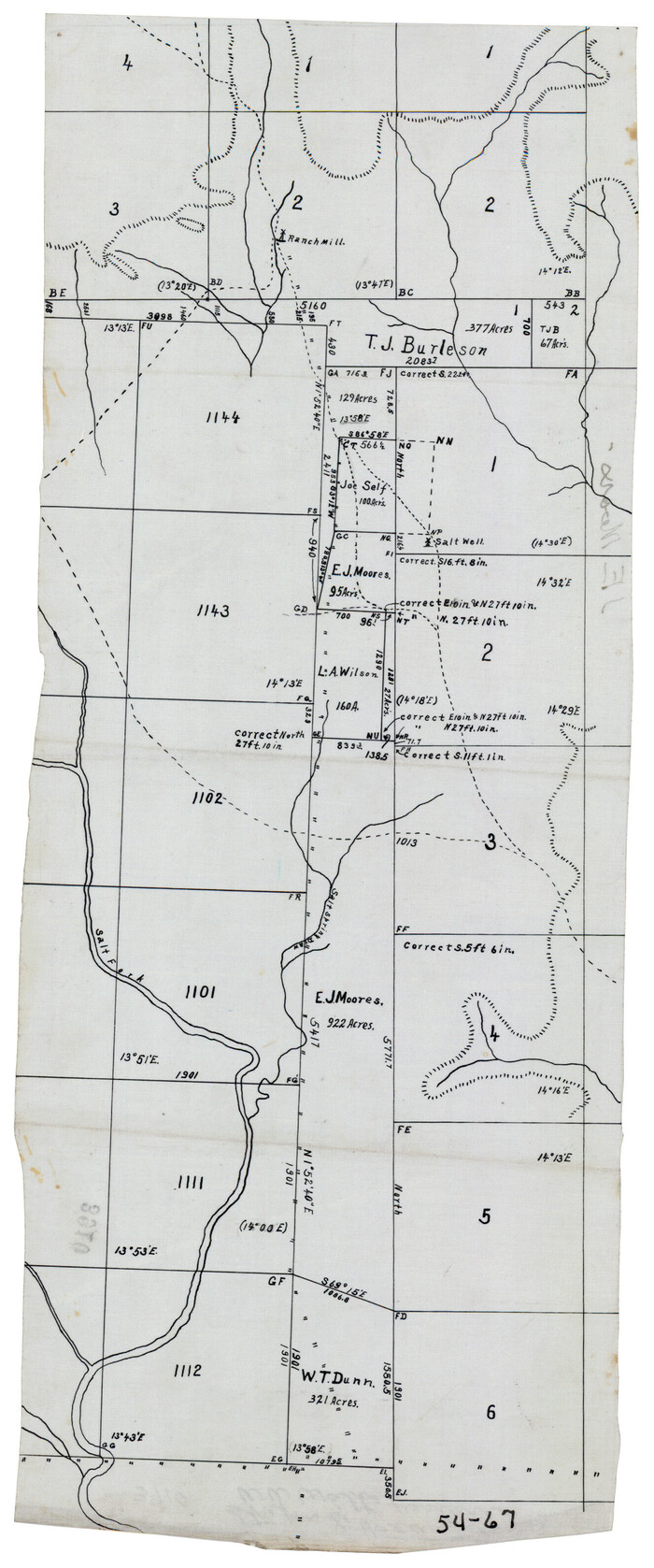
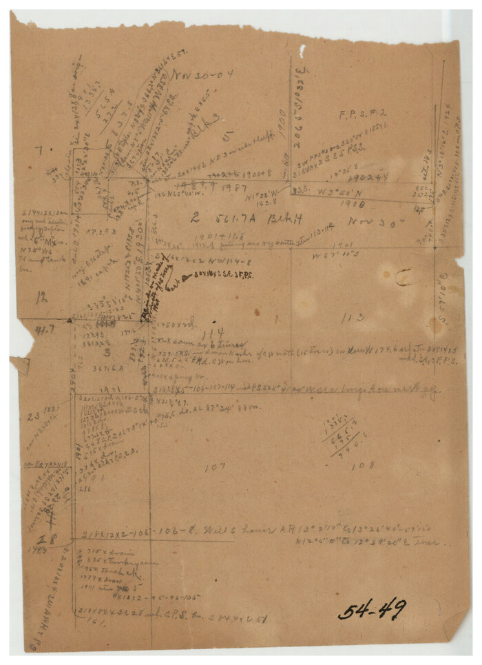
[Surveys 111-114, north of Morris County School Land]
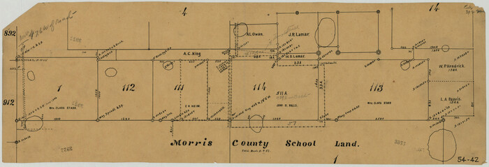
Print $20.00
- Digital $50.00
[Surveys 111-114, north of Morris County School Land]
Size: 23.7 x 8.2 inches
90362
[Southwest part of H. & G. N. Block 8]
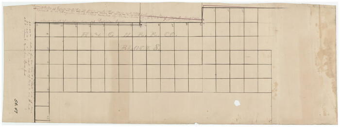
Print $20.00
- Digital $50.00
[Southwest part of H. & G. N. Block 8]
Size: 24.6 x 9.3 inches
90372
[Southwest corner of county covering Blks. 24 and B9]
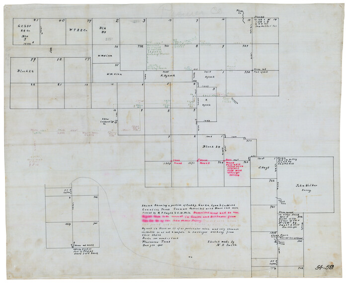
Print $20.00
- Digital $50.00
[Southwest corner of county covering Blks. 24 and B9]
1905
Size: 16.7 x 13.9 inches
90489
[South Center of County near surveys 1144 and 1143]
Print $2.00
- Digital $50.00
[South Center of County near surveys 1144 and 1143]
Size: 6.6 x 16.1 inches
90502
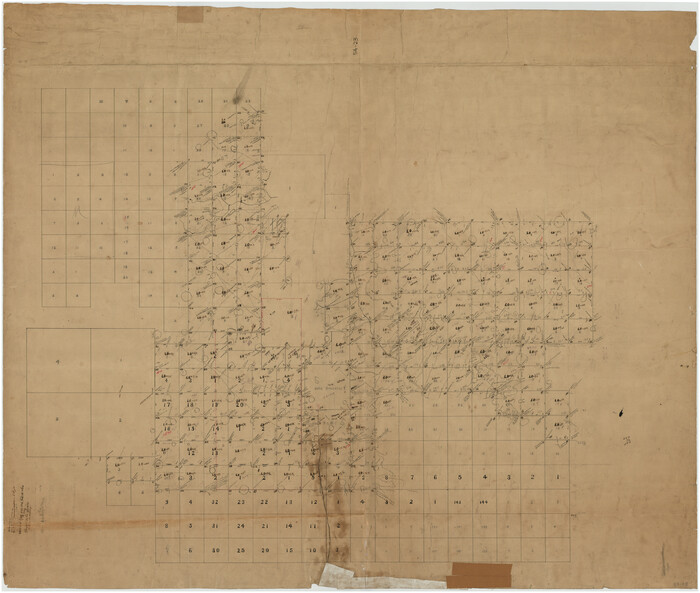
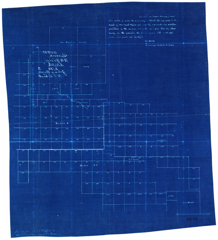
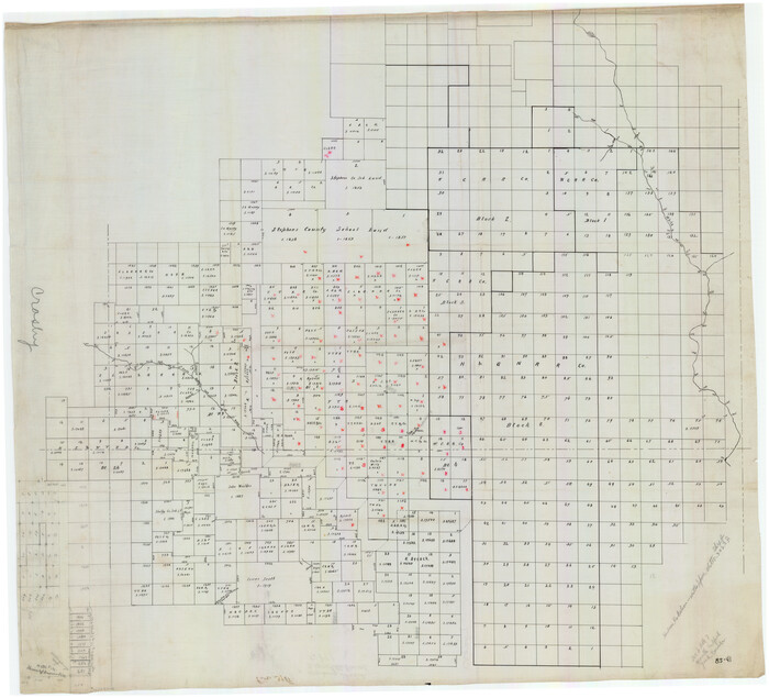
[Sketch showing San Augustine, Morris, Stephens and Eastland School Land Leagues and adjacent Blocks]
Print $40.00
- Digital $50.00
[Sketch showing San Augustine, Morris, Stephens and Eastland School Land Leagues and adjacent Blocks]
Size: 54.7 x 43.5 inches
89918
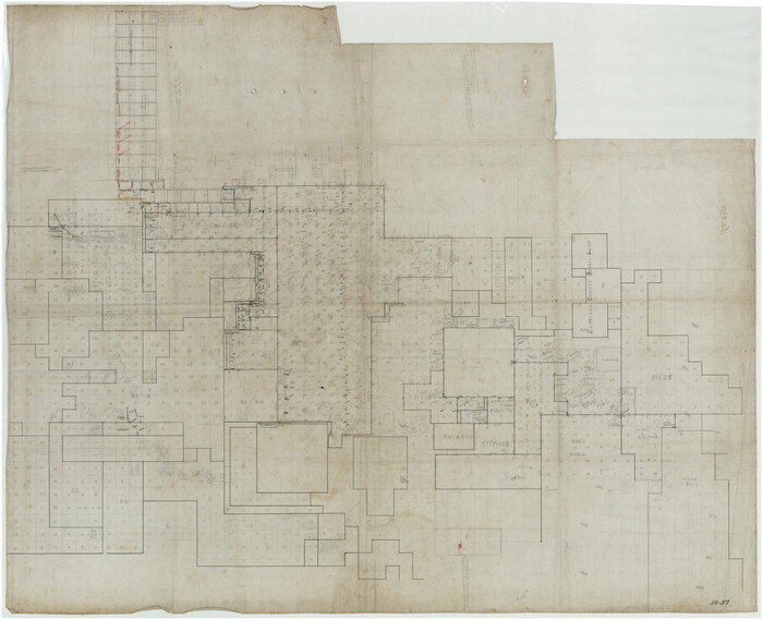
[Sketch of most of Crosby County]
Print $40.00
- Digital $50.00
[Sketch of most of Crosby County]
Size: 54.9 x 45.3 inches
89762
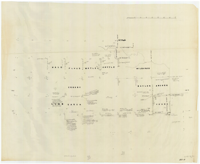
[Sketch of counties just south of the Panhandle]
Print $20.00
- Digital $50.00
[Sketch of counties just south of the Panhandle]
Size: 42.7 x 34.8 inches
90913
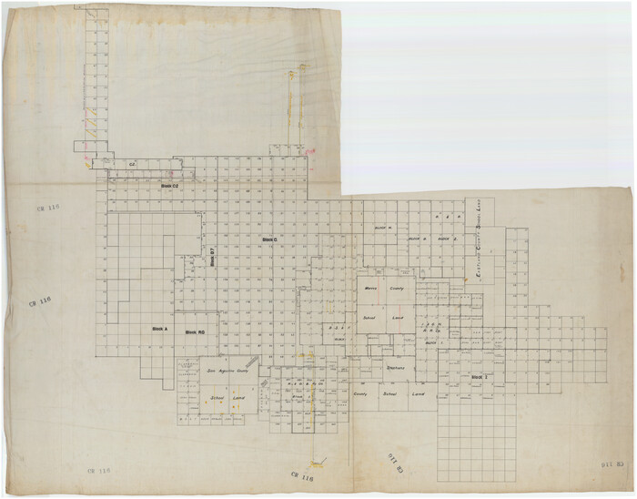
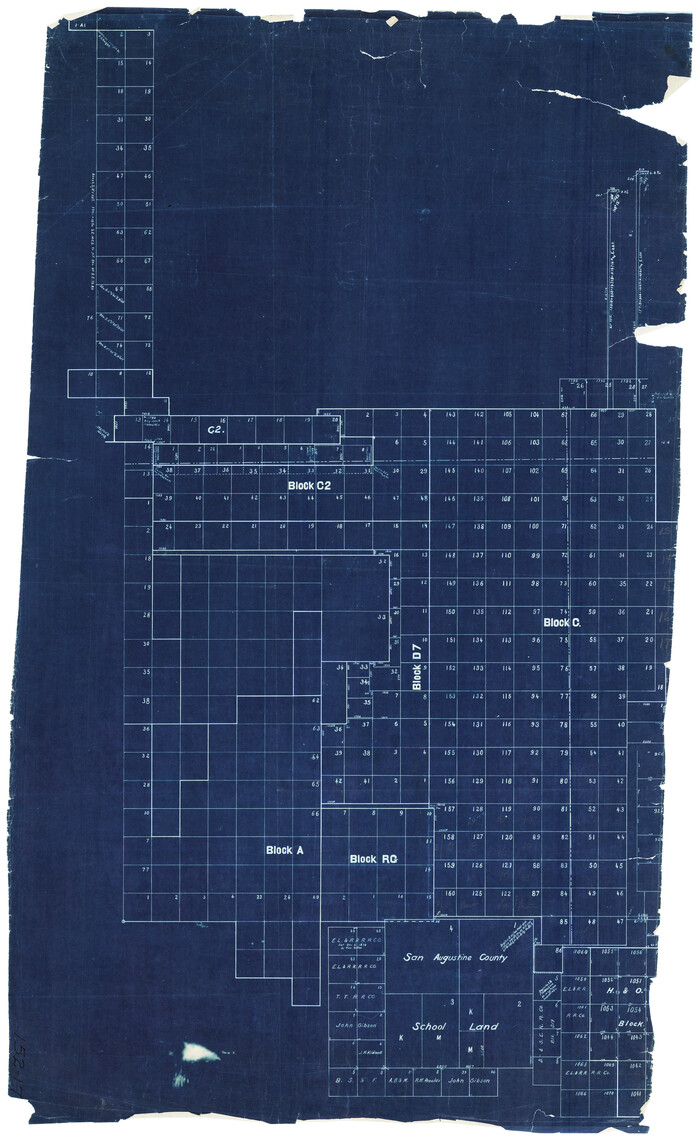
[Sketch of Blocks C2, C, D7, A, RG and San Augustine County School Land]
Print $20.00
- Digital $50.00
[Sketch of Blocks C2, C, D7, A, RG and San Augustine County School Land]
Size: 15.5 x 25.8 inches
93021
[Sketch in Crosby County]
Print $40.00
- Digital $50.00
[Sketch in Crosby County]
Size: 54.6 x 46.5 inches
89759
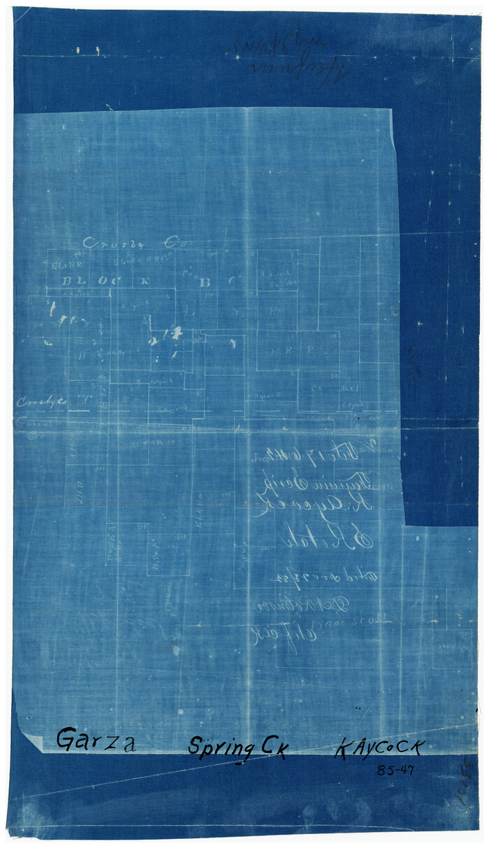
[Sketch fragment in Garza and Crosby Counties]
Print $20.00
- Digital $50.00
[Sketch fragment in Garza and Crosby Counties]
Size: 32.6 x 17.0 inches
90855
[Sketch focused on Southeast corner of Lubbock County]
Print $20.00
- Digital $50.00
[Sketch focused on Southeast corner of Lubbock County]
Size: 42.8 x 36.9 inches
89899
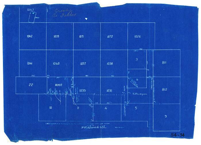
[Sections 1035-1038, E. B. Logan survey and vicinity]
Print $3.00
- Digital $50.00
[Sections 1035-1038, E. B. Logan survey and vicinity]
Size: 15.0 x 10.6 inches
90342
[Section 114, Block Z2]
Print $2.00
- Digital $50.00
[Section 114, Block Z2]
1907
Size: 8.9 x 10.1 inches
90371
[S. M. Walker, D. P. Allen, J. C. Guinn, J. R. Lamar and surrounding surveys]
Print $3.00
- Digital $50.00
[S. M. Walker, D. P. Allen, J. C. Guinn, J. R. Lamar and surrounding surveys]
1912
Size: 9.7 x 11.2 inches
90334
[S. M. Walker, D. P. Allen, J. C. Guinn, J. R. Lamar and surrounding surveys]
Print $3.00
- Digital $50.00
[S. M. Walker, D. P. Allen, J. C. Guinn, J. R. Lamar and surrounding surveys]
1912
Size: 9.8 x 11.3 inches
90335
[Portion of Blk. D-19 & H. & O. B. Blk. 1]
Print $3.00
- Digital $50.00
[Portion of Blk. D-19 & H. & O. B. Blk. 1]
Size: 13.9 x 10.1 inches
90352
[Pencil sketch showing area between sections 1102, 1101, 1111, and 1112 on the west and sections 3-6 on the east]
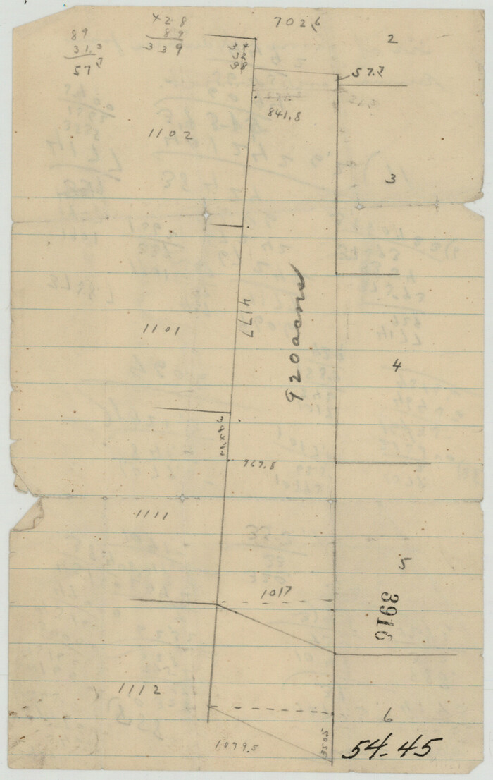
Print $2.00
- Digital $50.00
[Pencil sketch showing area between sections 1102, 1101, 1111, and 1112 on the west and sections 3-6 on the east]
Size: 5.1 x 8.1 inches
90365
[Part of H. & G. N. Blocks 2 and D-13]
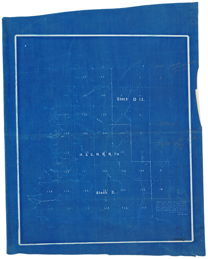
Print $20.00
- Digital $50.00
[Part of H. & G. N. Blocks 2 and D-13]
1907
Size: 14.1 x 17.7 inches
90490
[Northwest part of County]
Print $20.00
- Digital $50.00
[Northwest part of County]
Size: 32.3 x 22.3 inches
90865
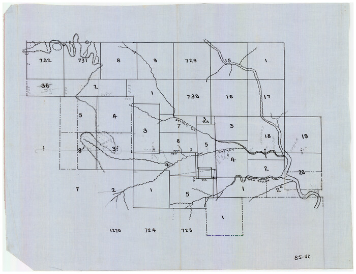
[Northwest part of County showing surveys along Spring Creek, Harvey Creek, and Red Hollow Creek]
Print $20.00
- Digital $50.00
[Northwest part of County showing surveys along Spring Creek, Harvey Creek, and Red Hollow Creek]
Size: 18.5 x 14.4 inches
90909
[Northwest corner of the County]
Print $20.00
- Digital $50.00
[Northwest corner of the County]
1903
Size: 19.1 x 21.5 inches
90873
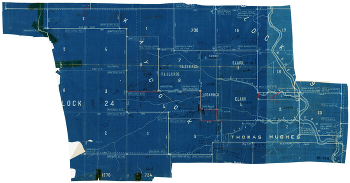
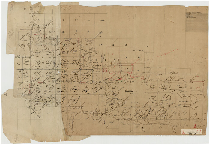
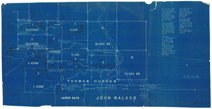
[Northwest Garza County around John Walker and Thomas Hughes surveys]
Print $20.00
- Digital $50.00
[Northwest Garza County around John Walker and Thomas Hughes surveys]
1913
Size: 28.3 x 14.5 inches
90906
[Northeast 1/4 County]
Print $20.00
- Digital $50.00
[Northeast 1/4 County]
Size: 11.9 x 20.3 inches
90876
[North part of Block 8, H. & G. N. RR. Co.]
Print $2.00
- Digital $50.00
[North part of Block 8, H. & G. N. RR. Co.]
Size: 6.6 x 8.9 inches
90376
[North 1/2 of Garza County, South 1/2 of Crosby County]
Print $20.00
- Digital $50.00
[North 1/2 of Garza County, South 1/2 of Crosby County]
Size: 34.7 x 31.1 inches
90908
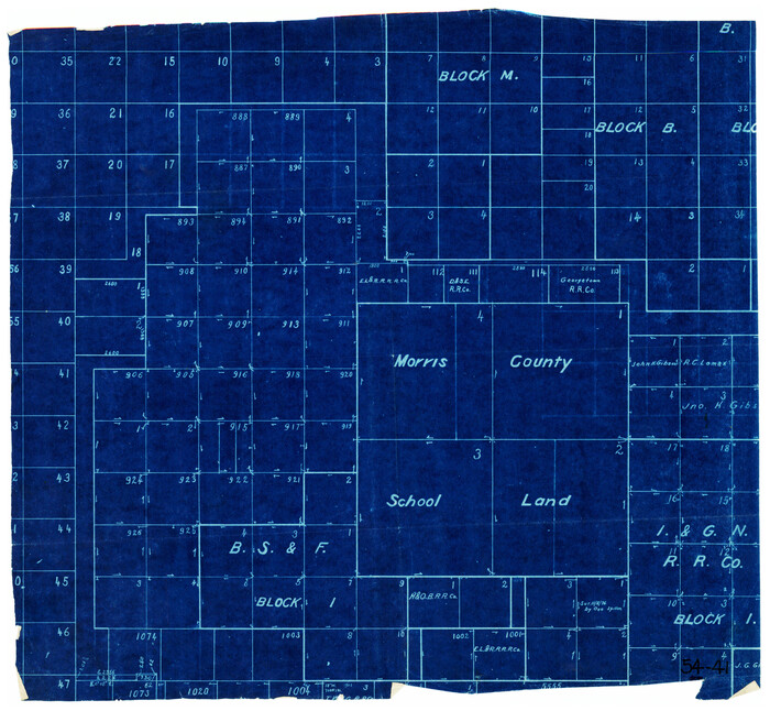
[Morris County School Land and vicinity]
Print $20.00
- Digital $50.00
[Morris County School Land and vicinity]
Size: 14.2 x 13.0 inches
90360
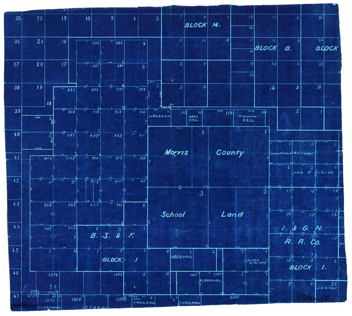
[Morris County School Land Leagues and vicinity]
Print $20.00
- Digital $50.00
[Morris County School Land Leagues and vicinity]
Size: 14.3 x 12.7 inches
90336
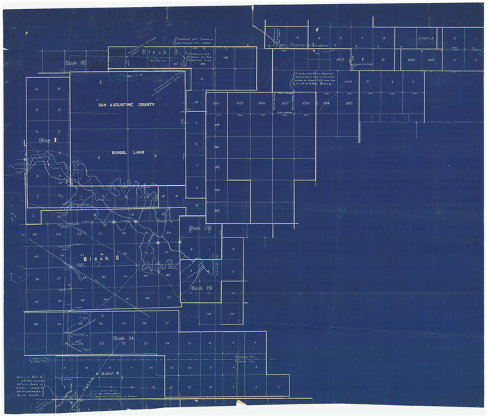
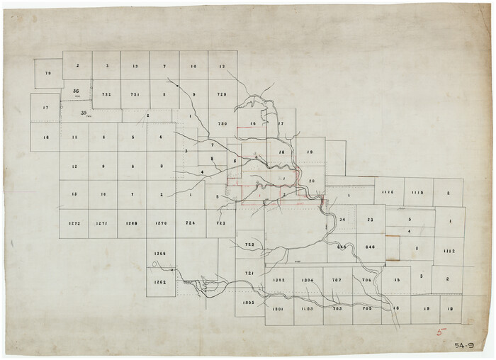
[John Walker, south part B9 and vicinity]
Print $20.00
- Digital $50.00
[John Walker, south part B9 and vicinity]
Size: 32.7 x 24.1 inches
90330
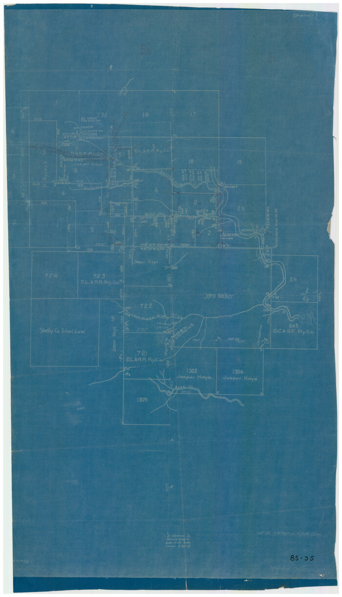
[In Northwest 1/4 of County in the vicinity of the John Walker Survey]
Print $20.00
- Digital $50.00
[In Northwest 1/4 of County in the vicinity of the John Walker Survey]
Size: 14.4 x 24.3 inches
90898
[W. C. RR. Co. Blks. 1 & 2, I. & G. N. RR. Co. Blk. 1, in southeast part of County]
Print $2.00
- Digital $50.00
[W. C. RR. Co. Blks. 1 & 2, I. & G. N. RR. Co. Blk. 1, in southeast part of County]
1879
-
Size
6.5 x 5.8 inches
-
Map/Doc
90487
-
Creation Date
1879
[Surveys 111-114, north of Morris County School Land]
Print $20.00
- Digital $50.00
[Surveys 111-114, north of Morris County School Land]
-
Size
23.7 x 8.2 inches
-
Map/Doc
90362
[Southwest part of H. & G. N. Block 8]
Print $20.00
- Digital $50.00
[Southwest part of H. & G. N. Block 8]
-
Size
24.6 x 9.3 inches
-
Map/Doc
90372
[Southwest corner of county covering Blks. 24 and B9]
Print $20.00
- Digital $50.00
[Southwest corner of county covering Blks. 24 and B9]
1905
-
Size
16.7 x 13.9 inches
-
Map/Doc
90489
-
Creation Date
1905
[South Center of County near surveys 1144 and 1143]
Print $2.00
- Digital $50.00
[South Center of County near surveys 1144 and 1143]
-
Size
6.6 x 16.1 inches
-
Map/Doc
90502
[Sketch showing San Augustine, Morris, Stephens and Eastland School Land Leagues and adjacent Blocks]
Print $40.00
- Digital $50.00
[Sketch showing San Augustine, Morris, Stephens and Eastland School Land Leagues and adjacent Blocks]
-
Size
54.7 x 43.5 inches
-
Map/Doc
89918
[Sketch of most of Crosby County]
Print $40.00
- Digital $50.00
[Sketch of most of Crosby County]
-
Size
54.9 x 45.3 inches
-
Map/Doc
89762
[Sketch of counties just south of the Panhandle]
Print $20.00
- Digital $50.00
[Sketch of counties just south of the Panhandle]
-
Size
42.7 x 34.8 inches
-
Map/Doc
90913
[Sketch of Blocks C2, C, D7, A, RG and San Augustine County School Land]
Print $20.00
- Digital $50.00
[Sketch of Blocks C2, C, D7, A, RG and San Augustine County School Land]
-
Size
15.5 x 25.8 inches
-
Map/Doc
93021
[Sketch in Crosby County]
Print $40.00
- Digital $50.00
[Sketch in Crosby County]
-
Size
54.6 x 46.5 inches
-
Map/Doc
89759
[Sketch fragment in Garza and Crosby Counties]
Print $20.00
- Digital $50.00
[Sketch fragment in Garza and Crosby Counties]
-
Size
32.6 x 17.0 inches
-
Map/Doc
90855
[Sketch focused on Southeast corner of Lubbock County]
Print $20.00
- Digital $50.00
[Sketch focused on Southeast corner of Lubbock County]
-
Size
42.8 x 36.9 inches
-
Map/Doc
89899
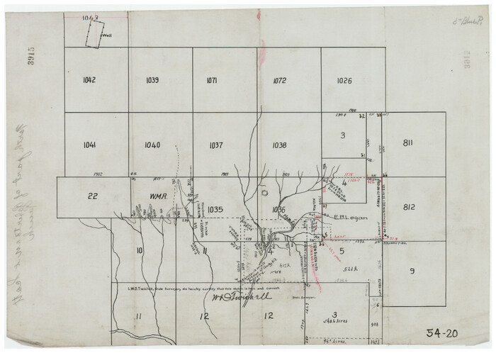
[Sections 1035-1038, E. B. Logan survey and vicinity]
Print $3.00
- Digital $50.00
[Sections 1035-1038, E. B. Logan survey and vicinity]
-
Size
15.0 x 10.6 inches
-
Map/Doc
90342
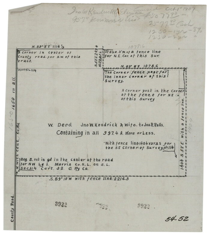
[Section 114, Block Z2]
Print $2.00
- Digital $50.00
[Section 114, Block Z2]
1907
-
Size
8.9 x 10.1 inches
-
Map/Doc
90371
-
Creation Date
1907
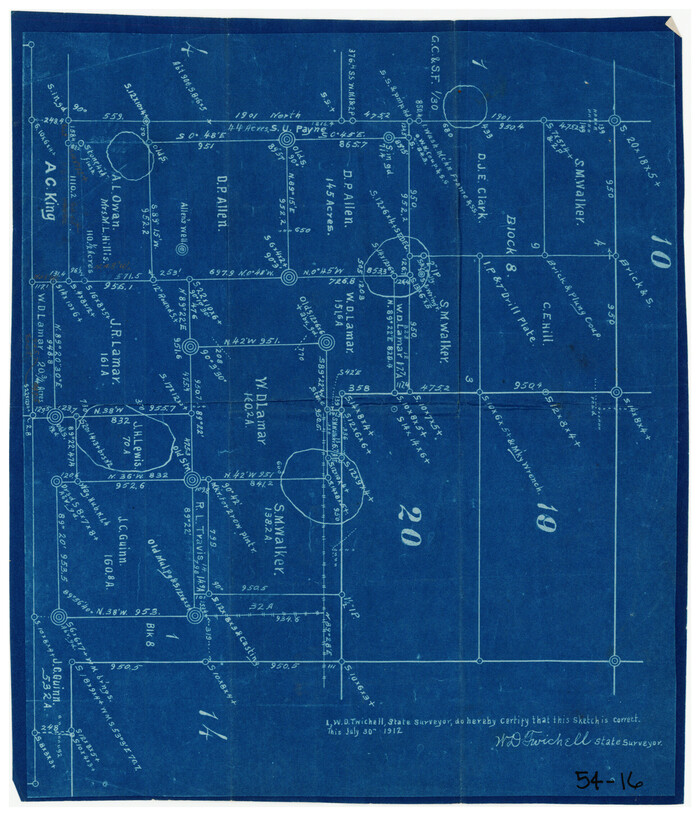
[S. M. Walker, D. P. Allen, J. C. Guinn, J. R. Lamar and surrounding surveys]
Print $3.00
- Digital $50.00
[S. M. Walker, D. P. Allen, J. C. Guinn, J. R. Lamar and surrounding surveys]
1912
-
Size
9.7 x 11.2 inches
-
Map/Doc
90334
-
Creation Date
1912
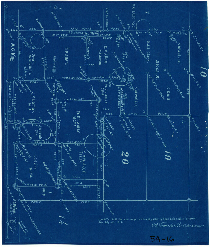
[S. M. Walker, D. P. Allen, J. C. Guinn, J. R. Lamar and surrounding surveys]
Print $3.00
- Digital $50.00
[S. M. Walker, D. P. Allen, J. C. Guinn, J. R. Lamar and surrounding surveys]
1912
-
Size
9.8 x 11.3 inches
-
Map/Doc
90335
-
Creation Date
1912
[Portion of Blk. D-19 & H. & O. B. Blk. 1]
Print $3.00
- Digital $50.00
[Portion of Blk. D-19 & H. & O. B. Blk. 1]
-
Size
13.9 x 10.1 inches
-
Map/Doc
90352
[Pencil sketch showing area between sections 1102, 1101, 1111, and 1112 on the west and sections 3-6 on the east]
Print $2.00
- Digital $50.00
[Pencil sketch showing area between sections 1102, 1101, 1111, and 1112 on the west and sections 3-6 on the east]
-
Size
5.1 x 8.1 inches
-
Map/Doc
90365
[Part of H. & G. N. Blocks 2 and D-13]
Print $20.00
- Digital $50.00
[Part of H. & G. N. Blocks 2 and D-13]
1907
-
Size
14.1 x 17.7 inches
-
Map/Doc
90490
-
Creation Date
1907
[Northwest part of County]
Print $20.00
- Digital $50.00
[Northwest part of County]
-
Size
32.3 x 22.3 inches
-
Map/Doc
90865
[Northwest part of County showing surveys along Spring Creek, Harvey Creek, and Red Hollow Creek]
Print $20.00
- Digital $50.00
[Northwest part of County showing surveys along Spring Creek, Harvey Creek, and Red Hollow Creek]
-
Size
18.5 x 14.4 inches
-
Map/Doc
90909
[Northwest corner of the County]
Print $20.00
- Digital $50.00
[Northwest corner of the County]
1903
-
Size
19.1 x 21.5 inches
-
Map/Doc
90873
-
Creation Date
1903
[Northwest Garza County around John Walker and Thomas Hughes surveys]
Print $20.00
- Digital $50.00
[Northwest Garza County around John Walker and Thomas Hughes surveys]
1913
-
Size
28.3 x 14.5 inches
-
Map/Doc
90906
-
Creation Date
1913
[Northeast 1/4 County]
Print $20.00
- Digital $50.00
[Northeast 1/4 County]
-
Size
11.9 x 20.3 inches
-
Map/Doc
90876
[North part of Block 8, H. & G. N. RR. Co.]
Print $2.00
- Digital $50.00
[North part of Block 8, H. & G. N. RR. Co.]
-
Size
6.6 x 8.9 inches
-
Map/Doc
90376
[North 1/2 of Garza County, South 1/2 of Crosby County]
Print $20.00
- Digital $50.00
[North 1/2 of Garza County, South 1/2 of Crosby County]
-
Size
34.7 x 31.1 inches
-
Map/Doc
90908
[Morris County School Land and vicinity]
Print $20.00
- Digital $50.00
[Morris County School Land and vicinity]
-
Size
14.2 x 13.0 inches
-
Map/Doc
90360
[Morris County School Land Leagues and vicinity]
Print $20.00
- Digital $50.00
[Morris County School Land Leagues and vicinity]
-
Size
14.3 x 12.7 inches
-
Map/Doc
90336
[John Walker, south part B9 and vicinity]
Print $20.00
- Digital $50.00
[John Walker, south part B9 and vicinity]
-
Size
32.7 x 24.1 inches
-
Map/Doc
90330
[In Northwest 1/4 of County in the vicinity of the John Walker Survey]
Print $20.00
- Digital $50.00
[In Northwest 1/4 of County in the vicinity of the John Walker Survey]
-
Size
14.4 x 24.3 inches
-
Map/Doc
90898