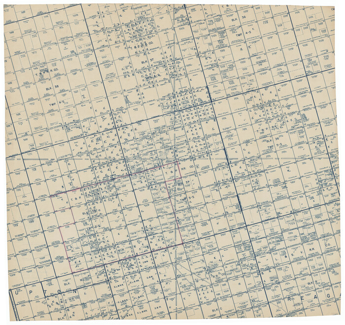
[Township 5-S, Blocks 36, 37 & 38]
Print $20.00
- Digital $50.00
[Township 5-S, Blocks 36, 37 & 38]
1952
Size: 27.6 x 26.5 inches
92291
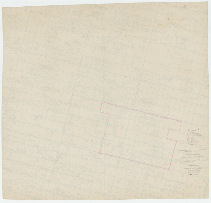
[Township 5-S, Blocks 36, 37 & 38]
Print $20.00
- Digital $50.00
[Township 5-S, Blocks 36, 37 & 38]
1952
Size: 27.7 x 26.6 inches
92292
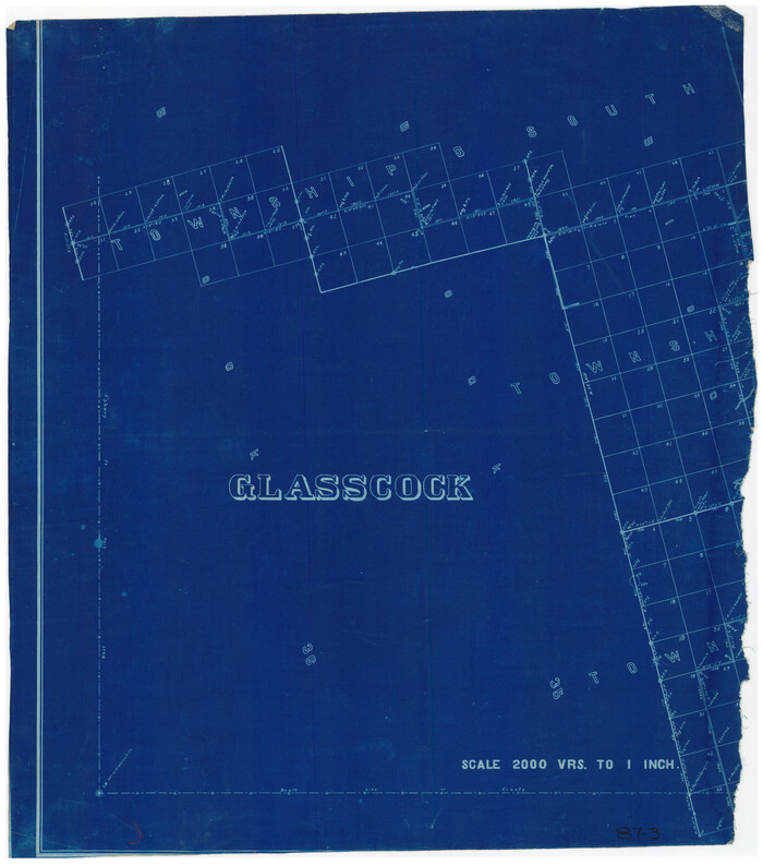
[Southwest Portion of Glasscock County]
Print $20.00
- Digital $50.00
[Southwest Portion of Glasscock County]
Size: 18.7 x 20.9 inches
90765
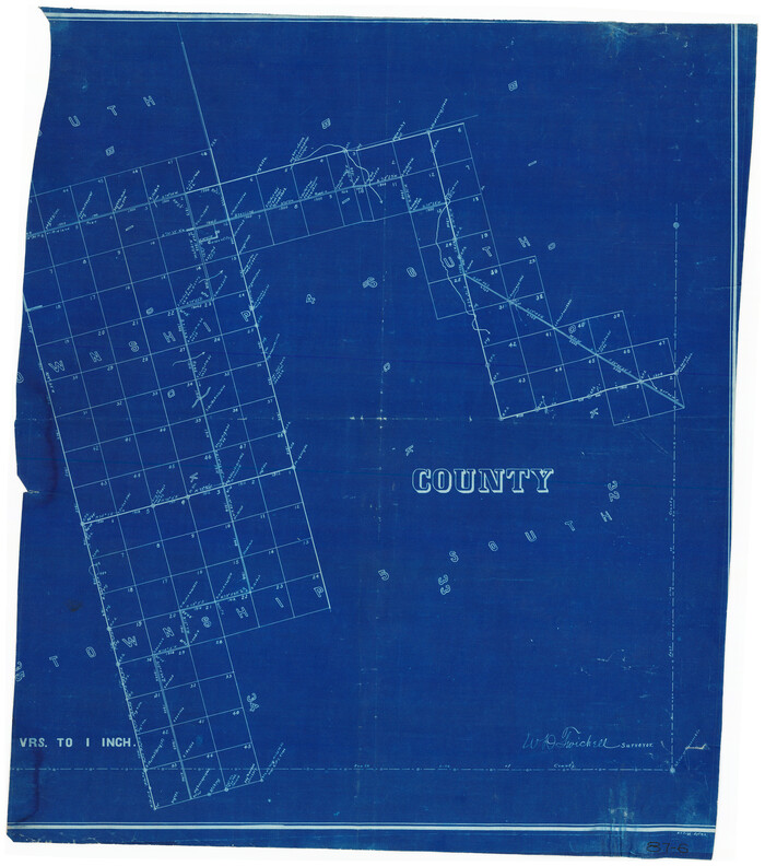
[Southeast Corner of Glasscock County]
Print $20.00
- Digital $50.00
[Southeast Corner of Glasscock County]
Size: 19.2 x 22.5 inches
90786
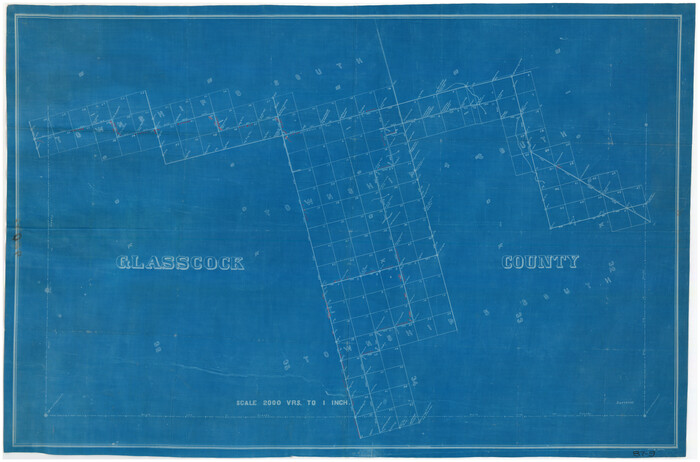
[South Part of Glasscock County]
Print $20.00
- Digital $50.00
[South Part of Glasscock County]
Size: 34.0 x 23.2 inches
90782
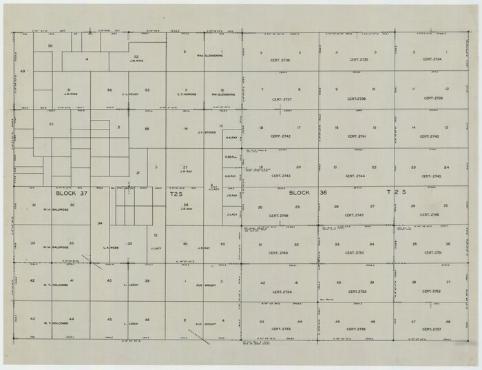
[Blocks 36, 37 Township 2 South]
Print $20.00
- Digital $50.00
[Blocks 36, 37 Township 2 South]
Size: 24.6 x 18.9 inches
92320
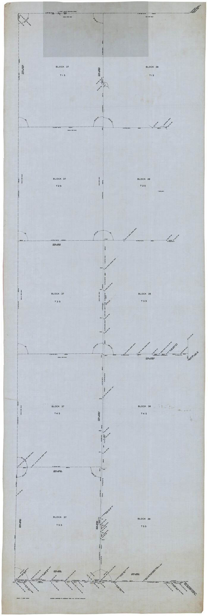
[Blocks 36 and 37, Townships 1S-5S]
Print $40.00
- Digital $50.00
[Blocks 36 and 37, Townships 1S-5S]
Size: 28.9 x 83.7 inches
93213
Working Sketch in Glasscock County

Print $3.00
- Digital $50.00
Working Sketch in Glasscock County
Size: 9.8 x 9.8 inches
90750
Water-Shed of the Colorado River

Print $40.00
- Digital $50.00
Water-Shed of the Colorado River
1925
Size: 37.1 x 79.8 inches
65261
Upton County Sketch File 36

Print $14.00
- Digital $50.00
Upton County Sketch File 36
1952
Size: 11.3 x 8.8 inches
38893
Sterling County Sketch File D

Print $8.00
- Digital $50.00
Sterling County Sketch File D
Size: 11.2 x 8.6 inches
37157
Sterling County Sketch File 21

Print $6.00
- Digital $50.00
Sterling County Sketch File 21
1954
Size: 9.7 x 8.4 inches
37179
Sterling County Sketch File 17a

Print $20.00
- Digital $50.00
Sterling County Sketch File 17a
Size: 42.8 x 31.6 inches
10609
Sterling County Sketch File 10

Print $30.00
- Digital $50.00
Sterling County Sketch File 10
1927
Size: 11.2 x 8.7 inches
37133
Sterling County Rolled Sketch 9

Print $20.00
- Digital $50.00
Sterling County Rolled Sketch 9
1929
Size: 29.3 x 24.3 inches
7845
Sterling County Rolled Sketch 32

Print $20.00
- Digital $50.00
Sterling County Rolled Sketch 32
Size: 17.9 x 29.4 inches
7856
Sterling County Rolled Sketch 31

Print $40.00
- Digital $50.00
Sterling County Rolled Sketch 31
Size: 40.9 x 92.6 inches
9956
Sterling County Rolled Sketch 23

Print $40.00
- Digital $50.00
Sterling County Rolled Sketch 23
Size: 46.0 x 88.6 inches
9954
Sterling County Rolled Sketch 18

Print $20.00
- Digital $50.00
Sterling County Rolled Sketch 18
Size: 34.6 x 35.9 inches
9950
Sterling County Rolled Sketch 16

Print $40.00
- Digital $50.00
Sterling County Rolled Sketch 16
1951
Size: 73.6 x 43.0 inches
9948
Revised Sectional Map Number 2, Showing Surveys in Howard, Martin, Andrews, Glasscock, Midland, Ector

Print $20.00
- Digital $50.00
Revised Sectional Map Number 2, Showing Surveys in Howard, Martin, Andrews, Glasscock, Midland, Ector
1908
Size: 24.7 x 19.6 inches
91367
Revised Sectional Map Number 2, Showing Lands in Howard, Martin, Andrews, Glasscock, Midland, Ector, and Portions of Borden, Dawson, Irion, Reagan, Upton, Crane, Ward, and Winkler Counties

Print $20.00
- Digital $50.00
Revised Sectional Map Number 2, Showing Lands in Howard, Martin, Andrews, Glasscock, Midland, Ector, and Portions of Borden, Dawson, Irion, Reagan, Upton, Crane, Ward, and Winkler Counties
1908
Size: 16.6 x 13.3 inches
91113
Reagan County Working Sketch 16

Print $20.00
- Digital $50.00
Reagan County Working Sketch 16
1950
Size: 24.5 x 42.5 inches
71858
Reagan County Sketch File 5

Print $12.00
- Digital $50.00
Reagan County Sketch File 5
1927
Size: 11.2 x 8.7 inches
34980
Reagan County Sketch File 4

Print $20.00
- Digital $50.00
Reagan County Sketch File 4
Size: 20.8 x 29.8 inches
12214
Reagan County Sketch File 28

Print $20.00
- Digital $50.00
Reagan County Sketch File 28
1951
Size: 29.6 x 21.7 inches
12224
Reagan County Sketch File 14

Print $6.00
- Digital $50.00
Reagan County Sketch File 14
Size: 11.3 x 8.8 inches
34993
Reagan County Sketch File 13

Print $40.00
- Digital $50.00
Reagan County Sketch File 13
1931
Size: 15.6 x 15.1 inches
34991
Reagan County Rolled Sketch 36

Print $20.00
- Digital $50.00
Reagan County Rolled Sketch 36
1960
Size: 31.0 x 13.4 inches
7449
Reagan County Rolled Sketch 28

Print $40.00
- Digital $50.00
Reagan County Rolled Sketch 28
1952
Size: 64.1 x 46.5 inches
9823
[Township 5-S, Blocks 36, 37 & 38]
Print $20.00
- Digital $50.00
[Township 5-S, Blocks 36, 37 & 38]
1952
-
Size
27.6 x 26.5 inches
-
Map/Doc
92291
-
Creation Date
1952
[Township 5-S, Blocks 36, 37 & 38]
Print $20.00
- Digital $50.00
[Township 5-S, Blocks 36, 37 & 38]
1952
-
Size
27.7 x 26.6 inches
-
Map/Doc
92292
-
Creation Date
1952
[Southwest Portion of Glasscock County]
Print $20.00
- Digital $50.00
[Southwest Portion of Glasscock County]
-
Size
18.7 x 20.9 inches
-
Map/Doc
90765
[Southeast Corner of Glasscock County]
Print $20.00
- Digital $50.00
[Southeast Corner of Glasscock County]
-
Size
19.2 x 22.5 inches
-
Map/Doc
90786
[South Part of Glasscock County]
Print $20.00
- Digital $50.00
[South Part of Glasscock County]
-
Size
34.0 x 23.2 inches
-
Map/Doc
90782
[Blocks 36, 37 Township 2 South]
Print $20.00
- Digital $50.00
[Blocks 36, 37 Township 2 South]
-
Size
24.6 x 18.9 inches
-
Map/Doc
92320
[Blocks 36 and 37, Townships 1S-5S]
Print $40.00
- Digital $50.00
[Blocks 36 and 37, Townships 1S-5S]
-
Size
28.9 x 83.7 inches
-
Map/Doc
93213
Working Sketch in Glasscock County
Print $3.00
- Digital $50.00
Working Sketch in Glasscock County
-
Size
9.8 x 9.8 inches
-
Map/Doc
90750
Water-Shed of the Colorado River
Print $40.00
- Digital $50.00
Water-Shed of the Colorado River
1925
-
Size
37.1 x 79.8 inches
-
Map/Doc
65261
-
Creation Date
1925
Upton County Sketch File 36
Print $14.00
- Digital $50.00
Upton County Sketch File 36
1952
-
Size
11.3 x 8.8 inches
-
Map/Doc
38893
-
Creation Date
1952
Sterling County Sketch File D
Print $8.00
- Digital $50.00
Sterling County Sketch File D
-
Size
11.2 x 8.6 inches
-
Map/Doc
37157
Sterling County Sketch File 21
Print $6.00
- Digital $50.00
Sterling County Sketch File 21
1954
-
Size
9.7 x 8.4 inches
-
Map/Doc
37179
-
Creation Date
1954
Sterling County Sketch File 17a
Print $20.00
- Digital $50.00
Sterling County Sketch File 17a
-
Size
42.8 x 31.6 inches
-
Map/Doc
10609
Sterling County Sketch File 10
Print $30.00
- Digital $50.00
Sterling County Sketch File 10
1927
-
Size
11.2 x 8.7 inches
-
Map/Doc
37133
-
Creation Date
1927
Sterling County Rolled Sketch 9
Print $20.00
- Digital $50.00
Sterling County Rolled Sketch 9
1929
-
Size
29.3 x 24.3 inches
-
Map/Doc
7845
-
Creation Date
1929
Sterling County Rolled Sketch 32
Print $20.00
- Digital $50.00
Sterling County Rolled Sketch 32
-
Size
17.9 x 29.4 inches
-
Map/Doc
7856
Sterling County Rolled Sketch 31
Print $40.00
- Digital $50.00
Sterling County Rolled Sketch 31
-
Size
40.9 x 92.6 inches
-
Map/Doc
9956
Sterling County Rolled Sketch 23
Print $40.00
- Digital $50.00
Sterling County Rolled Sketch 23
-
Size
46.0 x 88.6 inches
-
Map/Doc
9954
Sterling County Rolled Sketch 18
Print $20.00
- Digital $50.00
Sterling County Rolled Sketch 18
-
Size
34.6 x 35.9 inches
-
Map/Doc
9950
Sterling County Rolled Sketch 16
Print $40.00
- Digital $50.00
Sterling County Rolled Sketch 16
1951
-
Size
73.6 x 43.0 inches
-
Map/Doc
9948
-
Creation Date
1951
Revised Sectional Map Number 2, Showing Surveys in Howard, Martin, Andrews, Glasscock, Midland, Ector
Print $20.00
- Digital $50.00
Revised Sectional Map Number 2, Showing Surveys in Howard, Martin, Andrews, Glasscock, Midland, Ector
1908
-
Size
24.7 x 19.6 inches
-
Map/Doc
91367
-
Creation Date
1908
Revised Sectional Map Number 2, Showing Lands in Howard, Martin, Andrews, Glasscock, Midland, Ector, and Portions of Borden, Dawson, Irion, Reagan, Upton, Crane, Ward, and Winkler Counties
Print $20.00
- Digital $50.00
Revised Sectional Map Number 2, Showing Lands in Howard, Martin, Andrews, Glasscock, Midland, Ector, and Portions of Borden, Dawson, Irion, Reagan, Upton, Crane, Ward, and Winkler Counties
1908
-
Size
16.6 x 13.3 inches
-
Map/Doc
91113
-
Creation Date
1908
Reagan County Working Sketch 16
Print $20.00
- Digital $50.00
Reagan County Working Sketch 16
1950
-
Size
24.5 x 42.5 inches
-
Map/Doc
71858
-
Creation Date
1950
Reagan County Sketch File 5
Print $12.00
- Digital $50.00
Reagan County Sketch File 5
1927
-
Size
11.2 x 8.7 inches
-
Map/Doc
34980
-
Creation Date
1927
Reagan County Sketch File 4
Print $20.00
- Digital $50.00
Reagan County Sketch File 4
-
Size
20.8 x 29.8 inches
-
Map/Doc
12214
Reagan County Sketch File 28
Print $20.00
- Digital $50.00
Reagan County Sketch File 28
1951
-
Size
29.6 x 21.7 inches
-
Map/Doc
12224
-
Creation Date
1951
Reagan County Sketch File 14
Print $6.00
- Digital $50.00
Reagan County Sketch File 14
-
Size
11.3 x 8.8 inches
-
Map/Doc
34993
Reagan County Sketch File 13
Print $40.00
- Digital $50.00
Reagan County Sketch File 13
1931
-
Size
15.6 x 15.1 inches
-
Map/Doc
34991
-
Creation Date
1931
Reagan County Rolled Sketch 36
Print $20.00
- Digital $50.00
Reagan County Rolled Sketch 36
1960
-
Size
31.0 x 13.4 inches
-
Map/Doc
7449
-
Creation Date
1960
Reagan County Rolled Sketch 28
Print $40.00
- Digital $50.00
Reagan County Rolled Sketch 28
1952
-
Size
64.1 x 46.5 inches
-
Map/Doc
9823
-
Creation Date
1952