Glasscock County Working Sketch 17

Print $20.00
- Digital $50.00
Glasscock County Working Sketch 17
1990
Size: 27.7 x 30.6 inches
63190
Glasscock County Sketch File 27

Print $10.00
- Digital $50.00
Glasscock County Sketch File 27
1989
Size: 11.3 x 8.8 inches
24206
Glasscock County Rolled Sketch 16

Print $40.00
- Digital $50.00
Glasscock County Rolled Sketch 16
1986
Size: 63.3 x 46.1 inches
9060
Glasscock County Working Sketch 16

Print $40.00
- Digital $50.00
Glasscock County Working Sketch 16
1984
Size: 61.2 x 44.0 inches
63189
Glasscock County Working Sketch 15

Print $40.00
- Digital $50.00
Glasscock County Working Sketch 15
1984
Size: 65.6 x 42.1 inches
63188
Glasscock County Working Sketch 14

Print $40.00
- Digital $50.00
Glasscock County Working Sketch 14
1984
Size: 67.0 x 42.1 inches
63187
Glasscock County Working Sketch 13

Print $20.00
- Digital $50.00
Glasscock County Working Sketch 13
1981
Size: 17.5 x 19.5 inches
63186
Martin County Working Sketch 16

Print $20.00
- Digital $50.00
Martin County Working Sketch 16
1979
Size: 26.6 x 36.8 inches
70834
Martin County Working Sketch 11

Print $40.00
- Digital $50.00
Martin County Working Sketch 11
1971
Size: 49.8 x 38.1 inches
70829
Martin County Working Sketch 8

Print $40.00
- Digital $50.00
Martin County Working Sketch 8
1971
Size: 53.1 x 36.8 inches
70826
Glasscock County Working Sketch 12

Print $40.00
- Digital $50.00
Glasscock County Working Sketch 12
1971
Size: 51.2 x 39.0 inches
63185
Midland County Working Sketch 30

Print $20.00
- Digital $50.00
Midland County Working Sketch 30
1971
Size: 45.1 x 35.4 inches
71011
Glasscock County Rolled Sketch 15

Print $20.00
- Digital $50.00
Glasscock County Rolled Sketch 15
1964
Size: 36.5 x 35.8 inches
9059
Midland County Working Sketch 26

Print $20.00
- Digital $50.00
Midland County Working Sketch 26
1962
Size: 24.8 x 28.6 inches
71007
General Highway Map, Glasscock County, Texas

Print $20.00
General Highway Map, Glasscock County, Texas
1961
Size: 18.2 x 24.8 inches
79480
Reagan County Rolled Sketch 36

Print $20.00
- Digital $50.00
Reagan County Rolled Sketch 36
1960
Size: 31.0 x 13.4 inches
7449
Glasscock County Rolled Sketch 14

Print $20.00
- Digital $50.00
Glasscock County Rolled Sketch 14
1957
Size: 29.0 x 26.3 inches
6020
Glasscock County Working Sketch 11

Print $40.00
- Digital $50.00
Glasscock County Working Sketch 11
1957
Size: 87.4 x 36.2 inches
63184
Glasscock County Working Sketch 10

Print $40.00
- Digital $50.00
Glasscock County Working Sketch 10
1957
Size: 77.9 x 37.2 inches
63183
Glasscock County Working Sketch 9

Print $40.00
- Digital $50.00
Glasscock County Working Sketch 9
1957
Size: 77.9 x 25.5 inches
63182
Glasscock County Rolled Sketch 12

Print $20.00
- Digital $50.00
Glasscock County Rolled Sketch 12
1957
Size: 19.6 x 16.1 inches
6018
Glasscock County Working Sketch 8

Print $40.00
- Digital $50.00
Glasscock County Working Sketch 8
1955
Size: 43.5 x 120.3 inches
63181
Sterling County Sketch File 21

Print $6.00
- Digital $50.00
Sterling County Sketch File 21
1954
Size: 9.7 x 8.4 inches
37179
Midland County Working Sketch 17

Print $40.00
- Digital $50.00
Midland County Working Sketch 17
1953
Size: 32.3 x 49.4 inches
70997
Upton County Sketch File 36

Print $14.00
- Digital $50.00
Upton County Sketch File 36
1952
Size: 11.3 x 8.8 inches
38893
Reagan County Rolled Sketch 27A

Print $40.00
- Digital $50.00
Reagan County Rolled Sketch 27A
1952
Size: 63.7 x 47.2 inches
9822
Reagan County Rolled Sketch 28

Print $40.00
- Digital $50.00
Reagan County Rolled Sketch 28
1952
Size: 64.1 x 46.5 inches
9823
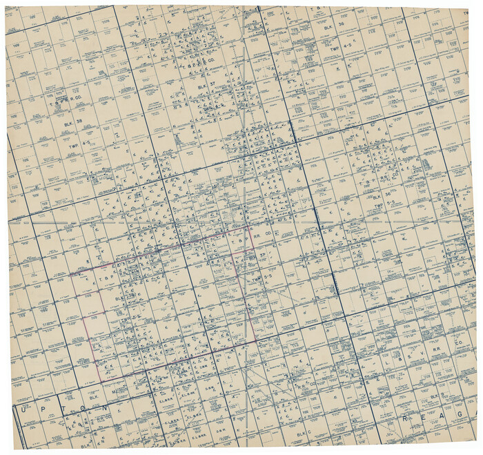
[Township 5-S, Blocks 36, 37 & 38]
Print $20.00
- Digital $50.00
[Township 5-S, Blocks 36, 37 & 38]
1952
Size: 27.6 x 26.5 inches
92291
[Township 5-S, Blocks 36, 37 & 38]
Print $20.00
- Digital $50.00
[Township 5-S, Blocks 36, 37 & 38]
1952
Size: 27.7 x 26.6 inches
92292
Glasscock County Working Sketch 7

Print $20.00
- Digital $50.00
Glasscock County Working Sketch 7
1952
Size: 36.8 x 31.9 inches
63180
Glasscock County Working Sketch 17
Print $20.00
- Digital $50.00
Glasscock County Working Sketch 17
1990
-
Size
27.7 x 30.6 inches
-
Map/Doc
63190
-
Creation Date
1990
Glasscock County Sketch File 27
Print $10.00
- Digital $50.00
Glasscock County Sketch File 27
1989
-
Size
11.3 x 8.8 inches
-
Map/Doc
24206
-
Creation Date
1989
Glasscock County Rolled Sketch 16
Print $40.00
- Digital $50.00
Glasscock County Rolled Sketch 16
1986
-
Size
63.3 x 46.1 inches
-
Map/Doc
9060
-
Creation Date
1986
Glasscock County Working Sketch 16
Print $40.00
- Digital $50.00
Glasscock County Working Sketch 16
1984
-
Size
61.2 x 44.0 inches
-
Map/Doc
63189
-
Creation Date
1984
Glasscock County Working Sketch 15
Print $40.00
- Digital $50.00
Glasscock County Working Sketch 15
1984
-
Size
65.6 x 42.1 inches
-
Map/Doc
63188
-
Creation Date
1984
Glasscock County Working Sketch 14
Print $40.00
- Digital $50.00
Glasscock County Working Sketch 14
1984
-
Size
67.0 x 42.1 inches
-
Map/Doc
63187
-
Creation Date
1984
Glasscock County Working Sketch 13
Print $20.00
- Digital $50.00
Glasscock County Working Sketch 13
1981
-
Size
17.5 x 19.5 inches
-
Map/Doc
63186
-
Creation Date
1981
Martin County Working Sketch 16
Print $20.00
- Digital $50.00
Martin County Working Sketch 16
1979
-
Size
26.6 x 36.8 inches
-
Map/Doc
70834
-
Creation Date
1979
Martin County Working Sketch 11
Print $40.00
- Digital $50.00
Martin County Working Sketch 11
1971
-
Size
49.8 x 38.1 inches
-
Map/Doc
70829
-
Creation Date
1971
Martin County Working Sketch 8
Print $40.00
- Digital $50.00
Martin County Working Sketch 8
1971
-
Size
53.1 x 36.8 inches
-
Map/Doc
70826
-
Creation Date
1971
Glasscock County Working Sketch 12
Print $40.00
- Digital $50.00
Glasscock County Working Sketch 12
1971
-
Size
51.2 x 39.0 inches
-
Map/Doc
63185
-
Creation Date
1971
Midland County Working Sketch 30
Print $20.00
- Digital $50.00
Midland County Working Sketch 30
1971
-
Size
45.1 x 35.4 inches
-
Map/Doc
71011
-
Creation Date
1971
Glasscock County Rolled Sketch 15
Print $20.00
- Digital $50.00
Glasscock County Rolled Sketch 15
1964
-
Size
36.5 x 35.8 inches
-
Map/Doc
9059
-
Creation Date
1964
Midland County Working Sketch 26
Print $20.00
- Digital $50.00
Midland County Working Sketch 26
1962
-
Size
24.8 x 28.6 inches
-
Map/Doc
71007
-
Creation Date
1962
General Highway Map, Glasscock County, Texas
Print $20.00
General Highway Map, Glasscock County, Texas
1961
-
Size
18.2 x 24.8 inches
-
Map/Doc
79480
-
Creation Date
1961
Reagan County Rolled Sketch 36
Print $20.00
- Digital $50.00
Reagan County Rolled Sketch 36
1960
-
Size
31.0 x 13.4 inches
-
Map/Doc
7449
-
Creation Date
1960
Glasscock County Rolled Sketch 14
Print $20.00
- Digital $50.00
Glasscock County Rolled Sketch 14
1957
-
Size
29.0 x 26.3 inches
-
Map/Doc
6020
-
Creation Date
1957
Glasscock County Working Sketch 11
Print $40.00
- Digital $50.00
Glasscock County Working Sketch 11
1957
-
Size
87.4 x 36.2 inches
-
Map/Doc
63184
-
Creation Date
1957
Glasscock County Working Sketch 10
Print $40.00
- Digital $50.00
Glasscock County Working Sketch 10
1957
-
Size
77.9 x 37.2 inches
-
Map/Doc
63183
-
Creation Date
1957
Glasscock County Working Sketch 9
Print $40.00
- Digital $50.00
Glasscock County Working Sketch 9
1957
-
Size
77.9 x 25.5 inches
-
Map/Doc
63182
-
Creation Date
1957
Glasscock County Rolled Sketch 12
Print $20.00
- Digital $50.00
Glasscock County Rolled Sketch 12
1957
-
Size
19.6 x 16.1 inches
-
Map/Doc
6018
-
Creation Date
1957
Glasscock County Working Sketch 8
Print $40.00
- Digital $50.00
Glasscock County Working Sketch 8
1955
-
Size
43.5 x 120.3 inches
-
Map/Doc
63181
-
Creation Date
1955
Sterling County Sketch File 21
Print $6.00
- Digital $50.00
Sterling County Sketch File 21
1954
-
Size
9.7 x 8.4 inches
-
Map/Doc
37179
-
Creation Date
1954
Midland County Working Sketch 17
Print $40.00
- Digital $50.00
Midland County Working Sketch 17
1953
-
Size
32.3 x 49.4 inches
-
Map/Doc
70997
-
Creation Date
1953
Upton County Sketch File 36
Print $14.00
- Digital $50.00
Upton County Sketch File 36
1952
-
Size
11.3 x 8.8 inches
-
Map/Doc
38893
-
Creation Date
1952
Reagan County Rolled Sketch 27A
Print $40.00
- Digital $50.00
Reagan County Rolled Sketch 27A
1952
-
Size
63.7 x 47.2 inches
-
Map/Doc
9822
-
Creation Date
1952
Reagan County Rolled Sketch 28
Print $40.00
- Digital $50.00
Reagan County Rolled Sketch 28
1952
-
Size
64.1 x 46.5 inches
-
Map/Doc
9823
-
Creation Date
1952
[Township 5-S, Blocks 36, 37 & 38]
Print $20.00
- Digital $50.00
[Township 5-S, Blocks 36, 37 & 38]
1952
-
Size
27.6 x 26.5 inches
-
Map/Doc
92291
-
Creation Date
1952
[Township 5-S, Blocks 36, 37 & 38]
Print $20.00
- Digital $50.00
[Township 5-S, Blocks 36, 37 & 38]
1952
-
Size
27.7 x 26.6 inches
-
Map/Doc
92292
-
Creation Date
1952
Glasscock County Working Sketch 7
Print $20.00
- Digital $50.00
Glasscock County Working Sketch 7
1952
-
Size
36.8 x 31.9 inches
-
Map/Doc
63180
-
Creation Date
1952