[Surveys in the Harris District at Clear Lake]
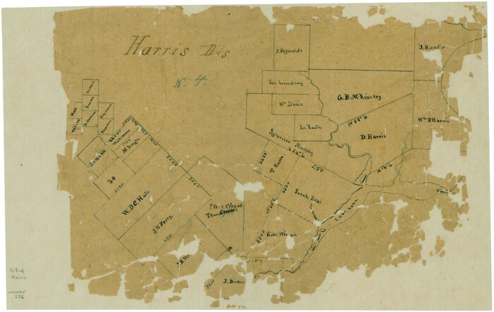
Print $2.00
- Digital $50.00
[Surveys in the Harris District at Clear Lake]
1840
Size: 6.7 x 10.5 inches
276
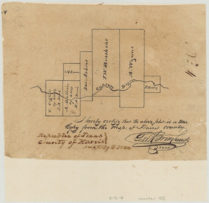
[Surveys in Vehlein's Colony along the San Jacinto River and Cedar Bayou]
Print $20.00
- Digital $50.00
[Surveys in Vehlein's Colony along the San Jacinto River and Cedar Bayou]
1837
Size: 17.5 x 15.1 inches
75
[Surveys in Austin's Colony along Buffalo Bayou and the San Jacinto River]
Print $20.00
- Digital $50.00
[Surveys in Austin's Colony along Buffalo Bayou and the San Jacinto River]
1824
Size: 22.3 x 14.3 inches
207
[Surveys in Austin's Colony along Buffalo Bayou and the San Jacinto River]
Print $20.00
- Digital $50.00
[Surveys in Austin's Colony along Buffalo Bayou and the San Jacinto River]
1824
Size: 23.7 x 17.6 inches
51
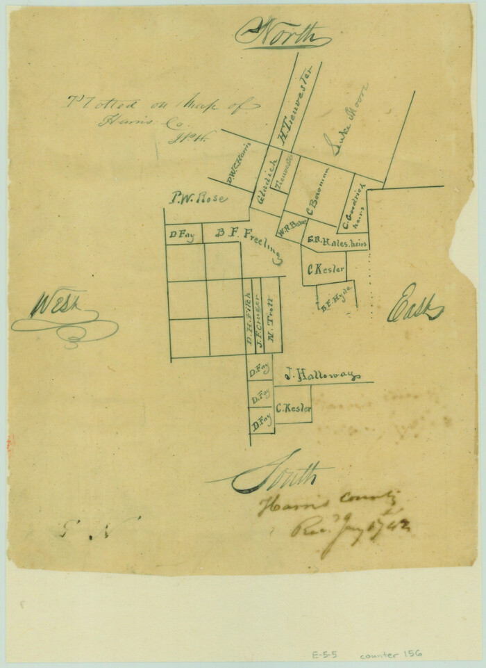
[Surveys along Sims Bayou]
Print $2.00
- Digital $50.00
[Surveys along Sims Bayou]
1842
Size: 8.6 x 6.2 inches
156
[Surveys along Cypress Creek]
Print $2.00
- Digital $50.00
[Surveys along Cypress Creek]
1844
Size: 6.0 x 6.1 inches
155
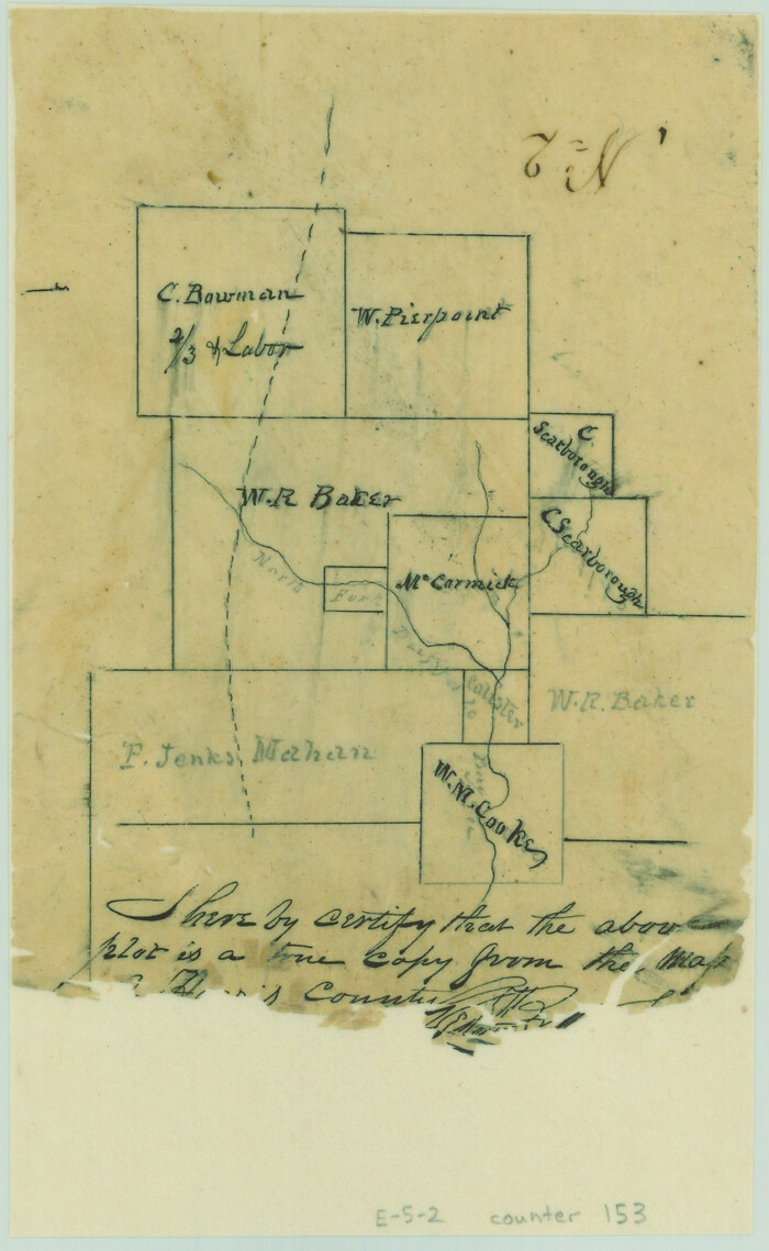
[Surveys along Buffalo Bayou]
Print $2.00
- Digital $50.00
[Surveys along Buffalo Bayou]
Size: 6.3 x 3.9 inches
153
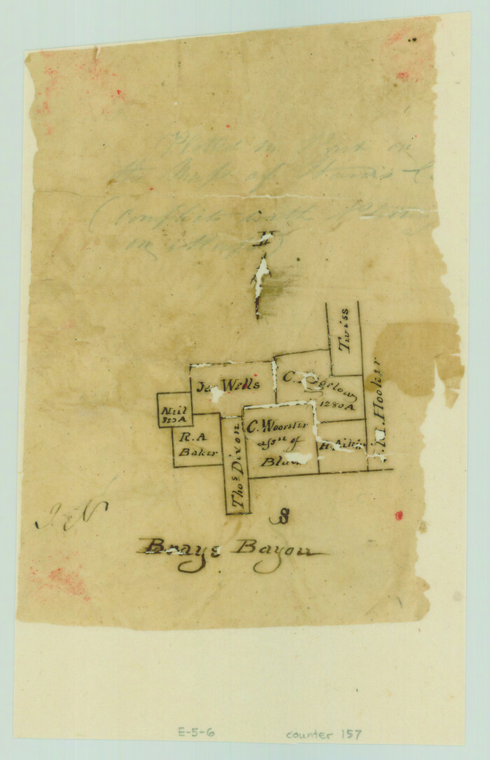
[Surveys along Bray's Bayou]
Print $2.00
- Digital $50.00
[Surveys along Bray's Bayou]
Size: 7.6 x 4.9 inches
157
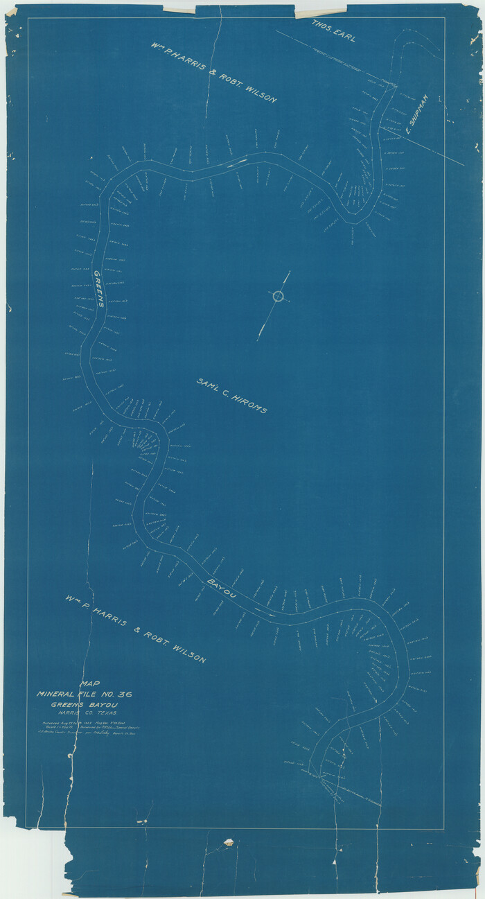
[Sketch for Mineral Application 11108 - Greens Bayou]
Print $40.00
- Digital $50.00
[Sketch for Mineral Application 11108 - Greens Bayou]
Size: 58.2 x 31.4 inches
76156
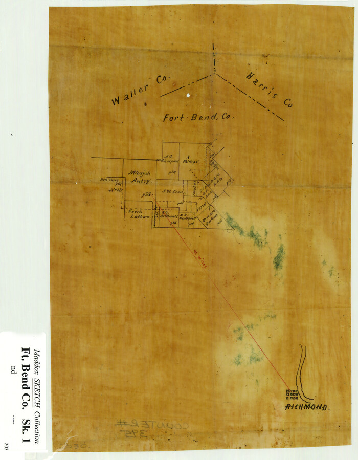
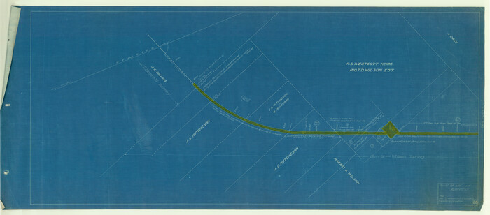
[Sketch Showing Surveys Adjacent to Richmond, Fort Bend County, Texas]
Print $2.00
- Digital $50.00
[Sketch Showing Surveys Adjacent to Richmond, Fort Bend County, Texas]
Size: 9.9 x 7.7 inches
395
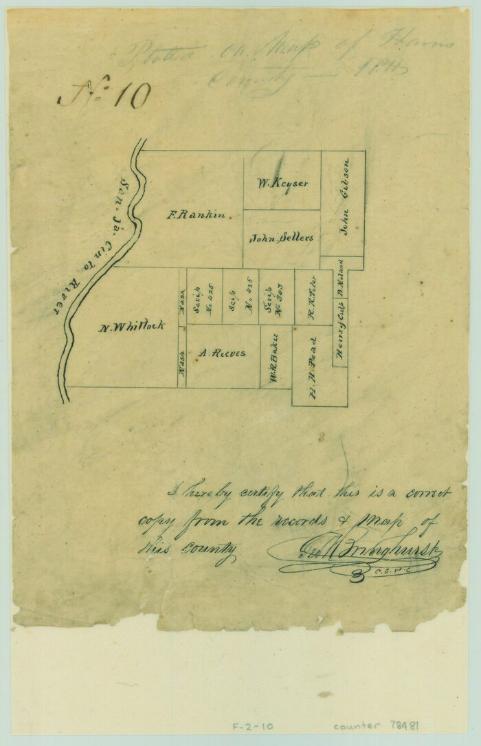
[Portion of Harris County]
Print $2.00
- Digital $50.00
[Portion of Harris County]
Size: 7.9 x 5.1 inches
78481
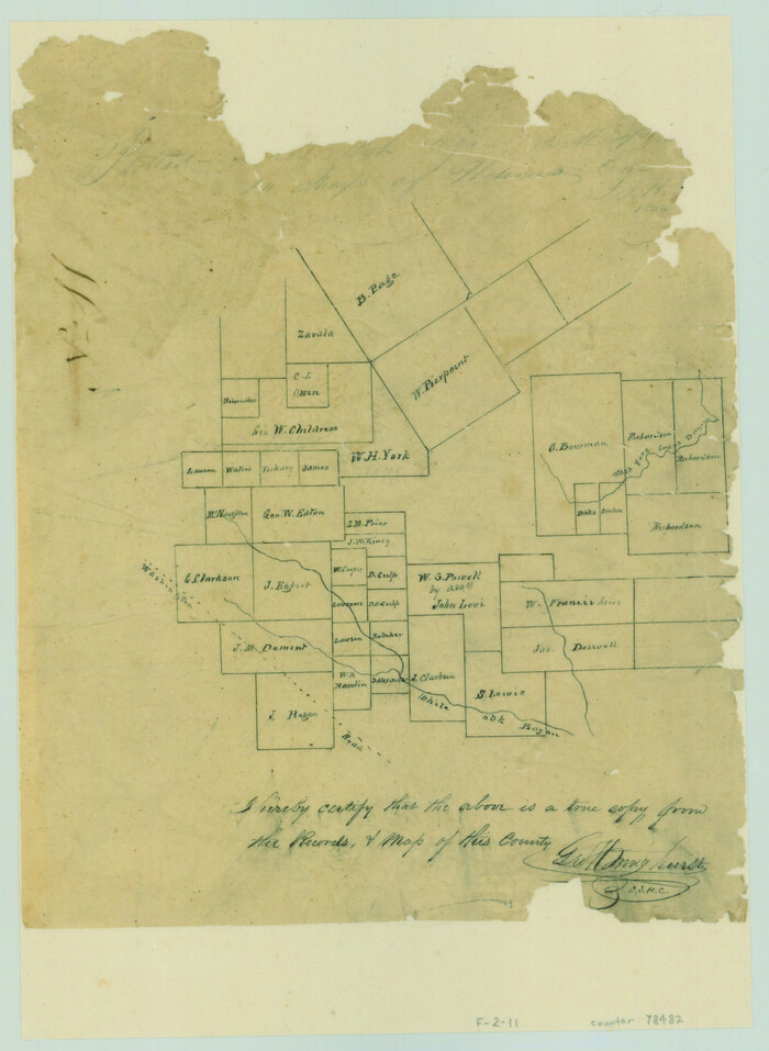
[Portion of Harris County]
Print $2.00
- Digital $50.00
[Portion of Harris County]
Size: 9.8 x 7.2 inches
78482
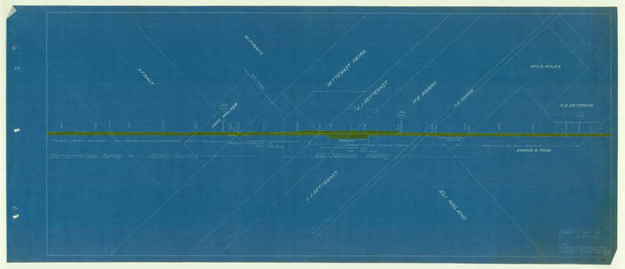
[Map Showing Surveys in Liberty, Chambers and Harris Counties, Texas]

Print $20.00
- Digital $50.00
[Map Showing Surveys in Liberty, Chambers and Harris Counties, Texas]
1890
Size: 16.1 x 21.1 inches
75768
[Gulf, Colorado & Santa Fe]
Print $40.00
- Digital $50.00
[Gulf, Colorado & Santa Fe]
1918
Size: 63.1 x 31.2 inches
64591
[Copy from Harris County map]
Print $2.00
- Digital $50.00
[Copy from Harris County map]
Size: 7.4 x 3.9 inches
78371
[Beaumont, Sour Lake and Western Ry. Right of Way and Alignment - Frisco]
Print $20.00
- Digital $50.00
[Beaumont, Sour Lake and Western Ry. Right of Way and Alignment - Frisco]
1910
Size: 20.1 x 46.1 inches
64126
[Beaumont, Sour Lake and Western Ry. Right of Way and Alignment - Frisco]
Print $20.00
- Digital $50.00
[Beaumont, Sour Lake and Western Ry. Right of Way and Alignment - Frisco]
1910
Size: 20.1 x 45.8 inches
64127
[Beaumont, Sour Lake and Western Ry. Right of Way and Alignment - Frisco]
Print $20.00
- Digital $50.00
[Beaumont, Sour Lake and Western Ry. Right of Way and Alignment - Frisco]
1910
Size: 20.1 x 45.9 inches
64128
[Beaumont, Sour Lake and Western Ry. Right of Way and Alignment - Frisco]
Print $20.00
- Digital $50.00
[Beaumont, Sour Lake and Western Ry. Right of Way and Alignment - Frisco]
1910
Size: 20.1 x 45.9 inches
64129
[Beaumont, Sour Lake and Western Ry. Right of Way and Alignment - Frisco]
Print $20.00
- Digital $50.00
[Beaumont, Sour Lake and Western Ry. Right of Way and Alignment - Frisco]
1910
Size: 20.3 x 45.9 inches
64130
[Beaumont, Sour Lake and Western Ry. Right of Way and Alignment - Frisco]
Print $20.00
- Digital $50.00
[Beaumont, Sour Lake and Western Ry. Right of Way and Alignment - Frisco]
1910
Size: 20.3 x 46.2 inches
64131
[Beaumont, Sour Lake and Western Ry. Right of Way and Alignment - Frisco]
Print $20.00
- Digital $50.00
[Beaumont, Sour Lake and Western Ry. Right of Way and Alignment - Frisco]
1910
Size: 19.9 x 46.1 inches
64132
[Beaumont, Sour Lake and Western Ry. Right of Way and Alignment - Frisco]
Print $20.00
- Digital $50.00
[Beaumont, Sour Lake and Western Ry. Right of Way and Alignment - Frisco]
1910
Size: 20.0 x 45.5 inches
64133
[Atlas B, Table of Contents]
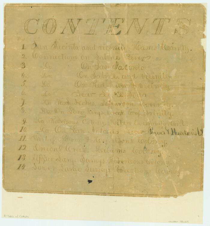
Print $3.00
- Digital $50.00
[Atlas B, Table of Contents]
Size: 10.3 x 9.6 inches
78269
West Houston: Hwy. 6 from Spencer Rd. in the North to South of Sugar Land. From Wilcrest Dr. in the East to and including Katy.

West Houston: Hwy. 6 from Spencer Rd. in the North to South of Sugar Land. From Wilcrest Dr. in the East to and including Katy.
Size: 35.4 x 22.8 inches
94335
West Houston: Hwy. 6 from Spencer Rd. in the North to South of Sugar Land. From Wilcrest Dr. in the East to and including Katy.

West Houston: Hwy. 6 from Spencer Rd. in the North to South of Sugar Land. From Wilcrest Dr. in the East to and including Katy.
Size: 35.4 x 22.7 inches
94336
Waller County Sketch File 9

Print $4.00
- Digital $50.00
Waller County Sketch File 9
Size: 9.1 x 7.8 inches
39610
Waller County Sketch File 2

Print $52.00
- Digital $50.00
Waller County Sketch File 2
Size: 13.3 x 9.0 inches
39570
Waller County Sketch File 1a

Print $20.00
- Digital $50.00
Waller County Sketch File 1a
Size: 25.4 x 16.6 inches
12598
Waller County Sketch File 11

Print $40.00
- Digital $50.00
Waller County Sketch File 11
1913
Size: 16.6 x 14.3 inches
39614
[Surveys in the Harris District at Clear Lake]
Print $2.00
- Digital $50.00
[Surveys in the Harris District at Clear Lake]
1840
-
Size
6.7 x 10.5 inches
-
Map/Doc
276
-
Creation Date
1840
[Surveys in Vehlein's Colony along the San Jacinto River and Cedar Bayou]
Print $20.00
- Digital $50.00
[Surveys in Vehlein's Colony along the San Jacinto River and Cedar Bayou]
1837
-
Size
17.5 x 15.1 inches
-
Map/Doc
75
-
Creation Date
1837
[Surveys in Austin's Colony along Buffalo Bayou and the San Jacinto River]
Print $20.00
- Digital $50.00
[Surveys in Austin's Colony along Buffalo Bayou and the San Jacinto River]
1824
-
Size
22.3 x 14.3 inches
-
Map/Doc
207
-
Creation Date
1824
[Surveys in Austin's Colony along Buffalo Bayou and the San Jacinto River]
Print $20.00
- Digital $50.00
[Surveys in Austin's Colony along Buffalo Bayou and the San Jacinto River]
1824
-
Size
23.7 x 17.6 inches
-
Map/Doc
51
-
Creation Date
1824
[Surveys along Sims Bayou]
Print $2.00
- Digital $50.00
[Surveys along Sims Bayou]
1842
-
Size
8.6 x 6.2 inches
-
Map/Doc
156
-
Creation Date
1842
[Surveys along Cypress Creek]
Print $2.00
- Digital $50.00
[Surveys along Cypress Creek]
1844
-
Size
6.0 x 6.1 inches
-
Map/Doc
155
-
Creation Date
1844
[Surveys along Buffalo Bayou]
Print $2.00
- Digital $50.00
[Surveys along Buffalo Bayou]
-
Size
6.3 x 3.9 inches
-
Map/Doc
153
[Surveys along Bray's Bayou]
Print $2.00
- Digital $50.00
[Surveys along Bray's Bayou]
-
Size
7.6 x 4.9 inches
-
Map/Doc
157
[Sketch for Mineral Application 11108 - Greens Bayou]
Print $40.00
- Digital $50.00
[Sketch for Mineral Application 11108 - Greens Bayou]
-
Size
58.2 x 31.4 inches
-
Map/Doc
76156
[Sketch Showing Surveys Adjacent to Richmond, Fort Bend County, Texas]
Print $2.00
- Digital $50.00
[Sketch Showing Surveys Adjacent to Richmond, Fort Bend County, Texas]
-
Size
9.9 x 7.7 inches
-
Map/Doc
395
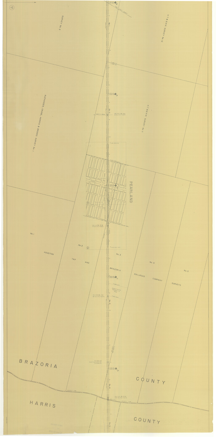
[Portion of Harris County]
Print $2.00
- Digital $50.00
[Portion of Harris County]
-
Size
7.9 x 5.1 inches
-
Map/Doc
78481
[Portion of Harris County]
Print $2.00
- Digital $50.00
[Portion of Harris County]
-
Size
9.8 x 7.2 inches
-
Map/Doc
78482
[Map Showing Surveys in Liberty, Chambers and Harris Counties, Texas]
Print $20.00
- Digital $50.00
[Map Showing Surveys in Liberty, Chambers and Harris Counties, Texas]
1890
-
Size
16.1 x 21.1 inches
-
Map/Doc
75768
-
Creation Date
1890
[Gulf, Colorado & Santa Fe]
Print $40.00
- Digital $50.00
[Gulf, Colorado & Santa Fe]
1918
-
Size
63.1 x 31.2 inches
-
Map/Doc
64591
-
Creation Date
1918
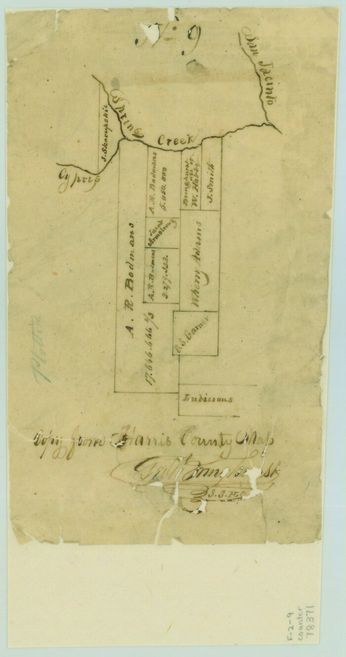
[Copy from Harris County map]
Print $2.00
- Digital $50.00
[Copy from Harris County map]
-
Size
7.4 x 3.9 inches
-
Map/Doc
78371
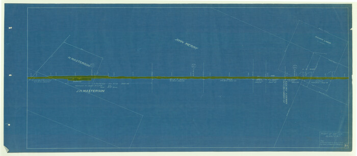
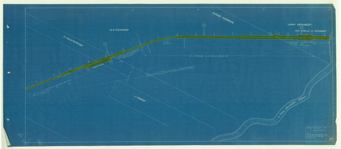
[Beaumont, Sour Lake and Western Ry. Right of Way and Alignment - Frisco]
Print $20.00
- Digital $50.00
[Beaumont, Sour Lake and Western Ry. Right of Way and Alignment - Frisco]
1910
-
Size
20.1 x 46.1 inches
-
Map/Doc
64126
-
Creation Date
1910
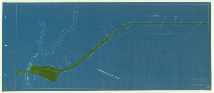
[Beaumont, Sour Lake and Western Ry. Right of Way and Alignment - Frisco]
Print $20.00
- Digital $50.00
[Beaumont, Sour Lake and Western Ry. Right of Way and Alignment - Frisco]
1910
-
Size
20.1 x 45.8 inches
-
Map/Doc
64127
-
Creation Date
1910
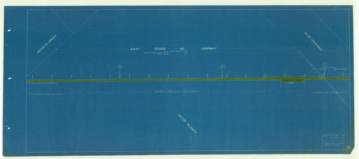
[Beaumont, Sour Lake and Western Ry. Right of Way and Alignment - Frisco]
Print $20.00
- Digital $50.00
[Beaumont, Sour Lake and Western Ry. Right of Way and Alignment - Frisco]
1910
-
Size
20.1 x 45.9 inches
-
Map/Doc
64128
-
Creation Date
1910
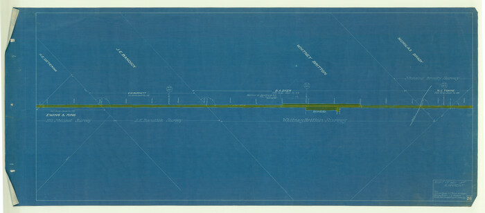
[Beaumont, Sour Lake and Western Ry. Right of Way and Alignment - Frisco]
Print $20.00
- Digital $50.00
[Beaumont, Sour Lake and Western Ry. Right of Way and Alignment - Frisco]
1910
-
Size
20.1 x 45.9 inches
-
Map/Doc
64129
-
Creation Date
1910
[Beaumont, Sour Lake and Western Ry. Right of Way and Alignment - Frisco]
Print $20.00
- Digital $50.00
[Beaumont, Sour Lake and Western Ry. Right of Way and Alignment - Frisco]
1910
-
Size
20.3 x 45.9 inches
-
Map/Doc
64130
-
Creation Date
1910
[Beaumont, Sour Lake and Western Ry. Right of Way and Alignment - Frisco]
Print $20.00
- Digital $50.00
[Beaumont, Sour Lake and Western Ry. Right of Way and Alignment - Frisco]
1910
-
Size
20.3 x 46.2 inches
-
Map/Doc
64131
-
Creation Date
1910
[Beaumont, Sour Lake and Western Ry. Right of Way and Alignment - Frisco]
Print $20.00
- Digital $50.00
[Beaumont, Sour Lake and Western Ry. Right of Way and Alignment - Frisco]
1910
-
Size
19.9 x 46.1 inches
-
Map/Doc
64132
-
Creation Date
1910
[Beaumont, Sour Lake and Western Ry. Right of Way and Alignment - Frisco]
Print $20.00
- Digital $50.00
[Beaumont, Sour Lake and Western Ry. Right of Way and Alignment - Frisco]
1910
-
Size
20.0 x 45.5 inches
-
Map/Doc
64133
-
Creation Date
1910
[Atlas B, Table of Contents]
Print $3.00
- Digital $50.00
[Atlas B, Table of Contents]
-
Size
10.3 x 9.6 inches
-
Map/Doc
78269
West Houston: Hwy. 6 from Spencer Rd. in the North to South of Sugar Land. From Wilcrest Dr. in the East to and including Katy.
West Houston: Hwy. 6 from Spencer Rd. in the North to South of Sugar Land. From Wilcrest Dr. in the East to and including Katy.
-
Size
35.4 x 22.8 inches
-
Map/Doc
94335
West Houston: Hwy. 6 from Spencer Rd. in the North to South of Sugar Land. From Wilcrest Dr. in the East to and including Katy.
West Houston: Hwy. 6 from Spencer Rd. in the North to South of Sugar Land. From Wilcrest Dr. in the East to and including Katy.
-
Size
35.4 x 22.7 inches
-
Map/Doc
94336
Waller County Sketch File 9
Print $4.00
- Digital $50.00
Waller County Sketch File 9
-
Size
9.1 x 7.8 inches
-
Map/Doc
39610
Waller County Sketch File 2
Print $52.00
- Digital $50.00
Waller County Sketch File 2
-
Size
13.3 x 9.0 inches
-
Map/Doc
39570
Waller County Sketch File 1a
Print $20.00
- Digital $50.00
Waller County Sketch File 1a
-
Size
25.4 x 16.6 inches
-
Map/Doc
12598
Waller County Sketch File 11
Print $40.00
- Digital $50.00
Waller County Sketch File 11
1913
-
Size
16.6 x 14.3 inches
-
Map/Doc
39614
-
Creation Date
1913