222 results

The Republic County of Jackson. Boundaries Defined, December 29, 1837
96184.tif
Print $20.00 - Digital $50.00

The Republic County of Jackson. Boundaries Defined, December 29, 1837

2020

Size: 7.8 x 10.9 inches
96184
The Republic County of Jackson. September 17, 1838
96185.tif
Print $20.00 - Digital $50.00

The Republic County of Jackson. September 17, 1838

2020

Size: 7.8 x 10.9 inches
96185
The Republic County of Jackson. 1840
96186.tif
Print $20.00 - Digital $50.00

The Republic County of Jackson. 1840

2020

Size: 7.8 x 10.9 inches
96186
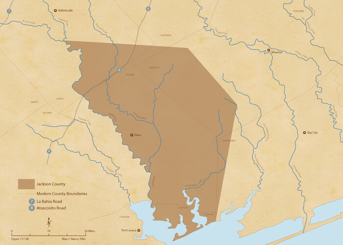
The Republic County of Jackson. 1841
96187.tif
Print $20.00 - Digital $50.00

The Republic County of Jackson. 1841

2020
Size: 7.8 x 10.9 inches
96187
The Republic County of Jackson. January 19, 1841
96188.tif
Print $20.00 - Digital $50.00

The Republic County of Jackson. January 19, 1841

2020

Size: 7.8 x 10.9 inches
96188
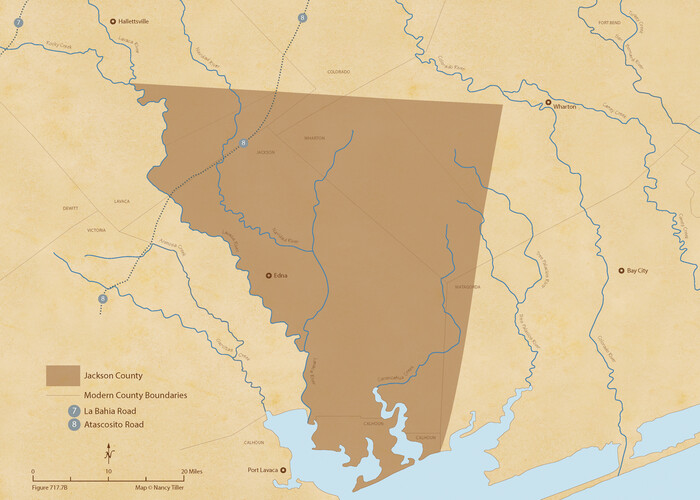
The Republic County of Jackson. January 29, 1842
96189.tif
Print $20.00 - Digital $50.00

The Republic County of Jackson. January 29, 1842

2020
Size: 7.8 x 10.9 inches
96189
The Republic County of Jackson. Spring 1842
96190.tif
Print $20.00 - Digital $50.00

The Republic County of Jackson. Spring 1842

2020

Size: 7.8 x 10.9 inches
96190
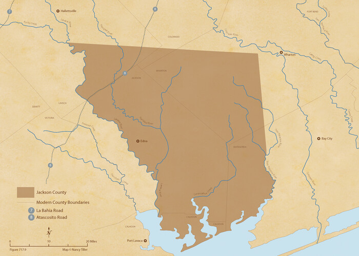
The Republic County of Jackson. December 24, 1844
96191.tif
Print $20.00 - Digital $50.00

The Republic County of Jackson. December 24, 1844

2020
Size: 7.8 x 10.9 inches
96191
The Republic County of Jackson. December 29, 1845
96192.tif
Print $20.00 - Digital $50.00

The Republic County of Jackson. December 29, 1845

2020

Size: 7.8 x 10.9 inches
96192
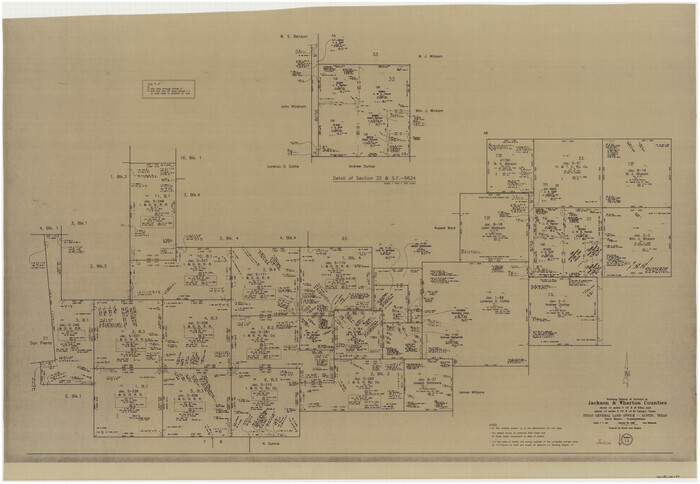
Jackson County NRC Article 33.136 Sketch 1
94950, Jackson County NRC Article 33.136 Sketch 1, General Map Collection
Print $66.00 - Digital $50.00

Jackson County NRC Article 33.136 Sketch 1

2013

Size: 34.0 x 22.0 inches
94950
Jackson County Sketch File 21
27673, Jackson County Sketch File 21, General Map Collection
Print $70.00 - Digital $50.00

Jackson County Sketch File 21

2000

Size: 11.3 x 8.8 inches
27673
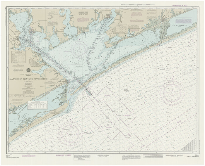
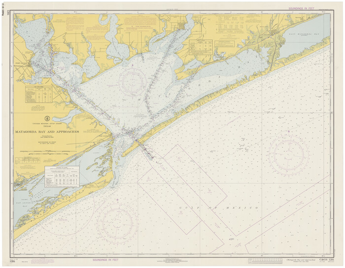
Matagorda Bay and Approaches
73390.tif
Print $20.00 - Digital $50.00

Matagorda Bay and Approaches

1992

Size: 36.6 x 44.6 inches
73390
Matagorda Bay and Approaches
73389.tif
Print $20.00 - Digital $50.00

Matagorda Bay and Approaches

1989

Size: 36.3 x 45.0 inches
73389
Matagorda Bay and Approaches
73388.tif
Print $20.00 - Digital $50.00

Matagorda Bay and Approaches

1982

Size: 36.2 x 44.9 inches
73388
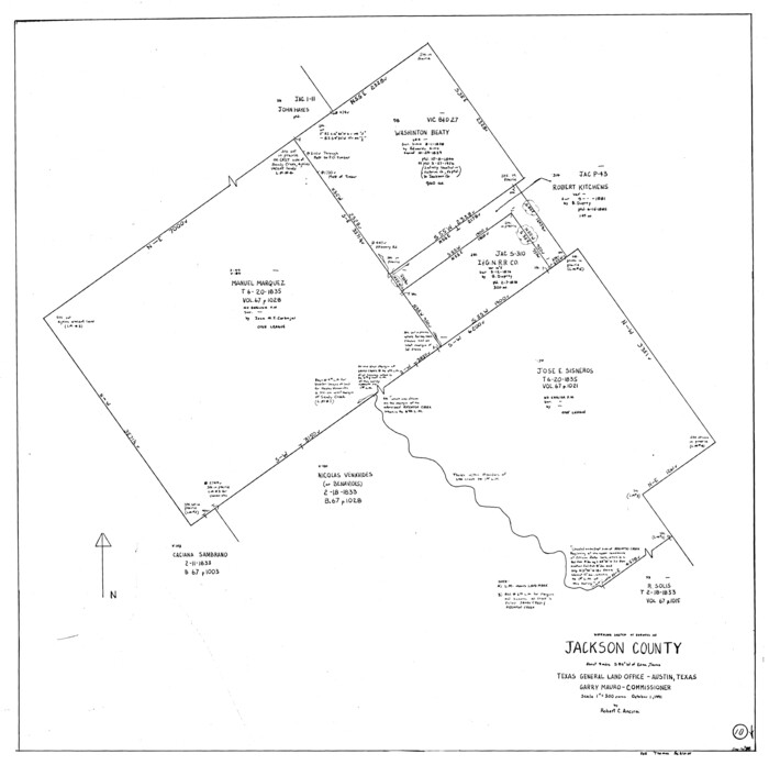
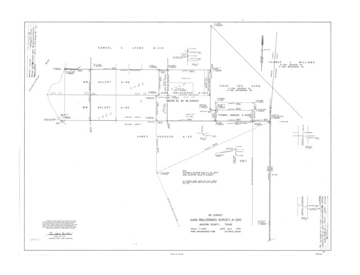
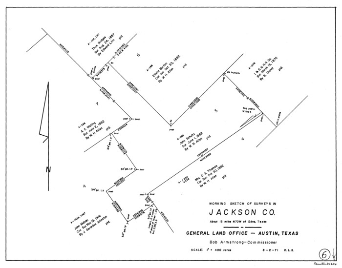
Jackson County Rolled Sketch 14
6345.tif
Print $20.00 - Digital $50.00

Jackson County Rolled Sketch 14

1978

Size: 28.3 x 37.0 inches
6345
Matagorda Bay and Approaches
73387.tif
Print $20.00 - Digital $50.00

Matagorda Bay and Approaches

1976

Size: 35.8 x 45.2 inches
73387
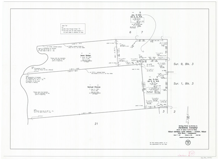
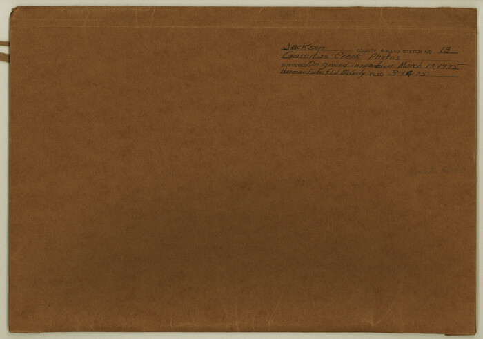
Jackson County Rolled Sketch 13
46135, Jackson County Rolled Sketch 13, General Map Collection
Print $92.00 - Digital $50.00

Jackson County Rolled Sketch 13

1975

Size: 10.7 x 15.3 inches
46135
Matagorda Bay and Approaches
73386.tif
Print $20.00 - Digital $50.00

Matagorda Bay and Approaches

1974

Size: 35.1 x 44.6 inches
73386
Matagorda Bay and Approaches
73385.tif
Print $20.00 - Digital $50.00

Matagorda Bay and Approaches

1973

Size: 34.9 x 45.0 inches
73385
Matagorda Bay and Approaches
73384.tif
Print $20.00 - Digital $50.00

Matagorda Bay and Approaches

1972

Size: 34.8 x 44.8 inches
73384
Matagorda Bay and Approaches
73383.tif
Print $20.00 - Digital $50.00

Matagorda Bay and Approaches

1965

Size: 34.8 x 44.9 inches
73383
Matagorda Bay and Approaches
73382.tif
Print $20.00 - Digital $50.00

Matagorda Bay and Approaches

1961

Size: 35.0 x 45.0 inches
73382
General Highway Map, Jackson County, Texas
79533.tif
Print $20.00

General Highway Map, Jackson County, Texas

1961

Size: 18.2 x 24.7 inches
79533
Matagorda Bay and Approaches
73381.tif
Print $20.00 - Digital $50.00

Matagorda Bay and Approaches

1957

Size: 35.1 x 44.8 inches
73381
Jackson County Aerial Photograph Index Sheet 6
83705, Jackson County Aerial Photograph Index Sheet 6, General Map Collection
Print $20.00 - Digital $50.00

Jackson County Aerial Photograph Index Sheet 6

1956

Size: 21.2 x 15.7 inches
83705
Jackson County Aerial Photograph Index Sheet 7
83706, Jackson County Aerial Photograph Index Sheet 7, General Map Collection
Print $20.00 - Digital $50.00

Jackson County Aerial Photograph Index Sheet 7

1956

Size: 21.2 x 15.8 inches
83706
Flight Mission No. CRE-1R, Frame 4, Jackson County
85324, Flight Mission No. CRE-1R, Frame 4, Jackson County, General Map Collection
Print $20.00 - Digital $50.00

Flight Mission No. CRE-1R, Frame 4, Jackson County

1956

Size: 18.5 x 22.3 inches
85324
Flight Mission No. CRE-1R, Frame 57, Jackson County
85325, Flight Mission No. CRE-1R, Frame 57, Jackson County, General Map Collection
Print $20.00 - Digital $50.00

Flight Mission No. CRE-1R, Frame 57, Jackson County

1956

Size: 17.3 x 22.4 inches
85325
Flight Mission No. CRE-1R, Frame 63, Jackson County
85326, Flight Mission No. CRE-1R, Frame 63, Jackson County, General Map Collection
Print $20.00 - Digital $50.00

Flight Mission No. CRE-1R, Frame 63, Jackson County

1956

Size: 18.6 x 18.9 inches
85326
Flight Mission No. CRE-1R, Frame 64, Jackson County
85327, Flight Mission No. CRE-1R, Frame 64, Jackson County, General Map Collection
Print $20.00 - Digital $50.00

Flight Mission No. CRE-1R, Frame 64, Jackson County

1956

Size: 15.9 x 15.9 inches
85327
The Republic County of Jackson. Boundaries Defined, December 29, 1837
96184, The Republic County of Jackson. Boundaries Defined, December 29, 1837, Nancy and Jim Tiller Digital Collection
Print $20.00 - Digital $50.00

The Republic County of Jackson. Boundaries Defined, December 29, 1837

2020

  • Size

    7.8 x 10.9 inches

  • Map/Doc

    96184

  • Creation Date

    2020

The Republic County of Jackson. September 17, 1838
96185, The Republic County of Jackson. September 17, 1838, Nancy and Jim Tiller Digital Collection
Print $20.00 - Digital $50.00

The Republic County of Jackson. September 17, 1838

2020

  • Size

    7.8 x 10.9 inches

  • Map/Doc

    96185

  • Creation Date

    2020

The Republic County of Jackson. 1840
96186, The Republic County of Jackson. 1840, Nancy and Jim Tiller Digital Collection
Print $20.00 - Digital $50.00

The Republic County of Jackson. 1840

2020

  • Size

    7.8 x 10.9 inches

  • Map/Doc

    96186

  • Creation Date

    2020

The Republic County of Jackson. 1841
96187, The Republic County of Jackson. 1841, Nancy and Jim Tiller Digital Collection
Print $20.00 - Digital $50.00

The Republic County of Jackson. 1841

2020

  • Size

    7.8 x 10.9 inches

  • Map/Doc

    96187

  • Creation Date

    2020

The Republic County of Jackson. January 19, 1841
96188, The Republic County of Jackson. January 19, 1841, Nancy and Jim Tiller Digital Collection
Print $20.00 - Digital $50.00

The Republic County of Jackson. January 19, 1841

2020

  • Size

    7.8 x 10.9 inches

  • Map/Doc

    96188

  • Creation Date

    2020

The Republic County of Jackson. January 29, 1842
96189, The Republic County of Jackson. January 29, 1842, Nancy and Jim Tiller Digital Collection
Print $20.00 - Digital $50.00

The Republic County of Jackson. January 29, 1842

2020

  • Size

    7.8 x 10.9 inches

  • Map/Doc

    96189

  • Creation Date

    2020

The Republic County of Jackson. Spring 1842
96190, The Republic County of Jackson. Spring 1842, Nancy and Jim Tiller Digital Collection
Print $20.00 - Digital $50.00

The Republic County of Jackson. Spring 1842

2020

  • Size

    7.8 x 10.9 inches

  • Map/Doc

    96190

  • Creation Date

    2020

The Republic County of Jackson. December 24, 1844
96191, The Republic County of Jackson. December 24, 1844, Nancy and Jim Tiller Digital Collection
Print $20.00 - Digital $50.00

The Republic County of Jackson. December 24, 1844

2020

  • Size

    7.8 x 10.9 inches

  • Map/Doc

    96191

  • Creation Date

    2020

The Republic County of Jackson. December 29, 1845
96192, The Republic County of Jackson. December 29, 1845, Nancy and Jim Tiller Digital Collection
Print $20.00 - Digital $50.00

The Republic County of Jackson. December 29, 1845

2020

  • Size

    7.8 x 10.9 inches

  • Map/Doc

    96192

  • Creation Date

    2020

Jackson County NRC Article 33.136 Sketch 1
94950, Jackson County NRC Article 33.136 Sketch 1, General Map Collection
Print $66.00 - Digital $50.00

Jackson County NRC Article 33.136 Sketch 1

2013

  • Size

    34.0 x 22.0 inches

  • Map/Doc

    94950

  • Creation Date

    2013

Jackson County Sketch File 21
27673, Jackson County Sketch File 21, General Map Collection
Print $70.00 - Digital $50.00

Jackson County Sketch File 21

2000

  • Size

    11.3 x 8.8 inches

  • Map/Doc

    27673

  • Creation Date

    2000

Matagorda Bay and Approaches
73390, Matagorda Bay and Approaches, General Map Collection
Print $20.00 - Digital $50.00

Matagorda Bay and Approaches

1992

  • Size

    36.6 x 44.6 inches

  • Map/Doc

    73390

  • Creation Date

    1992

Matagorda Bay and Approaches
73389, Matagorda Bay and Approaches, General Map Collection
Print $20.00 - Digital $50.00

Matagorda Bay and Approaches

1989

  • Size

    36.3 x 45.0 inches

  • Map/Doc

    73389

  • Creation Date

    1989

Matagorda Bay and Approaches
73388, Matagorda Bay and Approaches, General Map Collection
Print $20.00 - Digital $50.00

Matagorda Bay and Approaches

1982

  • Size

    36.2 x 44.9 inches

  • Map/Doc

    73388

  • Creation Date

    1982

Jackson County Rolled Sketch 14
6345, Jackson County Rolled Sketch 14, General Map Collection
Print $20.00 - Digital $50.00

Jackson County Rolled Sketch 14

1978

  • Size

    28.3 x 37.0 inches

  • Map/Doc

    6345

  • Creation Date

    1978

Matagorda Bay and Approaches
73387, Matagorda Bay and Approaches, General Map Collection
Print $20.00 - Digital $50.00

Matagorda Bay and Approaches

1976

  • Size

    35.8 x 45.2 inches

  • Map/Doc

    73387

  • Creation Date

    1976

Jackson County Rolled Sketch 13
46135, Jackson County Rolled Sketch 13, General Map Collection
Print $92.00 - Digital $50.00

Jackson County Rolled Sketch 13

1975

  • Size

    10.7 x 15.3 inches

  • Map/Doc

    46135

  • Creation Date

    1975

Matagorda Bay and Approaches
73386, Matagorda Bay and Approaches, General Map Collection
Print $20.00 - Digital $50.00

Matagorda Bay and Approaches

1974

  • Size

    35.1 x 44.6 inches

  • Map/Doc

    73386

  • Creation Date

    1974

Matagorda Bay and Approaches
73385, Matagorda Bay and Approaches, General Map Collection
Print $20.00 - Digital $50.00

Matagorda Bay and Approaches

1973

  • Size

    34.9 x 45.0 inches

  • Map/Doc

    73385

  • Creation Date

    1973

Matagorda Bay and Approaches
73384, Matagorda Bay and Approaches, General Map Collection
Print $20.00 - Digital $50.00

Matagorda Bay and Approaches

1972

  • Size

    34.8 x 44.8 inches

  • Map/Doc

    73384

  • Creation Date

    1972

Matagorda Bay and Approaches
73383, Matagorda Bay and Approaches, General Map Collection
Print $20.00 - Digital $50.00

Matagorda Bay and Approaches

1965

  • Size

    34.8 x 44.9 inches

  • Map/Doc

    73383

  • Creation Date

    1965

Matagorda Bay and Approaches
73382, Matagorda Bay and Approaches, General Map Collection
Print $20.00 - Digital $50.00

Matagorda Bay and Approaches

1961

  • Size

    35.0 x 45.0 inches

  • Map/Doc

    73382

  • Creation Date

    1961

General Highway Map, Jackson County, Texas
79533, General Highway Map, Jackson County, Texas, Texas State Library and Archives
Print $20.00

General Highway Map, Jackson County, Texas

1961

  • Size

    18.2 x 24.7 inches

  • Map/Doc

    79533

  • Creation Date

    1961

Matagorda Bay and Approaches
73381, Matagorda Bay and Approaches, General Map Collection
Print $20.00 - Digital $50.00

Matagorda Bay and Approaches

1957

  • Size

    35.1 x 44.8 inches

  • Map/Doc

    73381

  • Creation Date

    1957

Jackson County Aerial Photograph Index Sheet 6
83705, Jackson County Aerial Photograph Index Sheet 6, General Map Collection
Print $20.00 - Digital $50.00

Jackson County Aerial Photograph Index Sheet 6

1956

  • Size

    21.2 x 15.7 inches

  • Map/Doc

    83705

  • Creation Date

    1956

Jackson County Aerial Photograph Index Sheet 7
83706, Jackson County Aerial Photograph Index Sheet 7, General Map Collection
Print $20.00 - Digital $50.00

Jackson County Aerial Photograph Index Sheet 7

1956

  • Size

    21.2 x 15.8 inches

  • Map/Doc

    83706

  • Creation Date

    1956

Flight Mission No. CRE-1R, Frame 4, Jackson County
85324, Flight Mission No. CRE-1R, Frame 4, Jackson County, General Map Collection
Print $20.00 - Digital $50.00

Flight Mission No. CRE-1R, Frame 4, Jackson County

1956

  • Size

    18.5 x 22.3 inches

  • Map/Doc

    85324

  • Creation Date

    1956

Flight Mission No. CRE-1R, Frame 57, Jackson County
85325, Flight Mission No. CRE-1R, Frame 57, Jackson County, General Map Collection
Print $20.00 - Digital $50.00

Flight Mission No. CRE-1R, Frame 57, Jackson County

1956

  • Size

    17.3 x 22.4 inches

  • Map/Doc

    85325

  • Creation Date

    1956

Flight Mission No. CRE-1R, Frame 63, Jackson County
85326, Flight Mission No. CRE-1R, Frame 63, Jackson County, General Map Collection
Print $20.00 - Digital $50.00

Flight Mission No. CRE-1R, Frame 63, Jackson County

1956

  • Size

    18.6 x 18.9 inches

  • Map/Doc

    85326

  • Creation Date

    1956

Flight Mission No. CRE-1R, Frame 64, Jackson County
85327, Flight Mission No. CRE-1R, Frame 64, Jackson County, General Map Collection
Print $20.00 - Digital $50.00

Flight Mission No. CRE-1R, Frame 64, Jackson County

1956

  • Size

    15.9 x 15.9 inches

  • Map/Doc

    85327

  • Creation Date

    1956