Lamb County Working Sketch 4

Print $40.00
- Digital $50.00
Lamb County Working Sketch 4
1984
Size: 42.9 x 58.0 inches
70277
Lamb County Sketch File 18

Print $4.00
- Digital $50.00
Lamb County Sketch File 18
1979
Size: 14.3 x 8.9 inches
29381
Bailey County Working Sketch 6

Print $20.00
- Digital $50.00
Bailey County Working Sketch 6
1966
Size: 37.0 x 34.5 inches
67593
Lamb County Working Sketch 3

Print $20.00
- Digital $50.00
Lamb County Working Sketch 3
1962
Size: 32.1 x 37.7 inches
70276
Lamb County Working Sketch Graphic Index

Print $20.00
- Digital $50.00
Lamb County Working Sketch Graphic Index
1961
Size: 43.8 x 34.1 inches
76613
General Highway Map, Lamb County, Texas

Print $20.00
General Highway Map, Lamb County, Texas
1961
Size: 24.5 x 18.2 inches
79562
Plat Showing Part of Block Y, W. D. and F. W. Johnson Subdivision Number 2; and Part of Block W, Edward K. Warren Subdivision Number 1

Print $20.00
- Digital $50.00
Plat Showing Part of Block Y, W. D. and F. W. Johnson Subdivision Number 2; and Part of Block W, Edward K. Warren Subdivision Number 1
1954
Size: 23.3 x 17.4 inches
92502
League 206, Ochiltree County School Land, Bailey and Lamb Counties, Texas

Print $20.00
- Digital $50.00
League 206, Ochiltree County School Land, Bailey and Lamb Counties, Texas
1954
Size: 36.9 x 25.0 inches
92537
Part of Block T-2 Lamb County Texas

Print $20.00
- Digital $50.00
Part of Block T-2 Lamb County Texas
1952
Size: 14.3 x 24.6 inches
92182
Western Cotton Oil Co. Property Lamb County, Texas

Print $20.00
- Digital $50.00
Western Cotton Oil Co. Property Lamb County, Texas
1951
Size: 20.9 x 16.9 inches
92166
Western Cotton Oil Co. Property Lamb County, Texas

Print $20.00
- Digital $50.00
Western Cotton Oil Co. Property Lamb County, Texas
1951
Size: 24.1 x 19.6 inches
92165
P. W. Walker Seed and Grain Co. Littlefield, Texas

Print $20.00
- Digital $50.00
P. W. Walker Seed and Grain Co. Littlefield, Texas
1950
Size: 36.9 x 15.8 inches
92404
General Highway Map Lamb County, Texas

Print $20.00
- Digital $50.00
General Highway Map Lamb County, Texas
1949
Size: 19.0 x 26.0 inches
92172
Spade Ranch Hockley County, Texas

Print $3.00
- Digital $50.00
Spade Ranch Hockley County, Texas
1948
Size: 17.6 x 7.7 inches
92226
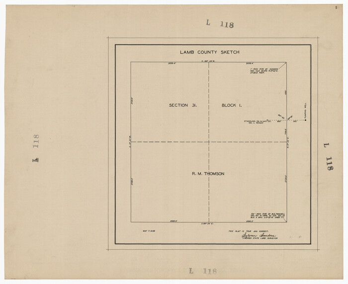
[Block 1, Section 31]
Print $20.00
- Digital $50.00
[Block 1, Section 31]
1946
Size: 24.3 x 19.7 inches
92171
Castro County Rolled Sketch 12

Print $20.00
- Digital $50.00
Castro County Rolled Sketch 12
1945
Size: 25.7 x 15.8 inches
5421
Lamb County Sketch File 17

Print $20.00
- Digital $50.00
Lamb County Sketch File 17
1940
Size: 25.4 x 12.3 inches
11973
General Highway Map, Lamb County, Texas

Print $20.00
General Highway Map, Lamb County, Texas
1940
Size: 24.7 x 18.3 inches
79168
Ownership Map Lamb County

Print $20.00
- Digital $50.00
Ownership Map Lamb County
1934
Size: 37.6 x 45.0 inches
89847
Lamb County Sketch File 16

Print $4.00
- Digital $50.00
Lamb County Sketch File 16
1929
Size: 11.2 x 8.8 inches
29379
Yellowhouse Addition to Littlefield, Texas Located on Labors 12 & 13 Capitol League 664

Print $20.00
- Digital $50.00
Yellowhouse Addition to Littlefield, Texas Located on Labors 12 & 13 Capitol League 664
1925
Size: 26.9 x 26.7 inches
92402
Sudan Cemetery Sudan, Texas

Print $20.00
- Digital $50.00
Sudan Cemetery Sudan, Texas
1925
Size: 24.1 x 28.2 inches
92403
Sketch Portion of Lamb County, Texas

Print $20.00
- Digital $50.00
Sketch Portion of Lamb County, Texas
1924
Size: 19.9 x 21.4 inches
92176
Lamb County Working Sketch 2

Print $20.00
- Digital $50.00
Lamb County Working Sketch 2
1919
Size: 13.6 x 15.3 inches
70275
Map Showing Resurvey of Capitol Leagues, Bailey, Lamb & Castro Co's.

Print $20.00
- Digital $50.00
Map Showing Resurvey of Capitol Leagues, Bailey, Lamb & Castro Co's.
1918
Size: 17.3 x 42.5 inches
1758
Map Showing Resurvey of Capitol Leagues, Lamb, Cochran & Hockley Co's.

Print $20.00
- Digital $50.00
Map Showing Resurvey of Capitol Leagues, Lamb, Cochran & Hockley Co's.
1918
Size: 37.0 x 29.3 inches
1759
Lamb County Rolled Sketch 3

Print $20.00
- Digital $50.00
Lamb County Rolled Sketch 3
1917
Size: 23.0 x 42.5 inches
9413
Lamb County Working Sketch 4
Print $40.00
- Digital $50.00
Lamb County Working Sketch 4
1984
-
Size
42.9 x 58.0 inches
-
Map/Doc
70277
-
Creation Date
1984
Lamb County Sketch File 18
Print $4.00
- Digital $50.00
Lamb County Sketch File 18
1979
-
Size
14.3 x 8.9 inches
-
Map/Doc
29381
-
Creation Date
1979
Bailey County Working Sketch 6
Print $20.00
- Digital $50.00
Bailey County Working Sketch 6
1966
-
Size
37.0 x 34.5 inches
-
Map/Doc
67593
-
Creation Date
1966
Lamb County Working Sketch 3
Print $20.00
- Digital $50.00
Lamb County Working Sketch 3
1962
-
Size
32.1 x 37.7 inches
-
Map/Doc
70276
-
Creation Date
1962
Lamb County

Print $20.00
- Digital $50.00
Lamb County
1961
-
Size
45.2 x 35.4 inches
-
Map/Doc
73213
-
Creation Date
1961
Lamb County Working Sketch Graphic Index
Print $20.00
- Digital $50.00
Lamb County Working Sketch Graphic Index
1961
-
Size
43.8 x 34.1 inches
-
Map/Doc
76613
-
Creation Date
1961
Lamb County

Print $20.00
- Digital $50.00
Lamb County
1961
-
Size
39.6 x 30.6 inches
-
Map/Doc
77346
-
Creation Date
1961
Lamb County

Print $20.00
- Digital $50.00
Lamb County
1961
-
Size
46.7 x 36.7 inches
-
Map/Doc
95564
-
Creation Date
1961
General Highway Map, Lamb County, Texas
Print $20.00
General Highway Map, Lamb County, Texas
1961
-
Size
24.5 x 18.2 inches
-
Map/Doc
79562
-
Creation Date
1961
Plat Showing Part of Block Y, W. D. and F. W. Johnson Subdivision Number 2; and Part of Block W, Edward K. Warren Subdivision Number 1
Print $20.00
- Digital $50.00
Plat Showing Part of Block Y, W. D. and F. W. Johnson Subdivision Number 2; and Part of Block W, Edward K. Warren Subdivision Number 1
1954
-
Size
23.3 x 17.4 inches
-
Map/Doc
92502
-
Creation Date
1954
League 206, Ochiltree County School Land, Bailey and Lamb Counties, Texas
Print $20.00
- Digital $50.00
League 206, Ochiltree County School Land, Bailey and Lamb Counties, Texas
1954
-
Size
36.9 x 25.0 inches
-
Map/Doc
92537
-
Creation Date
1954
Part of Block T-2 Lamb County Texas
Print $20.00
- Digital $50.00
Part of Block T-2 Lamb County Texas
1952
-
Size
14.3 x 24.6 inches
-
Map/Doc
92182
-
Creation Date
1952
Western Cotton Oil Co. Property Lamb County, Texas
Print $20.00
- Digital $50.00
Western Cotton Oil Co. Property Lamb County, Texas
1951
-
Size
20.9 x 16.9 inches
-
Map/Doc
92166
-
Creation Date
1951
Western Cotton Oil Co. Property Lamb County, Texas
Print $20.00
- Digital $50.00
Western Cotton Oil Co. Property Lamb County, Texas
1951
-
Size
24.1 x 19.6 inches
-
Map/Doc
92165
-
Creation Date
1951
P. W. Walker Seed and Grain Co. Littlefield, Texas
Print $20.00
- Digital $50.00
P. W. Walker Seed and Grain Co. Littlefield, Texas
1950
-
Size
36.9 x 15.8 inches
-
Map/Doc
92404
-
Creation Date
1950
General Highway Map Lamb County, Texas
Print $20.00
- Digital $50.00
General Highway Map Lamb County, Texas
1949
-
Size
19.0 x 26.0 inches
-
Map/Doc
92172
-
Creation Date
1949
Spade Ranch Hockley County, Texas
Print $3.00
- Digital $50.00
Spade Ranch Hockley County, Texas
1948
-
Size
17.6 x 7.7 inches
-
Map/Doc
92226
-
Creation Date
1948
[Block 1, Section 31]
Print $20.00
- Digital $50.00
[Block 1, Section 31]
1946
-
Size
24.3 x 19.7 inches
-
Map/Doc
92171
-
Creation Date
1946
Castro County Rolled Sketch 12
Print $20.00
- Digital $50.00
Castro County Rolled Sketch 12
1945
-
Size
25.7 x 15.8 inches
-
Map/Doc
5421
-
Creation Date
1945
Lamb County Sketch File 17
Print $20.00
- Digital $50.00
Lamb County Sketch File 17
1940
-
Size
25.4 x 12.3 inches
-
Map/Doc
11973
-
Creation Date
1940
General Highway Map, Lamb County, Texas
Print $20.00
General Highway Map, Lamb County, Texas
1940
-
Size
24.7 x 18.3 inches
-
Map/Doc
79168
-
Creation Date
1940
Ownership Map Lamb County
Print $20.00
- Digital $50.00
Ownership Map Lamb County
1934
-
Size
37.6 x 45.0 inches
-
Map/Doc
89847
-
Creation Date
1934
Lamb County Sketch File 16
Print $4.00
- Digital $50.00
Lamb County Sketch File 16
1929
-
Size
11.2 x 8.8 inches
-
Map/Doc
29379
-
Creation Date
1929
Yellowhouse Addition to Littlefield, Texas Located on Labors 12 & 13 Capitol League 664
Print $20.00
- Digital $50.00
Yellowhouse Addition to Littlefield, Texas Located on Labors 12 & 13 Capitol League 664
1925
-
Size
26.9 x 26.7 inches
-
Map/Doc
92402
-
Creation Date
1925
Sudan Cemetery Sudan, Texas
Print $20.00
- Digital $50.00
Sudan Cemetery Sudan, Texas
1925
-
Size
24.1 x 28.2 inches
-
Map/Doc
92403
-
Creation Date
1925
Sketch Portion of Lamb County, Texas
Print $20.00
- Digital $50.00
Sketch Portion of Lamb County, Texas
1924
-
Size
19.9 x 21.4 inches
-
Map/Doc
92176
-
Creation Date
1924
Lamb County Working Sketch 2
Print $20.00
- Digital $50.00
Lamb County Working Sketch 2
1919
-
Size
13.6 x 15.3 inches
-
Map/Doc
70275
-
Creation Date
1919
Map Showing Resurvey of Capitol Leagues, Bailey, Lamb & Castro Co's.
Print $20.00
- Digital $50.00
Map Showing Resurvey of Capitol Leagues, Bailey, Lamb & Castro Co's.
1918
-
Size
17.3 x 42.5 inches
-
Map/Doc
1758
-
Creation Date
1918
Map Showing Resurvey of Capitol Leagues, Lamb, Cochran & Hockley Co's.
Print $20.00
- Digital $50.00
Map Showing Resurvey of Capitol Leagues, Lamb, Cochran & Hockley Co's.
1918
-
Size
37.0 x 29.3 inches
-
Map/Doc
1759
-
Creation Date
1918
Lamb County Rolled Sketch 3
Print $20.00
- Digital $50.00
Lamb County Rolled Sketch 3
1917
-
Size
23.0 x 42.5 inches
-
Map/Doc
9413
-
Creation Date
1917