[Surveys in the Liberty District]
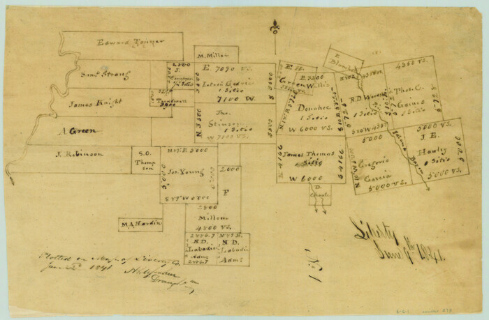
Print $2.00
- Digital $50.00
[Surveys in the Liberty District]
1841
Size: 7.0 x 10.7 inches
273
[Surveys in Vehlein's Colony along the San Jacinto River and Cedar Bayou]
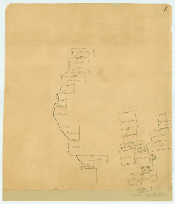
Print $20.00
- Digital $50.00
[Surveys in Vehlein's Colony along the San Jacinto River and Cedar Bayou]
1837
Size: 17.5 x 15.1 inches
75
[Surveys in Liberty County]
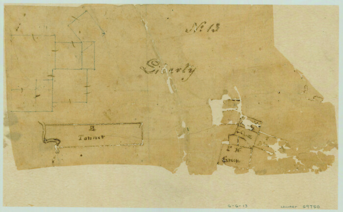
Print $2.00
- Digital $50.00
[Surveys in Liberty County]
Size: 5.8 x 9.3 inches
69750
[Surveys along the Trinity River]
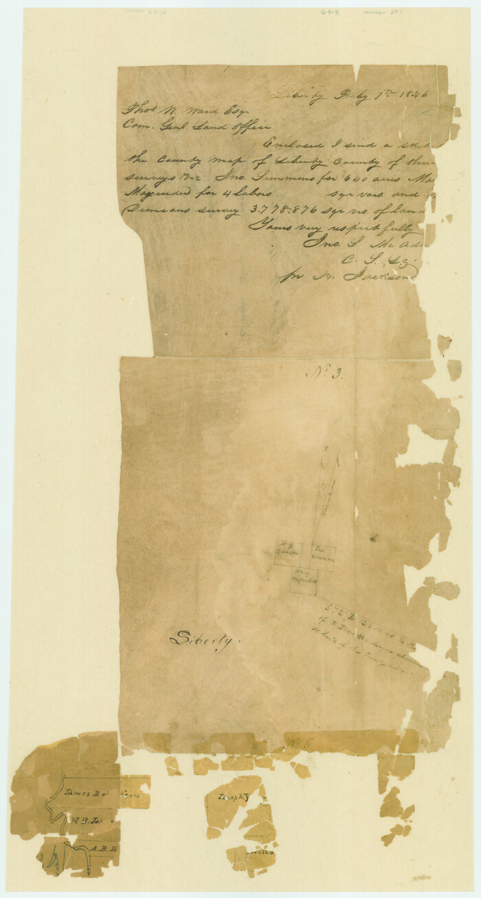
Print $3.00
- Digital $50.00
[Surveys along the Trinity River]
Size: 17.8 x 9.5 inches
297
[Surveys along the Trinity River]
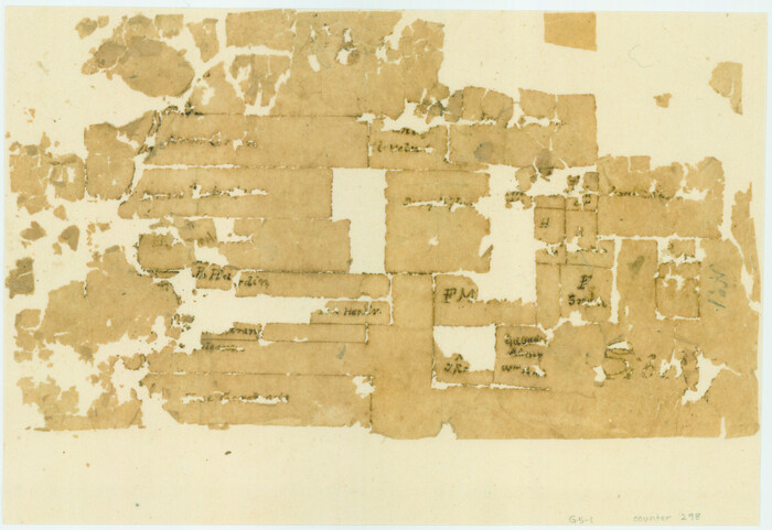
Print $2.00
- Digital $50.00
[Surveys along the Trinity River]
Size: 6.3 x 9.2 inches
298
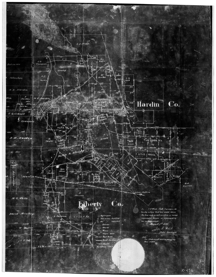
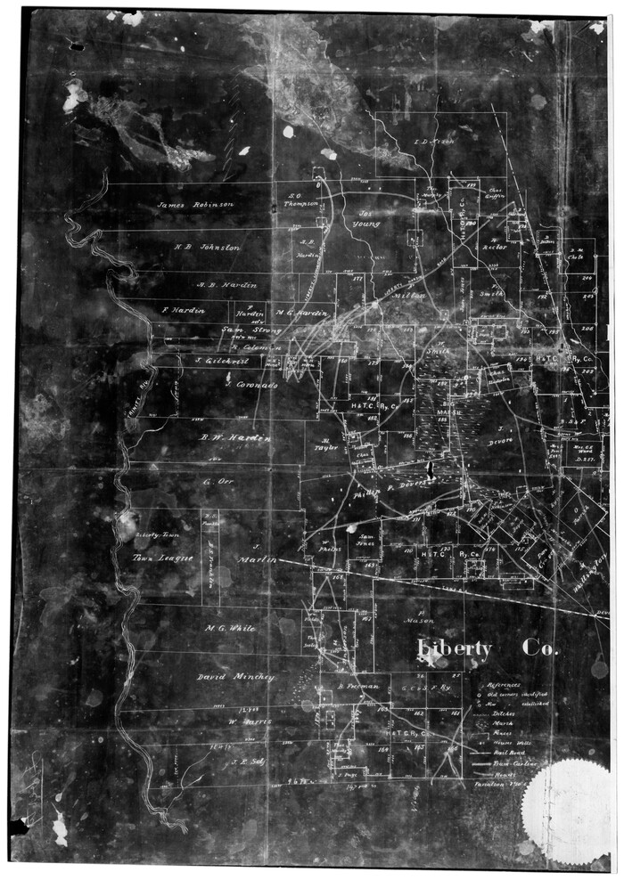
[Surveys along the Liberty and Hardin County line]
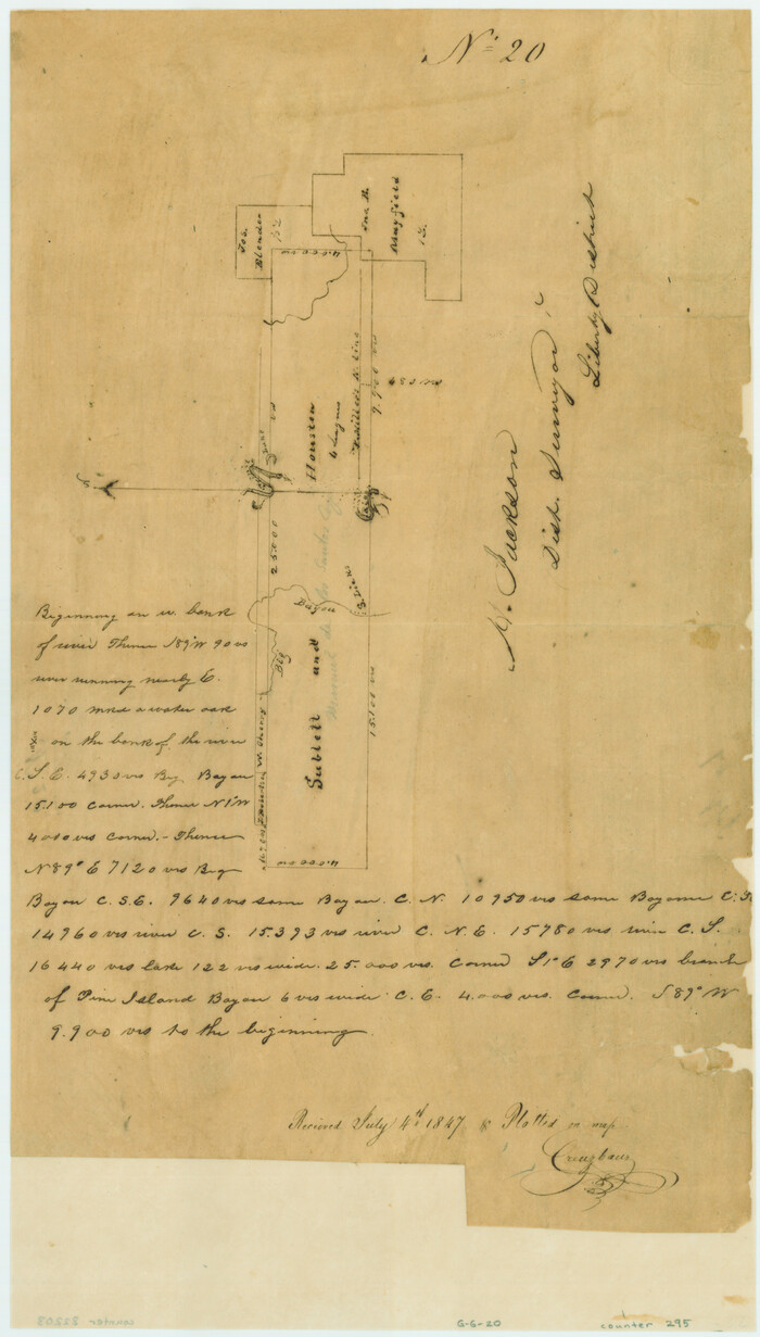
Print $2.00
- Digital $50.00
[Surveys along the Liberty and Hardin County line]
1847
Size: 13.5 x 7.7 inches
295
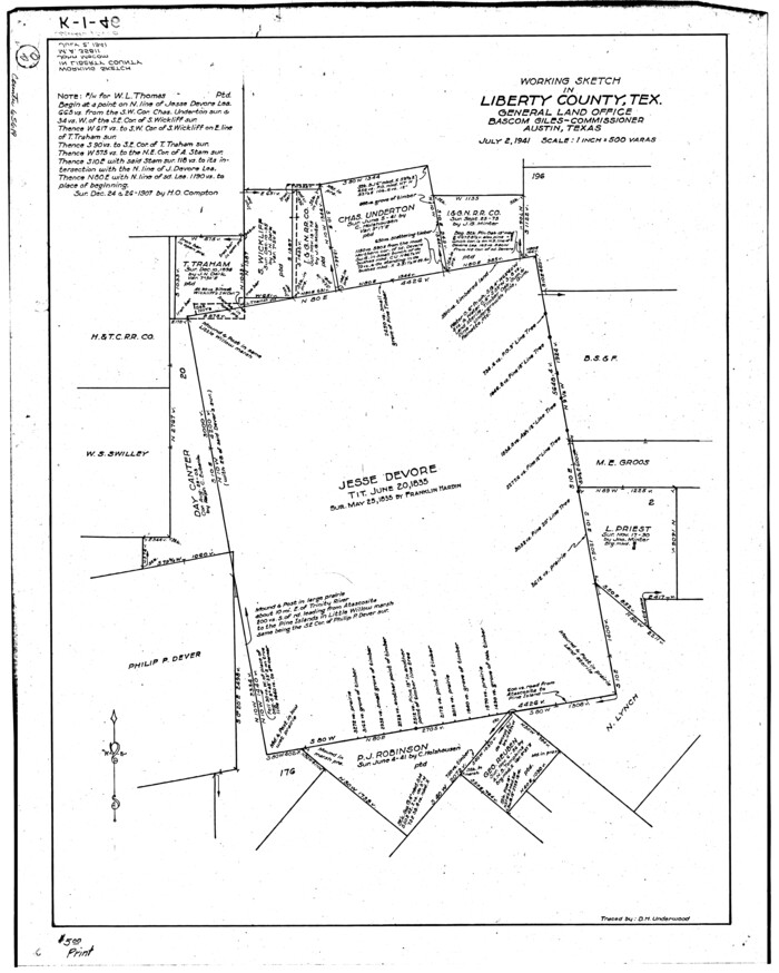
[Sketch for Mineral Application 35981 - Liberty County, John Mecom]
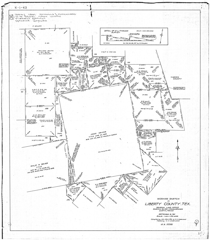
Print $20.00
- Digital $50.00
[Sketch for Mineral Application 35981 - Liberty County, John Mecom]
1941
Size: 30.2 x 26.5 inches
65617
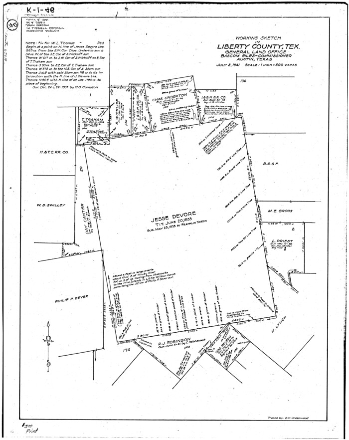
[Sketch for Mineral Application 35981 - Liberty County, John Mecom]
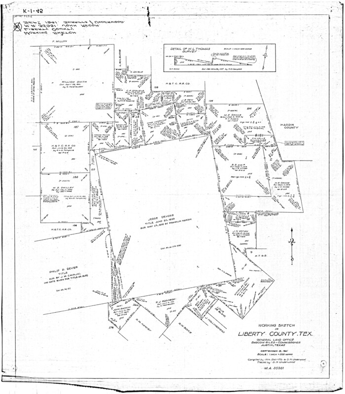
Print $20.00
- Digital $50.00
[Sketch for Mineral Application 35981 - Liberty County, John Mecom]
1941
Size: 30.1 x 26.4 inches
65618
[Sketch for Mineral Application 35811 - Liberty County, John Mecom]
Print $4.00
- Digital $50.00
[Sketch for Mineral Application 35811 - Liberty County, John Mecom]
1941
Size: 24.9 x 20.0 inches
65619
[Sketch for Mineral Application 35811 - Liberty County, John Mecom]
Print $4.00
- Digital $50.00
[Sketch for Mineral Application 35811 - Liberty County, John Mecom]
1941
Size: 24.8 x 19.7 inches
65620
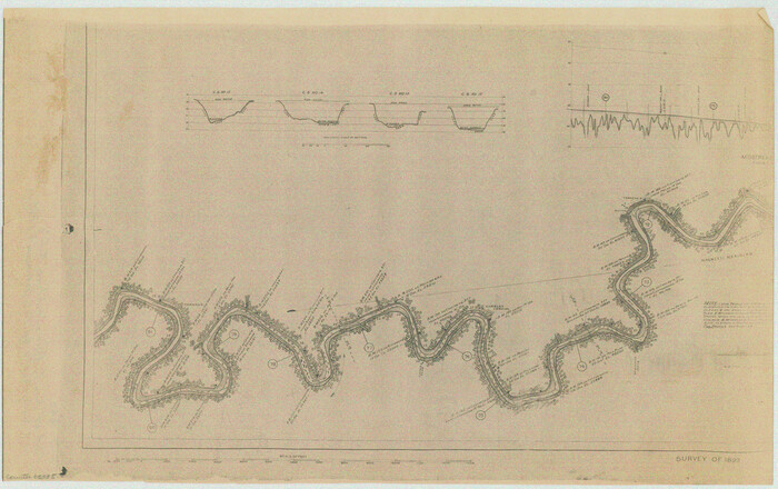
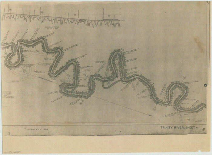
[Plat of Trinity River w/ Midstream Profile in Liberty County by US Government 1899]
Print $20.00
- Digital $50.00
[Plat of Trinity River w/ Midstream Profile in Liberty County by US Government 1899]
1899
Size: 11.5 x 18.3 inches
65335
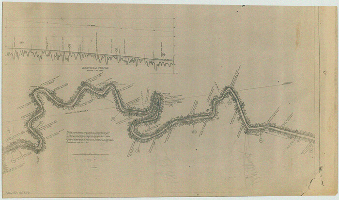
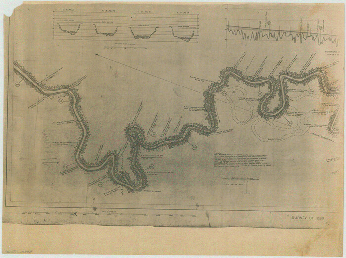
[Plat of Trinity River w/ Midstream Profile in Liberty County by US Government 1899]
Print $20.00
- Digital $50.00
[Plat of Trinity River w/ Midstream Profile in Liberty County by US Government 1899]
1899
Size: 10.8 x 18.3 inches
65336
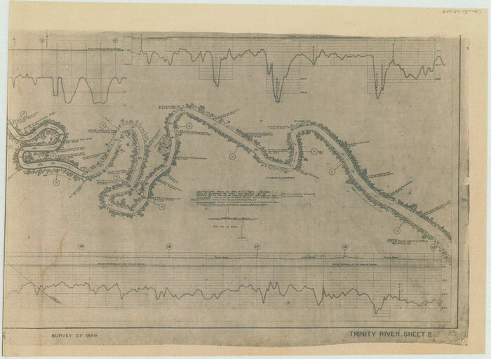
[Plat of Trinity River w/ Midstream Profile in Liberty County by US Government 1899]
Print $20.00
- Digital $50.00
[Plat of Trinity River w/ Midstream Profile in Liberty County by US Government 1899]
1899
Size: 12.3 x 16.7 inches
65337
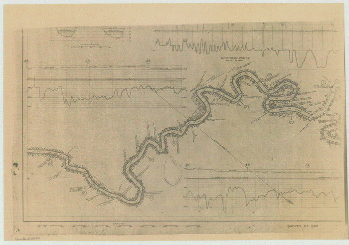
[Plat of Trinity River w/ Midstream Profile in Liberty County by US Government 1899]
Print $20.00
- Digital $50.00
[Plat of Trinity River w/ Midstream Profile in Liberty County by US Government 1899]
1899
Size: 12.5 x 16.8 inches
65338
[Plat of Trinity River w/ Midstream Profile in Liberty County by US Government 1899]
Print $20.00
- Digital $50.00
[Plat of Trinity River w/ Midstream Profile in Liberty County by US Government 1899]
1899
Size: 12.8 x 17.6 inches
65339
[Plat of Trinity River w/ Midstream Profile in Liberty County by US Government 1899]
Print $20.00
- Digital $50.00
[Plat of Trinity River w/ Midstream Profile in Liberty County by US Government 1899]
1899
Size: 12.8 x 18.2 inches
65340
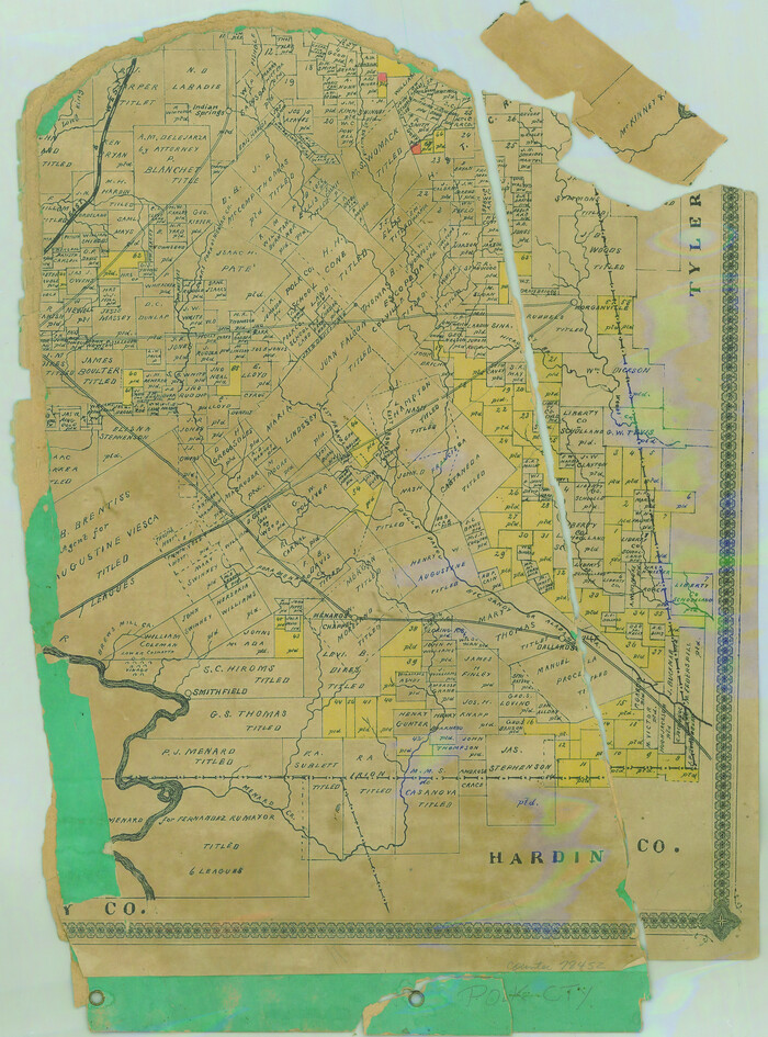
[Partial Map of Polk County, Texas]
Print $20.00
- Digital $50.00
[Partial Map of Polk County, Texas]
Size: 16.6 x 12.3 inches
78452
[Map Showing Surveys in Liberty, Chambers and Harris Counties, Texas]

Print $20.00
- Digital $50.00
[Map Showing Surveys in Liberty, Chambers and Harris Counties, Texas]
1890
Size: 16.1 x 21.1 inches
75768
[Liberty County, Texas]
Print $20.00
- Digital $50.00
[Liberty County, Texas]
1890
Size: 23.7 x 18.3 inches
2058
[Liberty County, Texas]
Print $20.00
- Digital $50.00
[Liberty County, Texas]
1890
Size: 24.2 x 16.9 inches
60297
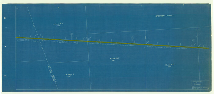
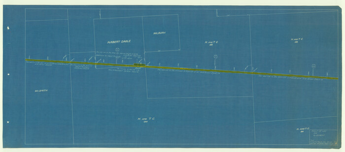
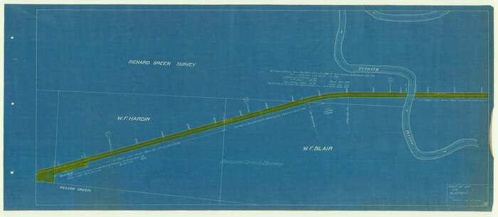
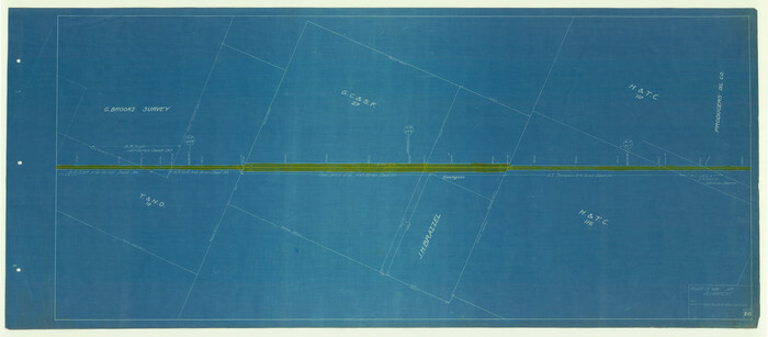
[Beaumont, Sour Lake and Western Ry. Right of Way and Alignment - Frisco]
Print $20.00
- Digital $50.00
[Beaumont, Sour Lake and Western Ry. Right of Way and Alignment - Frisco]
1910
Size: 20.3 x 46.1 inches
64116
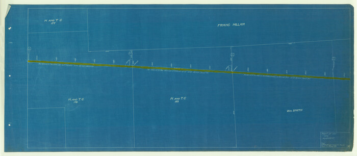
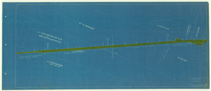
[Beaumont, Sour Lake and Western Ry. Right of Way and Alignment - Frisco]
Print $20.00
- Digital $50.00
[Beaumont, Sour Lake and Western Ry. Right of Way and Alignment - Frisco]
1910
Size: 20.2 x 45.9 inches
64117
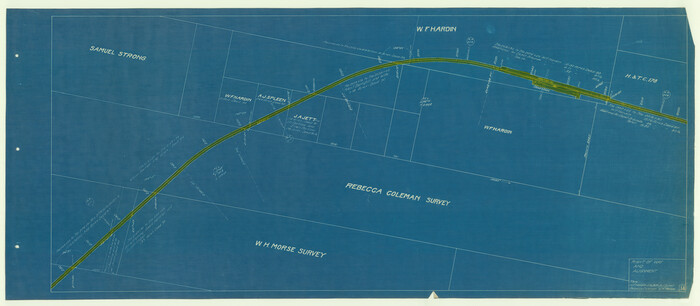
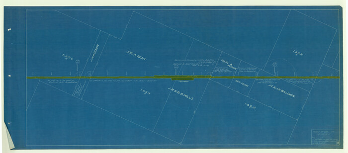
[Beaumont, Sour Lake and Western Ry. Right of Way and Alignment - Frisco]
Print $20.00
- Digital $50.00
[Beaumont, Sour Lake and Western Ry. Right of Way and Alignment - Frisco]
1910
Size: 20.1 x 46.1 inches
64118
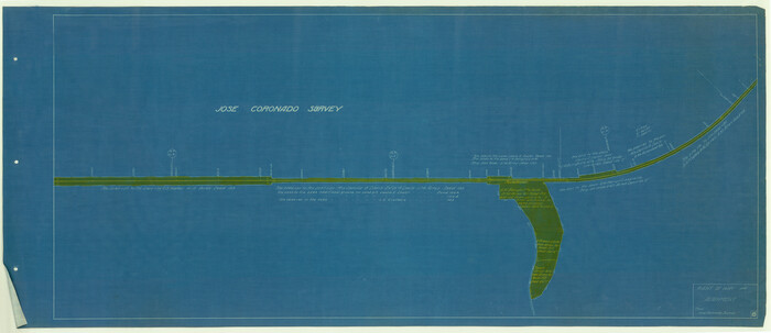
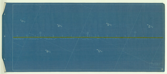
[Beaumont, Sour Lake and Western Ry. Right of Way and Alignment - Frisco]
Print $20.00
- Digital $50.00
[Beaumont, Sour Lake and Western Ry. Right of Way and Alignment - Frisco]
1910
Size: 20.0 x 45.8 inches
64119
[Beaumont, Sour Lake and Western Ry. Right of Way and Alignment - Frisco]
Print $20.00
- Digital $50.00
[Beaumont, Sour Lake and Western Ry. Right of Way and Alignment - Frisco]
1910
Size: 19.7 x 45.6 inches
64120
[Beaumont, Sour Lake and Western Ry. Right of Way and Alignment - Frisco]
Print $20.00
- Digital $50.00
[Beaumont, Sour Lake and Western Ry. Right of Way and Alignment - Frisco]
1910
Size: 20.0 x 45.8 inches
64121
[Beaumont, Sour Lake and Western Ry. Right of Way and Alignment - Frisco]
Print $20.00
- Digital $50.00
[Beaumont, Sour Lake and Western Ry. Right of Way and Alignment - Frisco]
1910
Size: 19.8 x 45.9 inches
64122
[Beaumont, Sour Lake and Western Ry. Right of Way and Alignment - Frisco]
Print $20.00
- Digital $50.00
[Beaumont, Sour Lake and Western Ry. Right of Way and Alignment - Frisco]
1910
Size: 20.4 x 46.2 inches
64123
[Beaumont, Sour Lake and Western Ry. Right of Way and Alignment - Frisco]
Print $20.00
- Digital $50.00
[Beaumont, Sour Lake and Western Ry. Right of Way and Alignment - Frisco]
1910
Size: 20.4 x 46.0 inches
64124
[Beaumont, Sour Lake and Western Ry. Right of Way and Alignment - Frisco]
Print $20.00
- Digital $50.00
[Beaumont, Sour Lake and Western Ry. Right of Way and Alignment - Frisco]
1910
Size: 20.1 x 45.9 inches
64125
[Surveys in the Liberty District]
Print $2.00
- Digital $50.00
[Surveys in the Liberty District]
1841
-
Size
7.0 x 10.7 inches
-
Map/Doc
273
-
Creation Date
1841
[Surveys in Vehlein's Colony along the San Jacinto River and Cedar Bayou]
Print $20.00
- Digital $50.00
[Surveys in Vehlein's Colony along the San Jacinto River and Cedar Bayou]
1837
-
Size
17.5 x 15.1 inches
-
Map/Doc
75
-
Creation Date
1837
[Surveys in Liberty County]
Print $2.00
- Digital $50.00
[Surveys in Liberty County]
-
Size
5.8 x 9.3 inches
-
Map/Doc
69750
[Surveys along the Trinity River]
Print $3.00
- Digital $50.00
[Surveys along the Trinity River]
-
Size
17.8 x 9.5 inches
-
Map/Doc
297
[Surveys along the Trinity River]
Print $2.00
- Digital $50.00
[Surveys along the Trinity River]
-
Size
6.3 x 9.2 inches
-
Map/Doc
298
[Surveys along the Liberty and Hardin County line]
Print $2.00
- Digital $50.00
[Surveys along the Liberty and Hardin County line]
1847
-
Size
13.5 x 7.7 inches
-
Map/Doc
295
-
Creation Date
1847
[Sketch for Mineral Application 35981 - Liberty County, John Mecom]
Print $20.00
- Digital $50.00
[Sketch for Mineral Application 35981 - Liberty County, John Mecom]
1941
-
Size
30.2 x 26.5 inches
-
Map/Doc
65617
-
Creation Date
1941
[Sketch for Mineral Application 35981 - Liberty County, John Mecom]
Print $20.00
- Digital $50.00
[Sketch for Mineral Application 35981 - Liberty County, John Mecom]
1941
-
Size
30.1 x 26.4 inches
-
Map/Doc
65618
-
Creation Date
1941
[Sketch for Mineral Application 35811 - Liberty County, John Mecom]
Print $4.00
- Digital $50.00
[Sketch for Mineral Application 35811 - Liberty County, John Mecom]
1941
-
Size
24.9 x 20.0 inches
-
Map/Doc
65619
-
Creation Date
1941
[Sketch for Mineral Application 35811 - Liberty County, John Mecom]
Print $4.00
- Digital $50.00
[Sketch for Mineral Application 35811 - Liberty County, John Mecom]
1941
-
Size
24.8 x 19.7 inches
-
Map/Doc
65620
-
Creation Date
1941
[Plat of Trinity River w/ Midstream Profile in Liberty County by US Government 1899]
Print $20.00
- Digital $50.00
[Plat of Trinity River w/ Midstream Profile in Liberty County by US Government 1899]
1899
-
Size
11.5 x 18.3 inches
-
Map/Doc
65335
-
Creation Date
1899
[Plat of Trinity River w/ Midstream Profile in Liberty County by US Government 1899]
Print $20.00
- Digital $50.00
[Plat of Trinity River w/ Midstream Profile in Liberty County by US Government 1899]
1899
-
Size
10.8 x 18.3 inches
-
Map/Doc
65336
-
Creation Date
1899
[Plat of Trinity River w/ Midstream Profile in Liberty County by US Government 1899]
Print $20.00
- Digital $50.00
[Plat of Trinity River w/ Midstream Profile in Liberty County by US Government 1899]
1899
-
Size
12.3 x 16.7 inches
-
Map/Doc
65337
-
Creation Date
1899
[Plat of Trinity River w/ Midstream Profile in Liberty County by US Government 1899]
Print $20.00
- Digital $50.00
[Plat of Trinity River w/ Midstream Profile in Liberty County by US Government 1899]
1899
-
Size
12.5 x 16.8 inches
-
Map/Doc
65338
-
Creation Date
1899
[Plat of Trinity River w/ Midstream Profile in Liberty County by US Government 1899]
Print $20.00
- Digital $50.00
[Plat of Trinity River w/ Midstream Profile in Liberty County by US Government 1899]
1899
-
Size
12.8 x 17.6 inches
-
Map/Doc
65339
-
Creation Date
1899
[Plat of Trinity River w/ Midstream Profile in Liberty County by US Government 1899]
Print $20.00
- Digital $50.00
[Plat of Trinity River w/ Midstream Profile in Liberty County by US Government 1899]
1899
-
Size
12.8 x 18.2 inches
-
Map/Doc
65340
-
Creation Date
1899
[Partial Map of Polk County, Texas]
Print $20.00
- Digital $50.00
[Partial Map of Polk County, Texas]
-
Size
16.6 x 12.3 inches
-
Map/Doc
78452
[Map Showing Surveys in Liberty, Chambers and Harris Counties, Texas]
Print $20.00
- Digital $50.00
[Map Showing Surveys in Liberty, Chambers and Harris Counties, Texas]
1890
-
Size
16.1 x 21.1 inches
-
Map/Doc
75768
-
Creation Date
1890
[Liberty County, Texas]
Print $20.00
- Digital $50.00
[Liberty County, Texas]
1890
-
Size
23.7 x 18.3 inches
-
Map/Doc
2058
-
Creation Date
1890
[Liberty County, Texas]
Print $20.00
- Digital $50.00
[Liberty County, Texas]
1890
-
Size
24.2 x 16.9 inches
-
Map/Doc
60297
-
Creation Date
1890
[Beaumont, Sour Lake and Western Ry. Right of Way and Alignment - Frisco]
Print $20.00
- Digital $50.00
[Beaumont, Sour Lake and Western Ry. Right of Way and Alignment - Frisco]
1910
-
Size
20.3 x 46.1 inches
-
Map/Doc
64116
-
Creation Date
1910
[Beaumont, Sour Lake and Western Ry. Right of Way and Alignment - Frisco]
Print $20.00
- Digital $50.00
[Beaumont, Sour Lake and Western Ry. Right of Way and Alignment - Frisco]
1910
-
Size
20.2 x 45.9 inches
-
Map/Doc
64117
-
Creation Date
1910
[Beaumont, Sour Lake and Western Ry. Right of Way and Alignment - Frisco]
Print $20.00
- Digital $50.00
[Beaumont, Sour Lake and Western Ry. Right of Way and Alignment - Frisco]
1910
-
Size
20.1 x 46.1 inches
-
Map/Doc
64118
-
Creation Date
1910
[Beaumont, Sour Lake and Western Ry. Right of Way and Alignment - Frisco]
Print $20.00
- Digital $50.00
[Beaumont, Sour Lake and Western Ry. Right of Way and Alignment - Frisco]
1910
-
Size
20.0 x 45.8 inches
-
Map/Doc
64119
-
Creation Date
1910
[Beaumont, Sour Lake and Western Ry. Right of Way and Alignment - Frisco]
Print $20.00
- Digital $50.00
[Beaumont, Sour Lake and Western Ry. Right of Way and Alignment - Frisco]
1910
-
Size
19.7 x 45.6 inches
-
Map/Doc
64120
-
Creation Date
1910
[Beaumont, Sour Lake and Western Ry. Right of Way and Alignment - Frisco]
Print $20.00
- Digital $50.00
[Beaumont, Sour Lake and Western Ry. Right of Way and Alignment - Frisco]
1910
-
Size
20.0 x 45.8 inches
-
Map/Doc
64121
-
Creation Date
1910
[Beaumont, Sour Lake and Western Ry. Right of Way and Alignment - Frisco]
Print $20.00
- Digital $50.00
[Beaumont, Sour Lake and Western Ry. Right of Way and Alignment - Frisco]
1910
-
Size
19.8 x 45.9 inches
-
Map/Doc
64122
-
Creation Date
1910
[Beaumont, Sour Lake and Western Ry. Right of Way and Alignment - Frisco]
Print $20.00
- Digital $50.00
[Beaumont, Sour Lake and Western Ry. Right of Way and Alignment - Frisco]
1910
-
Size
20.4 x 46.2 inches
-
Map/Doc
64123
-
Creation Date
1910
[Beaumont, Sour Lake and Western Ry. Right of Way and Alignment - Frisco]
Print $20.00
- Digital $50.00
[Beaumont, Sour Lake and Western Ry. Right of Way and Alignment - Frisco]
1910
-
Size
20.4 x 46.0 inches
-
Map/Doc
64124
-
Creation Date
1910
[Beaumont, Sour Lake and Western Ry. Right of Way and Alignment - Frisco]
Print $20.00
- Digital $50.00
[Beaumont, Sour Lake and Western Ry. Right of Way and Alignment - Frisco]
1910
-
Size
20.1 x 45.9 inches
-
Map/Doc
64125
-
Creation Date
1910