The Republic County of Milam. Proposed, Late Fall 1837

Print $20.00
The Republic County of Milam. Proposed, Late Fall 1837
2020
Size: 19.9 x 21.7 inches
96225
The Republic County of Milam. Proposed, Late Fall 1837-December 31, 1838

Print $20.00
The Republic County of Milam. Proposed, Late Fall 1837-December 31, 1838
2020
Size: 17.4 x 21.6 inches
96226
The Republic County of Milam. December 31, 1838

Print $20.00
The Republic County of Milam. December 31, 1838
2020
Size: 17.4 x 21.6 inches
96227
The Republic County of Milam. November 28, 1839

Print $20.00
The Republic County of Milam. November 28, 1839
2020
Size: 17.4 x 21.6 inches
96228
The Republic County of Milam. February 4, 1840

Print $20.00
The Republic County of Milam. February 4, 1840
2020
Size: 17.4 x 21.6 inches
96229
The Republic County of Milam. January 15, 1842

Print $20.00
The Republic County of Milam. January 15, 1842
2020
Size: 17.4 x 21.6 inches
96230
The Republic County of Milam. January 29, 1842

Print $20.00
The Republic County of Milam. January 29, 1842
2020
Size: 17.4 x 21.6 inches
96231
The Republic County of Milam. Spring 1842

Print $20.00
The Republic County of Milam. Spring 1842
2020
Size: 17.4 x 21.6 inches
96232
The Republic County of Milam. December 29, 1845

Print $20.00
The Republic County of Milam. December 29, 1845
2020
Size: 17.4 x 21.6 inches
96233
Milam County Working Sketch 13

Print $20.00
- Digital $50.00
Milam County Working Sketch 13
2004
Size: 34.1 x 46.0 inches
83578
Milam County Rolled Sketch 5A

Print $20.00
- Digital $50.00
Milam County Rolled Sketch 5A
1997
Size: 28.0 x 39.8 inches
6778
Milam County Working Sketch 11

Print $20.00
- Digital $50.00
Milam County Working Sketch 11
1987
Size: 43.8 x 31.9 inches
71026
Milam County Working Sketch 10

Print $20.00
- Digital $50.00
Milam County Working Sketch 10
1986
Size: 25.5 x 34.6 inches
71025
Burleson County Working Sketch 2

Print $20.00
- Digital $50.00
Burleson County Working Sketch 2
1976
Size: 36.4 x 31.2 inches
67721
Milam County Working Sketch 9

Print $20.00
- Digital $50.00
Milam County Working Sketch 9
1976
Size: 27.2 x 22.7 inches
71024
Milam County Working Sketch Graphic Index

Print $40.00
- Digital $50.00
Milam County Working Sketch Graphic Index
1975
Size: 51.6 x 42.7 inches
76642
Milam County Working Sketch 17

Print $40.00
- Digital $50.00
Milam County Working Sketch 17
1972
Size: 54.7 x 32.2 inches
89031
Milam County Working Sketch 8

Print $20.00
- Digital $50.00
Milam County Working Sketch 8
1970
Size: 27.1 x 30.7 inches
71023
Milam County Working Sketch 7

Print $40.00
- Digital $50.00
Milam County Working Sketch 7
1969
Size: 42.7 x 48.0 inches
71022
Milam County Rolled Sketch 3A

Print $40.00
- Digital $50.00
Milam County Rolled Sketch 3A
1967
Size: 49.1 x 38.8 inches
43048
Milam County Rolled Sketch 3B

Print $20.00
- Digital $50.00
Milam County Rolled Sketch 3B
1967
Size: 30.8 x 24.5 inches
6775
Milam County Rolled Sketch 3A

Print $40.00
- Digital $50.00
Milam County Rolled Sketch 3A
1967
Size: 49.5 x 43.3 inches
9522
Milam County Working Sketch 5

Print $20.00
- Digital $50.00
Milam County Working Sketch 5
1963
Size: 29.1 x 23.7 inches
71020
Milam County Working Sketch 6

Print $20.00
- Digital $50.00
Milam County Working Sketch 6
1963
Size: 29.1 x 23.9 inches
71021
General Highway Map, Milam County, Texas

Print $20.00
General Highway Map, Milam County, Texas
1961
Size: 18.1 x 24.6 inches
79597
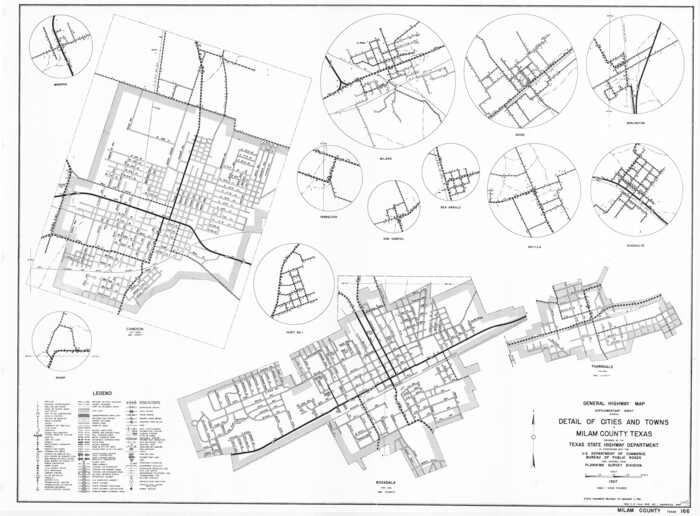
General Highway Map. Detail of Cities and Towns in Milam County, Texas [Rockdale and Cameron and vicinities]
Print $20.00
General Highway Map. Detail of Cities and Towns in Milam County, Texas [Rockdale and Cameron and vicinities]
1961
Size: 18.1 x 24.6 inches
79598
Milam County Rolled Sketch 3C

Print $20.00
- Digital $50.00
Milam County Rolled Sketch 3C
1959
Size: 21.8 x 18.4 inches
6776
The Republic County of Milam. Proposed, Late Fall 1837
Print $20.00
The Republic County of Milam. Proposed, Late Fall 1837
2020
-
Size
19.9 x 21.7 inches
-
Map/Doc
96225
-
Creation Date
2020
The Republic County of Milam. Proposed, Late Fall 1837-December 31, 1838
Print $20.00
The Republic County of Milam. Proposed, Late Fall 1837-December 31, 1838
2020
-
Size
17.4 x 21.6 inches
-
Map/Doc
96226
-
Creation Date
2020
The Republic County of Milam. December 31, 1838
Print $20.00
The Republic County of Milam. December 31, 1838
2020
-
Size
17.4 x 21.6 inches
-
Map/Doc
96227
-
Creation Date
2020
The Republic County of Milam. November 28, 1839
Print $20.00
The Republic County of Milam. November 28, 1839
2020
-
Size
17.4 x 21.6 inches
-
Map/Doc
96228
-
Creation Date
2020
The Republic County of Milam. February 4, 1840
Print $20.00
The Republic County of Milam. February 4, 1840
2020
-
Size
17.4 x 21.6 inches
-
Map/Doc
96229
-
Creation Date
2020
The Republic County of Milam. January 15, 1842
Print $20.00
The Republic County of Milam. January 15, 1842
2020
-
Size
17.4 x 21.6 inches
-
Map/Doc
96230
-
Creation Date
2020
The Republic County of Milam. January 29, 1842
Print $20.00
The Republic County of Milam. January 29, 1842
2020
-
Size
17.4 x 21.6 inches
-
Map/Doc
96231
-
Creation Date
2020
The Republic County of Milam. Spring 1842
Print $20.00
The Republic County of Milam. Spring 1842
2020
-
Size
17.4 x 21.6 inches
-
Map/Doc
96232
-
Creation Date
2020
The Republic County of Milam. December 29, 1845
Print $20.00
The Republic County of Milam. December 29, 1845
2020
-
Size
17.4 x 21.6 inches
-
Map/Doc
96233
-
Creation Date
2020
Milam County Working Sketch 13
Print $20.00
- Digital $50.00
Milam County Working Sketch 13
2004
-
Size
34.1 x 46.0 inches
-
Map/Doc
83578
-
Creation Date
2004
Milam County Rolled Sketch 5A
Print $20.00
- Digital $50.00
Milam County Rolled Sketch 5A
1997
-
Size
28.0 x 39.8 inches
-
Map/Doc
6778
-
Creation Date
1997
Milam County Working Sketch 11
Print $20.00
- Digital $50.00
Milam County Working Sketch 11
1987
-
Size
43.8 x 31.9 inches
-
Map/Doc
71026
-
Creation Date
1987
Milam County Working Sketch 10
Print $20.00
- Digital $50.00
Milam County Working Sketch 10
1986
-
Size
25.5 x 34.6 inches
-
Map/Doc
71025
-
Creation Date
1986
Burleson County Working Sketch 2
Print $20.00
- Digital $50.00
Burleson County Working Sketch 2
1976
-
Size
36.4 x 31.2 inches
-
Map/Doc
67721
-
Creation Date
1976
Milam County Working Sketch 9
Print $20.00
- Digital $50.00
Milam County Working Sketch 9
1976
-
Size
27.2 x 22.7 inches
-
Map/Doc
71024
-
Creation Date
1976
Milam County

Print $40.00
- Digital $50.00
Milam County
1975
-
Size
51.4 x 43.0 inches
-
Map/Doc
73240
-
Creation Date
1975
Milam County Working Sketch Graphic Index
Print $40.00
- Digital $50.00
Milam County Working Sketch Graphic Index
1975
-
Size
51.6 x 42.7 inches
-
Map/Doc
76642
-
Creation Date
1975
Milam County

Print $40.00
- Digital $50.00
Milam County
1975
-
Size
50.9 x 43.0 inches
-
Map/Doc
77373
-
Creation Date
1975
Milam County

Print $40.00
- Digital $50.00
Milam County
1975
-
Size
52.4 x 44.0 inches
-
Map/Doc
95590
-
Creation Date
1975
Milam County Working Sketch 17
Print $40.00
- Digital $50.00
Milam County Working Sketch 17
1972
-
Size
54.7 x 32.2 inches
-
Map/Doc
89031
-
Creation Date
1972
Milam County Working Sketch 8
Print $20.00
- Digital $50.00
Milam County Working Sketch 8
1970
-
Size
27.1 x 30.7 inches
-
Map/Doc
71023
-
Creation Date
1970
Milam County Working Sketch 7
Print $40.00
- Digital $50.00
Milam County Working Sketch 7
1969
-
Size
42.7 x 48.0 inches
-
Map/Doc
71022
-
Creation Date
1969
Milam County Rolled Sketch 3A
Print $40.00
- Digital $50.00
Milam County Rolled Sketch 3A
1967
-
Size
49.1 x 38.8 inches
-
Map/Doc
43048
-
Creation Date
1967
Milam County Rolled Sketch 3B
Print $20.00
- Digital $50.00
Milam County Rolled Sketch 3B
1967
-
Size
30.8 x 24.5 inches
-
Map/Doc
6775
-
Creation Date
1967
Milam County Rolled Sketch 3A
Print $40.00
- Digital $50.00
Milam County Rolled Sketch 3A
1967
-
Size
49.5 x 43.3 inches
-
Map/Doc
9522
-
Creation Date
1967
Milam County Working Sketch 5
Print $20.00
- Digital $50.00
Milam County Working Sketch 5
1963
-
Size
29.1 x 23.7 inches
-
Map/Doc
71020
-
Creation Date
1963
Milam County Working Sketch 6
Print $20.00
- Digital $50.00
Milam County Working Sketch 6
1963
-
Size
29.1 x 23.9 inches
-
Map/Doc
71021
-
Creation Date
1963
General Highway Map, Milam County, Texas
Print $20.00
General Highway Map, Milam County, Texas
1961
-
Size
18.1 x 24.6 inches
-
Map/Doc
79597
-
Creation Date
1961
General Highway Map. Detail of Cities and Towns in Milam County, Texas [Rockdale and Cameron and vicinities]
Print $20.00
General Highway Map. Detail of Cities and Towns in Milam County, Texas [Rockdale and Cameron and vicinities]
1961
-
Size
18.1 x 24.6 inches
-
Map/Doc
79598
-
Creation Date
1961
Milam County Rolled Sketch 3C
Print $20.00
- Digital $50.00
Milam County Rolled Sketch 3C
1959
-
Size
21.8 x 18.4 inches
-
Map/Doc
6776
-
Creation Date
1959