[Surveys in Austin's Colony along the Brazos River]
Print $20.00
- Digital $50.00
[Surveys in Austin's Colony along the Brazos River]
1833
Size: 25.0 x 23.9 inches
164
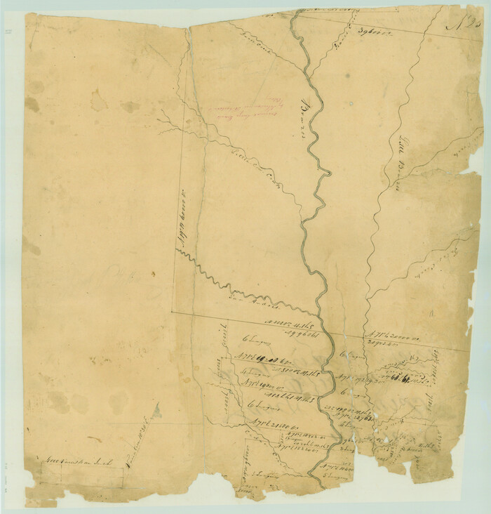
[Surveys along the Brazos River]
Print $2.00
- Digital $50.00
[Surveys along the Brazos River]
1847
Size: 12.1 x 8.4 inches
261
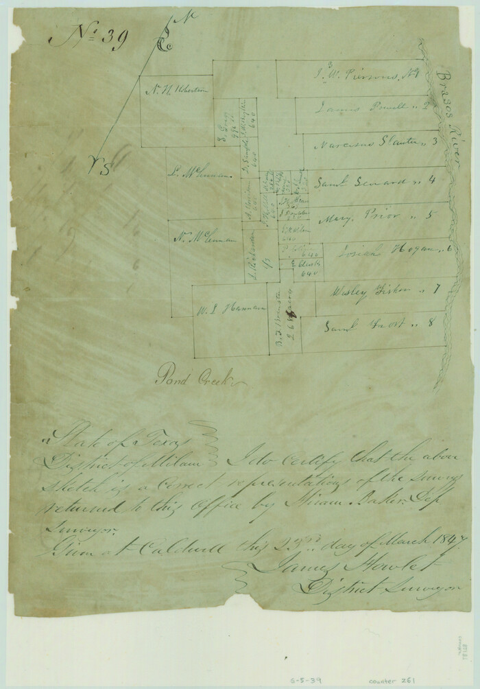
[Surveys along the Brazos River]
Print $3.00
- Digital $50.00
[Surveys along the Brazos River]
1840
Size: 9.5 x 10.9 inches
39
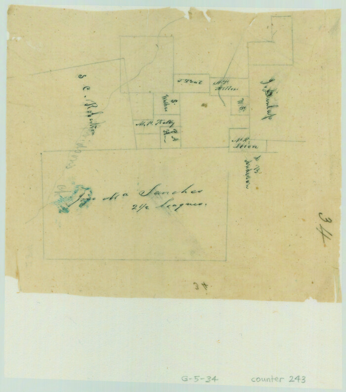
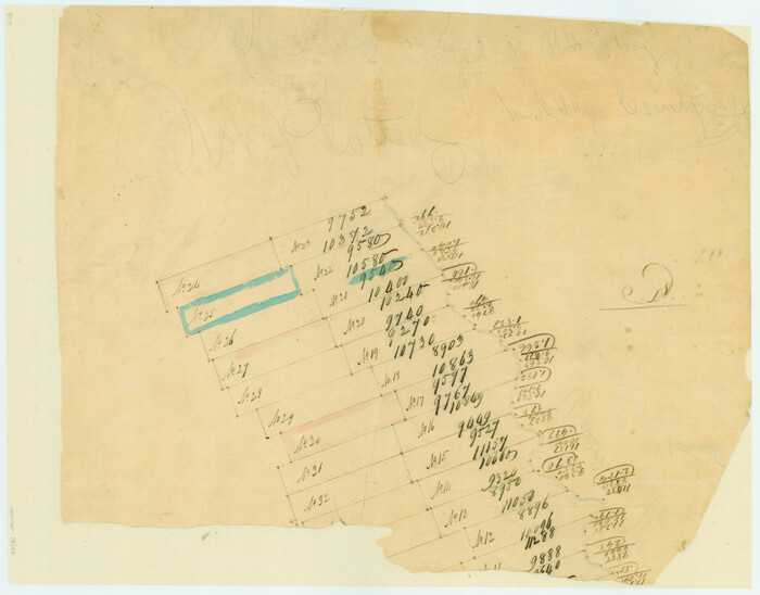
[Surveys along Davidson's Creek]
Print $2.00
- Digital $50.00
[Surveys along Davidson's Creek]
Size: 5.3 x 4.7 inches
243
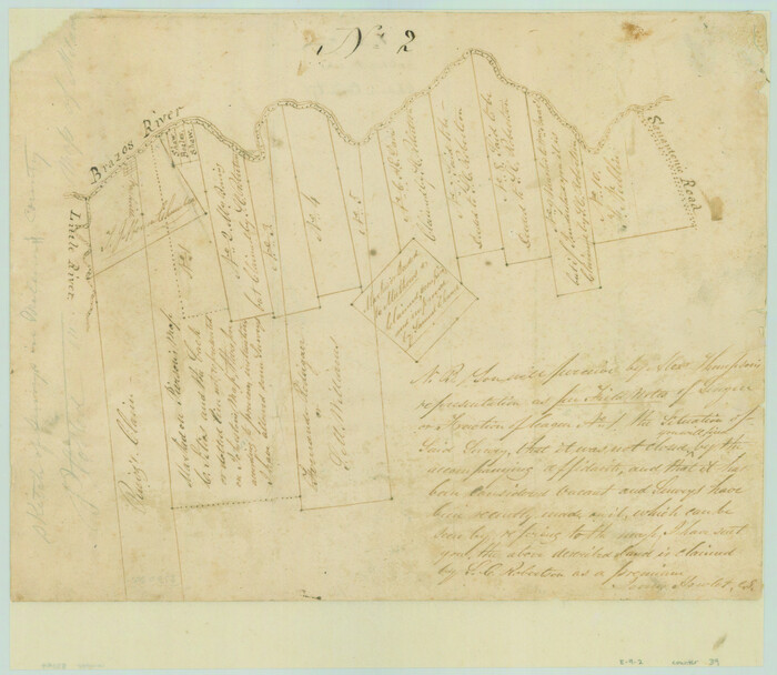
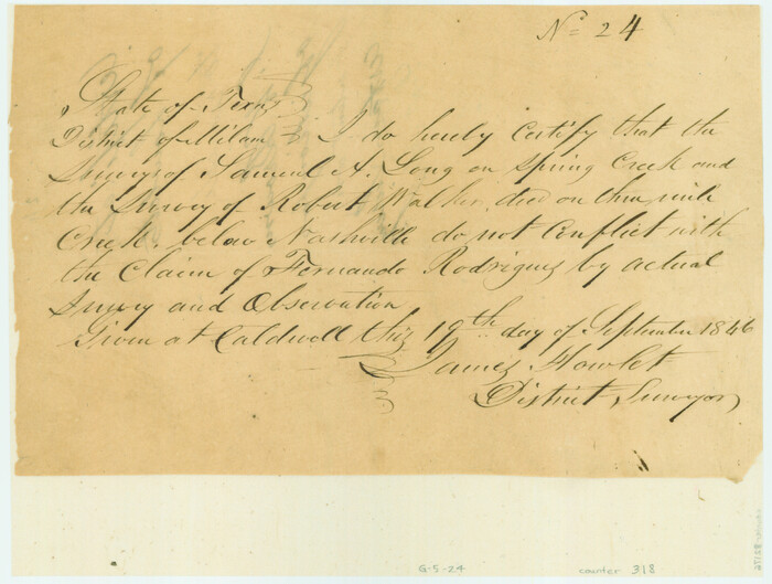
[Surveyor's certificate by James Howlet, District Surveyor]
Print $2.00
- Digital $50.00
[Surveyor's certificate by James Howlet, District Surveyor]
Size: 6.1 x 8.0 inches
318
[Old Surveys, Robertson Colony in Milam County]
Print $20.00
- Digital $50.00
[Old Surveys, Robertson Colony in Milam County]
Size: 12.2 x 15.6 inches
78268
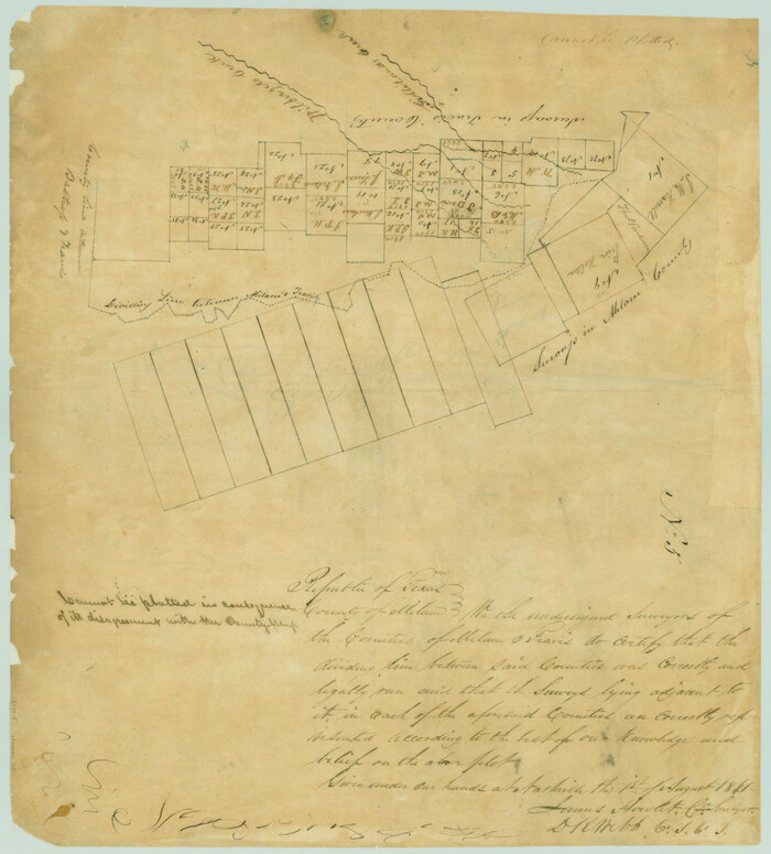
[Map of the dividing line between Milam and Travis Counties]
Print $20.00
- Digital $50.00
[Map of the dividing line between Milam and Travis Counties]
1841
Size: 14.2 x 12.8 inches
110
[Gulf, Colorado & Santa Fe Railway Company]
Print $40.00
- Digital $50.00
[Gulf, Colorado & Santa Fe Railway Company]
1893
Size: 21.5 x 121.2 inches
64410
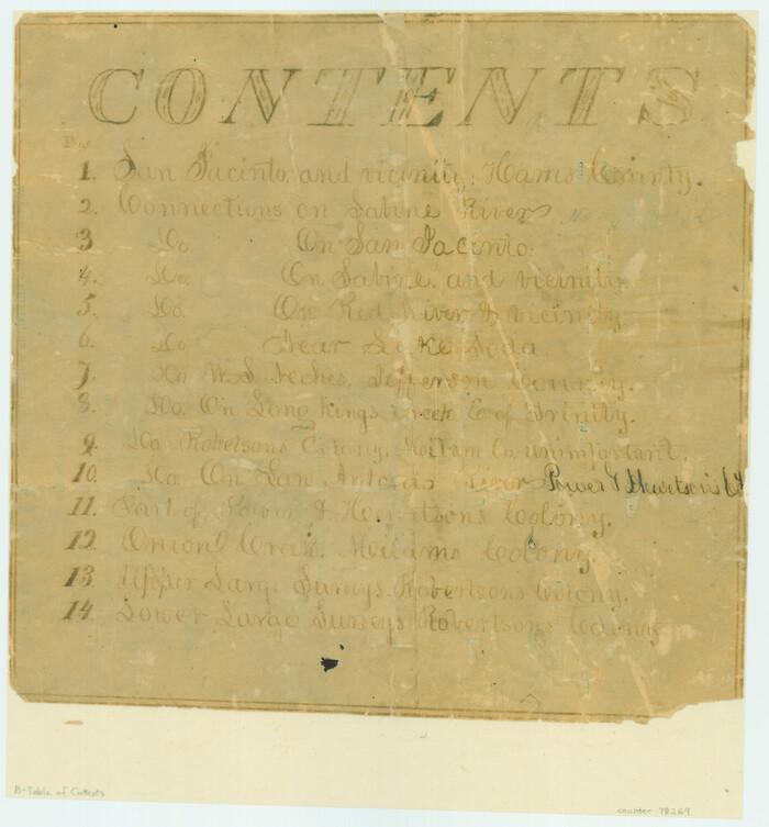
[Atlas B, Table of Contents]
Print $3.00
- Digital $50.00
[Atlas B, Table of Contents]
Size: 10.3 x 9.6 inches
78269
Williamson County Sketch File 17

Print $8.00
- Digital $50.00
Williamson County Sketch File 17
1876
Size: 6.5 x 8.1 inches
40338
Williamson County Sketch File 13

Print $5.00
- Digital $50.00
Williamson County Sketch File 13
Size: 9.3 x 14.3 inches
40328
Williamson County Sketch File 10

Print $22.00
- Digital $50.00
Williamson County Sketch File 10
1858
Size: 12.2 x 17.1 inches
40322
The Republic County of Milam. Spring 1842

Print $20.00
The Republic County of Milam. Spring 1842
2020
Size: 17.4 x 21.6 inches
96232
The Republic County of Milam. Proposed, Late Fall 1837-December 31, 1838

Print $20.00
The Republic County of Milam. Proposed, Late Fall 1837-December 31, 1838
2020
Size: 17.4 x 21.6 inches
96226
The Republic County of Milam. Proposed, Late Fall 1837

Print $20.00
The Republic County of Milam. Proposed, Late Fall 1837
2020
Size: 19.9 x 21.7 inches
96225
The Republic County of Milam. November 28, 1839

Print $20.00
The Republic County of Milam. November 28, 1839
2020
Size: 17.4 x 21.6 inches
96228
The Republic County of Milam. January 29, 1842

Print $20.00
The Republic County of Milam. January 29, 1842
2020
Size: 17.4 x 21.6 inches
96231
The Republic County of Milam. January 15, 1842

Print $20.00
The Republic County of Milam. January 15, 1842
2020
Size: 17.4 x 21.6 inches
96230
The Republic County of Milam. February 4, 1840

Print $20.00
The Republic County of Milam. February 4, 1840
2020
Size: 17.4 x 21.6 inches
96229
The Republic County of Milam. December 31, 1838

Print $20.00
The Republic County of Milam. December 31, 1838
2020
Size: 17.4 x 21.6 inches
96227
The Republic County of Milam. December 29, 1845

Print $20.00
The Republic County of Milam. December 29, 1845
2020
Size: 17.4 x 21.6 inches
96233
San Antonio and Aransas Pass Ry. from Survey Station 4852+100 to Survey Station 5280+00

Print $4.00
- Digital $50.00
San Antonio and Aransas Pass Ry. from Survey Station 4852+100 to Survey Station 5280+00
Size: 11.8 x 18.6 inches
62570
Official Copy of the Map of Milam County made for the International and G. N. R. R. Co.

Print $20.00
- Digital $50.00
Official Copy of the Map of Milam County made for the International and G. N. R. R. Co.
1877
Size: 23.9 x 22.5 inches
581
Milam County Working Sketch Graphic Index

Print $40.00
- Digital $50.00
Milam County Working Sketch Graphic Index
1975
Size: 51.6 x 42.7 inches
76642
Milam County Working Sketch 9

Print $20.00
- Digital $50.00
Milam County Working Sketch 9
1976
Size: 27.2 x 22.7 inches
71024
Milam County Working Sketch 8

Print $20.00
- Digital $50.00
Milam County Working Sketch 8
1970
Size: 27.1 x 30.7 inches
71023
Milam County Working Sketch 7

Print $40.00
- Digital $50.00
Milam County Working Sketch 7
1969
Size: 42.7 x 48.0 inches
71022
Milam County Working Sketch 6

Print $20.00
- Digital $50.00
Milam County Working Sketch 6
1963
Size: 29.1 x 23.9 inches
71021
Milam County Working Sketch 5

Print $20.00
- Digital $50.00
Milam County Working Sketch 5
1963
Size: 29.1 x 23.7 inches
71020
Milam County Working Sketch 4

Print $20.00
- Digital $50.00
Milam County Working Sketch 4
1954
Size: 26.1 x 32.4 inches
71019
[Surveys in Austin's Colony along the Brazos River]
Print $20.00
- Digital $50.00
[Surveys in Austin's Colony along the Brazos River]
1833
-
Size
25.0 x 23.9 inches
-
Map/Doc
164
-
Creation Date
1833
[Surveys along the Brazos River]
Print $2.00
- Digital $50.00
[Surveys along the Brazos River]
1847
-
Size
12.1 x 8.4 inches
-
Map/Doc
261
-
Creation Date
1847
[Surveys along the Brazos River]
Print $3.00
- Digital $50.00
[Surveys along the Brazos River]
1840
-
Size
9.5 x 10.9 inches
-
Map/Doc
39
-
Creation Date
1840
[Surveys along Davidson's Creek]
Print $2.00
- Digital $50.00
[Surveys along Davidson's Creek]
-
Size
5.3 x 4.7 inches
-
Map/Doc
243
[Surveyor's certificate by James Howlet, District Surveyor]
Print $2.00
- Digital $50.00
[Surveyor's certificate by James Howlet, District Surveyor]
-
Size
6.1 x 8.0 inches
-
Map/Doc
318
[Old Surveys, Robertson Colony in Milam County]
Print $20.00
- Digital $50.00
[Old Surveys, Robertson Colony in Milam County]
-
Size
12.2 x 15.6 inches
-
Map/Doc
78268
[Map of the dividing line between Milam and Travis Counties]
Print $20.00
- Digital $50.00
[Map of the dividing line between Milam and Travis Counties]
1841
-
Size
14.2 x 12.8 inches
-
Map/Doc
110
-
Creation Date
1841
[Gulf, Colorado & Santa Fe Railway Company]
Print $40.00
- Digital $50.00
[Gulf, Colorado & Santa Fe Railway Company]
1893
-
Size
21.5 x 121.2 inches
-
Map/Doc
64410
-
Creation Date
1893
[Atlas B, Table of Contents]
Print $3.00
- Digital $50.00
[Atlas B, Table of Contents]
-
Size
10.3 x 9.6 inches
-
Map/Doc
78269
Williamson County Sketch File 17
Print $8.00
- Digital $50.00
Williamson County Sketch File 17
1876
-
Size
6.5 x 8.1 inches
-
Map/Doc
40338
-
Creation Date
1876
Williamson County Sketch File 13
Print $5.00
- Digital $50.00
Williamson County Sketch File 13
-
Size
9.3 x 14.3 inches
-
Map/Doc
40328
Williamson County Sketch File 10
Print $22.00
- Digital $50.00
Williamson County Sketch File 10
1858
-
Size
12.2 x 17.1 inches
-
Map/Doc
40322
-
Creation Date
1858
The Republic County of Milam. Spring 1842
Print $20.00
The Republic County of Milam. Spring 1842
2020
-
Size
17.4 x 21.6 inches
-
Map/Doc
96232
-
Creation Date
2020
The Republic County of Milam. Proposed, Late Fall 1837-December 31, 1838
Print $20.00
The Republic County of Milam. Proposed, Late Fall 1837-December 31, 1838
2020
-
Size
17.4 x 21.6 inches
-
Map/Doc
96226
-
Creation Date
2020
The Republic County of Milam. Proposed, Late Fall 1837
Print $20.00
The Republic County of Milam. Proposed, Late Fall 1837
2020
-
Size
19.9 x 21.7 inches
-
Map/Doc
96225
-
Creation Date
2020
The Republic County of Milam. November 28, 1839
Print $20.00
The Republic County of Milam. November 28, 1839
2020
-
Size
17.4 x 21.6 inches
-
Map/Doc
96228
-
Creation Date
2020
The Republic County of Milam. January 29, 1842
Print $20.00
The Republic County of Milam. January 29, 1842
2020
-
Size
17.4 x 21.6 inches
-
Map/Doc
96231
-
Creation Date
2020
The Republic County of Milam. January 15, 1842
Print $20.00
The Republic County of Milam. January 15, 1842
2020
-
Size
17.4 x 21.6 inches
-
Map/Doc
96230
-
Creation Date
2020
The Republic County of Milam. February 4, 1840
Print $20.00
The Republic County of Milam. February 4, 1840
2020
-
Size
17.4 x 21.6 inches
-
Map/Doc
96229
-
Creation Date
2020
The Republic County of Milam. December 31, 1838
Print $20.00
The Republic County of Milam. December 31, 1838
2020
-
Size
17.4 x 21.6 inches
-
Map/Doc
96227
-
Creation Date
2020
The Republic County of Milam. December 29, 1845
Print $20.00
The Republic County of Milam. December 29, 1845
2020
-
Size
17.4 x 21.6 inches
-
Map/Doc
96233
-
Creation Date
2020
San Antonio and Aransas Pass Ry. from Survey Station 4852+100 to Survey Station 5280+00
Print $4.00
- Digital $50.00
San Antonio and Aransas Pass Ry. from Survey Station 4852+100 to Survey Station 5280+00
-
Size
11.8 x 18.6 inches
-
Map/Doc
62570
Official Copy of the Map of Milam County made for the International and G. N. R. R. Co.
Print $20.00
- Digital $50.00
Official Copy of the Map of Milam County made for the International and G. N. R. R. Co.
1877
-
Size
23.9 x 22.5 inches
-
Map/Doc
581
-
Creation Date
1877
Milam County Working Sketch Graphic Index
Print $40.00
- Digital $50.00
Milam County Working Sketch Graphic Index
1975
-
Size
51.6 x 42.7 inches
-
Map/Doc
76642
-
Creation Date
1975
Milam County Working Sketch 9
Print $20.00
- Digital $50.00
Milam County Working Sketch 9
1976
-
Size
27.2 x 22.7 inches
-
Map/Doc
71024
-
Creation Date
1976
Milam County Working Sketch 8
Print $20.00
- Digital $50.00
Milam County Working Sketch 8
1970
-
Size
27.1 x 30.7 inches
-
Map/Doc
71023
-
Creation Date
1970
Milam County Working Sketch 7
Print $40.00
- Digital $50.00
Milam County Working Sketch 7
1969
-
Size
42.7 x 48.0 inches
-
Map/Doc
71022
-
Creation Date
1969
Milam County Working Sketch 6
Print $20.00
- Digital $50.00
Milam County Working Sketch 6
1963
-
Size
29.1 x 23.9 inches
-
Map/Doc
71021
-
Creation Date
1963
Milam County Working Sketch 5
Print $20.00
- Digital $50.00
Milam County Working Sketch 5
1963
-
Size
29.1 x 23.7 inches
-
Map/Doc
71020
-
Creation Date
1963
Milam County Working Sketch 4
Print $20.00
- Digital $50.00
Milam County Working Sketch 4
1954
-
Size
26.1 x 32.4 inches
-
Map/Doc
71019
-
Creation Date
1954