Morris County Working Sketch 6

Print $20.00
- Digital $50.00
Morris County Working Sketch 6
1985
Size: 35.8 x 36.7 inches
71205
Camp County Working Sketch 1

Print $20.00
- Digital $50.00
Camp County Working Sketch 1
1970
Size: 32.9 x 29.7 inches
67877
Titus County Working Sketch 7

Print $20.00
- Digital $50.00
Titus County Working Sketch 7
1970
Size: 31.5 x 28.7 inches
69368
Morris County Working Sketch 5

Print $20.00
- Digital $50.00
Morris County Working Sketch 5
1965
Size: 24.7 x 18.9 inches
71204
General Highway Map, Camp County, Morris County, Titus County, Texas

Print $20.00
General Highway Map, Camp County, Morris County, Titus County, Texas
1961
Size: 24.7 x 18.1 inches
79400
Morris County Working Sketch 4

Print $20.00
- Digital $50.00
Morris County Working Sketch 4
1959
Size: 35.2 x 23.8 inches
71203
Morris County Working Sketch 3

Print $20.00
- Digital $50.00
Morris County Working Sketch 3
1958
Size: 27.6 x 38.2 inches
71202
Morris County Working Sketch 2

Print $20.00
- Digital $50.00
Morris County Working Sketch 2
1958
Size: 24.7 x 21.9 inches
71201
Morris County Working Sketch 1

Print $20.00
- Digital $50.00
Morris County Working Sketch 1
1948
Size: 31.2 x 28.0 inches
71200
Morris County Working Sketch Graphic Index

Print $20.00
- Digital $50.00
Morris County Working Sketch Graphic Index
1948
Size: 42.8 x 20.1 inches
76649
Morris County Rolled Sketch 2A

Print $64.00
- Digital $50.00
Morris County Rolled Sketch 2A
1944
Size: 11.2 x 8.8 inches
41667
Morris County Rolled Sketch 2

Print $40.00
- Digital $50.00
Morris County Rolled Sketch 2
1944
Size: 59.4 x 43.5 inches
9550
Morris County Rolled Sketch 1

Print $20.00
- Digital $50.00
Morris County Rolled Sketch 1
1942
Size: 23.7 x 24.9 inches
6835
General Highway Map, Franklin County, Morris County, Titus County, Camp County

Print $20.00
General Highway Map, Franklin County, Morris County, Titus County, Camp County
1940
Size: 18.4 x 25.1 inches
79040
Sulphur River, Bassett Sheet

Print $6.00
- Digital $50.00
Sulphur River, Bassett Sheet
1939
Size: 23.9 x 31.2 inches
65176
Sulphur River, Bassett Sheet

Print $20.00
- Digital $50.00
Sulphur River, Bassett Sheet
1939
Size: 23.9 x 31.5 inches
69683
Sulphur River, Bassett Sheet

Print $20.00
- Digital $50.00
Sulphur River, Bassett Sheet
1939
Size: 25.3 x 32.0 inches
78320
Sulphur River, Bassett Sheet

Print $20.00
- Digital $50.00
Sulphur River, Bassett Sheet
1939
Size: 24.8 x 32.0 inches
78322
Red River, Water-Shed of Cypress Creek in Texas Drainage Area

Print $4.00
- Digital $50.00
Red River, Water-Shed of Cypress Creek in Texas Drainage Area
1925
Size: 16.3 x 19.2 inches
65057
Morris County Sketch File 4

Print $4.00
- Digital $50.00
Morris County Sketch File 4
1910
Size: 8.3 x 8.6 inches
31968
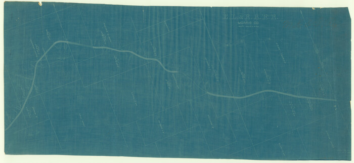
[Missouri, Kansas & Texas] E. L. & R. R. Railroad, Morris Co.
Print $20.00
- Digital $50.00
[Missouri, Kansas & Texas] E. L. & R. R. Railroad, Morris Co.
1906
Size: 13.1 x 28.4 inches
64273
Missouri, Kansas & Texas Railway in Morris County

Print $20.00
- Digital $50.00
Missouri, Kansas & Texas Railway in Morris County
1906
Size: 14.9 x 36.2 inches
64274
St. Louis Southwestern Railway of Texas

Print $20.00
- Digital $50.00
St. Louis Southwestern Railway of Texas
1906
Size: 21.2 x 30.0 inches
64447
St. Louis Southwestern Railway of Texas

Print $20.00
- Digital $50.00
St. Louis Southwestern Railway of Texas
1906
Size: 22.6 x 30.3 inches
64448
St. Louis Southwestern Railway of Texas

Print $20.00
- Digital $50.00
St. Louis Southwestern Railway of Texas
1906
Size: 22.5 x 30.5 inches
64449
St. Louis Southwestern Railway of Texas

Print $20.00
- Digital $50.00
St. Louis Southwestern Railway of Texas
1906
Size: 21.4 x 30.0 inches
64450
Morris County Working Sketch 6
Print $20.00
- Digital $50.00
Morris County Working Sketch 6
1985
-
Size
35.8 x 36.7 inches
-
Map/Doc
71205
-
Creation Date
1985
Camp County Working Sketch 1
Print $20.00
- Digital $50.00
Camp County Working Sketch 1
1970
-
Size
32.9 x 29.7 inches
-
Map/Doc
67877
-
Creation Date
1970
Titus County Working Sketch 7
Print $20.00
- Digital $50.00
Titus County Working Sketch 7
1970
-
Size
31.5 x 28.7 inches
-
Map/Doc
69368
-
Creation Date
1970
Morris County Working Sketch 5
Print $20.00
- Digital $50.00
Morris County Working Sketch 5
1965
-
Size
24.7 x 18.9 inches
-
Map/Doc
71204
-
Creation Date
1965
General Highway Map, Camp County, Morris County, Titus County, Texas
Print $20.00
General Highway Map, Camp County, Morris County, Titus County, Texas
1961
-
Size
24.7 x 18.1 inches
-
Map/Doc
79400
-
Creation Date
1961
Morris County Working Sketch 4
Print $20.00
- Digital $50.00
Morris County Working Sketch 4
1959
-
Size
35.2 x 23.8 inches
-
Map/Doc
71203
-
Creation Date
1959
Morris County Working Sketch 3
Print $20.00
- Digital $50.00
Morris County Working Sketch 3
1958
-
Size
27.6 x 38.2 inches
-
Map/Doc
71202
-
Creation Date
1958
Morris County Working Sketch 2
Print $20.00
- Digital $50.00
Morris County Working Sketch 2
1958
-
Size
24.7 x 21.9 inches
-
Map/Doc
71201
-
Creation Date
1958
Morris Co.

Print $20.00
- Digital $50.00
Morris Co.
1948
-
Size
44.3 x 20.6 inches
-
Map/Doc
66945
-
Creation Date
1948
Morris Co.

Print $20.00
- Digital $50.00
Morris Co.
1948
-
Size
44.1 x 20.5 inches
-
Map/Doc
73246
-
Creation Date
1948
Morris Co.

Print $20.00
- Digital $50.00
Morris Co.
1948
-
Size
40.0 x 17.7 inches
-
Map/Doc
77379
-
Creation Date
1948
Morris County Working Sketch 1
Print $20.00
- Digital $50.00
Morris County Working Sketch 1
1948
-
Size
31.2 x 28.0 inches
-
Map/Doc
71200
-
Creation Date
1948
Morris County Working Sketch Graphic Index
Print $20.00
- Digital $50.00
Morris County Working Sketch Graphic Index
1948
-
Size
42.8 x 20.1 inches
-
Map/Doc
76649
-
Creation Date
1948
Morris Co.

Print $20.00
- Digital $50.00
Morris Co.
1948
-
Size
45.1 x 21.5 inches
-
Map/Doc
95596
-
Creation Date
1948
Morris County Rolled Sketch 2A
Print $64.00
- Digital $50.00
Morris County Rolled Sketch 2A
1944
-
Size
11.2 x 8.8 inches
-
Map/Doc
41667
-
Creation Date
1944
Morris County Rolled Sketch 2
Print $40.00
- Digital $50.00
Morris County Rolled Sketch 2
1944
-
Size
59.4 x 43.5 inches
-
Map/Doc
9550
-
Creation Date
1944
Morris County Rolled Sketch 1
Print $20.00
- Digital $50.00
Morris County Rolled Sketch 1
1942
-
Size
23.7 x 24.9 inches
-
Map/Doc
6835
-
Creation Date
1942
General Highway Map, Franklin County, Morris County, Titus County, Camp County
Print $20.00
General Highway Map, Franklin County, Morris County, Titus County, Camp County
1940
-
Size
18.4 x 25.1 inches
-
Map/Doc
79040
-
Creation Date
1940
Sulphur River, Bassett Sheet
Print $6.00
- Digital $50.00
Sulphur River, Bassett Sheet
1939
-
Size
23.9 x 31.2 inches
-
Map/Doc
65176
-
Creation Date
1939
Sulphur River, Bassett Sheet
Print $20.00
- Digital $50.00
Sulphur River, Bassett Sheet
1939
-
Size
23.9 x 31.5 inches
-
Map/Doc
69683
-
Creation Date
1939
Sulphur River, Bassett Sheet
Print $20.00
- Digital $50.00
Sulphur River, Bassett Sheet
1939
-
Size
25.3 x 32.0 inches
-
Map/Doc
78320
-
Creation Date
1939
Sulphur River, Bassett Sheet
Print $20.00
- Digital $50.00
Sulphur River, Bassett Sheet
1939
-
Size
24.8 x 32.0 inches
-
Map/Doc
78322
-
Creation Date
1939
Red River, Water-Shed of Cypress Creek in Texas Drainage Area
Print $4.00
- Digital $50.00
Red River, Water-Shed of Cypress Creek in Texas Drainage Area
1925
-
Size
16.3 x 19.2 inches
-
Map/Doc
65057
-
Creation Date
1925
Morris County Sketch File 4
Print $4.00
- Digital $50.00
Morris County Sketch File 4
1910
-
Size
8.3 x 8.6 inches
-
Map/Doc
31968
-
Creation Date
1910
[Missouri, Kansas & Texas] E. L. & R. R. Railroad, Morris Co.
Print $20.00
- Digital $50.00
[Missouri, Kansas & Texas] E. L. & R. R. Railroad, Morris Co.
1906
-
Size
13.1 x 28.4 inches
-
Map/Doc
64273
-
Creation Date
1906
Missouri, Kansas & Texas Railway in Morris County
Print $20.00
- Digital $50.00
Missouri, Kansas & Texas Railway in Morris County
1906
-
Size
14.9 x 36.2 inches
-
Map/Doc
64274
-
Creation Date
1906
St. Louis Southwestern Railway of Texas
Print $20.00
- Digital $50.00
St. Louis Southwestern Railway of Texas
1906
-
Size
21.2 x 30.0 inches
-
Map/Doc
64447
-
Creation Date
1906
St. Louis Southwestern Railway of Texas
Print $20.00
- Digital $50.00
St. Louis Southwestern Railway of Texas
1906
-
Size
22.6 x 30.3 inches
-
Map/Doc
64448
-
Creation Date
1906
St. Louis Southwestern Railway of Texas
Print $20.00
- Digital $50.00
St. Louis Southwestern Railway of Texas
1906
-
Size
22.5 x 30.5 inches
-
Map/Doc
64449
-
Creation Date
1906
St. Louis Southwestern Railway of Texas
Print $20.00
- Digital $50.00
St. Louis Southwestern Railway of Texas
1906
-
Size
21.4 x 30.0 inches
-
Map/Doc
64450
-
Creation Date
1906