[Map of Parker County]
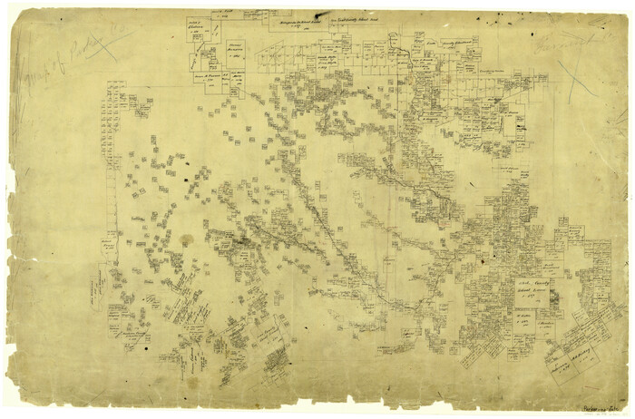
Print $20.00
- Digital $50.00
[Map of Parker County]
Size: 22.0 x 34.0 inches
3941
[Map of Parker County]
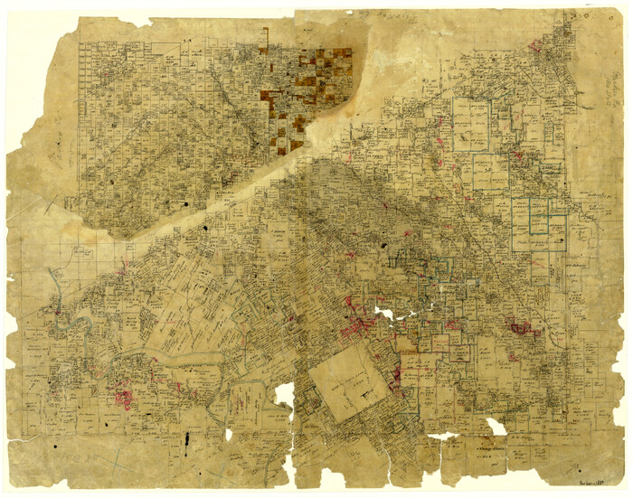
Print $20.00
- Digital $50.00
[Map of Parker County]
1889
Size: 25.9 x 32.9 inches
3948
Wise County Working Sketch 22

Print $20.00
- Digital $50.00
Wise County Working Sketch 22
1980
Size: 28.1 x 27.8 inches
72636
Wise County Sketch File F

Print $20.00
- Digital $50.00
Wise County Sketch File F
1857
Size: 16.2 x 29.2 inches
12704
Wise County Sketch File 7

Print $4.00
- Digital $50.00
Wise County Sketch File 7
1857
Size: 8.1 x 14.0 inches
40535
Wise County Sketch File 29

Print $20.00
- Digital $50.00
Wise County Sketch File 29
1857
Size: 11.1 x 20.7 inches
76762
Wise County Sketch File 16 and 17

Print $4.00
- Digital $50.00
Wise County Sketch File 16 and 17
1856
Size: 13.1 x 8.3 inches
40551
Tarrant County Working Sketch 7

Print $40.00
- Digital $50.00
Tarrant County Working Sketch 7
1981
Size: 18.9 x 54.3 inches
62424
Tarrant County Working Sketch 5

Print $20.00
- Digital $50.00
Tarrant County Working Sketch 5
1980
Size: 27.7 x 27.3 inches
62422
Tarrant County Sketch File 31

Print $20.00
- Digital $50.00
Tarrant County Sketch File 31
Size: 27.2 x 39.3 inches
10380
Tarrant County Sketch File 22

Print $9.00
- Digital $50.00
Tarrant County Sketch File 22
1860
Size: 10.3 x 8.9 inches
37729
Tarrant County Sketch File 1

Print $4.00
- Digital $50.00
Tarrant County Sketch File 1
1851
Size: 10.2 x 7.9 inches
37672
Tarrant County Rolled Sketch 2

Print $40.00
- Digital $50.00
Tarrant County Rolled Sketch 2
Size: 91.5 x 13.4 inches
78246
Tarrant County Rolled Sketch 2

Print $40.00
- Digital $50.00
Tarrant County Rolled Sketch 2
1955
Size: 96.5 x 23.5 inches
9984
Sketch showing the Connnecting Lines run by Olliver Hedgcoxe for the Texan Emigration and Land Company connecting their Surveys made by them in Peters' Colony, Texas

Print $40.00
- Digital $50.00
Sketch showing the Connnecting Lines run by Olliver Hedgcoxe for the Texan Emigration and Land Company connecting their Surveys made by them in Peters' Colony, Texas
1854
Size: 45.8 x 61.9 inches
1969
Roberts County Sketch File 5

Print $4.00
- Digital $50.00
Roberts County Sketch File 5
Size: 8.0 x 9.8 inches
35312
Parker County Working Sketch Graphic Index

Print $20.00
- Digital $50.00
Parker County Working Sketch Graphic Index
1942
76661
Parker County Working Sketch 9

Print $20.00
- Digital $50.00
Parker County Working Sketch 9
1958
71459
Parker County Working Sketch 8

Print $20.00
- Digital $50.00
Parker County Working Sketch 8
1956
71458
Parker County Working Sketch 7

Print $20.00
- Digital $50.00
Parker County Working Sketch 7
1955
71457
Parker County Working Sketch 6

Print $20.00
- Digital $50.00
Parker County Working Sketch 6
1923
71456
Parker County Working Sketch 5

Print $20.00
- Digital $50.00
Parker County Working Sketch 5
1952
71455
Parker County Working Sketch 4

Print $20.00
- Digital $50.00
Parker County Working Sketch 4
1941
71454
Parker County Working Sketch 3

Print $20.00
- Digital $50.00
Parker County Working Sketch 3
1941
71453
Parker County Working Sketch 29

Print $20.00
- Digital $50.00
Parker County Working Sketch 29
2020
Size: 24.3 x 35.9 inches
95961
Parker County Working Sketch 28

Print $20.00
- Digital $50.00
Parker County Working Sketch 28
2009
89011
Parker County Working Sketch 27

Print $20.00
- Digital $50.00
Parker County Working Sketch 27
2009
89001
Parker County Working Sketch 26

Print $20.00
- Digital $50.00
Parker County Working Sketch 26
2008
88856
Parker County Working Sketch 25

Print $20.00
- Digital $50.00
Parker County Working Sketch 25
2008
88836
Parker County Working Sketch 24

Print $20.00
- Digital $50.00
Parker County Working Sketch 24
2008
88814
[Map of Parker County]
Print $20.00
- Digital $50.00
[Map of Parker County]
-
Size
22.0 x 34.0 inches
-
Map/Doc
3941
[Map of Parker County]
Print $20.00
- Digital $50.00
[Map of Parker County]
1889
-
Size
25.9 x 32.9 inches
-
Map/Doc
3948
-
Creation Date
1889
Wise County Working Sketch 22
Print $20.00
- Digital $50.00
Wise County Working Sketch 22
1980
-
Size
28.1 x 27.8 inches
-
Map/Doc
72636
-
Creation Date
1980
Wise County Sketch File F
Print $20.00
- Digital $50.00
Wise County Sketch File F
1857
-
Size
16.2 x 29.2 inches
-
Map/Doc
12704
-
Creation Date
1857
Wise County Sketch File 7
Print $4.00
- Digital $50.00
Wise County Sketch File 7
1857
-
Size
8.1 x 14.0 inches
-
Map/Doc
40535
-
Creation Date
1857
Wise County Sketch File 29
Print $20.00
- Digital $50.00
Wise County Sketch File 29
1857
-
Size
11.1 x 20.7 inches
-
Map/Doc
76762
-
Creation Date
1857
Wise County Sketch File 16 and 17
Print $4.00
- Digital $50.00
Wise County Sketch File 16 and 17
1856
-
Size
13.1 x 8.3 inches
-
Map/Doc
40551
-
Creation Date
1856
Tarrant County Working Sketch 7
Print $40.00
- Digital $50.00
Tarrant County Working Sketch 7
1981
-
Size
18.9 x 54.3 inches
-
Map/Doc
62424
-
Creation Date
1981
Tarrant County Working Sketch 5
Print $20.00
- Digital $50.00
Tarrant County Working Sketch 5
1980
-
Size
27.7 x 27.3 inches
-
Map/Doc
62422
-
Creation Date
1980
Tarrant County Sketch File 31
Print $20.00
- Digital $50.00
Tarrant County Sketch File 31
-
Size
27.2 x 39.3 inches
-
Map/Doc
10380
Tarrant County Sketch File 22
Print $9.00
- Digital $50.00
Tarrant County Sketch File 22
1860
-
Size
10.3 x 8.9 inches
-
Map/Doc
37729
-
Creation Date
1860
Tarrant County Sketch File 1
Print $4.00
- Digital $50.00
Tarrant County Sketch File 1
1851
-
Size
10.2 x 7.9 inches
-
Map/Doc
37672
-
Creation Date
1851
Tarrant County Rolled Sketch 2
Print $40.00
- Digital $50.00
Tarrant County Rolled Sketch 2
-
Size
91.5 x 13.4 inches
-
Map/Doc
78246
Tarrant County Rolled Sketch 2
Print $40.00
- Digital $50.00
Tarrant County Rolled Sketch 2
1955
-
Size
96.5 x 23.5 inches
-
Map/Doc
9984
-
Creation Date
1955
Sketch showing the Connnecting Lines run by Olliver Hedgcoxe for the Texan Emigration and Land Company connecting their Surveys made by them in Peters' Colony, Texas
Print $40.00
- Digital $50.00
Sketch showing the Connnecting Lines run by Olliver Hedgcoxe for the Texan Emigration and Land Company connecting their Surveys made by them in Peters' Colony, Texas
1854
-
Size
45.8 x 61.9 inches
-
Map/Doc
1969
-
Creation Date
1854
Roberts County Sketch File 5
Print $4.00
- Digital $50.00
Roberts County Sketch File 5
-
Size
8.0 x 9.8 inches
-
Map/Doc
35312
Parker County Working Sketch Graphic Index
Print $20.00
- Digital $50.00
Parker County Working Sketch Graphic Index
1942
-
Map/Doc
76661
-
Creation Date
1942
Parker County Working Sketch 9
Print $20.00
- Digital $50.00
Parker County Working Sketch 9
1958
-
Map/Doc
71459
-
Creation Date
1958
Parker County Working Sketch 8
Print $20.00
- Digital $50.00
Parker County Working Sketch 8
1956
-
Map/Doc
71458
-
Creation Date
1956
Parker County Working Sketch 7
Print $20.00
- Digital $50.00
Parker County Working Sketch 7
1955
-
Map/Doc
71457
-
Creation Date
1955
Parker County Working Sketch 6
Print $20.00
- Digital $50.00
Parker County Working Sketch 6
1923
-
Map/Doc
71456
-
Creation Date
1923
Parker County Working Sketch 5
Print $20.00
- Digital $50.00
Parker County Working Sketch 5
1952
-
Map/Doc
71455
-
Creation Date
1952
Parker County Working Sketch 4
Print $20.00
- Digital $50.00
Parker County Working Sketch 4
1941
-
Map/Doc
71454
-
Creation Date
1941
Parker County Working Sketch 3
Print $20.00
- Digital $50.00
Parker County Working Sketch 3
1941
-
Map/Doc
71453
-
Creation Date
1941
Parker County Working Sketch 29
Print $20.00
- Digital $50.00
Parker County Working Sketch 29
2020
-
Size
24.3 x 35.9 inches
-
Map/Doc
95961
-
Creation Date
2020
Parker County Working Sketch 28
Print $20.00
- Digital $50.00
Parker County Working Sketch 28
2009
-
Map/Doc
89011
-
Creation Date
2009
Parker County Working Sketch 27
Print $20.00
- Digital $50.00
Parker County Working Sketch 27
2009
-
Map/Doc
89001
-
Creation Date
2009
Parker County Working Sketch 26
Print $20.00
- Digital $50.00
Parker County Working Sketch 26
2008
-
Map/Doc
88856
-
Creation Date
2008
Parker County Working Sketch 25
Print $20.00
- Digital $50.00
Parker County Working Sketch 25
2008
-
Map/Doc
88836
-
Creation Date
2008
Parker County Working Sketch 24
Print $20.00
- Digital $50.00
Parker County Working Sketch 24
2008
-
Map/Doc
88814
-
Creation Date
2008