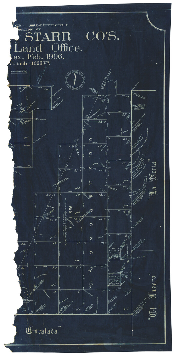
[Working Sketch of a portion of Hidalgo & Starr Co's.]
Print $20.00
- Digital $50.00
[Working Sketch of a portion of Hidalgo & Starr Co's.]
1906
Size: 27.8 x 13.8 inches
4447
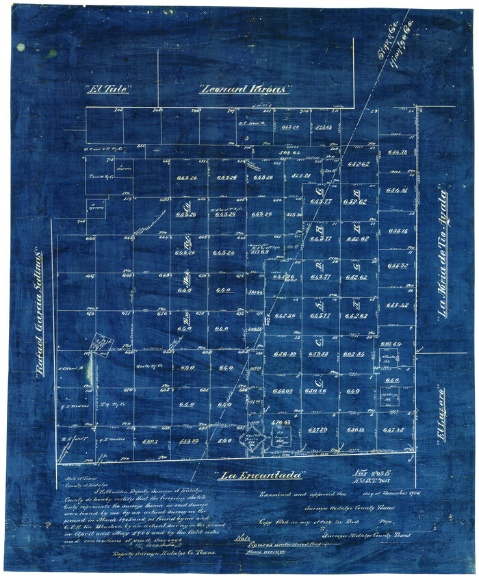
[Tex Mex & CCSDRG&G Railroad Blocks in Starr and Hidalgo Counties, Texas]
Print $20.00
- Digital $50.00
[Tex Mex & CCSDRG&G Railroad Blocks in Starr and Hidalgo Counties, Texas]
1906
Size: 28.7 x 24.2 inches
4452
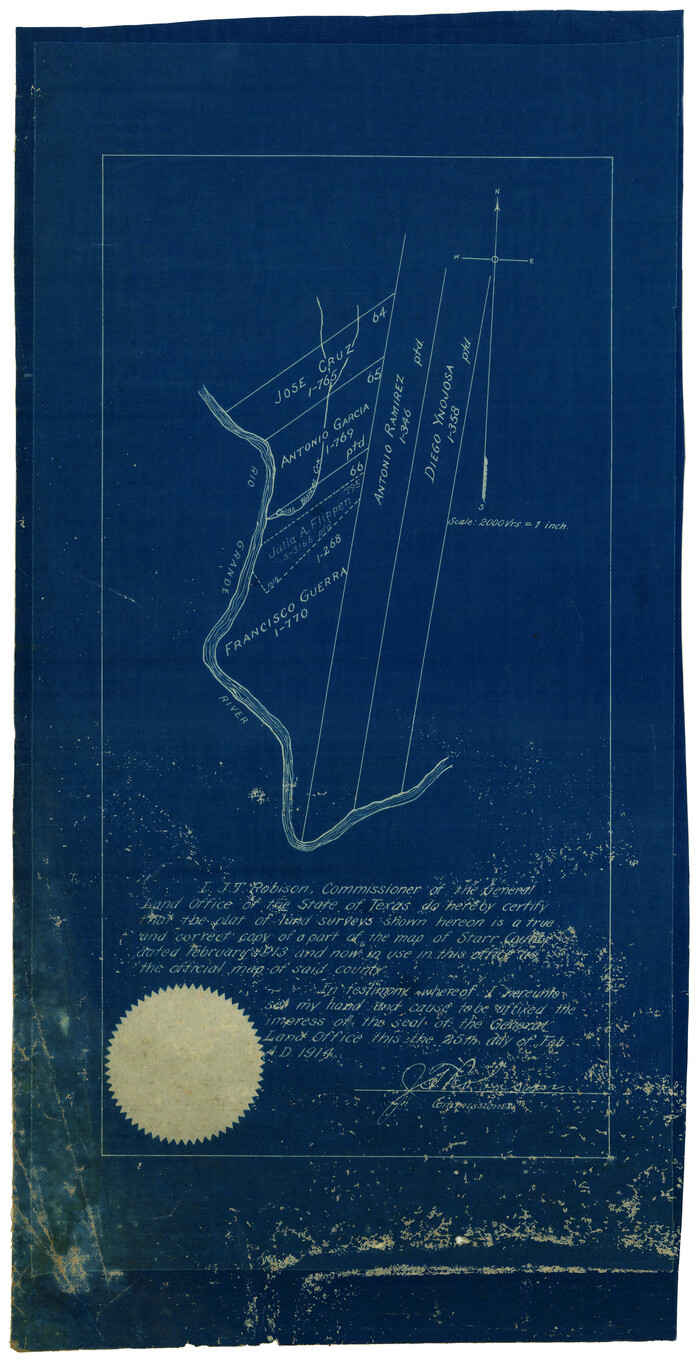
[Surveying Sketch of Francisco Guerra, Antonio Ramirez, Diego Ynojosa, et al on Rio Grande, Starr County]
Print $20.00
- Digital $50.00
[Surveying Sketch of Francisco Guerra, Antonio Ramirez, Diego Ynojosa, et al on Rio Grande, Starr County]
1914
Size: 21.7 x 13.0 inches
5073
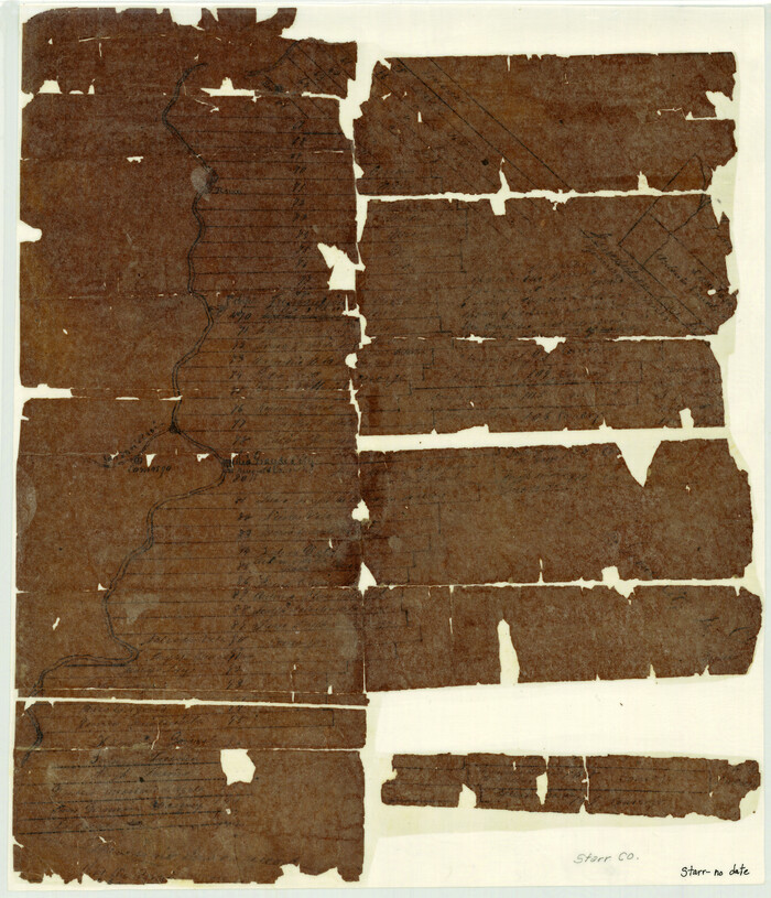
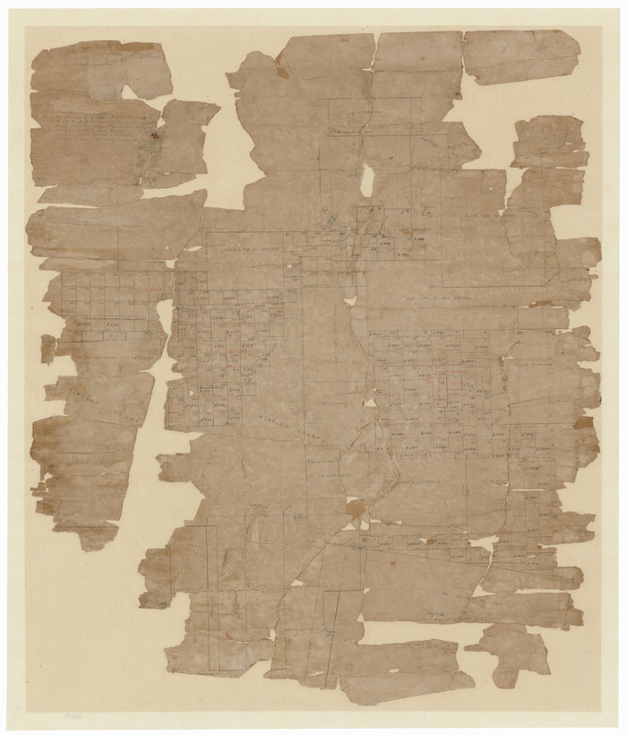
[Sketch with field note calls of the boundaries of Webb, Duval, Jim Wells,Nueces, Kleberg, Zapata, Jim Hogg, Brooks, Willacy, Starr, Hidalgo and Cameron Counties]
![1689, [Sketch with field note calls of the boundaries of Webb, Duval, Jim Wells,Nueces, Kleberg, Zapata, Jim Hogg, Brooks, Willacy, Starr, Hidalgo and Cameron Counties], General Map Collection](https://historictexasmaps.com/wmedia_w700/pdf_converted_jpg/qi_pdf_thumbnail_720.jpg)
Print $20.00
- Digital $50.00
[Sketch with field note calls of the boundaries of Webb, Duval, Jim Wells,Nueces, Kleberg, Zapata, Jim Hogg, Brooks, Willacy, Starr, Hidalgo and Cameron Counties]
1915
Size: 21.9 x 26.2 inches
1689
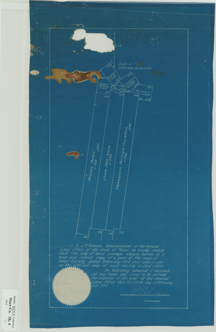
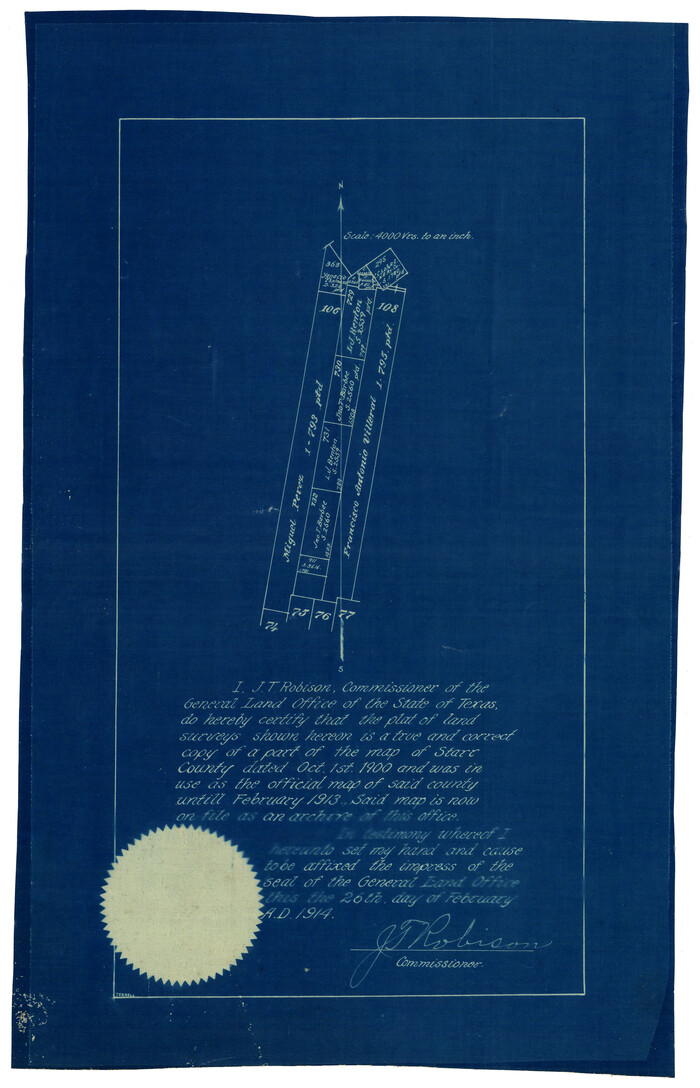
[Sketch showing Miguel Perez, Juan Jose Solis and Francisco Antonio Villareal surveys in Starr County]
Print $20.00
- Digital $50.00
[Sketch showing Miguel Perez, Juan Jose Solis and Francisco Antonio Villareal surveys in Starr County]
1914
Size: 20.9 x 13.6 inches
75549
[Sketch of surveys between Miguel Perez and Francisco Antonio Villareal grants, Starr County]
Print $3.00
- Digital $50.00
[Sketch of surveys between Miguel Perez and Francisco Antonio Villareal grants, Starr County]
1914
Size: 16.7 x 10.6 inches
5074
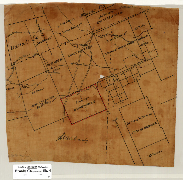
[Sketch of Surveys in Brooks County, Texas]
Print $20.00
- Digital $50.00
[Sketch of Surveys in Brooks County, Texas]
Size: 12.1 x 12.4 inches
10775
[Map of Starr County]
Print $20.00
- Digital $50.00
[Map of Starr County]
Size: 18.8 x 16.2 inches
4049
[Map of Hidalgo County]
Print $20.00
- Digital $50.00
[Map of Hidalgo County]
1882
Size: 26.0 x 19.9 inches
6207
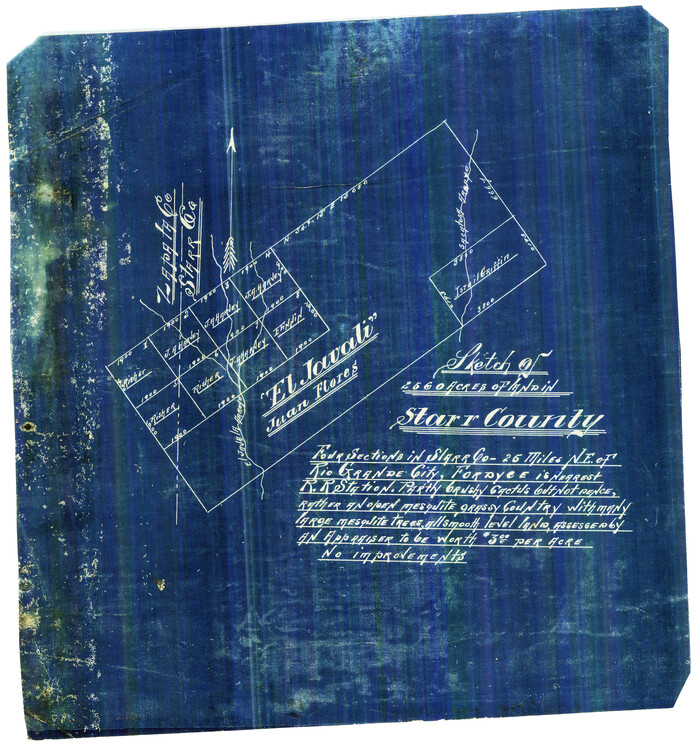
[El Javali Grant,] Sketch of 2560 acres of land in Starr County
Print $20.00
- Digital $50.00
[El Javali Grant,] Sketch of 2560 acres of land in Starr County
Size: 13.4 x 14.0 inches
474
Zapata County Sketch File 5

Print $20.00
- Digital $50.00
Zapata County Sketch File 5
1886
Size: 15.4 x 16.9 inches
12719
Zapata County Sketch File 19

Print $20.00
- Digital $50.00
Zapata County Sketch File 19
1957
Size: 23.5 x 13.2 inches
12724
Zapata County Sketch File 12a

Print $42.00
- Digital $50.00
Zapata County Sketch File 12a
1921
Size: 11.2 x 8.7 inches
40949
Zapata County Rolled Sketch 7A

Print $20.00
- Digital $50.00
Zapata County Rolled Sketch 7A
1912
Size: 17.9 x 26.6 inches
8309
Zapata County Rolled Sketch 7

Print $20.00
- Digital $50.00
Zapata County Rolled Sketch 7
1912
Size: 18.1 x 27.9 inches
8308
Zapata County Rolled Sketch 28

Print $20.00
- Digital $50.00
Zapata County Rolled Sketch 28
Size: 35.5 x 35.3 inches
10174
Starr County Working Sketch Graphic Index

Print $40.00
- Digital $50.00
Starr County Working Sketch Graphic Index
1977
Size: 43.0 x 55.5 inches
76701
Starr County Working Sketch 9

Print $20.00
- Digital $50.00
Starr County Working Sketch 9
1940
Size: 41.5 x 21.4 inches
63925
Starr County Working Sketch 8

Print $20.00
- Digital $50.00
Starr County Working Sketch 8
1939
Size: 21.9 x 28.8 inches
63924
Starr County Working Sketch 7

Print $20.00
- Digital $50.00
Starr County Working Sketch 7
1938
Size: 39.2 x 36.4 inches
63923
Starr County Working Sketch 6

Print $20.00
- Digital $50.00
Starr County Working Sketch 6
Size: 24.3 x 16.2 inches
63922
Starr County Working Sketch 5

Print $20.00
- Digital $50.00
Starr County Working Sketch 5
1930
Size: 35.8 x 24.8 inches
63921
Starr County Working Sketch 4

Print $20.00
- Digital $50.00
Starr County Working Sketch 4
1927
Size: 38.5 x 28.9 inches
63920
Starr County Working Sketch 30

Print $20.00
- Digital $50.00
Starr County Working Sketch 30
2015
Size: 24.6 x 36.6 inches
93750
Starr County Working Sketch 3

Print $20.00
- Digital $50.00
Starr County Working Sketch 3
1920
Size: 35.6 x 23.0 inches
63919
Starr County Working Sketch 29

Print $20.00
- Digital $50.00
Starr County Working Sketch 29
2007
Size: 28.6 x 34.0 inches
87208
Starr County Working Sketch 28

Print $20.00
- Digital $50.00
Starr County Working Sketch 28
2004
Size: 28.0 x 39.6 inches
83010
Starr County Working Sketch 27

Print $20.00
- Digital $50.00
Starr County Working Sketch 27
1994
Size: 29.6 x 30.3 inches
63943
Starr County Working Sketch 25

Print $20.00
- Digital $50.00
Starr County Working Sketch 25
1988
Size: 38.5 x 27.9 inches
63941
Starr County Working Sketch 24

Print $20.00
- Digital $50.00
Starr County Working Sketch 24
1988
Size: 37.1 x 20.2 inches
63940
[Working Sketch of a portion of Hidalgo & Starr Co's.]
Print $20.00
- Digital $50.00
[Working Sketch of a portion of Hidalgo & Starr Co's.]
1906
-
Size
27.8 x 13.8 inches
-
Map/Doc
4447
-
Creation Date
1906
[Tex Mex & CCSDRG&G Railroad Blocks in Starr and Hidalgo Counties, Texas]
Print $20.00
- Digital $50.00
[Tex Mex & CCSDRG&G Railroad Blocks in Starr and Hidalgo Counties, Texas]
1906
-
Size
28.7 x 24.2 inches
-
Map/Doc
4452
-
Creation Date
1906
[Surveying Sketch of Francisco Guerra, Antonio Ramirez, Diego Ynojosa, et al on Rio Grande, Starr County]
Print $20.00
- Digital $50.00
[Surveying Sketch of Francisco Guerra, Antonio Ramirez, Diego Ynojosa, et al on Rio Grande, Starr County]
1914
-
Size
21.7 x 13.0 inches
-
Map/Doc
5073
-
Creation Date
1914
[Sketch with field note calls of the boundaries of Webb, Duval, Jim Wells,Nueces, Kleberg, Zapata, Jim Hogg, Brooks, Willacy, Starr, Hidalgo and Cameron Counties]
Print $20.00
- Digital $50.00
[Sketch with field note calls of the boundaries of Webb, Duval, Jim Wells,Nueces, Kleberg, Zapata, Jim Hogg, Brooks, Willacy, Starr, Hidalgo and Cameron Counties]
1915
-
Size
21.9 x 26.2 inches
-
Map/Doc
1689
-
Creation Date
1915
[Sketch showing Miguel Perez, Juan Jose Solis and Francisco Antonio Villareal surveys in Starr County]
Print $20.00
- Digital $50.00
[Sketch showing Miguel Perez, Juan Jose Solis and Francisco Antonio Villareal surveys in Starr County]
1914
-
Size
20.9 x 13.6 inches
-
Map/Doc
75549
-
Creation Date
1914
[Sketch of surveys between Miguel Perez and Francisco Antonio Villareal grants, Starr County]
Print $3.00
- Digital $50.00
[Sketch of surveys between Miguel Perez and Francisco Antonio Villareal grants, Starr County]
1914
-
Size
16.7 x 10.6 inches
-
Map/Doc
5074
-
Creation Date
1914
[Sketch of Surveys in Brooks County, Texas]
Print $20.00
- Digital $50.00
[Sketch of Surveys in Brooks County, Texas]
-
Size
12.1 x 12.4 inches
-
Map/Doc
10775
[Map of Starr County]
Print $20.00
- Digital $50.00
[Map of Starr County]
-
Size
18.8 x 16.2 inches
-
Map/Doc
4049
[Map of Hidalgo County]
Print $20.00
- Digital $50.00
[Map of Hidalgo County]
1882
-
Size
26.0 x 19.9 inches
-
Map/Doc
6207
-
Creation Date
1882
[El Javali Grant,] Sketch of 2560 acres of land in Starr County
Print $20.00
- Digital $50.00
[El Javali Grant,] Sketch of 2560 acres of land in Starr County
-
Size
13.4 x 14.0 inches
-
Map/Doc
474
Zapata County Sketch File 5
Print $20.00
- Digital $50.00
Zapata County Sketch File 5
1886
-
Size
15.4 x 16.9 inches
-
Map/Doc
12719
-
Creation Date
1886
Zapata County Sketch File 19
Print $20.00
- Digital $50.00
Zapata County Sketch File 19
1957
-
Size
23.5 x 13.2 inches
-
Map/Doc
12724
-
Creation Date
1957
Zapata County Sketch File 12a
Print $42.00
- Digital $50.00
Zapata County Sketch File 12a
1921
-
Size
11.2 x 8.7 inches
-
Map/Doc
40949
-
Creation Date
1921
Zapata County Rolled Sketch 7A
Print $20.00
- Digital $50.00
Zapata County Rolled Sketch 7A
1912
-
Size
17.9 x 26.6 inches
-
Map/Doc
8309
-
Creation Date
1912
Zapata County Rolled Sketch 7
Print $20.00
- Digital $50.00
Zapata County Rolled Sketch 7
1912
-
Size
18.1 x 27.9 inches
-
Map/Doc
8308
-
Creation Date
1912
Zapata County Rolled Sketch 28
Print $20.00
- Digital $50.00
Zapata County Rolled Sketch 28
-
Size
35.5 x 35.3 inches
-
Map/Doc
10174
Starr County Working Sketch Graphic Index
Print $40.00
- Digital $50.00
Starr County Working Sketch Graphic Index
1977
-
Size
43.0 x 55.5 inches
-
Map/Doc
76701
-
Creation Date
1977
Starr County Working Sketch 9
Print $20.00
- Digital $50.00
Starr County Working Sketch 9
1940
-
Size
41.5 x 21.4 inches
-
Map/Doc
63925
-
Creation Date
1940
Starr County Working Sketch 8
Print $20.00
- Digital $50.00
Starr County Working Sketch 8
1939
-
Size
21.9 x 28.8 inches
-
Map/Doc
63924
-
Creation Date
1939
Starr County Working Sketch 7
Print $20.00
- Digital $50.00
Starr County Working Sketch 7
1938
-
Size
39.2 x 36.4 inches
-
Map/Doc
63923
-
Creation Date
1938
Starr County Working Sketch 6
Print $20.00
- Digital $50.00
Starr County Working Sketch 6
-
Size
24.3 x 16.2 inches
-
Map/Doc
63922
Starr County Working Sketch 5
Print $20.00
- Digital $50.00
Starr County Working Sketch 5
1930
-
Size
35.8 x 24.8 inches
-
Map/Doc
63921
-
Creation Date
1930
Starr County Working Sketch 4
Print $20.00
- Digital $50.00
Starr County Working Sketch 4
1927
-
Size
38.5 x 28.9 inches
-
Map/Doc
63920
-
Creation Date
1927
Starr County Working Sketch 30
Print $20.00
- Digital $50.00
Starr County Working Sketch 30
2015
-
Size
24.6 x 36.6 inches
-
Map/Doc
93750
-
Creation Date
2015
Starr County Working Sketch 3
Print $20.00
- Digital $50.00
Starr County Working Sketch 3
1920
-
Size
35.6 x 23.0 inches
-
Map/Doc
63919
-
Creation Date
1920
Starr County Working Sketch 29
Print $20.00
- Digital $50.00
Starr County Working Sketch 29
2007
-
Size
28.6 x 34.0 inches
-
Map/Doc
87208
-
Creation Date
2007
Starr County Working Sketch 28
Print $20.00
- Digital $50.00
Starr County Working Sketch 28
2004
-
Size
28.0 x 39.6 inches
-
Map/Doc
83010
-
Creation Date
2004
Starr County Working Sketch 27
Print $20.00
- Digital $50.00
Starr County Working Sketch 27
1994
-
Size
29.6 x 30.3 inches
-
Map/Doc
63943
-
Creation Date
1994
Starr County Working Sketch 25
Print $20.00
- Digital $50.00
Starr County Working Sketch 25
1988
-
Size
38.5 x 27.9 inches
-
Map/Doc
63941
-
Creation Date
1988
Starr County Working Sketch 24
Print $20.00
- Digital $50.00
Starr County Working Sketch 24
1988
-
Size
37.1 x 20.2 inches
-
Map/Doc
63940
-
Creation Date
1988