Taylor County Sketch File 23

Print $19.00
- Digital $50.00
Taylor County Sketch File 23
2005
Size: 11.0 x 8.5 inches
87114
Taylor County Rolled Sketch 30

Print $20.00
- Digital $50.00
Taylor County Rolled Sketch 30
1999
Size: 29.7 x 29.7 inches
7923
Taylor County Working Sketch 20

Print $40.00
- Digital $50.00
Taylor County Working Sketch 20
1985
Size: 58.7 x 36.7 inches
69630
Taylor County Working Sketch 22

Print $40.00
- Digital $50.00
Taylor County Working Sketch 22
1985
Size: 50.3 x 37.3 inches
69632
Taylor County Working Sketch 21

Print $40.00
- Digital $50.00
Taylor County Working Sketch 21
1985
Size: 55.9 x 43.8 inches
69631
Taylor County Working Sketch 18

Print $20.00
- Digital $50.00
Taylor County Working Sketch 18
1985
Size: 43.2 x 46.0 inches
69628
Taylor County Working Sketch 19

Print $20.00
- Digital $50.00
Taylor County Working Sketch 19
1985
Size: 30.0 x 44.0 inches
69629
Taylor County Sketch File 22

Print $189.00
- Digital $50.00
Taylor County Sketch File 22
1985
Size: 14.6 x 8.9 inches
37826
Taylor County Rolled Sketch 26

Print $20.00
- Digital $50.00
Taylor County Rolled Sketch 26
1982
Size: 35.0 x 35.0 inches
9987
Taylor County Working Sketch 17

Print $20.00
- Digital $50.00
Taylor County Working Sketch 17
1982
Size: 42.7 x 37.0 inches
69627
Taylor County Working Sketch 16

Print $20.00
- Digital $50.00
Taylor County Working Sketch 16
1981
Size: 28.8 x 41.2 inches
69626
Taylor County Working Sketch 15

Print $20.00
- Digital $50.00
Taylor County Working Sketch 15
1972
Size: 44.1 x 30.4 inches
69625
Taylor County Rolled Sketch 25

Print $20.00
- Digital $50.00
Taylor County Rolled Sketch 25
1962
Size: 27.1 x 46.0 inches
7917
Taylor County Sketch File 21

Print $10.00
- Digital $50.00
Taylor County Sketch File 21
1962
Size: 11.3 x 8.8 inches
37821
General Highway Map, Taylor County, Texas

Print $20.00
General Highway Map, Taylor County, Texas
1961
Size: 18.2 x 24.8 inches
79672
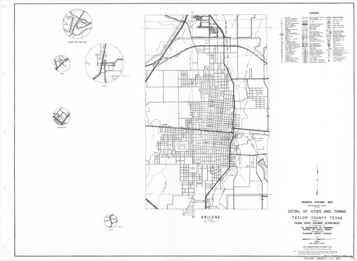
General Highway Map. Detail of Cities and Towns in Taylor County, Texas [Abilene and vicinity]
Print $20.00
General Highway Map. Detail of Cities and Towns in Taylor County, Texas [Abilene and vicinity]
1961
Size: 18.2 x 24.8 inches
79673
Taylor County Working Sketch 14

Print $20.00
- Digital $50.00
Taylor County Working Sketch 14
1959
Size: 26.8 x 21.4 inches
69624
Taylor County Working Sketch 13

Print $20.00
- Digital $50.00
Taylor County Working Sketch 13
1956
Size: 16.3 x 28.9 inches
69623
Taylor County Working Sketch 12

Print $20.00
- Digital $50.00
Taylor County Working Sketch 12
1956
Size: 25.5 x 26.9 inches
69622
Taylor County Working Sketch 11

Print $20.00
- Digital $50.00
Taylor County Working Sketch 11
1956
Size: 23.0 x 24.4 inches
69621
Taylor County Working Sketch 10

Print $20.00
- Digital $50.00
Taylor County Working Sketch 10
1955
Size: 21.6 x 25.5 inches
69620
Taylor County Working Sketch 9

Print $20.00
- Digital $50.00
Taylor County Working Sketch 9
1955
Size: 24.2 x 24.6 inches
69619
Taylor County Working Sketch 8

Print $40.00
- Digital $50.00
Taylor County Working Sketch 8
1953
Size: 73.2 x 43.1 inches
69618
Taylor County Working Sketch 7

Print $20.00
- Digital $50.00
Taylor County Working Sketch 7
1953
Size: 41.3 x 16.1 inches
69617
Taylor County Working Sketch 6

Print $20.00
- Digital $50.00
Taylor County Working Sketch 6
1951
Size: 35.4 x 31.9 inches
69616
Taylor County Sketch File 20

Print $20.00
- Digital $50.00
Taylor County Sketch File 20
1950
Size: 32.1 x 46.1 inches
10385
Taylor County Rolled Sketch 22

Print $20.00
- Digital $50.00
Taylor County Rolled Sketch 22
1950
Size: 23.3 x 26.7 inches
7915
Runnels County Working Sketch 16

Print $20.00
- Digital $50.00
Runnels County Working Sketch 16
1950
Size: 30.1 x 35.5 inches
63612
Taylor County Working Sketch 5

Print $20.00
- Digital $50.00
Taylor County Working Sketch 5
1950
Size: 31.1 x 24.7 inches
69615
Runnels County Working Sketch 11

Print $20.00
- Digital $50.00
Runnels County Working Sketch 11
1949
Size: 24.6 x 25.2 inches
63607
Taylor County Sketch File 23
Print $19.00
- Digital $50.00
Taylor County Sketch File 23
2005
-
Size
11.0 x 8.5 inches
-
Map/Doc
87114
-
Creation Date
2005
Taylor County Rolled Sketch 30
Print $20.00
- Digital $50.00
Taylor County Rolled Sketch 30
1999
-
Size
29.7 x 29.7 inches
-
Map/Doc
7923
-
Creation Date
1999
Taylor County Working Sketch 20
Print $40.00
- Digital $50.00
Taylor County Working Sketch 20
1985
-
Size
58.7 x 36.7 inches
-
Map/Doc
69630
-
Creation Date
1985
Taylor County Working Sketch 22
Print $40.00
- Digital $50.00
Taylor County Working Sketch 22
1985
-
Size
50.3 x 37.3 inches
-
Map/Doc
69632
-
Creation Date
1985
Taylor County Working Sketch 21
Print $40.00
- Digital $50.00
Taylor County Working Sketch 21
1985
-
Size
55.9 x 43.8 inches
-
Map/Doc
69631
-
Creation Date
1985
Taylor County Working Sketch 18
Print $20.00
- Digital $50.00
Taylor County Working Sketch 18
1985
-
Size
43.2 x 46.0 inches
-
Map/Doc
69628
-
Creation Date
1985
Taylor County Working Sketch 19
Print $20.00
- Digital $50.00
Taylor County Working Sketch 19
1985
-
Size
30.0 x 44.0 inches
-
Map/Doc
69629
-
Creation Date
1985
Taylor County Sketch File 22
Print $189.00
- Digital $50.00
Taylor County Sketch File 22
1985
-
Size
14.6 x 8.9 inches
-
Map/Doc
37826
-
Creation Date
1985
Taylor County Rolled Sketch 26
Print $20.00
- Digital $50.00
Taylor County Rolled Sketch 26
1982
-
Size
35.0 x 35.0 inches
-
Map/Doc
9987
-
Creation Date
1982
Taylor County Working Sketch 17
Print $20.00
- Digital $50.00
Taylor County Working Sketch 17
1982
-
Size
42.7 x 37.0 inches
-
Map/Doc
69627
-
Creation Date
1982
Taylor County Working Sketch 16
Print $20.00
- Digital $50.00
Taylor County Working Sketch 16
1981
-
Size
28.8 x 41.2 inches
-
Map/Doc
69626
-
Creation Date
1981
Taylor County Working Sketch 15
Print $20.00
- Digital $50.00
Taylor County Working Sketch 15
1972
-
Size
44.1 x 30.4 inches
-
Map/Doc
69625
-
Creation Date
1972
Taylor County Rolled Sketch 25
Print $20.00
- Digital $50.00
Taylor County Rolled Sketch 25
1962
-
Size
27.1 x 46.0 inches
-
Map/Doc
7917
-
Creation Date
1962
Taylor County Sketch File 21
Print $10.00
- Digital $50.00
Taylor County Sketch File 21
1962
-
Size
11.3 x 8.8 inches
-
Map/Doc
37821
-
Creation Date
1962
General Highway Map, Taylor County, Texas
Print $20.00
General Highway Map, Taylor County, Texas
1961
-
Size
18.2 x 24.8 inches
-
Map/Doc
79672
-
Creation Date
1961
General Highway Map. Detail of Cities and Towns in Taylor County, Texas [Abilene and vicinity]
Print $20.00
General Highway Map. Detail of Cities and Towns in Taylor County, Texas [Abilene and vicinity]
1961
-
Size
18.2 x 24.8 inches
-
Map/Doc
79673
-
Creation Date
1961
Taylor County Working Sketch 14
Print $20.00
- Digital $50.00
Taylor County Working Sketch 14
1959
-
Size
26.8 x 21.4 inches
-
Map/Doc
69624
-
Creation Date
1959
Taylor County Working Sketch 13
Print $20.00
- Digital $50.00
Taylor County Working Sketch 13
1956
-
Size
16.3 x 28.9 inches
-
Map/Doc
69623
-
Creation Date
1956
Taylor County Working Sketch 12
Print $20.00
- Digital $50.00
Taylor County Working Sketch 12
1956
-
Size
25.5 x 26.9 inches
-
Map/Doc
69622
-
Creation Date
1956
Taylor County Working Sketch 11
Print $20.00
- Digital $50.00
Taylor County Working Sketch 11
1956
-
Size
23.0 x 24.4 inches
-
Map/Doc
69621
-
Creation Date
1956
Taylor County Working Sketch 10
Print $20.00
- Digital $50.00
Taylor County Working Sketch 10
1955
-
Size
21.6 x 25.5 inches
-
Map/Doc
69620
-
Creation Date
1955
Taylor County Working Sketch 9
Print $20.00
- Digital $50.00
Taylor County Working Sketch 9
1955
-
Size
24.2 x 24.6 inches
-
Map/Doc
69619
-
Creation Date
1955
Taylor County Working Sketch 8
Print $40.00
- Digital $50.00
Taylor County Working Sketch 8
1953
-
Size
73.2 x 43.1 inches
-
Map/Doc
69618
-
Creation Date
1953
Taylor County Working Sketch 7
Print $20.00
- Digital $50.00
Taylor County Working Sketch 7
1953
-
Size
41.3 x 16.1 inches
-
Map/Doc
69617
-
Creation Date
1953
Taylor County Working Sketch 6
Print $20.00
- Digital $50.00
Taylor County Working Sketch 6
1951
-
Size
35.4 x 31.9 inches
-
Map/Doc
69616
-
Creation Date
1951
Taylor County Sketch File 20
Print $20.00
- Digital $50.00
Taylor County Sketch File 20
1950
-
Size
32.1 x 46.1 inches
-
Map/Doc
10385
-
Creation Date
1950
Taylor County Rolled Sketch 22
Print $20.00
- Digital $50.00
Taylor County Rolled Sketch 22
1950
-
Size
23.3 x 26.7 inches
-
Map/Doc
7915
-
Creation Date
1950
Runnels County Working Sketch 16
Print $20.00
- Digital $50.00
Runnels County Working Sketch 16
1950
-
Size
30.1 x 35.5 inches
-
Map/Doc
63612
-
Creation Date
1950
Taylor County Working Sketch 5
Print $20.00
- Digital $50.00
Taylor County Working Sketch 5
1950
-
Size
31.1 x 24.7 inches
-
Map/Doc
69615
-
Creation Date
1950
Runnels County Working Sketch 11
Print $20.00
- Digital $50.00
Runnels County Working Sketch 11
1949
-
Size
24.6 x 25.2 inches
-
Map/Doc
63607
-
Creation Date
1949