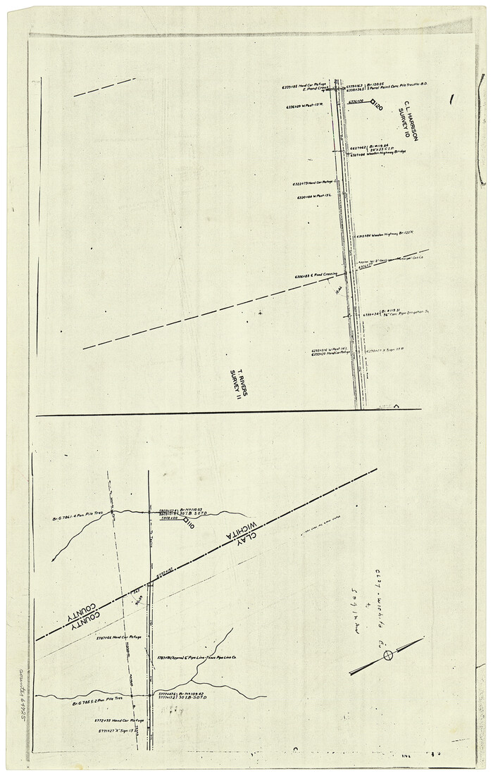
[Surveying sketch of P. Castleman, H. George, et al in Wichita County]
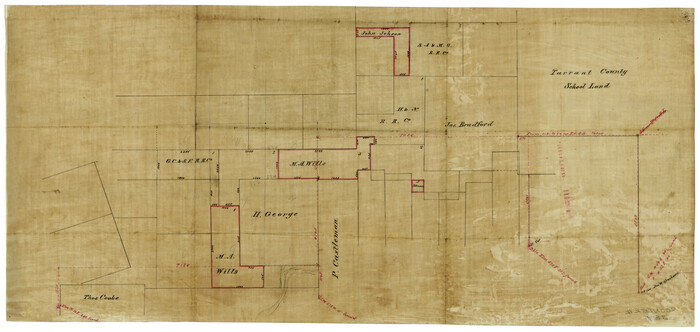
Print $20.00
- Digital $50.00
[Surveying sketch of P. Castleman, H. George, et al in Wichita County]
Size: 12.6 x 24.5 inches
389
[Sketch of Elizabeth Stanley and Wm. Rivers surveys]
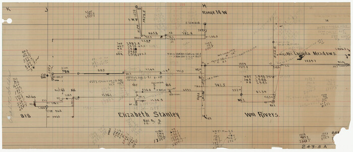
Print $20.00
- Digital $50.00
[Sketch of Elizabeth Stanley and Wm. Rivers surveys]
Size: 23.3 x 10.3 inches
91982
[Sketch of Elizabeth Stanley and Wm. Rivers surveys]
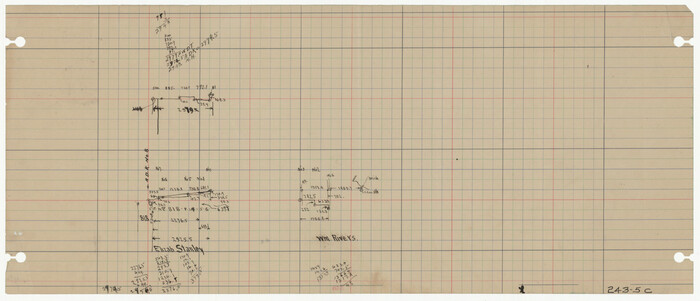
Print $20.00
- Digital $50.00
[Sketch of Elizabeth Stanley and Wm. Rivers surveys]
Size: 23.3 x 10.4 inches
91984
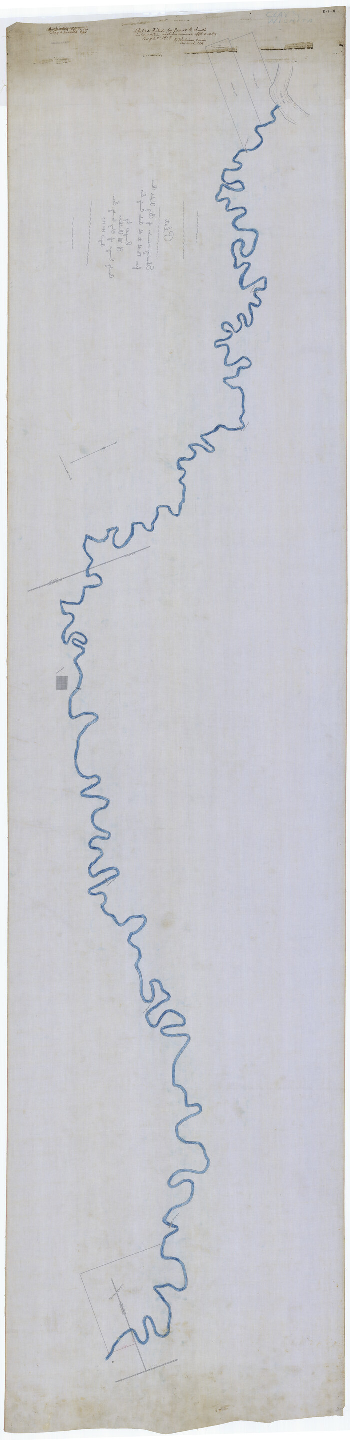
[Sketch for Mineral Application 1487 -Big Wichita River, Ernest R. Smith]
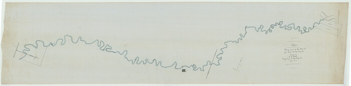
Print $40.00
- Digital $50.00
[Sketch for Mineral Application 1487 -Big Wichita River, Ernest R. Smith]
1918
Size: 32.2 x 130.1 inches
65684
[Sketch for Mineral Application 1487 -Big Wichita River, Ernest R. Smith]
Print $40.00
- Digital $50.00
[Sketch for Mineral Application 1487 -Big Wichita River, Ernest R. Smith]
1918
Size: 129.3 x 31.5 inches
65685
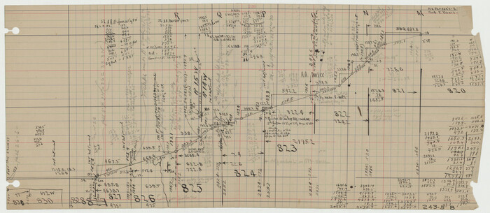
[Sections 94 and 826-831 along Red River]
Print $40.00
- Digital $50.00
[Sections 94 and 826-831 along Red River]
Size: 43.2 x 111.4 inches
93161
[Pencil sketch of surveys 820-831 along river]
Print $20.00
- Digital $50.00
[Pencil sketch of surveys 820-831 along river]
Size: 23.0 x 10.3 inches
91983
[Pencil sketch of Wm. Rivers survey]
Print $3.00
- Digital $50.00
[Pencil sketch of Wm. Rivers survey]
Size: 10.1 x 16.5 inches
91968
[Pencil sketch of Wm. Rivers survey]
Print $3.00
- Digital $50.00
[Pencil sketch of Wm. Rivers survey]
Size: 9.9 x 16.1 inches
91969
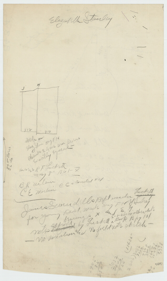
[Part of Wichita County in the vicinity of Elizabeth Stanley survey 812 and W. M. Rivers survey 810]
Print $3.00
- Digital $50.00
[Part of Wichita County in the vicinity of Elizabeth Stanley survey 812 and W. M. Rivers survey 810]
1920
Size: 11.6 x 11.0 inches
91970
[Part of Wichita County in the vicinity of Elizabeth Stanley survey 812 and W. M. Rivers survey 810]
Print $3.00
- Digital $50.00
[Part of Wichita County in the vicinity of Elizabeth Stanley survey 812 and W. M. Rivers survey 810]
1920
Size: 11.5 x 11.7 inches
91971
[Location, Fort Worth & Denver Railroad, through Wilbarger County]
Print $40.00
- Digital $50.00
[Location, Fort Worth & Denver Railroad, through Wilbarger County]
Size: 20.7 x 92.7 inches
64345
[F. W. & D. C. Ry. Co. Alignment and Right of Way Map, Clay County]
Print $20.00
- Digital $50.00
[F. W. & D. C. Ry. Co. Alignment and Right of Way Map, Clay County]
1927
Size: 18.6 x 11.7 inches
64725
Working Sketch in Wichita County [in northern part of county]
Print $20.00
- Digital $50.00
Working Sketch in Wichita County [in northern part of county]
1919
Size: 38.3 x 18.5 inches
91992
Working Sketch in Wichita County

Print $20.00
- Digital $50.00
Working Sketch in Wichita County
1919
Size: 14.1 x 27.0 inches
91993
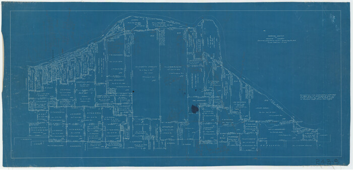
Working Sketch in Archer, Clay & Wichita Co's.

Print $40.00
- Digital $50.00
Working Sketch in Archer, Clay & Wichita Co's.
Size: 68.5 x 43.5 inches
89719
Wilbarger County Working Sketch 2b

Print $20.00
- Digital $50.00
Wilbarger County Working Sketch 2b
1922
Size: 19.8 x 20.0 inches
72540
Wilbarger County Working Sketch 2a

Print $20.00
- Digital $50.00
Wilbarger County Working Sketch 2a
1922
Size: 19.6 x 19.8 inches
72539
Wilbarger County Working Sketch 19

Print $20.00
- Digital $50.00
Wilbarger County Working Sketch 19
1972
Size: 36.6 x 38.3 inches
72557
Wilbarger County Sketch File 10

Print $20.00
- Digital $50.00
Wilbarger County Sketch File 10
1894
Size: 33.9 x 38.7 inches
10434
Wichita Falls, Wichita County, Texas

Print $20.00
- Digital $50.00
Wichita Falls, Wichita County, Texas
Size: 32.0 x 22.6 inches
96791
Wichita County, Texas

Print $20.00
- Digital $50.00
Wichita County, Texas
1890
Size: 26.9 x 32.1 inches
679
Wichita County, State of Texas 1889

Print $20.00
- Digital $50.00
Wichita County, State of Texas 1889
1889
Size: 44.3 x 32.6 inches
89649
Wichita County Working Sketch Graphic Index

Print $20.00
- Digital $50.00
Wichita County Working Sketch Graphic Index
1971
Size: 36.7 x 38.5 inches
76739
Wichita County Working Sketch 9

Print $20.00
- Digital $50.00
Wichita County Working Sketch 9
1920
Size: 23.7 x 17.6 inches
72518
Wichita County Working Sketch 8

Print $20.00
- Digital $50.00
Wichita County Working Sketch 8
1919
Size: 18.3 x 37.7 inches
72517
Wichita County Working Sketch 7

Print $20.00
- Digital $50.00
Wichita County Working Sketch 7
1919
Size: 20.8 x 13.6 inches
72516
Wichita County Working Sketch 6

Print $20.00
- Digital $50.00
Wichita County Working Sketch 6
1919
Size: 24.6 x 21.4 inches
72515
Wichita County Working Sketch 5

Print $20.00
- Digital $50.00
Wichita County Working Sketch 5
1913
Size: 18.2 x 27.0 inches
72514
[Surveying sketch of P. Castleman, H. George, et al in Wichita County]
Print $20.00
- Digital $50.00
[Surveying sketch of P. Castleman, H. George, et al in Wichita County]
-
Size
12.6 x 24.5 inches
-
Map/Doc
389
[Sketch of Elizabeth Stanley and Wm. Rivers surveys]
Print $20.00
- Digital $50.00
[Sketch of Elizabeth Stanley and Wm. Rivers surveys]
-
Size
23.3 x 10.3 inches
-
Map/Doc
91982
[Sketch of Elizabeth Stanley and Wm. Rivers surveys]
Print $20.00
- Digital $50.00
[Sketch of Elizabeth Stanley and Wm. Rivers surveys]
-
Size
23.3 x 10.4 inches
-
Map/Doc
91984
[Sketch for Mineral Application 1487 -Big Wichita River, Ernest R. Smith]
Print $40.00
- Digital $50.00
[Sketch for Mineral Application 1487 -Big Wichita River, Ernest R. Smith]
1918
-
Size
32.2 x 130.1 inches
-
Map/Doc
65684
-
Creation Date
1918
[Sketch for Mineral Application 1487 -Big Wichita River, Ernest R. Smith]
Print $40.00
- Digital $50.00
[Sketch for Mineral Application 1487 -Big Wichita River, Ernest R. Smith]
1918
-
Size
129.3 x 31.5 inches
-
Map/Doc
65685
-
Creation Date
1918
[Sections 94 and 826-831 along Red River]
Print $40.00
- Digital $50.00
[Sections 94 and 826-831 along Red River]
-
Size
43.2 x 111.4 inches
-
Map/Doc
93161
[Pencil sketch of surveys 820-831 along river]
Print $20.00
- Digital $50.00
[Pencil sketch of surveys 820-831 along river]
-
Size
23.0 x 10.3 inches
-
Map/Doc
91983
[Pencil sketch of Wm. Rivers survey]
Print $3.00
- Digital $50.00
[Pencil sketch of Wm. Rivers survey]
-
Size
10.1 x 16.5 inches
-
Map/Doc
91968
[Pencil sketch of Wm. Rivers survey]
Print $3.00
- Digital $50.00
[Pencil sketch of Wm. Rivers survey]
-
Size
9.9 x 16.1 inches
-
Map/Doc
91969
[Part of Wichita County in the vicinity of Elizabeth Stanley survey 812 and W. M. Rivers survey 810]
Print $3.00
- Digital $50.00
[Part of Wichita County in the vicinity of Elizabeth Stanley survey 812 and W. M. Rivers survey 810]
1920
-
Size
11.6 x 11.0 inches
-
Map/Doc
91970
-
Creation Date
1920
[Part of Wichita County in the vicinity of Elizabeth Stanley survey 812 and W. M. Rivers survey 810]
Print $3.00
- Digital $50.00
[Part of Wichita County in the vicinity of Elizabeth Stanley survey 812 and W. M. Rivers survey 810]
1920
-
Size
11.5 x 11.7 inches
-
Map/Doc
91971
-
Creation Date
1920
[Location, Fort Worth & Denver Railroad, through Wilbarger County]
Print $40.00
- Digital $50.00
[Location, Fort Worth & Denver Railroad, through Wilbarger County]
-
Size
20.7 x 92.7 inches
-
Map/Doc
64345
[F. W. & D. C. Ry. Co. Alignment and Right of Way Map, Clay County]
Print $20.00
- Digital $50.00
[F. W. & D. C. Ry. Co. Alignment and Right of Way Map, Clay County]
1927
-
Size
18.6 x 11.7 inches
-
Map/Doc
64725
-
Creation Date
1927
Working Sketch in Wichita County [in northern part of county]
Print $20.00
- Digital $50.00
Working Sketch in Wichita County [in northern part of county]
1919
-
Size
38.3 x 18.5 inches
-
Map/Doc
91992
-
Creation Date
1919
Working Sketch in Wichita County
Print $20.00
- Digital $50.00
Working Sketch in Wichita County
1919
-
Size
14.1 x 27.0 inches
-
Map/Doc
91993
-
Creation Date
1919
Working Sketch in Archer, Clay & Wichita Co's.
Print $40.00
- Digital $50.00
Working Sketch in Archer, Clay & Wichita Co's.
-
Size
68.5 x 43.5 inches
-
Map/Doc
89719
Wilbarger County Working Sketch 2b
Print $20.00
- Digital $50.00
Wilbarger County Working Sketch 2b
1922
-
Size
19.8 x 20.0 inches
-
Map/Doc
72540
-
Creation Date
1922
Wilbarger County Working Sketch 2a
Print $20.00
- Digital $50.00
Wilbarger County Working Sketch 2a
1922
-
Size
19.6 x 19.8 inches
-
Map/Doc
72539
-
Creation Date
1922
Wilbarger County Working Sketch 19
Print $20.00
- Digital $50.00
Wilbarger County Working Sketch 19
1972
-
Size
36.6 x 38.3 inches
-
Map/Doc
72557
-
Creation Date
1972
Wilbarger County Sketch File 10
Print $20.00
- Digital $50.00
Wilbarger County Sketch File 10
1894
-
Size
33.9 x 38.7 inches
-
Map/Doc
10434
-
Creation Date
1894
Wichita Falls, Wichita County, Texas
Print $20.00
- Digital $50.00
Wichita Falls, Wichita County, Texas
-
Size
32.0 x 22.6 inches
-
Map/Doc
96791
Wichita Falls, Texas

Print $20.00
Wichita Falls, Texas
1890
-
Size
21.0 x 30.9 inches
-
Map/Doc
89214
-
Creation Date
1890
Wichita County, Texas
Print $20.00
- Digital $50.00
Wichita County, Texas
1890
-
Size
26.9 x 32.1 inches
-
Map/Doc
679
-
Creation Date
1890
Wichita County, State of Texas 1889
Print $20.00
- Digital $50.00
Wichita County, State of Texas 1889
1889
-
Size
44.3 x 32.6 inches
-
Map/Doc
89649
-
Creation Date
1889
Wichita County Working Sketch Graphic Index
Print $20.00
- Digital $50.00
Wichita County Working Sketch Graphic Index
1971
-
Size
36.7 x 38.5 inches
-
Map/Doc
76739
-
Creation Date
1971
Wichita County Working Sketch 9
Print $20.00
- Digital $50.00
Wichita County Working Sketch 9
1920
-
Size
23.7 x 17.6 inches
-
Map/Doc
72518
-
Creation Date
1920
Wichita County Working Sketch 8
Print $20.00
- Digital $50.00
Wichita County Working Sketch 8
1919
-
Size
18.3 x 37.7 inches
-
Map/Doc
72517
-
Creation Date
1919
Wichita County Working Sketch 7
Print $20.00
- Digital $50.00
Wichita County Working Sketch 7
1919
-
Size
20.8 x 13.6 inches
-
Map/Doc
72516
-
Creation Date
1919
Wichita County Working Sketch 6
Print $20.00
- Digital $50.00
Wichita County Working Sketch 6
1919
-
Size
24.6 x 21.4 inches
-
Map/Doc
72515
-
Creation Date
1919
Wichita County Working Sketch 5
Print $20.00
- Digital $50.00
Wichita County Working Sketch 5
1913
-
Size
18.2 x 27.0 inches
-
Map/Doc
72514
-
Creation Date
1913