Archer County Sketch File 3

Print $4.00
- Digital $50.00
Archer County Sketch File 3
Size: 7.5 x 8.5 inches
13628
Archer County Sketch File 5

Print $4.00
- Digital $50.00
Archer County Sketch File 5
1858
Size: 7.8 x 8.7 inches
13632
Archer County Sketch File 7

Print $6.00
- Digital $50.00
Archer County Sketch File 7
Size: 8.8 x 11.8 inches
13636
Archer County Working Sketch 4

Print $40.00
- Digital $50.00
Archer County Working Sketch 4
1918
Size: 49.9 x 68.3 inches
67144
Archer County Working Sketch 5

Print $20.00
- Digital $50.00
Archer County Working Sketch 5
1919
Size: 14.7 x 23.4 inches
67145
Archer County Working Sketch 6

Print $20.00
- Digital $50.00
Archer County Working Sketch 6
1920
Size: 16.9 x 27.7 inches
67146
Baylor County Rolled Sketch 5

Print $20.00
- Digital $50.00
Baylor County Rolled Sketch 5
1874
Size: 43.2 x 39.7 inches
8444
Clay County Sketch File 1a

Print $25.00
- Digital $50.00
Clay County Sketch File 1a
1860
Size: 8.8 x 8.2 inches
18387
Clay County Sketch File 2

Print $4.00
- Digital $50.00
Clay County Sketch File 2
Size: 8.3 x 6.7 inches
18389
Clay County Sketch File 20

Print $8.00
- Digital $50.00
Clay County Sketch File 20
1882
Size: 11.2 x 8.6 inches
18431
Clay County Sketch File 26

Print $84.00
- Digital $50.00
Clay County Sketch File 26
1888
Size: 14.3 x 9.0 inches
18442
Clay County Sketch File 42

Print $20.00
- Digital $50.00
Clay County Sketch File 42
Size: 22.8 x 31.0 inches
11093
Clay County Sketch File 43

Print $40.00
- Digital $50.00
Clay County Sketch File 43
1891
Size: 23.2 x 33.7 inches
11094
Clay County Sketch File 44

Print $20.00
- Digital $50.00
Clay County Sketch File 44
Size: 24.7 x 36.0 inches
11096
Clay County Sketch File 45

Print $20.00
- Digital $50.00
Clay County Sketch File 45
Size: 23.5 x 35.4 inches
11097
Clay County Sketch File 49

Print $78.00
- Digital $50.00
Clay County Sketch File 49
1928
Size: 14.2 x 8.8 inches
18500
Clay County Sketch File 9

Print $6.00
- Digital $50.00
Clay County Sketch File 9
1860
Size: 8.4 x 7.6 inches
18400
General Highway Map, Wichita County, Texas

Print $20.00
General Highway Map, Wichita County, Texas
1940
Size: 18.1 x 24.8 inches
79277
General Highway Map, Wichita County, Texas

Print $20.00
General Highway Map, Wichita County, Texas
1961
Size: 18.2 x 24.6 inches
79709
Map [showing surveys 820-829] Along Red River
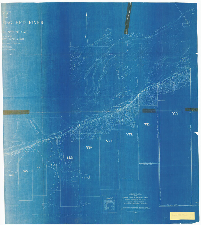
Print $20.00
- Digital $50.00
Map [showing surveys 820-829] Along Red River
1920
Size: 40.4 x 45.2 inches
89813
Map of Dallas & Wichita Railroad Survey

Print $40.00
- Digital $50.00
Map of Dallas & Wichita Railroad Survey
1874
Size: 37.3 x 82.7 inches
64417
Map of Wichita Co.

Print $20.00
- Digital $50.00
Map of Wichita Co.
1897
Size: 29.7 x 36.7 inches
16925
Map of Wichita County

Print $20.00
- Digital $50.00
Map of Wichita County
1874
Size: 22.8 x 21.0 inches
4142
Map of Wichita County Young Land District, formerly Fannin Land District

Print $20.00
- Digital $50.00
Map of Wichita County Young Land District, formerly Fannin Land District
1859
Size: 22.4 x 20.5 inches
4141
Map of the Fort Worth & Denver City Railway, Wichita County, Texas

Print $40.00
- Digital $50.00
Map of the Fort Worth & Denver City Railway, Wichita County, Texas
1885
Size: 25.2 x 122.4 inches
64454
Map of the Fort Worth & Denver City Railway, Wichita County, Texas

Print $40.00
- Digital $50.00
Map of the Fort Worth & Denver City Railway, Wichita County, Texas
1885
Size: 23.7 x 66.5 inches
64455
Map of the Fort Worth and Denver City Railway

Print $40.00
- Digital $50.00
Map of the Fort Worth and Denver City Railway
1873
Size: 31.6 x 90.3 inches
64778
Map of the Fort Worth and Denver City Railway, through Wilbarger County Texas, 1882

Print $40.00
- Digital $50.00
Map of the Fort Worth and Denver City Railway, through Wilbarger County Texas, 1882
Size: 22.6 x 79.4 inches
64427
Archer County Sketch File 3
Print $4.00
- Digital $50.00
Archer County Sketch File 3
-
Size
7.5 x 8.5 inches
-
Map/Doc
13628
Archer County Sketch File 5
Print $4.00
- Digital $50.00
Archer County Sketch File 5
1858
-
Size
7.8 x 8.7 inches
-
Map/Doc
13632
-
Creation Date
1858
Archer County Sketch File 7
Print $6.00
- Digital $50.00
Archer County Sketch File 7
-
Size
8.8 x 11.8 inches
-
Map/Doc
13636
Archer County Working Sketch 4
Print $40.00
- Digital $50.00
Archer County Working Sketch 4
1918
-
Size
49.9 x 68.3 inches
-
Map/Doc
67144
-
Creation Date
1918
Archer County Working Sketch 5
Print $20.00
- Digital $50.00
Archer County Working Sketch 5
1919
-
Size
14.7 x 23.4 inches
-
Map/Doc
67145
-
Creation Date
1919
Archer County Working Sketch 6
Print $20.00
- Digital $50.00
Archer County Working Sketch 6
1920
-
Size
16.9 x 27.7 inches
-
Map/Doc
67146
-
Creation Date
1920
Baylor County Rolled Sketch 5
Print $20.00
- Digital $50.00
Baylor County Rolled Sketch 5
1874
-
Size
43.2 x 39.7 inches
-
Map/Doc
8444
-
Creation Date
1874
Big Bend Sheet

Print $20.00
Big Bend Sheet
1920
-
Size
32.8 x 37.2 inches
-
Map/Doc
79760
-
Creation Date
1920
Clay County Sketch File 1a
Print $25.00
- Digital $50.00
Clay County Sketch File 1a
1860
-
Size
8.8 x 8.2 inches
-
Map/Doc
18387
-
Creation Date
1860
Clay County Sketch File 2
Print $4.00
- Digital $50.00
Clay County Sketch File 2
-
Size
8.3 x 6.7 inches
-
Map/Doc
18389
Clay County Sketch File 20
Print $8.00
- Digital $50.00
Clay County Sketch File 20
1882
-
Size
11.2 x 8.6 inches
-
Map/Doc
18431
-
Creation Date
1882
Clay County Sketch File 26
Print $84.00
- Digital $50.00
Clay County Sketch File 26
1888
-
Size
14.3 x 9.0 inches
-
Map/Doc
18442
-
Creation Date
1888
Clay County Sketch File 42
Print $20.00
- Digital $50.00
Clay County Sketch File 42
-
Size
22.8 x 31.0 inches
-
Map/Doc
11093
Clay County Sketch File 43
Print $40.00
- Digital $50.00
Clay County Sketch File 43
1891
-
Size
23.2 x 33.7 inches
-
Map/Doc
11094
-
Creation Date
1891
Clay County Sketch File 44
Print $20.00
- Digital $50.00
Clay County Sketch File 44
-
Size
24.7 x 36.0 inches
-
Map/Doc
11096
Clay County Sketch File 45
Print $20.00
- Digital $50.00
Clay County Sketch File 45
-
Size
23.5 x 35.4 inches
-
Map/Doc
11097
Clay County Sketch File 49
Print $78.00
- Digital $50.00
Clay County Sketch File 49
1928
-
Size
14.2 x 8.8 inches
-
Map/Doc
18500
-
Creation Date
1928
Clay County Sketch File 9
Print $6.00
- Digital $50.00
Clay County Sketch File 9
1860
-
Size
8.4 x 7.6 inches
-
Map/Doc
18400
-
Creation Date
1860
General Highway Map, Wichita County, Texas
Print $20.00
General Highway Map, Wichita County, Texas
1940
-
Size
18.1 x 24.8 inches
-
Map/Doc
79277
-
Creation Date
1940
General Highway Map, Wichita County, Texas
Print $20.00
General Highway Map, Wichita County, Texas
1961
-
Size
18.2 x 24.6 inches
-
Map/Doc
79709
-
Creation Date
1961
Grandfield Bridge Sheet

Print $20.00
Grandfield Bridge Sheet
1920
-
Size
39.4 x 35.8 inches
-
Map/Doc
79751
-
Creation Date
1920
Map [showing surveys 820-829] Along Red River
Print $20.00
- Digital $50.00
Map [showing surveys 820-829] Along Red River
1920
-
Size
40.4 x 45.2 inches
-
Map/Doc
89813
-
Creation Date
1920
Map of Dallas & Wichita Railroad Survey
Print $40.00
- Digital $50.00
Map of Dallas & Wichita Railroad Survey
1874
-
Size
37.3 x 82.7 inches
-
Map/Doc
64417
-
Creation Date
1874
Map of Wichita Co.
Print $20.00
- Digital $50.00
Map of Wichita Co.
1897
-
Size
29.7 x 36.7 inches
-
Map/Doc
16925
-
Creation Date
1897
Map of Wichita County
Print $20.00
- Digital $50.00
Map of Wichita County
1874
-
Size
22.8 x 21.0 inches
-
Map/Doc
4142
-
Creation Date
1874
Map of Wichita County Young Land District, formerly Fannin Land District
Print $20.00
- Digital $50.00
Map of Wichita County Young Land District, formerly Fannin Land District
1859
-
Size
22.4 x 20.5 inches
-
Map/Doc
4141
-
Creation Date
1859
Map of the Fort Worth & Denver City Railway, Wichita County, Texas
Print $40.00
- Digital $50.00
Map of the Fort Worth & Denver City Railway, Wichita County, Texas
1885
-
Size
25.2 x 122.4 inches
-
Map/Doc
64454
-
Creation Date
1885
Map of the Fort Worth & Denver City Railway, Wichita County, Texas
Print $40.00
- Digital $50.00
Map of the Fort Worth & Denver City Railway, Wichita County, Texas
1885
-
Size
23.7 x 66.5 inches
-
Map/Doc
64455
-
Creation Date
1885
Map of the Fort Worth and Denver City Railway
Print $40.00
- Digital $50.00
Map of the Fort Worth and Denver City Railway
1873
-
Size
31.6 x 90.3 inches
-
Map/Doc
64778
-
Creation Date
1873
Map of the Fort Worth and Denver City Railway, through Wilbarger County Texas, 1882
Print $40.00
- Digital $50.00
Map of the Fort Worth and Denver City Railway, through Wilbarger County Texas, 1882
-
Size
22.6 x 79.4 inches
-
Map/Doc
64427