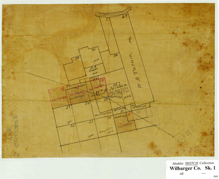
[Surveying Sketch of W.B. Tatum, Wm. B. Jordan, et al]
Print $2.00
- Digital $50.00
[Surveying Sketch of W.B. Tatum, Wm. B. Jordan, et al]
Size: 8.9 x 10.8 inches
428
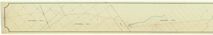
[Location, Fort Worth & Denver Railroad, through Wilbarger County]
Print $40.00
- Digital $50.00
[Location, Fort Worth & Denver Railroad, through Wilbarger County]
Size: 20.8 x 123.5 inches
64344
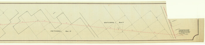
[Location, Fort Worth & Denver Railroad, through Wilbarger County]
Print $40.00
- Digital $50.00
[Location, Fort Worth & Denver Railroad, through Wilbarger County]
Size: 20.7 x 92.7 inches
64345
[Field book of Martin Duval, Wilbarger Co., H&TC RR Co. Blocks 13 & 14]
![61431, [Field book of Martin Duval, Wilbarger Co., H&TC RR Co. Blocks 13 & 14], General Map Collection](https://historictexasmaps.com/wmedia_w700/pdf_converted_jpg/qi_pdf_thumbnail_17161.jpg)
[Field book of Martin Duval, Wilbarger Co., H&TC RR Co. Blocks 13 & 14]
Size: 6.7 x 8.2 inches
61431
Wilbarger County Working Sketch Graphic Index

Print $20.00
- Digital $50.00
Wilbarger County Working Sketch Graphic Index
1949
Size: 46.7 x 38.0 inches
76740
Wilbarger County Working Sketch 9

Print $20.00
- Digital $50.00
Wilbarger County Working Sketch 9
1950
Size: 21.3 x 27.6 inches
72547
Wilbarger County Working Sketch 8

Print $20.00
- Digital $50.00
Wilbarger County Working Sketch 8
1948
Size: 31.8 x 38.2 inches
72546
Wilbarger County Working Sketch 7a and 7b

Print $20.00
- Digital $50.00
Wilbarger County Working Sketch 7a and 7b
1951
Size: 22.7 x 24.0 inches
72545
Wilbarger County Working Sketch 6

Print $20.00
- Digital $50.00
Wilbarger County Working Sketch 6
1946
Size: 27.1 x 41.4 inches
72544
Wilbarger County Working Sketch 5

Print $20.00
- Digital $50.00
Wilbarger County Working Sketch 5
1940
Size: 21.3 x 25.6 inches
72543
Wilbarger County Working Sketch 4

Print $20.00
- Digital $50.00
Wilbarger County Working Sketch 4
1925
Size: 14.6 x 17.1 inches
72542
Wilbarger County Working Sketch 3

Print $20.00
- Digital $50.00
Wilbarger County Working Sketch 3
1923
Size: 22.0 x 23.9 inches
72541
Wilbarger County Working Sketch 2b

Print $20.00
- Digital $50.00
Wilbarger County Working Sketch 2b
1922
Size: 19.8 x 20.0 inches
72540
Wilbarger County Working Sketch 2a

Print $20.00
- Digital $50.00
Wilbarger County Working Sketch 2a
1922
Size: 19.6 x 19.8 inches
72539
Wilbarger County Working Sketch 22

Print $20.00
- Digital $50.00
Wilbarger County Working Sketch 22
1983
Size: 39.8 x 33.6 inches
72560
Wilbarger County Working Sketch 21

Print $20.00
- Digital $50.00
Wilbarger County Working Sketch 21
1979
Size: 37.4 x 37.8 inches
72559
Wilbarger County Working Sketch 20

Print $20.00
- Digital $50.00
Wilbarger County Working Sketch 20
1976
Size: 27.4 x 43.4 inches
72558
Wilbarger County Working Sketch 19

Print $20.00
- Digital $50.00
Wilbarger County Working Sketch 19
1972
Size: 36.6 x 38.3 inches
72557
Wilbarger County Working Sketch 18

Print $20.00
- Digital $50.00
Wilbarger County Working Sketch 18
1965
Size: 42.0 x 46.6 inches
72556
Wilbarger County Working Sketch 17

Print $20.00
- Digital $50.00
Wilbarger County Working Sketch 17
1957
Size: 7.5 x 18.4 inches
72555
Wilbarger County Working Sketch 16

Print $20.00
- Digital $50.00
Wilbarger County Working Sketch 16
1955
Size: 32.7 x 19.9 inches
72554
Wilbarger County Working Sketch 15

Print $20.00
- Digital $50.00
Wilbarger County Working Sketch 15
1955
Size: 32.5 x 25.5 inches
72553
Wilbarger County Working Sketch 14

Print $20.00
- Digital $50.00
Wilbarger County Working Sketch 14
1955
Size: 24.8 x 21.7 inches
72552
Wilbarger County Working Sketch 13

Print $20.00
- Digital $50.00
Wilbarger County Working Sketch 13
1954
Size: 25.9 x 24.0 inches
72551
Wilbarger County Working Sketch 12

Print $20.00
- Digital $50.00
Wilbarger County Working Sketch 12
1953
Size: 42.2 x 33.5 inches
72550
Wilbarger County Working Sketch 11

Print $40.00
- Digital $50.00
Wilbarger County Working Sketch 11
1952
Size: 27.7 x 51.7 inches
72549
Wilbarger County Working Sketch 10

Print $20.00
- Digital $50.00
Wilbarger County Working Sketch 10
1951
Size: 23.5 x 32.3 inches
72548
Wilbarger County Working Sketch 1

Print $20.00
- Digital $50.00
Wilbarger County Working Sketch 1
1919
Size: 17.6 x 27.9 inches
72538
Wilbarger County Sketch File A

Print $6.00
- Digital $50.00
Wilbarger County Sketch File A
Size: 8.3 x 14.1 inches
40231
Wilbarger County Sketch File 9

Print $4.00
- Digital $50.00
Wilbarger County Sketch File 9
1885
Size: 12.7 x 8.2 inches
40181
[Surveying Sketch of W.B. Tatum, Wm. B. Jordan, et al]
Print $2.00
- Digital $50.00
[Surveying Sketch of W.B. Tatum, Wm. B. Jordan, et al]
-
Size
8.9 x 10.8 inches
-
Map/Doc
428
[Location, Fort Worth & Denver Railroad, through Wilbarger County]
Print $40.00
- Digital $50.00
[Location, Fort Worth & Denver Railroad, through Wilbarger County]
-
Size
20.8 x 123.5 inches
-
Map/Doc
64344
[Location, Fort Worth & Denver Railroad, through Wilbarger County]
Print $40.00
- Digital $50.00
[Location, Fort Worth & Denver Railroad, through Wilbarger County]
-
Size
20.7 x 92.7 inches
-
Map/Doc
64345
[Field book of Martin Duval, Wilbarger Co., H&TC RR Co. Blocks 13 & 14]
[Field book of Martin Duval, Wilbarger Co., H&TC RR Co. Blocks 13 & 14]
-
Size
6.7 x 8.2 inches
-
Map/Doc
61431
Wilbarger County Working Sketch Graphic Index
Print $20.00
- Digital $50.00
Wilbarger County Working Sketch Graphic Index
1949
-
Size
46.7 x 38.0 inches
-
Map/Doc
76740
-
Creation Date
1949
Wilbarger County Working Sketch 9
Print $20.00
- Digital $50.00
Wilbarger County Working Sketch 9
1950
-
Size
21.3 x 27.6 inches
-
Map/Doc
72547
-
Creation Date
1950
Wilbarger County Working Sketch 8
Print $20.00
- Digital $50.00
Wilbarger County Working Sketch 8
1948
-
Size
31.8 x 38.2 inches
-
Map/Doc
72546
-
Creation Date
1948
Wilbarger County Working Sketch 7a and 7b
Print $20.00
- Digital $50.00
Wilbarger County Working Sketch 7a and 7b
1951
-
Size
22.7 x 24.0 inches
-
Map/Doc
72545
-
Creation Date
1951
Wilbarger County Working Sketch 6
Print $20.00
- Digital $50.00
Wilbarger County Working Sketch 6
1946
-
Size
27.1 x 41.4 inches
-
Map/Doc
72544
-
Creation Date
1946
Wilbarger County Working Sketch 5
Print $20.00
- Digital $50.00
Wilbarger County Working Sketch 5
1940
-
Size
21.3 x 25.6 inches
-
Map/Doc
72543
-
Creation Date
1940
Wilbarger County Working Sketch 4
Print $20.00
- Digital $50.00
Wilbarger County Working Sketch 4
1925
-
Size
14.6 x 17.1 inches
-
Map/Doc
72542
-
Creation Date
1925
Wilbarger County Working Sketch 3
Print $20.00
- Digital $50.00
Wilbarger County Working Sketch 3
1923
-
Size
22.0 x 23.9 inches
-
Map/Doc
72541
-
Creation Date
1923
Wilbarger County Working Sketch 2b
Print $20.00
- Digital $50.00
Wilbarger County Working Sketch 2b
1922
-
Size
19.8 x 20.0 inches
-
Map/Doc
72540
-
Creation Date
1922
Wilbarger County Working Sketch 2a
Print $20.00
- Digital $50.00
Wilbarger County Working Sketch 2a
1922
-
Size
19.6 x 19.8 inches
-
Map/Doc
72539
-
Creation Date
1922
Wilbarger County Working Sketch 22
Print $20.00
- Digital $50.00
Wilbarger County Working Sketch 22
1983
-
Size
39.8 x 33.6 inches
-
Map/Doc
72560
-
Creation Date
1983
Wilbarger County Working Sketch 21
Print $20.00
- Digital $50.00
Wilbarger County Working Sketch 21
1979
-
Size
37.4 x 37.8 inches
-
Map/Doc
72559
-
Creation Date
1979
Wilbarger County Working Sketch 20
Print $20.00
- Digital $50.00
Wilbarger County Working Sketch 20
1976
-
Size
27.4 x 43.4 inches
-
Map/Doc
72558
-
Creation Date
1976
Wilbarger County Working Sketch 19
Print $20.00
- Digital $50.00
Wilbarger County Working Sketch 19
1972
-
Size
36.6 x 38.3 inches
-
Map/Doc
72557
-
Creation Date
1972
Wilbarger County Working Sketch 18
Print $20.00
- Digital $50.00
Wilbarger County Working Sketch 18
1965
-
Size
42.0 x 46.6 inches
-
Map/Doc
72556
-
Creation Date
1965
Wilbarger County Working Sketch 17
Print $20.00
- Digital $50.00
Wilbarger County Working Sketch 17
1957
-
Size
7.5 x 18.4 inches
-
Map/Doc
72555
-
Creation Date
1957
Wilbarger County Working Sketch 16
Print $20.00
- Digital $50.00
Wilbarger County Working Sketch 16
1955
-
Size
32.7 x 19.9 inches
-
Map/Doc
72554
-
Creation Date
1955
Wilbarger County Working Sketch 15
Print $20.00
- Digital $50.00
Wilbarger County Working Sketch 15
1955
-
Size
32.5 x 25.5 inches
-
Map/Doc
72553
-
Creation Date
1955
Wilbarger County Working Sketch 14
Print $20.00
- Digital $50.00
Wilbarger County Working Sketch 14
1955
-
Size
24.8 x 21.7 inches
-
Map/Doc
72552
-
Creation Date
1955
Wilbarger County Working Sketch 13
Print $20.00
- Digital $50.00
Wilbarger County Working Sketch 13
1954
-
Size
25.9 x 24.0 inches
-
Map/Doc
72551
-
Creation Date
1954
Wilbarger County Working Sketch 12
Print $20.00
- Digital $50.00
Wilbarger County Working Sketch 12
1953
-
Size
42.2 x 33.5 inches
-
Map/Doc
72550
-
Creation Date
1953
Wilbarger County Working Sketch 11
Print $40.00
- Digital $50.00
Wilbarger County Working Sketch 11
1952
-
Size
27.7 x 51.7 inches
-
Map/Doc
72549
-
Creation Date
1952
Wilbarger County Working Sketch 10
Print $20.00
- Digital $50.00
Wilbarger County Working Sketch 10
1951
-
Size
23.5 x 32.3 inches
-
Map/Doc
72548
-
Creation Date
1951
Wilbarger County Working Sketch 1
Print $20.00
- Digital $50.00
Wilbarger County Working Sketch 1
1919
-
Size
17.6 x 27.9 inches
-
Map/Doc
72538
-
Creation Date
1919
Wilbarger County Sketch File A
Print $6.00
- Digital $50.00
Wilbarger County Sketch File A
-
Size
8.3 x 14.1 inches
-
Map/Doc
40231
Wilbarger County Sketch File 9
Print $4.00
- Digital $50.00
Wilbarger County Sketch File 9
1885
-
Size
12.7 x 8.2 inches
-
Map/Doc
40181
-
Creation Date
1885