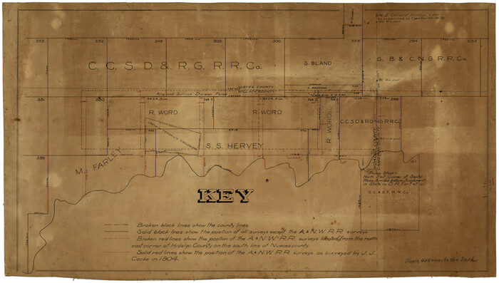
[Surveying Sketch of M. Farley, R. Word, S. S. Hervey, et al in Kleberg County, Texas]
Print $20.00
- Digital $50.00
[Surveying Sketch of M. Farley, R. Word, S. S. Hervey, et al in Kleberg County, Texas]
Size: 23.2 x 40.6 inches
10783
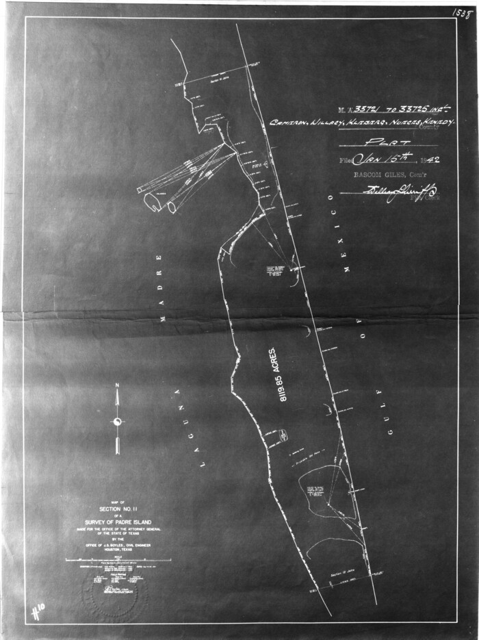
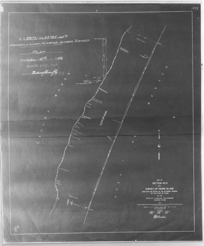
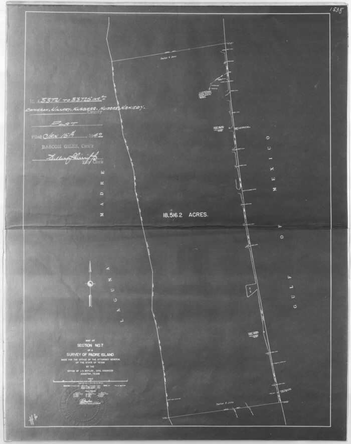
[Sketch for Mineral Application 33721 - 33725 Incl. - Padre and Mustang Island]
Print $20.00
- Digital $50.00
[Sketch for Mineral Application 33721 - 33725 Incl. - Padre and Mustang Island]
1942
Size: 29.7 x 22.3 inches
2868
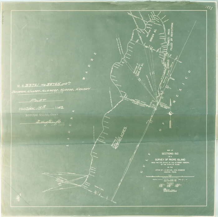
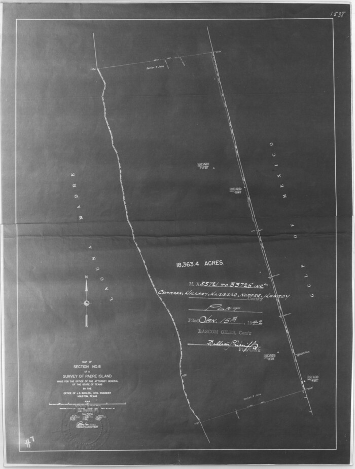
[Sketch for Mineral Application 33721 - 33725 Incl. - Padre and Mustang Island]
Print $20.00
- Digital $50.00
[Sketch for Mineral Application 33721 - 33725 Incl. - Padre and Mustang Island]
1942
Size: 22.2 x 22.3 inches
2869
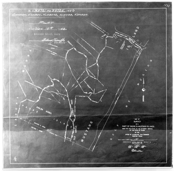
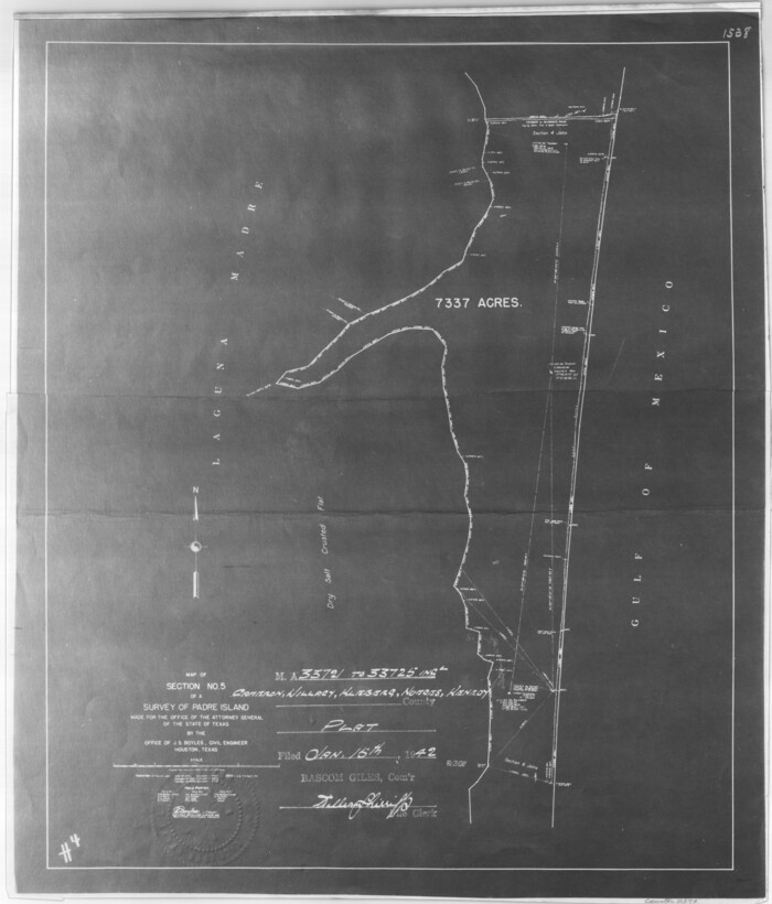
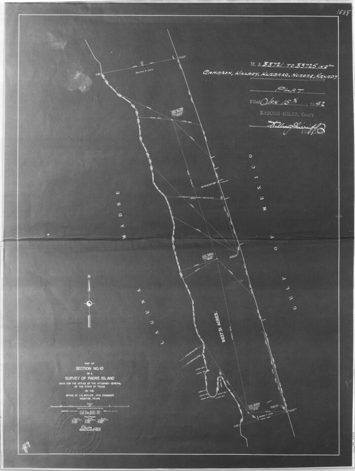
[Sketch for Mineral Application 33721 - 33725 Incl. - Padre and Mustang Island]
Print $20.00
- Digital $50.00
[Sketch for Mineral Application 33721 - 33725 Incl. - Padre and Mustang Island]
1942
Size: 22.1 x 22.4 inches
2870
[Sketch for Mineral Application 33721 - 33725 Incl. - Padre and Mustang Island]
Print $20.00
- Digital $50.00
[Sketch for Mineral Application 33721 - 33725 Incl. - Padre and Mustang Island]
1942
Size: 27.0 x 22.4 inches
2871
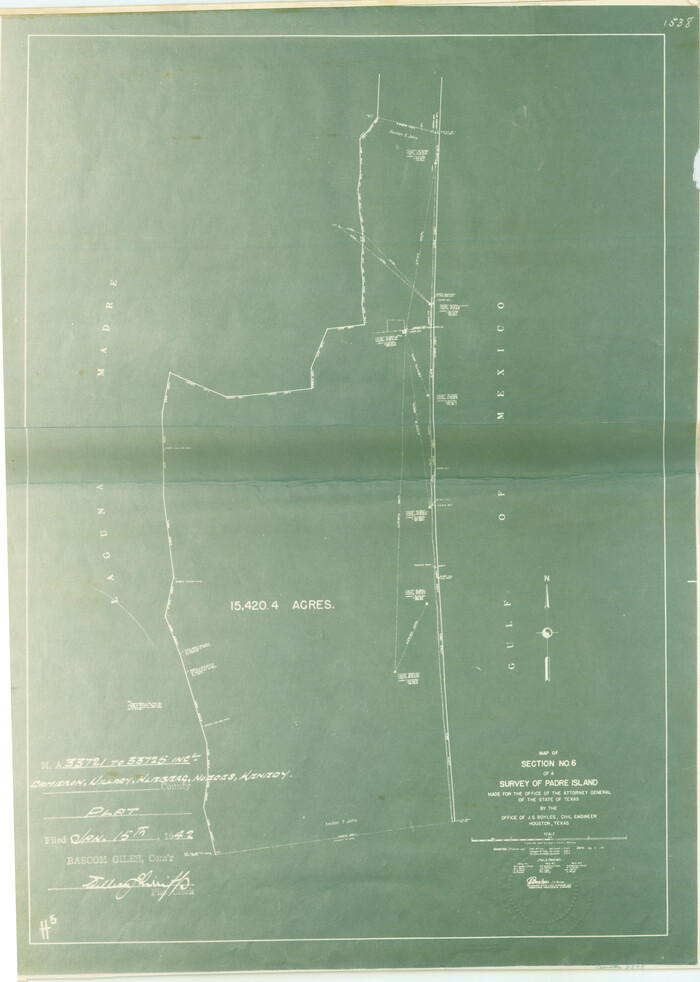
[Sketch for Mineral Application 33721 - 33725 Incl. - Padre and Mustang Island]
Print $20.00
- Digital $50.00
[Sketch for Mineral Application 33721 - 33725 Incl. - Padre and Mustang Island]
1942
Size: 26.6 x 22.7 inches
2873
[Sketch for Mineral Application 33721 - 33725 Incl. - Padre and Mustang Island]
Print $20.00
- Digital $50.00
[Sketch for Mineral Application 33721 - 33725 Incl. - Padre and Mustang Island]
1941
Size: 40.2 x 22.8 inches
2874
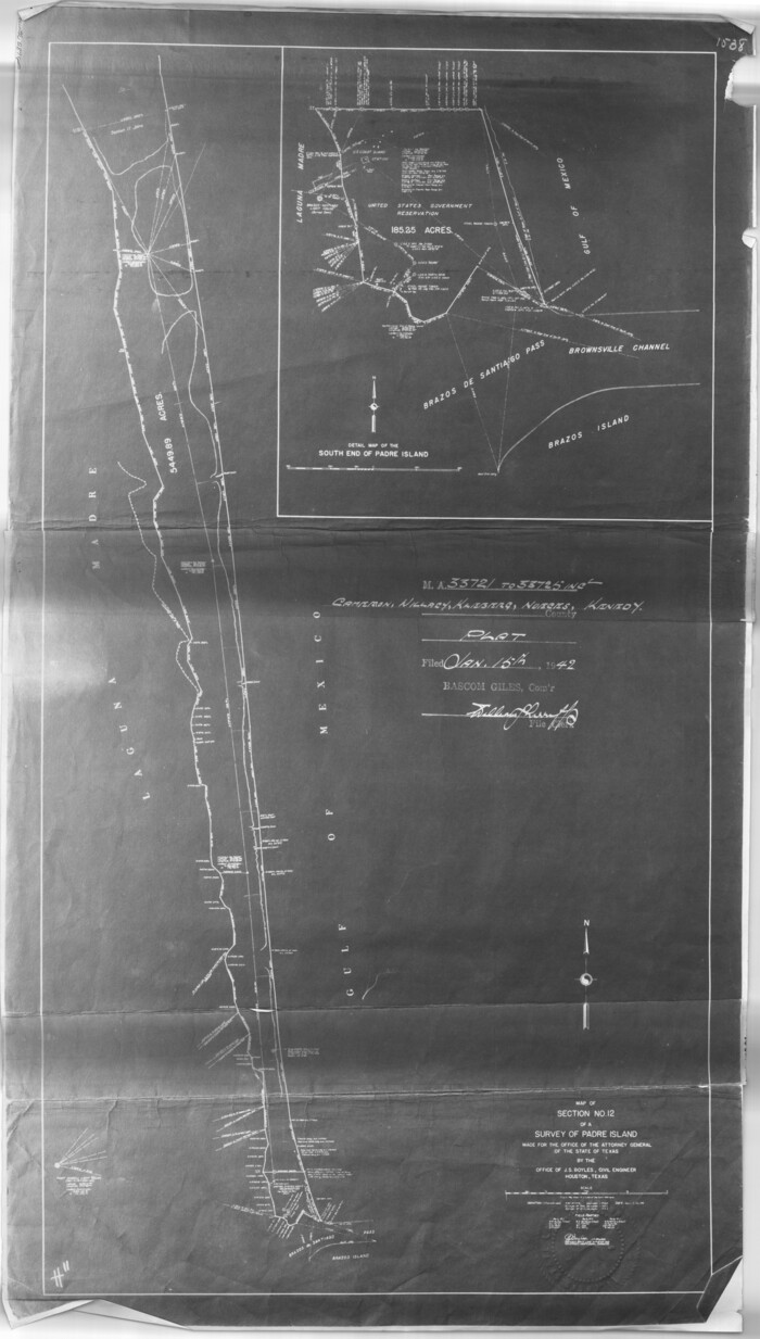
[Sketch for Mineral Application 33721 - 33725 Incl. - Padre and Mustang Island]
Print $20.00
- Digital $50.00
[Sketch for Mineral Application 33721 - 33725 Incl. - Padre and Mustang Island]
1942
Size: 30.9 x 22.0 inches
2875
[Sketch for Mineral Application 33721 - 33725 Incl. - Padre and Mustang Island]
Print $20.00
- Digital $50.00
[Sketch for Mineral Application 33721 - 33725 Incl. - Padre and Mustang Island]
1942
Size: 29.1 x 23.0 inches
2876
[Sketch for Mineral Application 33721 - 33725 Incl. - Padre and Mustang Island]
Print $20.00
- Digital $50.00
[Sketch for Mineral Application 33721 - 33725 Incl. - Padre and Mustang Island]
1942
Size: 29.8 x 22.6 inches
2877
[Sketch for Mineral Application 33721 - 33725 Incl. - Padre and Mustang Island]

Print $20.00
- Digital $50.00
[Sketch for Mineral Application 33721 - 33725 Incl. - Padre and Mustang Island]
1942
Size: 29.8 x 22.7 inches
2878
[Sketch for Mineral Application 33721 - 33725 Incl. - Padre and Mustang Island]
Print $20.00
- Digital $50.00
[Sketch for Mineral Application 33721 - 33725 Incl. - Padre and Mustang Island]
1942
Size: 29.4 x 22.2 inches
2879
[Sketch for Mineral Application 33721 - 33725 Incl. - Padre and Mustang Island]
Print $20.00
- Digital $50.00
[Sketch for Mineral Application 33721 - 33725 Incl. - Padre and Mustang Island]
Size: 42.3 x 22.6 inches
65664
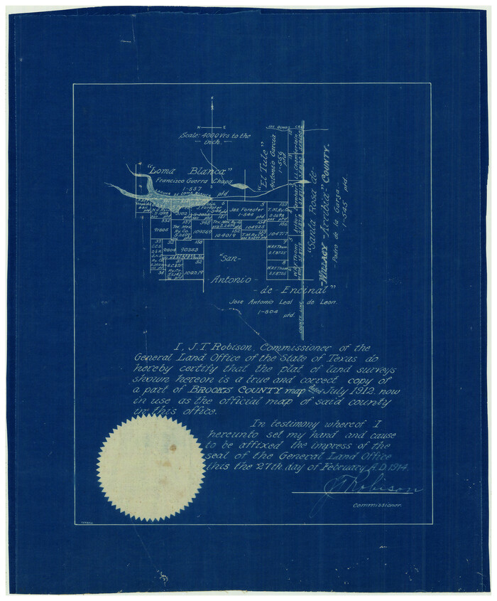
[Sketch Showing Loma Blanca and San Antonio de Encinal Leagues, Brooks County, Texas]
Print $3.00
- Digital $50.00
[Sketch Showing Loma Blanca and San Antonio de Encinal Leagues, Brooks County, Texas]
1912
Size: 15.1 x 11.4 inches
4448
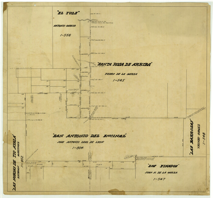
[Map of the San Antonio del Encinal as Corrected]
Print $20.00
- Digital $50.00
[Map of the San Antonio del Encinal as Corrected]
Size: 28.5 x 30.7 inches
4459
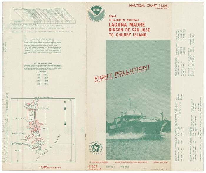
[Folder for] Nautical Chart 11305: Texas Intracoastal Waterway, Laguna Madre, Rincon de San Jose to Chubby Island
Print $20.00
- Digital $50.00
[Folder for] Nautical Chart 11305: Texas Intracoastal Waterway, Laguna Madre, Rincon de San Jose to Chubby Island
1976
Size: 16.0 x 19.0 inches
75913
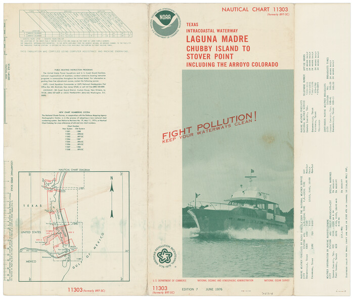
[Folder for] Nautical Chart 11303: Texas Intracoastal Waterway, Laguna Madre, Chubby Island to Stover Point including the Arroyo Colorado
Print $20.00
- Digital $50.00
[Folder for] Nautical Chart 11303: Texas Intracoastal Waterway, Laguna Madre, Chubby Island to Stover Point including the Arroyo Colorado
1976
Size: 15.9 x 18.8 inches
75914
Willacy County Working Sketch Graphic Index

Print $20.00
- Digital $50.00
Willacy County Working Sketch Graphic Index
1921
Size: 32.8 x 32.7 inches
76741
Willacy County Sketch File 3

Print $2.00
- Digital $50.00
Willacy County Sketch File 3
Size: 8.5 x 11.0 inches
90000
Willacy County Sketch File 1a

Print $272.00
- Digital $50.00
Willacy County Sketch File 1a
1977
Size: 8.3 x 3.7 inches
40239
Willacy County Sketch File 1

Print $30.00
- Digital $50.00
Willacy County Sketch File 1
1981
Size: 11.2 x 8.6 inches
40234
Willacy County Rolled Sketch 2

Print $40.00
- Digital $50.00
Willacy County Rolled Sketch 2
1921
Size: 30.7 x 62.9 inches
10145
Willacy County Rolled Sketch 1

Print $121.00
- Digital $50.00
Willacy County Rolled Sketch 1
1956
Size: 10.4 x 15.3 inches
49566
Willacy County Boundary File 2

Print $16.00
- Digital $50.00
Willacy County Boundary File 2
Size: 11.0 x 8.7 inches
59967
Willacy County Boundary File 1

Print $23.00
- Digital $50.00
Willacy County Boundary File 1
Size: 11.3 x 8.8 inches
59956
Willacy County Aerial Photograph Index Sheet 1

Print $20.00
- Digital $50.00
Willacy County Aerial Photograph Index Sheet 1
1940
Size: 24.0 x 19.7 inches
83755
Willacy County Aerial Photograph Index Sheet 1

Print $20.00
- Digital $50.00
Willacy County Aerial Photograph Index Sheet 1
1940
Size: 24.3 x 20.2 inches
83756
[Surveying Sketch of M. Farley, R. Word, S. S. Hervey, et al in Kleberg County, Texas]
Print $20.00
- Digital $50.00
[Surveying Sketch of M. Farley, R. Word, S. S. Hervey, et al in Kleberg County, Texas]
-
Size
23.2 x 40.6 inches
-
Map/Doc
10783
[Sketch for Mineral Application 33721 - 33725 Incl. - Padre and Mustang Island]
Print $20.00
- Digital $50.00
[Sketch for Mineral Application 33721 - 33725 Incl. - Padre and Mustang Island]
1942
-
Size
29.7 x 22.3 inches
-
Map/Doc
2868
-
Creation Date
1942
[Sketch for Mineral Application 33721 - 33725 Incl. - Padre and Mustang Island]
Print $20.00
- Digital $50.00
[Sketch for Mineral Application 33721 - 33725 Incl. - Padre and Mustang Island]
1942
-
Size
22.2 x 22.3 inches
-
Map/Doc
2869
-
Creation Date
1942
[Sketch for Mineral Application 33721 - 33725 Incl. - Padre and Mustang Island]
Print $20.00
- Digital $50.00
[Sketch for Mineral Application 33721 - 33725 Incl. - Padre and Mustang Island]
1942
-
Size
22.1 x 22.4 inches
-
Map/Doc
2870
-
Creation Date
1942
[Sketch for Mineral Application 33721 - 33725 Incl. - Padre and Mustang Island]
Print $20.00
- Digital $50.00
[Sketch for Mineral Application 33721 - 33725 Incl. - Padre and Mustang Island]
1942
-
Size
27.0 x 22.4 inches
-
Map/Doc
2871
-
Creation Date
1942
[Sketch for Mineral Application 33721 - 33725 Incl. - Padre and Mustang Island]
Print $20.00
- Digital $50.00
[Sketch for Mineral Application 33721 - 33725 Incl. - Padre and Mustang Island]
1942
-
Size
26.6 x 22.7 inches
-
Map/Doc
2873
-
Creation Date
1942
[Sketch for Mineral Application 33721 - 33725 Incl. - Padre and Mustang Island]
Print $20.00
- Digital $50.00
[Sketch for Mineral Application 33721 - 33725 Incl. - Padre and Mustang Island]
1941
-
Size
40.2 x 22.8 inches
-
Map/Doc
2874
-
Creation Date
1941
[Sketch for Mineral Application 33721 - 33725 Incl. - Padre and Mustang Island]
Print $20.00
- Digital $50.00
[Sketch for Mineral Application 33721 - 33725 Incl. - Padre and Mustang Island]
1942
-
Size
30.9 x 22.0 inches
-
Map/Doc
2875
-
Creation Date
1942
[Sketch for Mineral Application 33721 - 33725 Incl. - Padre and Mustang Island]
Print $20.00
- Digital $50.00
[Sketch for Mineral Application 33721 - 33725 Incl. - Padre and Mustang Island]
1942
-
Size
29.1 x 23.0 inches
-
Map/Doc
2876
-
Creation Date
1942
[Sketch for Mineral Application 33721 - 33725 Incl. - Padre and Mustang Island]
Print $20.00
- Digital $50.00
[Sketch for Mineral Application 33721 - 33725 Incl. - Padre and Mustang Island]
1942
-
Size
29.8 x 22.6 inches
-
Map/Doc
2877
-
Creation Date
1942
[Sketch for Mineral Application 33721 - 33725 Incl. - Padre and Mustang Island]
Print $20.00
- Digital $50.00
[Sketch for Mineral Application 33721 - 33725 Incl. - Padre and Mustang Island]
1942
-
Size
29.8 x 22.7 inches
-
Map/Doc
2878
-
Creation Date
1942
[Sketch for Mineral Application 33721 - 33725 Incl. - Padre and Mustang Island]
Print $20.00
- Digital $50.00
[Sketch for Mineral Application 33721 - 33725 Incl. - Padre and Mustang Island]
1942
-
Size
29.4 x 22.2 inches
-
Map/Doc
2879
-
Creation Date
1942
[Sketch for Mineral Application 33721 - 33725 Incl. - Padre and Mustang Island]
Print $20.00
- Digital $50.00
[Sketch for Mineral Application 33721 - 33725 Incl. - Padre and Mustang Island]
-
Size
42.3 x 22.6 inches
-
Map/Doc
65664
[Sketch Showing Loma Blanca and San Antonio de Encinal Leagues, Brooks County, Texas]
Print $3.00
- Digital $50.00
[Sketch Showing Loma Blanca and San Antonio de Encinal Leagues, Brooks County, Texas]
1912
-
Size
15.1 x 11.4 inches
-
Map/Doc
4448
-
Creation Date
1912
[Map of the San Antonio del Encinal as Corrected]
Print $20.00
- Digital $50.00
[Map of the San Antonio del Encinal as Corrected]
-
Size
28.5 x 30.7 inches
-
Map/Doc
4459
[Folder for] Nautical Chart 11305: Texas Intracoastal Waterway, Laguna Madre, Rincon de San Jose to Chubby Island
Print $20.00
- Digital $50.00
[Folder for] Nautical Chart 11305: Texas Intracoastal Waterway, Laguna Madre, Rincon de San Jose to Chubby Island
1976
-
Size
16.0 x 19.0 inches
-
Map/Doc
75913
-
Creation Date
1976
[Folder for] Nautical Chart 11303: Texas Intracoastal Waterway, Laguna Madre, Chubby Island to Stover Point including the Arroyo Colorado
Print $20.00
- Digital $50.00
[Folder for] Nautical Chart 11303: Texas Intracoastal Waterway, Laguna Madre, Chubby Island to Stover Point including the Arroyo Colorado
1976
-
Size
15.9 x 18.8 inches
-
Map/Doc
75914
-
Creation Date
1976
Willacy County Working Sketch Graphic Index
Print $20.00
- Digital $50.00
Willacy County Working Sketch Graphic Index
1921
-
Size
32.8 x 32.7 inches
-
Map/Doc
76741
-
Creation Date
1921
Willacy County Sketch File 3
Print $2.00
- Digital $50.00
Willacy County Sketch File 3
-
Size
8.5 x 11.0 inches
-
Map/Doc
90000
Willacy County Sketch File 1a
Print $272.00
- Digital $50.00
Willacy County Sketch File 1a
1977
-
Size
8.3 x 3.7 inches
-
Map/Doc
40239
-
Creation Date
1977
Willacy County Sketch File 1
Print $30.00
- Digital $50.00
Willacy County Sketch File 1
1981
-
Size
11.2 x 8.6 inches
-
Map/Doc
40234
-
Creation Date
1981
Willacy County Rolled Sketch 2
Print $40.00
- Digital $50.00
Willacy County Rolled Sketch 2
1921
-
Size
30.7 x 62.9 inches
-
Map/Doc
10145
-
Creation Date
1921
Willacy County Rolled Sketch 1
Print $121.00
- Digital $50.00
Willacy County Rolled Sketch 1
1956
-
Size
10.4 x 15.3 inches
-
Map/Doc
49566
-
Creation Date
1956
Willacy County Boundary File 2
Print $16.00
- Digital $50.00
Willacy County Boundary File 2
-
Size
11.0 x 8.7 inches
-
Map/Doc
59967
Willacy County Boundary File 1
Print $23.00
- Digital $50.00
Willacy County Boundary File 1
-
Size
11.3 x 8.8 inches
-
Map/Doc
59956
Willacy County Aerial Photograph Index Sheet 1
Print $20.00
- Digital $50.00
Willacy County Aerial Photograph Index Sheet 1
1940
-
Size
24.0 x 19.7 inches
-
Map/Doc
83755
-
Creation Date
1940
Willacy County Aerial Photograph Index Sheet 1
Print $20.00
- Digital $50.00
Willacy County Aerial Photograph Index Sheet 1
1940
-
Size
24.3 x 20.2 inches
-
Map/Doc
83756
-
Creation Date
1940
Willacy County

Print $20.00
- Digital $50.00
Willacy County
1921
-
Size
25.2 x 33.1 inches
-
Map/Doc
1901
-
Creation Date
1921
Willacy County

Print $20.00
- Digital $50.00
Willacy County
1921
-
Size
25.2 x 32.2 inches
-
Map/Doc
73325
-
Creation Date
1921
Willacy County

Print $20.00
- Digital $50.00
Willacy County
1921
-
Size
23.5 x 31.0 inches
-
Map/Doc
77459
-
Creation Date
1921