[Redfish Bay, Aransas Pass, and part of Mustang Island]
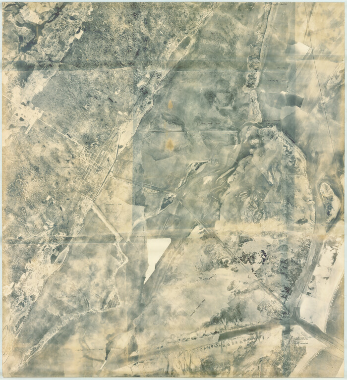
Print $40.00
- Digital $50.00
[Redfish Bay, Aransas Pass, and part of Mustang Island]
1930
Size: 51.0 x 46.5 inches
83009
[Nueces Bay Islands and Nesting Birds]
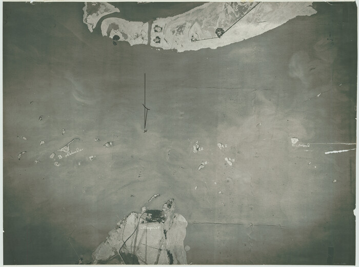
Print $20.00
- Digital $50.00
[Nueces Bay Islands and Nesting Birds]
1940
Size: 18.1 x 24.2 inches
2084
[Nueces Bay Islands and Nesting Birds]
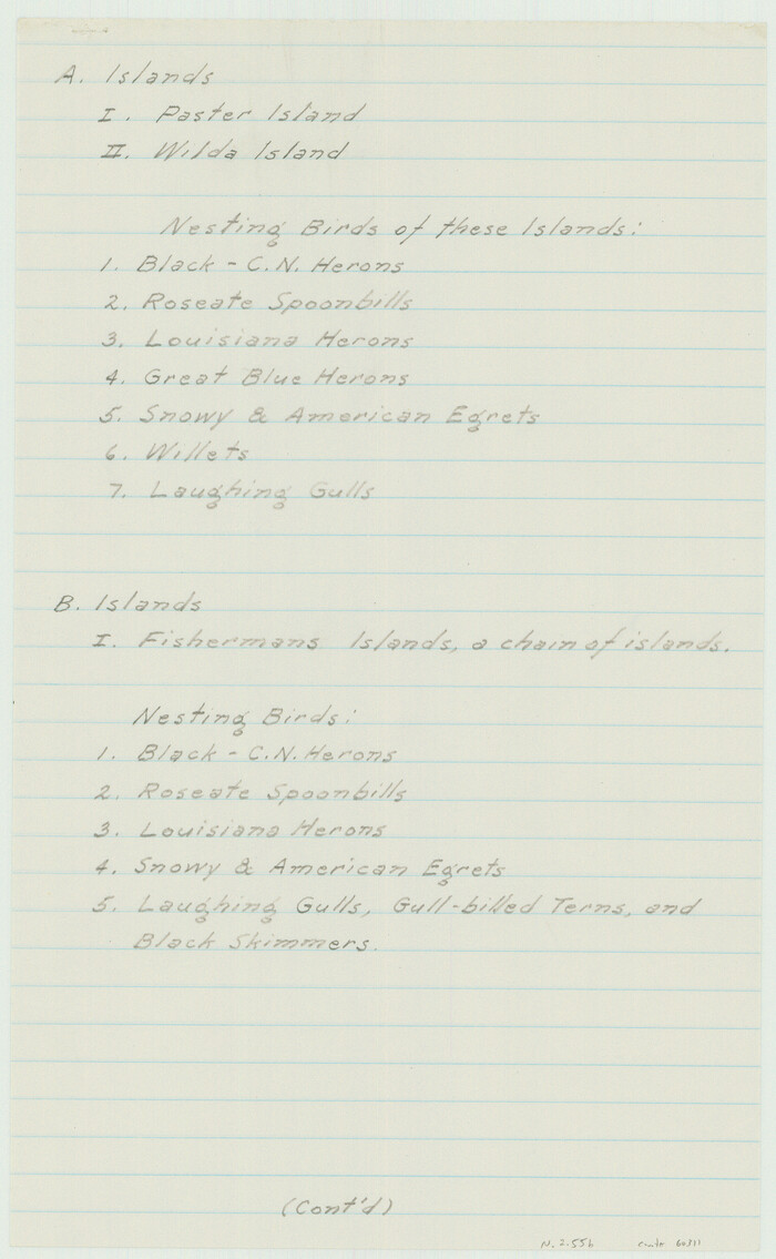
Print $2.00
- Digital $50.00
[Nueces Bay Islands and Nesting Birds]
1940
Size: 11.5 x 7.1 inches
60311
[Nueces Bay Islands and Nesting Birds]
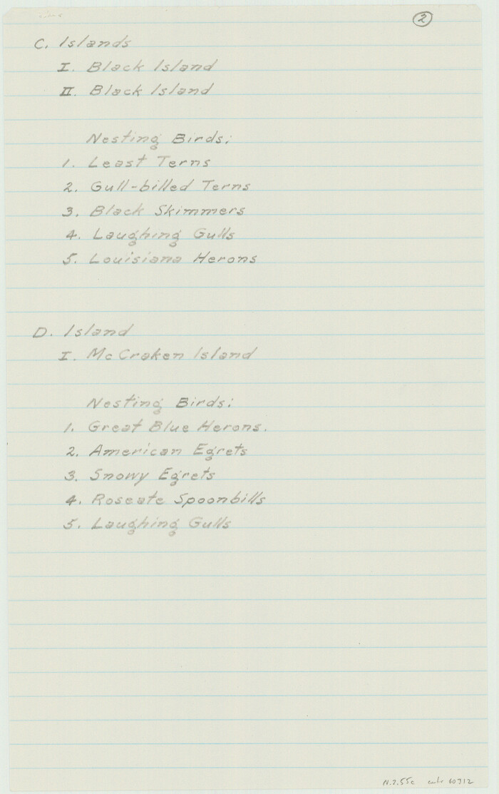
Print $2.00
- Digital $50.00
[Nueces Bay Islands and Nesting Birds]
1940
Size: 11.4 x 7.2 inches
60312
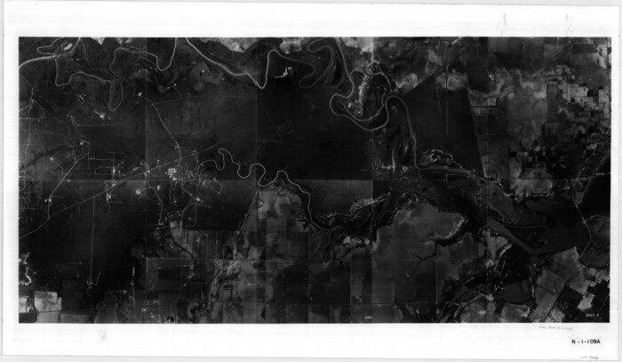
[Aerial photograph showing R. H. Welder Ranch, San Patricio County, Texas]
Print $20.00
- Digital $50.00
[Aerial photograph showing R. H. Welder Ranch, San Patricio County, Texas]
Size: 23.0 x 39.5 inches
61407
[Aerial Photograph of Galveston Island and the Gulf of Mexico]
Print $20.00
- Digital $50.00
[Aerial Photograph of Galveston Island and the Gulf of Mexico]
1956
Size: 15.5 x 12.7 inches
83434
Willacy County Aerial Photograph Index Sheet 5

Print $20.00
- Digital $50.00
Willacy County Aerial Photograph Index Sheet 5
1940
Size: 20.1 x 24.4 inches
83758
Willacy County Aerial Photograph Index Sheet 4

Print $20.00
- Digital $50.00
Willacy County Aerial Photograph Index Sheet 4
1955
Size: 24.3 x 19.8 inches
83759
Willacy County Aerial Photograph Index Sheet 2

Print $20.00
- Digital $50.00
Willacy County Aerial Photograph Index Sheet 2
1940
Size: 24.3 x 20.2 inches
83757
Willacy County Aerial Photograph Index Sheet 1

Print $20.00
- Digital $50.00
Willacy County Aerial Photograph Index Sheet 1
1940
Size: 24.0 x 19.7 inches
83755
Willacy County Aerial Photograph Index Sheet 1

Print $20.00
- Digital $50.00
Willacy County Aerial Photograph Index Sheet 1
1940
Size: 24.3 x 20.2 inches
83756
Wilbarger County Aerial Photograph Index Sheet 5

Print $20.00
- Digital $50.00
Wilbarger County Aerial Photograph Index Sheet 5
1950
Size: 22.3 x 18.0 inches
83754
Wilbarger County Aerial Photograph Index Sheet 4

Print $20.00
- Digital $50.00
Wilbarger County Aerial Photograph Index Sheet 4
1950
Size: 21.7 x 18.8 inches
83753
Wilbarger County Aerial Photograph Index Sheet 3

Print $20.00
- Digital $50.00
Wilbarger County Aerial Photograph Index Sheet 3
1950
Size: 22.5 x 18.9 inches
83752
Wilbarger County Aerial Photograph Index Sheet 2

Print $20.00
- Digital $50.00
Wilbarger County Aerial Photograph Index Sheet 2
1950
Size: 22.4 x 17.5 inches
83751
Wilbarger County Aerial Photograph Index Sheet 1

Print $20.00
- Digital $50.00
Wilbarger County Aerial Photograph Index Sheet 1
1950
Size: 22.4 x 18.9 inches
83750
Victoria County Aerial Photograph Index Sheet 5

Print $20.00
- Digital $50.00
Victoria County Aerial Photograph Index Sheet 5
1953
Size: 19.8 x 23.6 inches
83749
Victoria County Aerial Photograph Index Sheet 4

Print $20.00
- Digital $50.00
Victoria County Aerial Photograph Index Sheet 4
1953
Size: 19.8 x 23.4 inches
83748
Smith County Rolled Sketch 6A3

Print $40.00
- Digital $50.00
Smith County Rolled Sketch 6A3
1990
Size: 48.6 x 36.8 inches
10698
Smith County Rolled Sketch 6A2

Print $40.00
- Digital $50.00
Smith County Rolled Sketch 6A2
1934
Size: 48.7 x 36.7 inches
10702
San Patricio County Aerial Photograph Index Sheet 5

Print $20.00
- Digital $50.00
San Patricio County Aerial Photograph Index Sheet 5
1957
Size: 23.9 x 19.2 inches
83747
San Patricio County Aerial Photograph Index Sheet 4

Print $20.00
- Digital $50.00
San Patricio County Aerial Photograph Index Sheet 4
1957
Size: 23.3 x 19.3 inches
83746
San Patricio County Aerial Photograph Index Sheet 3

Print $20.00
- Digital $50.00
San Patricio County Aerial Photograph Index Sheet 3
1957
Size: 19.1 x 24.0 inches
83745
San Patricio County Aerial Photograph Index Sheet 1

Print $20.00
- Digital $50.00
San Patricio County Aerial Photograph Index Sheet 1
1957
Size: 23.8 x 19.3 inches
83744
Refugio County Aerial Photograph Index Sheet 5

Print $20.00
- Digital $50.00
Refugio County Aerial Photograph Index Sheet 5
1957
Size: 23.2 x 18.9 inches
83743
Refugio County Aerial Photograph Index Sheet 1

Print $20.00
- Digital $50.00
Refugio County Aerial Photograph Index Sheet 1
1957
Size: 23.1 x 18.8 inches
83742
Photo Index of Texas Coast - Sheet 6 of 6

Print $20.00
- Digital $50.00
Photo Index of Texas Coast - Sheet 6 of 6
1954
Size: 20.0 x 24.0 inches
83444
Photo Index of Texas Coast - Sheet 5 of 6

Print $20.00
- Digital $50.00
Photo Index of Texas Coast - Sheet 5 of 6
1954
Size: 20.0 x 24.0 inches
83443
Photo Index of Texas Coast - Sheet 4 of 6

Print $20.00
- Digital $50.00
Photo Index of Texas Coast - Sheet 4 of 6
1954
Size: 20.0 x 24.0 inches
83442
Photo Index of Texas Coast - Sheet 3 of 6

Print $20.00
- Digital $50.00
Photo Index of Texas Coast - Sheet 3 of 6
1954
Size: 20.0 x 24.0 inches
83441
[Redfish Bay, Aransas Pass, and part of Mustang Island]
Print $40.00
- Digital $50.00
[Redfish Bay, Aransas Pass, and part of Mustang Island]
1930
-
Size
51.0 x 46.5 inches
-
Map/Doc
83009
-
Creation Date
1930
[Nueces Bay Islands and Nesting Birds]
Print $20.00
- Digital $50.00
[Nueces Bay Islands and Nesting Birds]
1940
-
Size
18.1 x 24.2 inches
-
Map/Doc
2084
-
Creation Date
1940
[Nueces Bay Islands and Nesting Birds]
Print $2.00
- Digital $50.00
[Nueces Bay Islands and Nesting Birds]
1940
-
Size
11.5 x 7.1 inches
-
Map/Doc
60311
-
Creation Date
1940
[Nueces Bay Islands and Nesting Birds]
Print $2.00
- Digital $50.00
[Nueces Bay Islands and Nesting Birds]
1940
-
Size
11.4 x 7.2 inches
-
Map/Doc
60312
-
Creation Date
1940
[Aerial photograph showing R. H. Welder Ranch, San Patricio County, Texas]
Print $20.00
- Digital $50.00
[Aerial photograph showing R. H. Welder Ranch, San Patricio County, Texas]
-
Size
23.0 x 39.5 inches
-
Map/Doc
61407
[Aerial Photograph of Galveston Island and the Gulf of Mexico]
Print $20.00
- Digital $50.00
[Aerial Photograph of Galveston Island and the Gulf of Mexico]
1956
-
Size
15.5 x 12.7 inches
-
Map/Doc
83434
-
Creation Date
1956
Willacy County Aerial Photograph Index Sheet 5
Print $20.00
- Digital $50.00
Willacy County Aerial Photograph Index Sheet 5
1940
-
Size
20.1 x 24.4 inches
-
Map/Doc
83758
-
Creation Date
1940
Willacy County Aerial Photograph Index Sheet 4
Print $20.00
- Digital $50.00
Willacy County Aerial Photograph Index Sheet 4
1955
-
Size
24.3 x 19.8 inches
-
Map/Doc
83759
-
Creation Date
1955
Willacy County Aerial Photograph Index Sheet 2
Print $20.00
- Digital $50.00
Willacy County Aerial Photograph Index Sheet 2
1940
-
Size
24.3 x 20.2 inches
-
Map/Doc
83757
-
Creation Date
1940
Willacy County Aerial Photograph Index Sheet 1
Print $20.00
- Digital $50.00
Willacy County Aerial Photograph Index Sheet 1
1940
-
Size
24.0 x 19.7 inches
-
Map/Doc
83755
-
Creation Date
1940
Willacy County Aerial Photograph Index Sheet 1
Print $20.00
- Digital $50.00
Willacy County Aerial Photograph Index Sheet 1
1940
-
Size
24.3 x 20.2 inches
-
Map/Doc
83756
-
Creation Date
1940
Wilbarger County Aerial Photograph Index Sheet 5
Print $20.00
- Digital $50.00
Wilbarger County Aerial Photograph Index Sheet 5
1950
-
Size
22.3 x 18.0 inches
-
Map/Doc
83754
-
Creation Date
1950
Wilbarger County Aerial Photograph Index Sheet 4
Print $20.00
- Digital $50.00
Wilbarger County Aerial Photograph Index Sheet 4
1950
-
Size
21.7 x 18.8 inches
-
Map/Doc
83753
-
Creation Date
1950
Wilbarger County Aerial Photograph Index Sheet 3
Print $20.00
- Digital $50.00
Wilbarger County Aerial Photograph Index Sheet 3
1950
-
Size
22.5 x 18.9 inches
-
Map/Doc
83752
-
Creation Date
1950
Wilbarger County Aerial Photograph Index Sheet 2
Print $20.00
- Digital $50.00
Wilbarger County Aerial Photograph Index Sheet 2
1950
-
Size
22.4 x 17.5 inches
-
Map/Doc
83751
-
Creation Date
1950
Wilbarger County Aerial Photograph Index Sheet 1
Print $20.00
- Digital $50.00
Wilbarger County Aerial Photograph Index Sheet 1
1950
-
Size
22.4 x 18.9 inches
-
Map/Doc
83750
-
Creation Date
1950
Victoria County Aerial Photograph Index Sheet 5
Print $20.00
- Digital $50.00
Victoria County Aerial Photograph Index Sheet 5
1953
-
Size
19.8 x 23.6 inches
-
Map/Doc
83749
-
Creation Date
1953
Victoria County Aerial Photograph Index Sheet 4
Print $20.00
- Digital $50.00
Victoria County Aerial Photograph Index Sheet 4
1953
-
Size
19.8 x 23.4 inches
-
Map/Doc
83748
-
Creation Date
1953
Smith County Rolled Sketch 6A3
Print $40.00
- Digital $50.00
Smith County Rolled Sketch 6A3
1990
-
Size
48.6 x 36.8 inches
-
Map/Doc
10698
-
Creation Date
1990
Smith County Rolled Sketch 6A2
Print $40.00
- Digital $50.00
Smith County Rolled Sketch 6A2
1934
-
Size
48.7 x 36.7 inches
-
Map/Doc
10702
-
Creation Date
1934
San Patricio County Aerial Photograph Index Sheet 5
Print $20.00
- Digital $50.00
San Patricio County Aerial Photograph Index Sheet 5
1957
-
Size
23.9 x 19.2 inches
-
Map/Doc
83747
-
Creation Date
1957
San Patricio County Aerial Photograph Index Sheet 4
Print $20.00
- Digital $50.00
San Patricio County Aerial Photograph Index Sheet 4
1957
-
Size
23.3 x 19.3 inches
-
Map/Doc
83746
-
Creation Date
1957
San Patricio County Aerial Photograph Index Sheet 3
Print $20.00
- Digital $50.00
San Patricio County Aerial Photograph Index Sheet 3
1957
-
Size
19.1 x 24.0 inches
-
Map/Doc
83745
-
Creation Date
1957
San Patricio County Aerial Photograph Index Sheet 1
Print $20.00
- Digital $50.00
San Patricio County Aerial Photograph Index Sheet 1
1957
-
Size
23.8 x 19.3 inches
-
Map/Doc
83744
-
Creation Date
1957
Refugio County Aerial Photograph Index Sheet 5
Print $20.00
- Digital $50.00
Refugio County Aerial Photograph Index Sheet 5
1957
-
Size
23.2 x 18.9 inches
-
Map/Doc
83743
-
Creation Date
1957
Refugio County Aerial Photograph Index Sheet 1
Print $20.00
- Digital $50.00
Refugio County Aerial Photograph Index Sheet 1
1957
-
Size
23.1 x 18.8 inches
-
Map/Doc
83742
-
Creation Date
1957
Photo Index of Texas Coast - Sheet 6 of 6
Print $20.00
- Digital $50.00
Photo Index of Texas Coast - Sheet 6 of 6
1954
-
Size
20.0 x 24.0 inches
-
Map/Doc
83444
-
Creation Date
1954
Photo Index of Texas Coast - Sheet 5 of 6
Print $20.00
- Digital $50.00
Photo Index of Texas Coast - Sheet 5 of 6
1954
-
Size
20.0 x 24.0 inches
-
Map/Doc
83443
-
Creation Date
1954
Photo Index of Texas Coast - Sheet 4 of 6
Print $20.00
- Digital $50.00
Photo Index of Texas Coast - Sheet 4 of 6
1954
-
Size
20.0 x 24.0 inches
-
Map/Doc
83442
-
Creation Date
1954
Photo Index of Texas Coast - Sheet 3 of 6
Print $20.00
- Digital $50.00
Photo Index of Texas Coast - Sheet 3 of 6
1954
-
Size
20.0 x 24.0 inches
-
Map/Doc
83441
-
Creation Date
1954