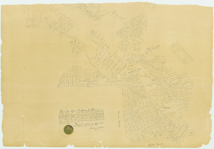
[Bastrop District]
Print $40.00
- Digital $50.00
[Bastrop District]
1895
Size: 36.5 x 52.0 inches
3131
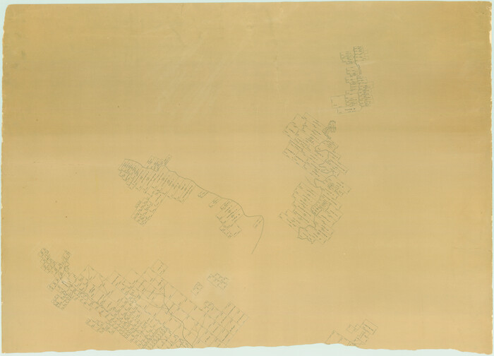
[Bastrop District]
Print $40.00
- Digital $50.00
[Bastrop District]
1895
Size: 37.4 x 51.9 inches
83005
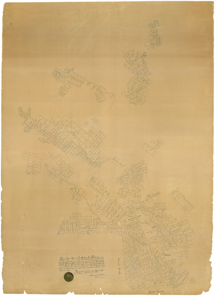
[Bastrop District]
Print $40.00
- Digital $50.00
[Bastrop District]
1895
Size: 71.8 x 52.3 inches
83006
Map of the State of Texas Showing Original Land Districts

Print $20.00
- Digital $50.00
Map of the State of Texas Showing Original Land Districts
1891
Size: 45.6 x 43.0 inches
1995
Map of the State of Texas Showing Original Land Districts

Print $20.00
- Digital $50.00
Map of the State of Texas Showing Original Land Districts
1891
Size: 42.2 x 42.4 inches
2138
Map of the State of Texas Showing Original Land Districts

Print $20.00
- Digital $50.00
Map of the State of Texas Showing Original Land Districts
1891
Size: 43.7 x 43.3 inches
73598
Old Miscellaneous File 27b

Print $10.00
- Digital $50.00
Old Miscellaneous File 27b
1880
Size: 14.3 x 8.8 inches
75722
Old Miscellaneous File 27

Print $28.00
- Digital $50.00
Old Miscellaneous File 27
1879
Size: 14.4 x 8.8 inches
75636
District Map Showing Deaf Smith, Randall, Armstrong, Donley, Collingsworth, Castro, Swisher, Briscoe, Hall & Childress Counties, Texas

Print $40.00
- Digital $50.00
District Map Showing Deaf Smith, Randall, Armstrong, Donley, Collingsworth, Castro, Swisher, Briscoe, Hall & Childress Counties, Texas
1878
Size: 42.9 x 82.3 inches
1994
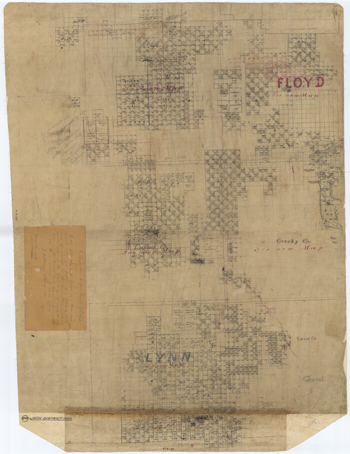
[Jack District Map]
Print $20.00
- Digital $50.00
[Jack District Map]
1877
Size: 46.4 x 35.8 inches
1991
[Young Territory]

Print $40.00
- Digital $50.00
[Young Territory]
1875
Size: 49.0 x 87.4 inches
16784
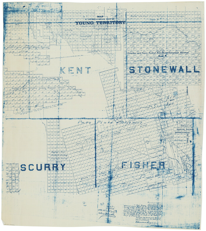
Map of Southeastern Part of Young Territory

Print $40.00
- Digital $50.00
Map of Southeastern Part of Young Territory
1874
Size: 54.7 x 30.1 inches
1989
[Map of Block 97, Borden and Scurry Co (Exhibit A); Map of Southeastern part of Young Territory; Map of part of of Borden, Fisher, Kent, Mitchell, Scurry and Garza Cos. Showing the north boundary line of the T&P 80 mile reservation]
Print $20.00
- Digital $50.00
[Map of Block 97, Borden and Scurry Co (Exhibit A); Map of Southeastern part of Young Territory; Map of part of of Borden, Fisher, Kent, Mitchell, Scurry and Garza Cos. Showing the north boundary line of the T&P 80 mile reservation]
1873
Size: 33.4 x 29.6 inches
65692
Map of San Patricio District

Print $40.00
- Digital $50.00
Map of San Patricio District
1870
Size: 43.8 x 51.4 inches
1987
A Map of that part of Young District south of old Fannin District line

Print $20.00
- Digital $50.00
A Map of that part of Young District south of old Fannin District line
1861
Size: 24.9 x 38.0 inches
1979
Map of the Surveyed Part of Young District

Print $40.00
- Digital $50.00
Map of the Surveyed Part of Young District
1860
Size: 56.3 x 32.6 inches
87373
Map of the Surveyed Part of Young District

Print $40.00
- Digital $50.00
Map of the Surveyed Part of Young District
1860
Size: 56.3 x 27.3 inches
87374
Map of the Surveyed Part of Young District

Print $40.00
- Digital $50.00
Map of the Surveyed Part of Young District
1860
Size: 56.2 x 54.7 inches
1986
Young Land District

Print $20.00
- Digital $50.00
Young Land District
1857
Size: 21.7 x 29.7 inches
1974
Rucker's Work on Upper Red River

Print $20.00
- Digital $50.00
Rucker's Work on Upper Red River
1857
Size: 39.3 x 26.2 inches
3220
Starr County Rolled Sketch 2

Print $40.00
- Digital $50.00
Starr County Rolled Sketch 2
1853
Size: 31.7 x 48.5 inches
9938
[Bastrop District]
Print $40.00
- Digital $50.00
[Bastrop District]
1895
-
Size
36.5 x 52.0 inches
-
Map/Doc
3131
-
Creation Date
1895
[Bastrop District]
Print $40.00
- Digital $50.00
[Bastrop District]
1895
-
Size
37.4 x 51.9 inches
-
Map/Doc
83005
-
Creation Date
1895
[Bastrop District]
Print $40.00
- Digital $50.00
[Bastrop District]
1895
-
Size
71.8 x 52.3 inches
-
Map/Doc
83006
-
Creation Date
1895
Map of the State of Texas Showing Original Land Districts
Print $20.00
- Digital $50.00
Map of the State of Texas Showing Original Land Districts
1891
-
Size
45.6 x 43.0 inches
-
Map/Doc
1995
-
Creation Date
1891
Map of the State of Texas Showing Original Land Districts
Print $20.00
- Digital $50.00
Map of the State of Texas Showing Original Land Districts
1891
-
Size
42.2 x 42.4 inches
-
Map/Doc
2138
-
Creation Date
1891
Map of the State of Texas Showing Original Land Districts
Print $20.00
- Digital $50.00
Map of the State of Texas Showing Original Land Districts
1891
-
Size
43.7 x 43.3 inches
-
Map/Doc
73598
-
Creation Date
1891
Old Miscellaneous File 27b
Print $10.00
- Digital $50.00
Old Miscellaneous File 27b
1880
-
Size
14.3 x 8.8 inches
-
Map/Doc
75722
-
Creation Date
1880
[Jack District]
![1992, [Jack District], General Map Collection](https://historictexasmaps.com/wmedia_w700/maps/1992.tif.jpg)
Print $40.00
- Digital $50.00
[Jack District]
1880
-
Size
52.7 x 43.4 inches
-
Map/Doc
1992
-
Creation Date
1880
Old Miscellaneous File 27
Print $28.00
- Digital $50.00
Old Miscellaneous File 27
1879
-
Size
14.4 x 8.8 inches
-
Map/Doc
75636
-
Creation Date
1879
[Jack District]
![1993, [Jack District], General Map Collection](https://historictexasmaps.com/wmedia_w700/maps/1993-1.tif.jpg)
Print $40.00
- Digital $50.00
[Jack District]
1878
-
Size
42.1 x 64.5 inches
-
Map/Doc
1993
-
Creation Date
1878
District Map Showing Deaf Smith, Randall, Armstrong, Donley, Collingsworth, Castro, Swisher, Briscoe, Hall & Childress Counties, Texas
Print $40.00
- Digital $50.00
District Map Showing Deaf Smith, Randall, Armstrong, Donley, Collingsworth, Castro, Swisher, Briscoe, Hall & Childress Counties, Texas
1878
-
Size
42.9 x 82.3 inches
-
Map/Doc
1994
-
Creation Date
1878
[Jack District Map]
Print $20.00
- Digital $50.00
[Jack District Map]
1877
-
Size
46.4 x 35.8 inches
-
Map/Doc
1991
-
Creation Date
1877
[Jack District]
![16828, [Jack District], General Map Collection](https://historictexasmaps.com/wmedia_w700/maps/16828.tif.jpg)
Print $40.00
- Digital $50.00
[Jack District]
1876
-
Size
50.0 x 76.4 inches
-
Map/Doc
16828
-
Creation Date
1876
[Young Territory]
Print $40.00
- Digital $50.00
[Young Territory]
1875
-
Size
49.0 x 87.4 inches
-
Map/Doc
16784
-
Creation Date
1875
Map of Southeastern Part of Young Territory
Print $40.00
- Digital $50.00
Map of Southeastern Part of Young Territory
1874
-
Size
54.7 x 30.1 inches
-
Map/Doc
1989
-
Creation Date
1874
Young Territory

Print $20.00
- Digital $50.00
Young Territory
1874
-
Size
29.4 x 29.2 inches
-
Map/Doc
1977
-
Creation Date
1874
Young Territory

Print $20.00
- Digital $50.00
Young Territory
1873
-
Size
29.2 x 29.9 inches
-
Map/Doc
1976
-
Creation Date
1873
[Map of Block 97, Borden and Scurry Co (Exhibit A); Map of Southeastern part of Young Territory; Map of part of of Borden, Fisher, Kent, Mitchell, Scurry and Garza Cos. Showing the north boundary line of the T&P 80 mile reservation]
Print $20.00
- Digital $50.00
[Map of Block 97, Borden and Scurry Co (Exhibit A); Map of Southeastern part of Young Territory; Map of part of of Borden, Fisher, Kent, Mitchell, Scurry and Garza Cos. Showing the north boundary line of the T&P 80 mile reservation]
1873
-
Size
33.4 x 29.6 inches
-
Map/Doc
65692
-
Creation Date
1873
Young Territory

Print $20.00
- Digital $50.00
Young Territory
1873
-
Size
45.3 x 42.8 inches
-
Map/Doc
1988
-
Creation Date
1873
Map of San Patricio District
Print $40.00
- Digital $50.00
Map of San Patricio District
1870
-
Size
43.8 x 51.4 inches
-
Map/Doc
1987
-
Creation Date
1870
Young Territory

Print $20.00
- Digital $50.00
Young Territory
1865
-
Size
29.7 x 30.5 inches
-
Map/Doc
1978
-
Creation Date
1865
A Map of that part of Young District south of old Fannin District line
Print $20.00
- Digital $50.00
A Map of that part of Young District south of old Fannin District line
1861
-
Size
24.9 x 38.0 inches
-
Map/Doc
1979
-
Creation Date
1861
Map of the Surveyed Part of Young District
Print $40.00
- Digital $50.00
Map of the Surveyed Part of Young District
1860
-
Size
56.3 x 32.6 inches
-
Map/Doc
87373
-
Creation Date
1860
Map of the Surveyed Part of Young District
Print $40.00
- Digital $50.00
Map of the Surveyed Part of Young District
1860
-
Size
56.3 x 27.3 inches
-
Map/Doc
87374
-
Creation Date
1860
Map of the Surveyed Part of Young District
Print $40.00
- Digital $50.00
Map of the Surveyed Part of Young District
1860
-
Size
56.2 x 54.7 inches
-
Map/Doc
1986
-
Creation Date
1860
Young Land District
Print $20.00
- Digital $50.00
Young Land District
1857
-
Size
21.7 x 29.7 inches
-
Map/Doc
1974
-
Creation Date
1857
Rucker's Work on Upper Red River
Print $20.00
- Digital $50.00
Rucker's Work on Upper Red River
1857
-
Size
39.3 x 26.2 inches
-
Map/Doc
3220
-
Creation Date
1857
Refugio District

Print $20.00
- Digital $50.00
Refugio District
1855
-
Size
30.7 x 34.7 inches
-
Map/Doc
2139
-
Creation Date
1855
Milam District

Print $20.00
- Digital $50.00
Milam District
1854
-
Size
30.2 x 18.9 inches
-
Map/Doc
3859
-
Creation Date
1854
Starr County Rolled Sketch 2
Print $40.00
- Digital $50.00
Starr County Rolled Sketch 2
1853
-
Size
31.7 x 48.5 inches
-
Map/Doc
9938
-
Creation Date
1853