


Texas Population Distribution in Cities, per the U.S. Census of 1910

Texas Population Distribution in Cities, per the U.S. Census of 1910
2022
Size: 11.0 x 8.5 inches
97092
Energy Map of Texas

Print $20.00
- Digital $50.00
Energy Map of Texas
2020
Size: 36.0 x 36.0 inches
96436
Texas and the Great War

Print $20.00
- Digital $50.00
Texas and the Great War
2017
Size: 24.3 x 18.3 inches
94412
Texas Land Commissioner George P. Bush's Energy Map of Texas Showing Significant Events and Well & Pipeline Locations Between 1543 and 2015

Print $20.00
- Digital $50.00
Texas Land Commissioner George P. Bush's Energy Map of Texas Showing Significant Events and Well & Pipeline Locations Between 1543 and 2015
2015
Size: 33.3 x 36.3 inches
93978
Texas Official Travel Map [Major Metropolitan Areas]
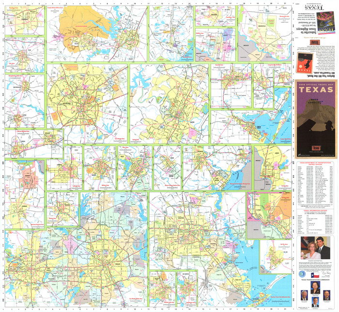
Texas Official Travel Map [Major Metropolitan Areas]
2008
Size: 33.2 x 36.1 inches
96830
Texas Land Commissioner Jerry Patterson's Great Military Map of Texas showing Significant Conflicts and Events between 1685 and 1916

Print $20.00
- Digital $50.00
Texas Land Commissioner Jerry Patterson's Great Military Map of Texas showing Significant Conflicts and Events between 1685 and 1916
2006
Size: 36.7 x 24.8 inches
83432
Texas 1849: A Lone Star Rising

Print $20.00
- Digital $50.00
Texas 1849: A Lone Star Rising
2000
Size: 40.6 x 40.7 inches
78270
The Military History of Texas Map!

The Military History of Texas Map!
1996
Size: 24.2 x 35.0 inches
96828
The Military History of Texas Map!

The Military History of Texas Map!
1996
Size: 24.2 x 35.1 inches
96827
Current Miscellaneous File 107

Print $4.00
- Digital $50.00
Current Miscellaneous File 107
1994
Size: 9.2 x 12.4 inches
74707

West and Trans-Pecos Texas with parts of New Mexico and Mexico and a New Map of Big Bend Ranch State Park and Surrounding Area

Print $32.48
West and Trans-Pecos Texas with parts of New Mexico and Mexico and a New Map of Big Bend Ranch State Park and Surrounding Area
1988
Size: 28.0 x 31.0 inches
89070
Natural Heritage of Texas

Print $40.00
- Digital $50.00
Natural Heritage of Texas
1986
Size: 54.3 x 56.0 inches
10786

Texas 1986, 150 Years of Independence

Print $81.19
Texas 1986, 150 Years of Independence
1985
Size: 42.0 x 46.3 inches
89069
Texas Population Distribution in Cities, per the U.S. Census of 1910
Texas Population Distribution in Cities, per the U.S. Census of 1910
2022
-
Size
11.0 x 8.5 inches
-
Map/Doc
97092
-
Creation Date
2022
Energy Map of Texas
Print $20.00
- Digital $50.00
Energy Map of Texas
2020
-
Size
36.0 x 36.0 inches
-
Map/Doc
96436
-
Creation Date
2020
Texas and the Great War
Print $20.00
- Digital $50.00
Texas and the Great War
2017
Promotional map and poster for the 2017 Save Texas History Symposium.
-
Size
24.3 x 18.3 inches
-
Map/Doc
94412
-
Creation Date
2017
2017 Official Travel Map, Texas

2017 Official Travel Map, Texas
2017
-
Size
33.5 x 36.4 inches
-
Map/Doc
94414
-
Creation Date
2017
Texas 1824 - 1874

Print $70.00
Texas 1824 - 1874
2017
-
Size
26.2 x 26.0 inches
-
Map/Doc
94794
-
Creation Date
2017
Texas Land Commissioner George P. Bush's Energy Map of Texas Showing Significant Events and Well & Pipeline Locations Between 1543 and 2015
Print $20.00
- Digital $50.00
Texas Land Commissioner George P. Bush's Energy Map of Texas Showing Significant Events and Well & Pipeline Locations Between 1543 and 2015
2015
-
Size
33.3 x 36.3 inches
-
Map/Doc
93978
-
Creation Date
2015
The Land Grants of Texas

Print $20.00
The Land Grants of Texas
2014
-
Size
28.0 x 36.2 inches
-
Map/Doc
93698
-
Creation Date
2014
Texas Official Travel Map [Major Metropolitan Areas]
Texas Official Travel Map [Major Metropolitan Areas]
2008
-
Size
33.2 x 36.1 inches
-
Map/Doc
96830
-
Creation Date
2008
Texas Official Travel Map

Texas Official Travel Map
2008
-
Size
33.3 x 36.1 inches
-
Map/Doc
96829
-
Creation Date
2008
Texas Land Commissioner Jerry Patterson's Great Military Map of Texas showing Significant Conflicts and Events between 1685 and 1916
Print $20.00
- Digital $50.00
Texas Land Commissioner Jerry Patterson's Great Military Map of Texas showing Significant Conflicts and Events between 1685 and 1916
2006
-
Size
36.7 x 24.8 inches
-
Map/Doc
83432
-
Creation Date
2006
Texas

Print $6.00
- Digital $50.00
Texas
2003
-
Size
29.1 x 30.4 inches
-
Map/Doc
2159
-
Creation Date
2003
Texas 1849: A Lone Star Rising
Print $20.00
- Digital $50.00
Texas 1849: A Lone Star Rising
2000
-
Size
40.6 x 40.7 inches
-
Map/Doc
78270
-
Creation Date
2000
The Military History of Texas Map!
The Military History of Texas Map!
1996
-
Size
24.2 x 35.0 inches
-
Map/Doc
96828
-
Creation Date
1996
The Military History of Texas Map!
The Military History of Texas Map!
1996
-
Size
24.2 x 35.1 inches
-
Map/Doc
96827
-
Creation Date
1996
Current Miscellaneous File 107
Print $4.00
- Digital $50.00
Current Miscellaneous File 107
1994
-
Size
9.2 x 12.4 inches
-
Map/Doc
74707
-
Creation Date
1994
[Metropolitan Areas of Texas]
![96824, [Metropolitan Areas of Texas], General Map Collection](https://historictexasmaps.com/wmedia_w700/maps/96824.tif.jpg)
[Metropolitan Areas of Texas]
1994
-
Size
33.6 x 36.1 inches
-
Map/Doc
96824
-
Creation Date
1994
Texas, The Lone Star State

Texas, The Lone Star State
1992
-
Size
34.4 x 22.1 inches
-
Map/Doc
82852
-
Creation Date
1992
Texas, The Lone Star State

Texas, The Lone Star State
1992
-
Size
34.4 x 22.1 inches
-
Map/Doc
82853
-
Creation Date
1992
Texas

Print $20.00
- Digital $50.00
Texas
1988
-
Size
33.7 x 22.4 inches
-
Map/Doc
82850
-
Creation Date
1988
Texas

Print $20.00
- Digital $50.00
Texas
1988
-
Size
33.8 x 22.3 inches
-
Map/Doc
82851
-
Creation Date
1988
West and Trans-Pecos Texas with parts of New Mexico and Mexico and a New Map of Big Bend Ranch State Park and Surrounding Area
Print $32.48
West and Trans-Pecos Texas with parts of New Mexico and Mexico and a New Map of Big Bend Ranch State Park and Surrounding Area
1988
-
Size
28.0 x 31.0 inches
-
Map/Doc
89070
-
Creation Date
1988
Natural Heritage of Texas
Print $40.00
- Digital $50.00
Natural Heritage of Texas
1986
-
Size
54.3 x 56.0 inches
-
Map/Doc
10786
-
Creation Date
1986
The Making of America - Texas

The Making of America - Texas
1986
-
Size
20.7 x 27.3 inches
-
Map/Doc
96825
-
Creation Date
1986
Texas 1986, 150 Years of Independence
Print $81.19
Texas 1986, 150 Years of Independence
1985
-
Size
42.0 x 46.3 inches
-
Map/Doc
89069
-
Creation Date
1985