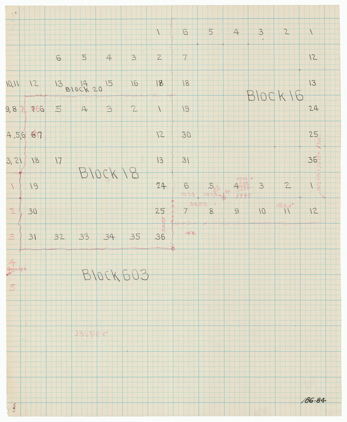
[University Lands Blocks 16-20]
Print $3.00
- Digital $50.00
[University Lands Blocks 16-20]
Size: 14.5 x 11.2 inches
91628
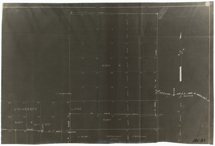
[University Lands Blocks 16-18]
Print $20.00
- Digital $50.00
[University Lands Blocks 16-18]
Size: 18.5 x 12.7 inches
91568
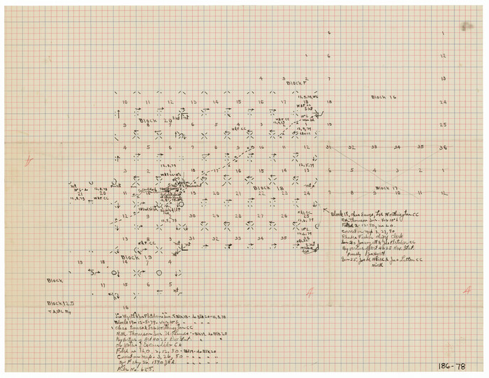
[University Lands Blocks 16, 18, 19 and 20]
Print $3.00
- Digital $50.00
[University Lands Blocks 16, 18, 19 and 20]
Size: 8.8 x 16.8 inches
91593
[University Lands Blocks 16, 18, 19 and 20]
Print $20.00
- Digital $50.00
[University Lands Blocks 16, 18, 19 and 20]
Size: 13.9 x 16.7 inches
91594
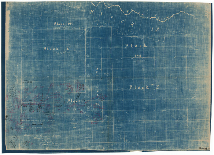
[University Lands Block 16 and Blocks 194, Z and part of 12]
Print $20.00
- Digital $50.00
[University Lands Block 16 and Blocks 194, Z and part of 12]
1911
Size: 32.2 x 23.3 inches
91618
[University Land in Loving, Ward, Winkler, Pecos, Crane, Ector, Upton, Crockett, Schleicher, Irion and Reagan Counties]
Print $40.00
- Digital $50.00
[University Land in Loving, Ward, Winkler, Pecos, Crane, Ector, Upton, Crockett, Schleicher, Irion and Reagan Counties]
1938
Size: 37.9 x 78.5 inches
2424
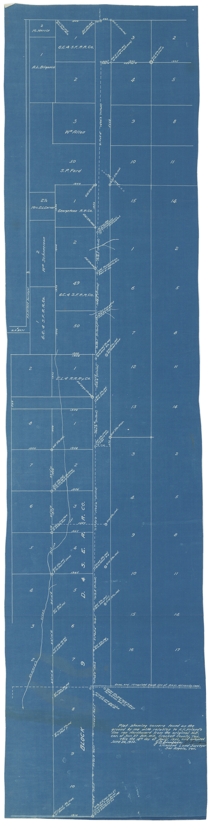
[Sketch for Mineral Applications 26885-6 - Reagan and Crockett Cos., W. H. Bland]
Print $20.00
- Digital $50.00
[Sketch for Mineral Applications 26885-6 - Reagan and Crockett Cos., W. H. Bland]
1932
Size: 38.4 x 9.7 inches
3219
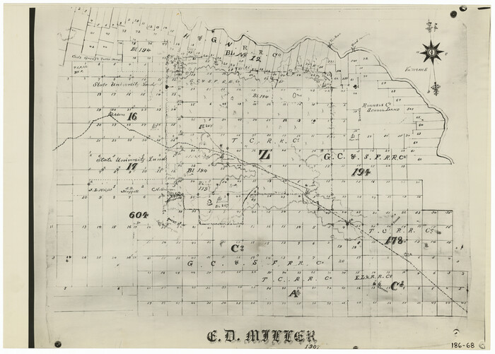
[Part of Blocks H. & G. N. 12, University Lands 16 and 17, C-3, C-4, A-2, 194 and Z]
Print $20.00
- Digital $50.00
[Part of Blocks H. & G. N. 12, University Lands 16 and 17, C-3, C-4, A-2, 194 and Z]
1907
Size: 26.1 x 18.9 inches
91621
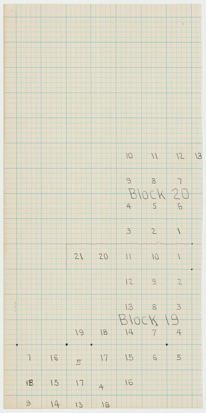
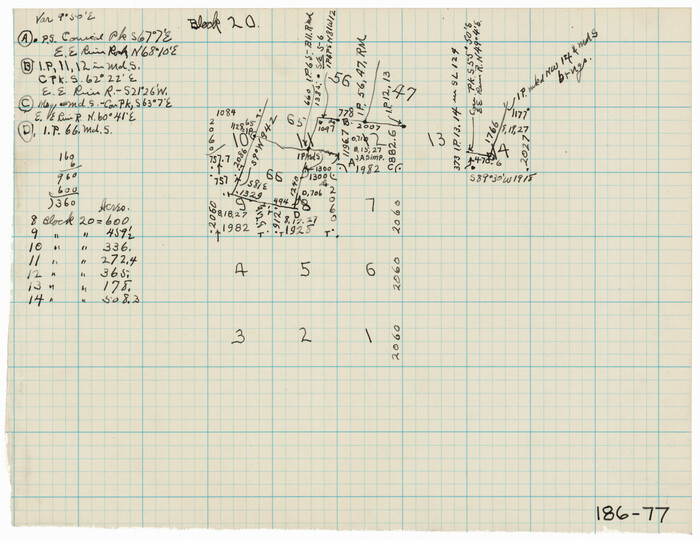
[North part of University Lands Block 20]
Print $2.00
- Digital $50.00
[North part of University Lands Block 20]
Size: 10.8 x 8.3 inches
91581
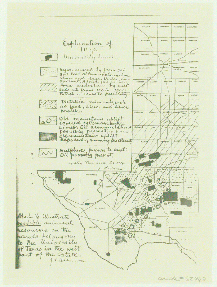
[Map to illustrate possible mineral resources on the lands belonging to the University of Texas]
Print $2.00
- Digital $50.00
[Map to illustrate possible mineral resources on the lands belonging to the University of Texas]
Size: 10.2 x 7.7 inches
62963
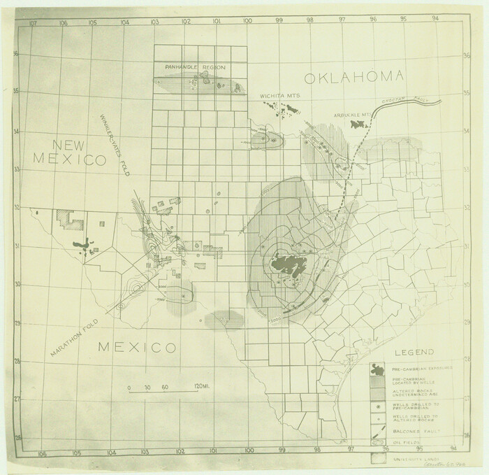
[Geological Map of Texas]
Print $20.00
- Digital $50.00
[Geological Map of Texas]
Size: 17.6 x 18.1 inches
62962
[G. C. & S. F. RR. Co. Block UV, and parts of University Land Blocks 51 and 46]
Print $20.00
- Digital $50.00
[G. C. & S. F. RR. Co. Block UV, and parts of University Land Blocks 51 and 46]
Size: 15.4 x 21.8 inches
90311
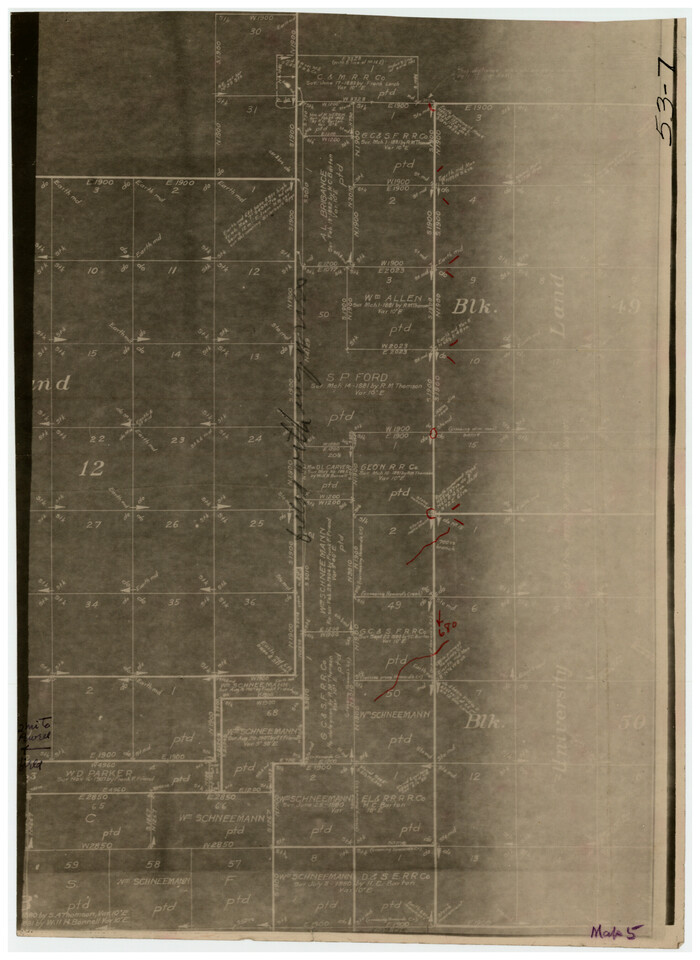
[D. & S. E. Surs., G. C. & S. F. Blk. 9 west of University Land Blks. 49 and 50]
Print $3.00
- Digital $50.00
[D. & S. E. Surs., G. C. & S. F. Blk. 9 west of University Land Blks. 49 and 50]
Size: 11.3 x 15.4 inches
90308
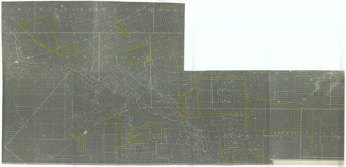
University of Texas System University Lands

Print $20.00
- Digital $50.00
University of Texas System University Lands
Size: 23.2 x 17.6 inches
93235
University of Texas System University Lands

Print $20.00
- Digital $50.00
University of Texas System University Lands
Size: 17.9 x 23.3 inches
93244
University of Texas System University Lands

Print $20.00
- Digital $50.00
University of Texas System University Lands
Size: 23.2 x 17.9 inches
93251
University of Texas Land Survey Isogonic Chart and Graph of Meridian Changes on University Lands Principally in Andrews County, Texas

Print $20.00
- Digital $50.00
University of Texas Land Survey Isogonic Chart and Graph of Meridian Changes on University Lands Principally in Andrews County, Texas
Size: 15.0 x 18.4 inches
62947
University Land, Winkler-Andrews-Gaines-Dawson-Martin Counties

Print $40.00
- Digital $50.00
University Land, Winkler-Andrews-Gaines-Dawson-Martin Counties
1931
Size: 42.3 x 52.1 inches
2419
University Land, Winkler-Andrews-Gaines-Dawson-Martin Counties

Print $40.00
- Digital $50.00
University Land, Winkler-Andrews-Gaines-Dawson-Martin Counties
Size: 42.8 x 53.2 inches
62931
University Land, Pecos County, Texas

Print $20.00
- Digital $50.00
University Land, Pecos County, Texas
1932
Size: 35.7 x 47.5 inches
2433
University Land, Lamar County

Print $20.00
- Digital $50.00
University Land, Lamar County
1906
Size: 23.8 x 29.9 inches
2431
University Land, El Paso County

Print $20.00
- Digital $50.00
University Land, El Paso County
1906
Size: 25.1 x 31.4 inches
2428
University Land, Block 48, Culberson County, Texas

Print $20.00
- Digital $50.00
University Land, Block 48, Culberson County, Texas
1938
Size: 28.1 x 21.7 inches
2411
University Land in Hudspeth County showing Mineral Surveys in Blocks A, B, C, D, E, F, G, H, I, J, K, L, M, N

Print $40.00
- Digital $50.00
University Land in Hudspeth County showing Mineral Surveys in Blocks A, B, C, D, E, F, G, H, I, J, K, L, M, N
Size: 39.7 x 48.4 inches
2421
University Land in Grayson County in Two Parts

Print $20.00
- Digital $50.00
University Land in Grayson County in Two Parts
Size: 23.9 x 30.4 inches
2429
University Land in Grayson County in Two Parts

Print $20.00
- Digital $50.00
University Land in Grayson County in Two Parts
Size: 30.6 x 25.8 inches
62965
University Land in Cooke County

Print $20.00
- Digital $50.00
University Land in Cooke County
1906
Size: 23.6 x 30.0 inches
2425
University Land Loving-Ward-Winkler Counties

Print $40.00
- Digital $50.00
University Land Loving-Ward-Winkler Counties
1931
Size: 47.9 x 63.2 inches
2415
University Land Loving-Ward-Winkler Counties

Print $20.00
- Digital $50.00
University Land Loving-Ward-Winkler Counties
1931
Size: 24.7 x 33.2 inches
2448
University Land Field Notes for Blocks K, L, M, and N in Hudspeth County

University Land Field Notes for Blocks K, L, M, and N in Hudspeth County
81713
[University Lands Blocks 16-20]
Print $3.00
- Digital $50.00
[University Lands Blocks 16-20]
-
Size
14.5 x 11.2 inches
-
Map/Doc
91628
[University Lands Blocks 16-18]
Print $20.00
- Digital $50.00
[University Lands Blocks 16-18]
-
Size
18.5 x 12.7 inches
-
Map/Doc
91568
[University Lands Blocks 16, 18, 19 and 20]
Print $3.00
- Digital $50.00
[University Lands Blocks 16, 18, 19 and 20]
-
Size
8.8 x 16.8 inches
-
Map/Doc
91593
[University Lands Blocks 16, 18, 19 and 20]
Print $20.00
- Digital $50.00
[University Lands Blocks 16, 18, 19 and 20]
-
Size
13.9 x 16.7 inches
-
Map/Doc
91594
[University Lands Block 16 and Blocks 194, Z and part of 12]
Print $20.00
- Digital $50.00
[University Lands Block 16 and Blocks 194, Z and part of 12]
1911
-
Size
32.2 x 23.3 inches
-
Map/Doc
91618
-
Creation Date
1911
[University Land in Loving, Ward, Winkler, Pecos, Crane, Ector, Upton, Crockett, Schleicher, Irion and Reagan Counties]
Print $40.00
- Digital $50.00
[University Land in Loving, Ward, Winkler, Pecos, Crane, Ector, Upton, Crockett, Schleicher, Irion and Reagan Counties]
1938
-
Size
37.9 x 78.5 inches
-
Map/Doc
2424
-
Creation Date
1938
[Sketch for Mineral Applications 26885-6 - Reagan and Crockett Cos., W. H. Bland]
Print $20.00
- Digital $50.00
[Sketch for Mineral Applications 26885-6 - Reagan and Crockett Cos., W. H. Bland]
1932
-
Size
38.4 x 9.7 inches
-
Map/Doc
3219
-
Creation Date
1932
[Part of Blocks H. & G. N. 12, University Lands 16 and 17, C-3, C-4, A-2, 194 and Z]
Print $20.00
- Digital $50.00
[Part of Blocks H. & G. N. 12, University Lands 16 and 17, C-3, C-4, A-2, 194 and Z]
1907
-
Size
26.1 x 18.9 inches
-
Map/Doc
91621
-
Creation Date
1907
[North part of University Lands Block 20]
Print $2.00
- Digital $50.00
[North part of University Lands Block 20]
-
Size
10.8 x 8.3 inches
-
Map/Doc
91581
[Map to illustrate possible mineral resources on the lands belonging to the University of Texas]
Print $2.00
- Digital $50.00
[Map to illustrate possible mineral resources on the lands belonging to the University of Texas]
-
Size
10.2 x 7.7 inches
-
Map/Doc
62963
[Geological Map of Texas]
Print $20.00
- Digital $50.00
[Geological Map of Texas]
-
Size
17.6 x 18.1 inches
-
Map/Doc
62962
[G. C. & S. F. RR. Co. Block UV, and parts of University Land Blocks 51 and 46]
Print $20.00
- Digital $50.00
[G. C. & S. F. RR. Co. Block UV, and parts of University Land Blocks 51 and 46]
-
Size
15.4 x 21.8 inches
-
Map/Doc
90311
[D. & S. E. Surs., G. C. & S. F. Blk. 9 west of University Land Blks. 49 and 50]
Print $3.00
- Digital $50.00
[D. & S. E. Surs., G. C. & S. F. Blk. 9 west of University Land Blks. 49 and 50]
-
Size
11.3 x 15.4 inches
-
Map/Doc
90308
University of Texas System University Lands
Print $20.00
- Digital $50.00
University of Texas System University Lands
-
Size
23.2 x 17.6 inches
-
Map/Doc
93235
University of Texas System University Lands
Print $20.00
- Digital $50.00
University of Texas System University Lands
-
Size
17.9 x 23.3 inches
-
Map/Doc
93244
University of Texas System University Lands
Print $20.00
- Digital $50.00
University of Texas System University Lands
-
Size
23.2 x 17.9 inches
-
Map/Doc
93251
University of Texas Land Survey Isogonic Chart and Graph of Meridian Changes on University Lands Principally in Andrews County, Texas
Print $20.00
- Digital $50.00
University of Texas Land Survey Isogonic Chart and Graph of Meridian Changes on University Lands Principally in Andrews County, Texas
-
Size
15.0 x 18.4 inches
-
Map/Doc
62947
University Land, Winkler-Andrews-Gaines-Dawson-Martin Counties
Print $40.00
- Digital $50.00
University Land, Winkler-Andrews-Gaines-Dawson-Martin Counties
1931
-
Size
42.3 x 52.1 inches
-
Map/Doc
2419
-
Creation Date
1931
University Land, Winkler-Andrews-Gaines-Dawson-Martin Counties
Print $40.00
- Digital $50.00
University Land, Winkler-Andrews-Gaines-Dawson-Martin Counties
-
Size
42.8 x 53.2 inches
-
Map/Doc
62931
University Land, Pecos County, Texas
Print $20.00
- Digital $50.00
University Land, Pecos County, Texas
1932
-
Size
35.7 x 47.5 inches
-
Map/Doc
2433
-
Creation Date
1932
University Land, Lamar County
Print $20.00
- Digital $50.00
University Land, Lamar County
1906
-
Size
23.8 x 29.9 inches
-
Map/Doc
2431
-
Creation Date
1906
University Land, El Paso County
Print $20.00
- Digital $50.00
University Land, El Paso County
1906
-
Size
25.1 x 31.4 inches
-
Map/Doc
2428
-
Creation Date
1906
University Land, Block 48, Culberson County, Texas
Print $20.00
- Digital $50.00
University Land, Block 48, Culberson County, Texas
1938
-
Size
28.1 x 21.7 inches
-
Map/Doc
2411
-
Creation Date
1938
University Land in Hudspeth County showing Mineral Surveys in Blocks A, B, C, D, E, F, G, H, I, J, K, L, M, N
Print $40.00
- Digital $50.00
University Land in Hudspeth County showing Mineral Surveys in Blocks A, B, C, D, E, F, G, H, I, J, K, L, M, N
-
Size
39.7 x 48.4 inches
-
Map/Doc
2421
University Land in Grayson County in Two Parts
Print $20.00
- Digital $50.00
University Land in Grayson County in Two Parts
-
Size
23.9 x 30.4 inches
-
Map/Doc
2429
University Land in Grayson County in Two Parts
Print $20.00
- Digital $50.00
University Land in Grayson County in Two Parts
-
Size
30.6 x 25.8 inches
-
Map/Doc
62965
University Land in Cooke County
Print $20.00
- Digital $50.00
University Land in Cooke County
1906
-
Size
23.6 x 30.0 inches
-
Map/Doc
2425
-
Creation Date
1906
University Land Loving-Ward-Winkler Counties
Print $40.00
- Digital $50.00
University Land Loving-Ward-Winkler Counties
1931
-
Size
47.9 x 63.2 inches
-
Map/Doc
2415
-
Creation Date
1931
University Land Loving-Ward-Winkler Counties
Print $20.00
- Digital $50.00
University Land Loving-Ward-Winkler Counties
1931
-
Size
24.7 x 33.2 inches
-
Map/Doc
2448
-
Creation Date
1931
University Land Field Notes for Blocks K, L, M, and N in Hudspeth County
University Land Field Notes for Blocks K, L, M, and N in Hudspeth County
-
Map/Doc
81713