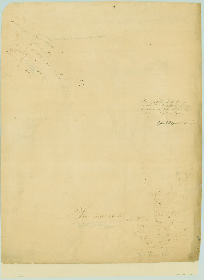
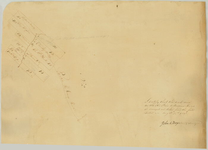
Surveys on the Coleto Creek, Goliad County

Print $20.00
- Digital $50.00
Surveys on the Coleto Creek, Goliad County
1841
Size: 13.8 x 14.9 inches
10
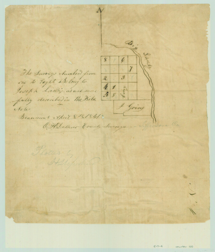
[Surveys in the Jefferson District along Big Sandy Creek]
Print $2.00
- Digital $50.00
[Surveys in the Jefferson District along Big Sandy Creek]
1841
Size: 9.5 x 8.1 inches
100
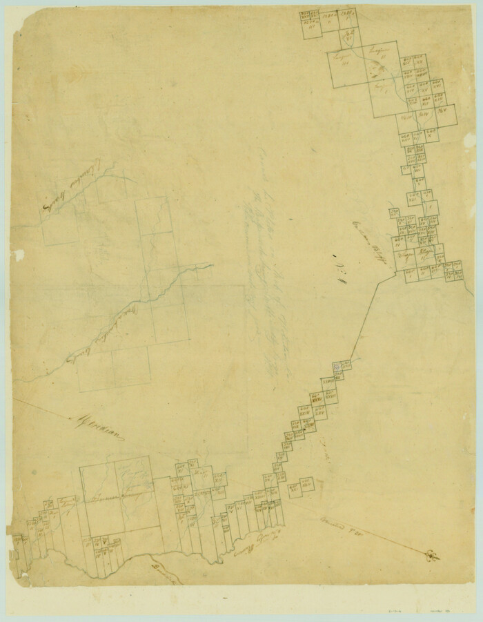
[Surveys along the Trinity River and below]
Print $20.00
- Digital $50.00
[Surveys along the Trinity River and below]
1840
Size: 22.6 x 17.6 inches
101
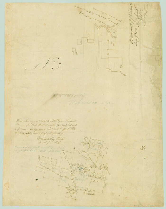
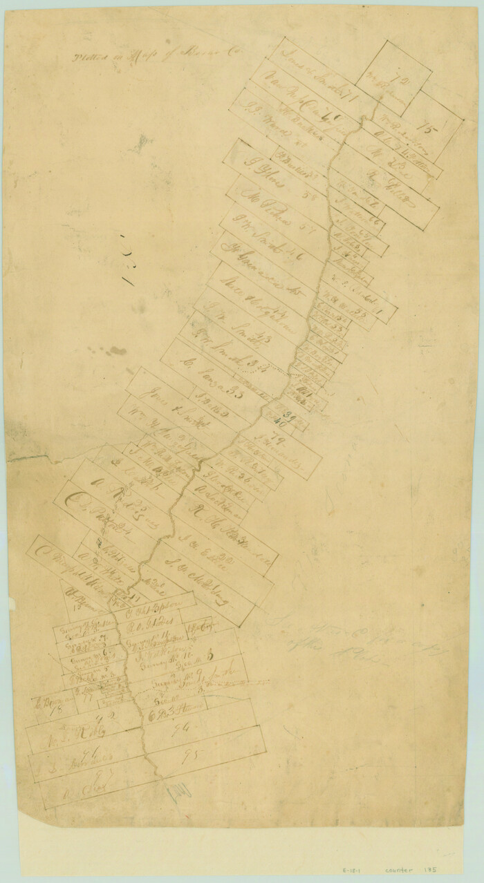
[Surveys in the Robertson District along the Trinity River and Richland Creek]
Print $20.00
- Digital $50.00
[Surveys in the Robertson District along the Trinity River and Richland Creek]
1841
Size: 15.3 x 12.2 inches
104
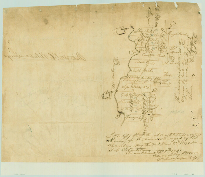
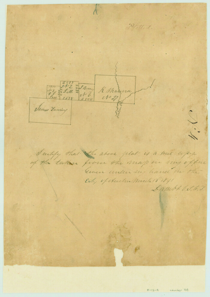
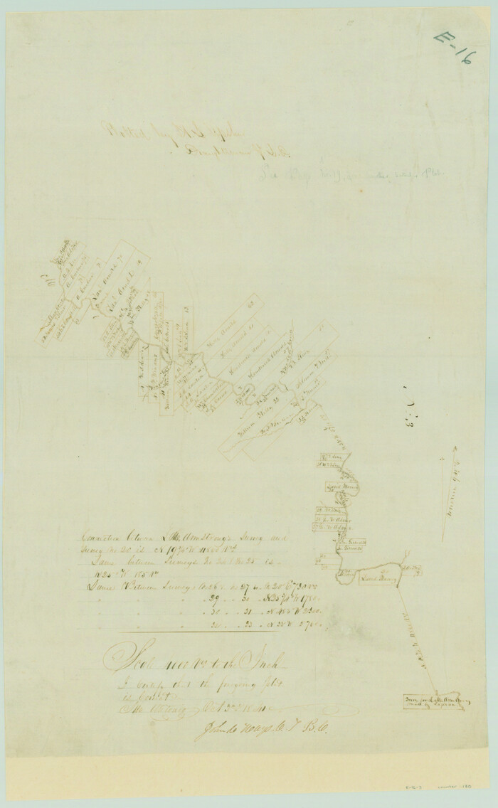
Platts [sic] of S. C. Robertson Surveys
Print $20.00
- Digital $50.00
Platts [sic] of S. C. Robertson Surveys
1841
Size: 13.6 x 15.7 inches
105
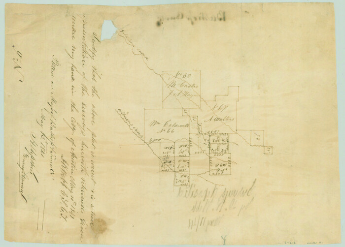
[Surveys near the city of Bastrop]
Print $2.00
- Digital $50.00
[Surveys near the city of Bastrop]
1841
Size: 6.5 x 7.0 inches
107
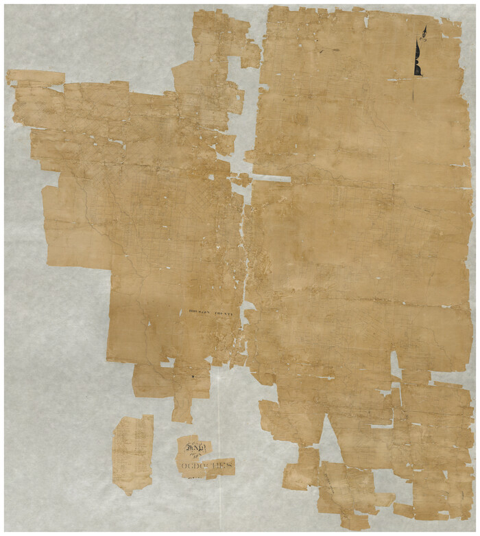
[Map of Nacogdoches County]
Print $40.00
- Digital $50.00
[Map of Nacogdoches County]
1840
Size: 79.3 x 69.8 inches
10784
[Surveys near Onion Creek]
Print $2.00
- Digital $50.00
[Surveys near Onion Creek]
1841
Size: 11.0 x 7.8 inches
108
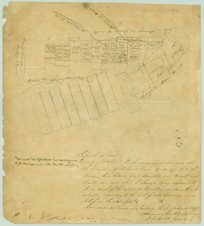
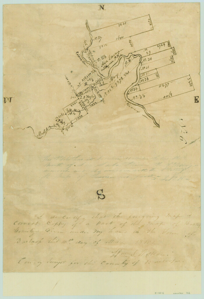
[Map of the dividing line between Milam and Travis Counties]
Print $20.00
- Digital $50.00
[Map of the dividing line between Milam and Travis Counties]
1841
Size: 14.2 x 12.8 inches
110
[Surveys along Gilleland and Wilbarger Creek in the Travis District]
Print $2.00
- Digital $50.00
[Surveys along Gilleland and Wilbarger Creek in the Travis District]
1841
Size: 8.1 x 11.2 inches
111
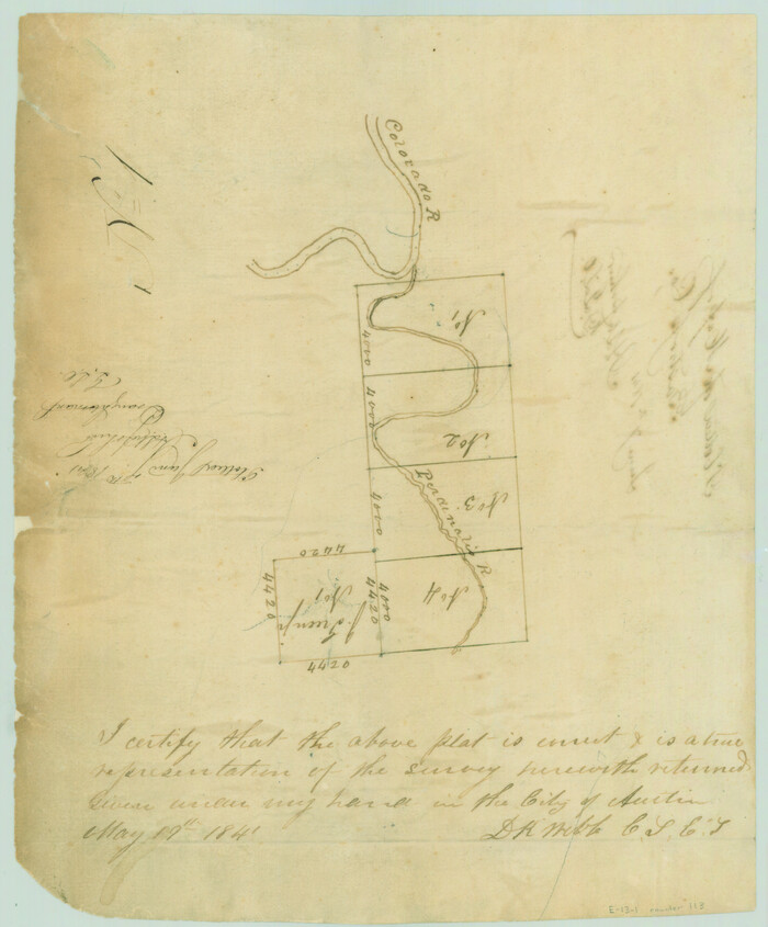
[Surveys along the Colorado River]
Print $2.00
- Digital $50.00
[Surveys along the Colorado River]
1841
Size: 12.2 x 8.3 inches
112
[Surveys in the Travis District along the Colorado and Pedernales Rivers]
Print $2.00
- Digital $50.00
[Surveys in the Travis District along the Colorado and Pedernales Rivers]
1841
Size: 9.9 x 8.2 inches
113
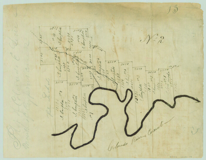
[Surveys in the Travis District along the Colorado River]
Print $2.00
- Digital $50.00
[Surveys in the Travis District along the Colorado River]
1840
Size: 8.0 x 10.2 inches
115
Gregg County Sketch File 12

Print $20.00
- Digital $50.00
Gregg County Sketch File 12
Size: 17.3 x 24.1 inches
11589
[Surveys in the Travis District along the Colorado River]
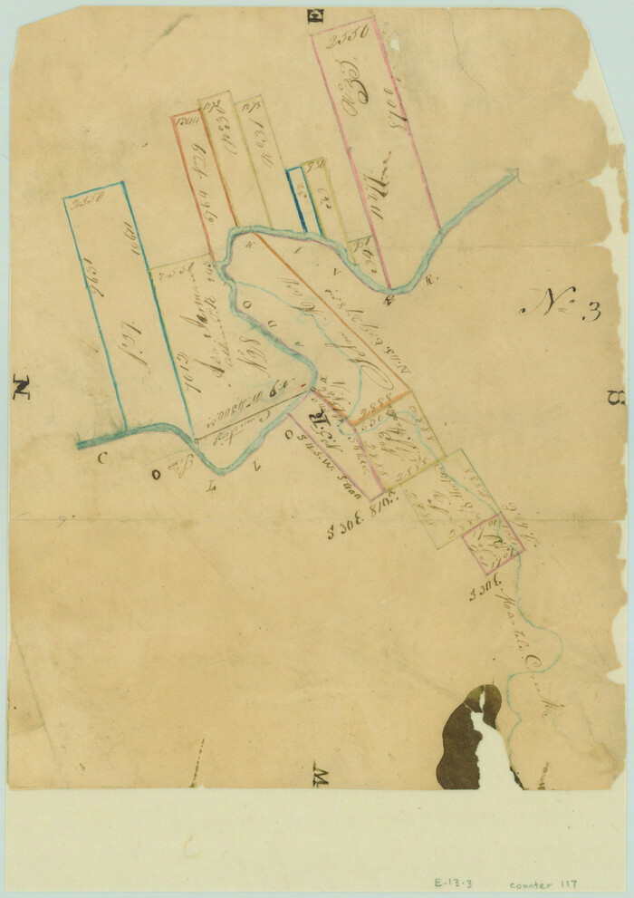
Print $2.00
- Digital $50.00
[Surveys in the Travis District along the Colorado River]
1840
Size: 8.9 x 6.3 inches
117
Henderson County Sketch File 24

Print $20.00
- Digital $50.00
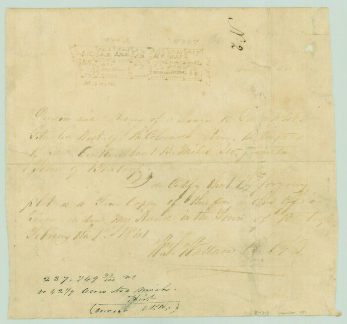
Henderson County Sketch File 24
1974
Size: 27.4 x 24.1 inches
11759
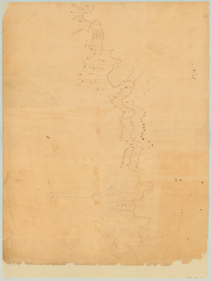
[Surveys in the Travis District along the Colorado River]
Print $2.00
- Digital $50.00
[Surveys in the Travis District along the Colorado River]
1841
Size: 8.6 x 15.3 inches
118
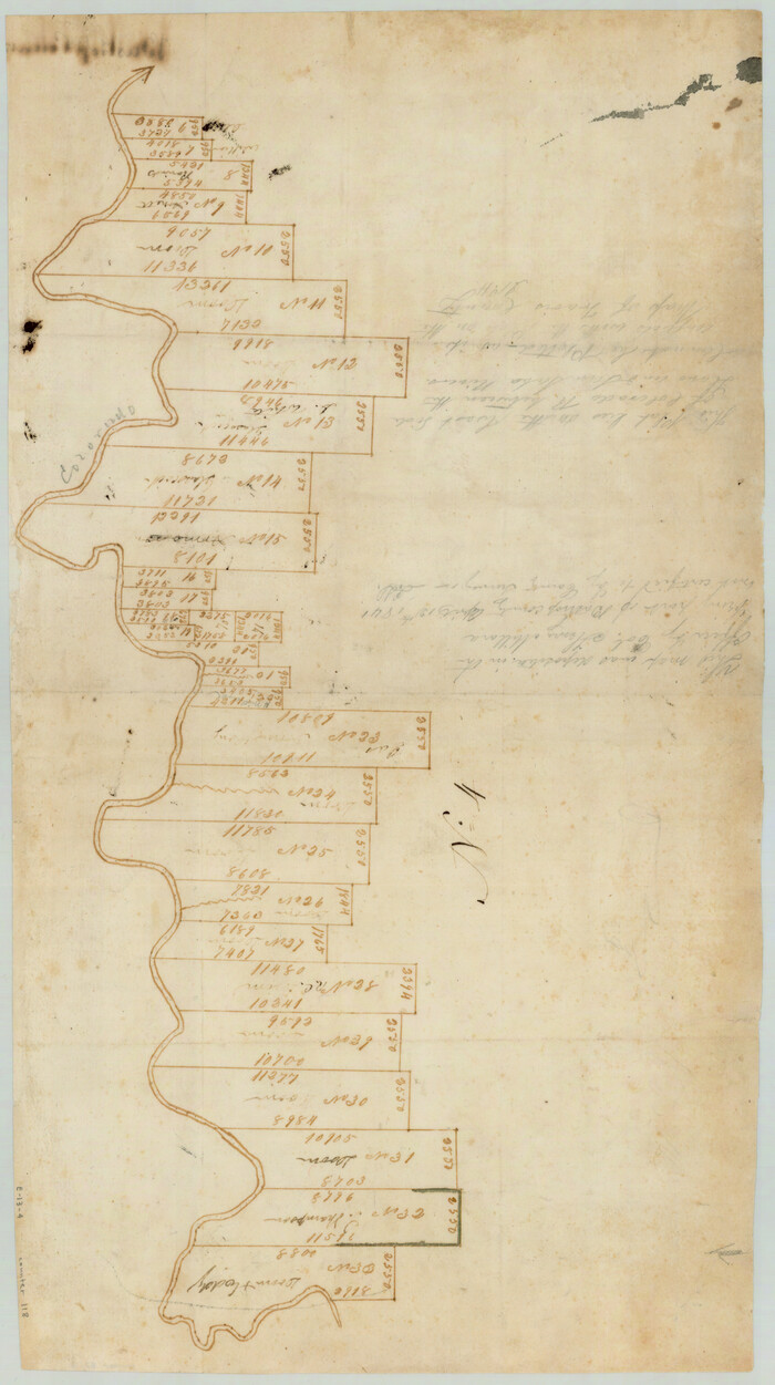
[Surveys along the Colorado River]
Print $20.00
- Digital $50.00
[Surveys along the Colorado River]
1840
Size: 23.8 x 17.9 inches
119
[Surveys in the Travis District along the Colorado River]
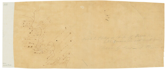
Print $3.00
- Digital $50.00
[Surveys in the Travis District along the Colorado River]
1841
Size: 7.0 x 16.5 inches
120
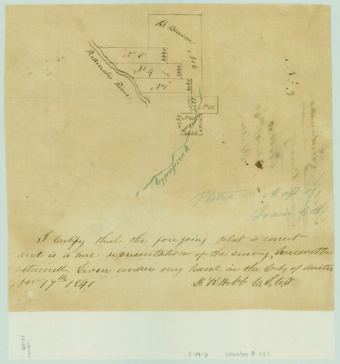
[Surveys along the Pedernales River and Cypress Creek]
Print $2.00
- Digital $50.00
[Surveys along the Pedernales River and Cypress Creek]
1841
Size: 8.3 x 7.7 inches
121
[Surveys in the Bexar District along the Guadalupe River]
Print $3.00
- Digital $50.00
[Surveys in the Bexar District along the Guadalupe River]
1841
Size: 17.2 x 10.8 inches
124
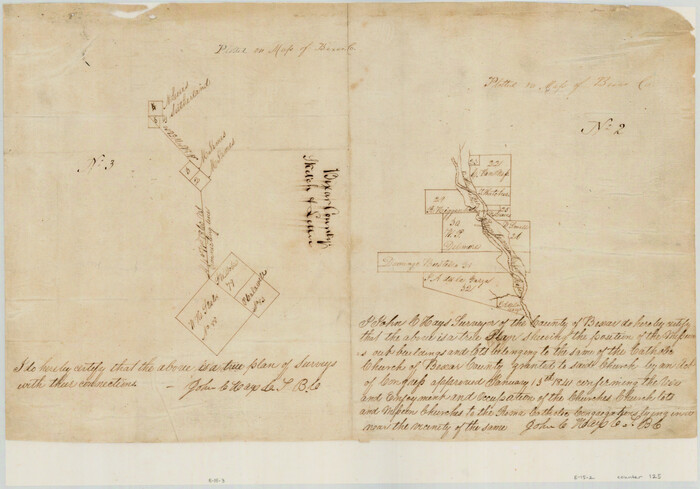
[Surveys in the Bexar District along the San Antonio River showing the position of the missions]
Print $3.00
- Digital $50.00
[Surveys in the Bexar District along the San Antonio River showing the position of the missions]
1841
Size: 11.2 x 16.0 inches
125
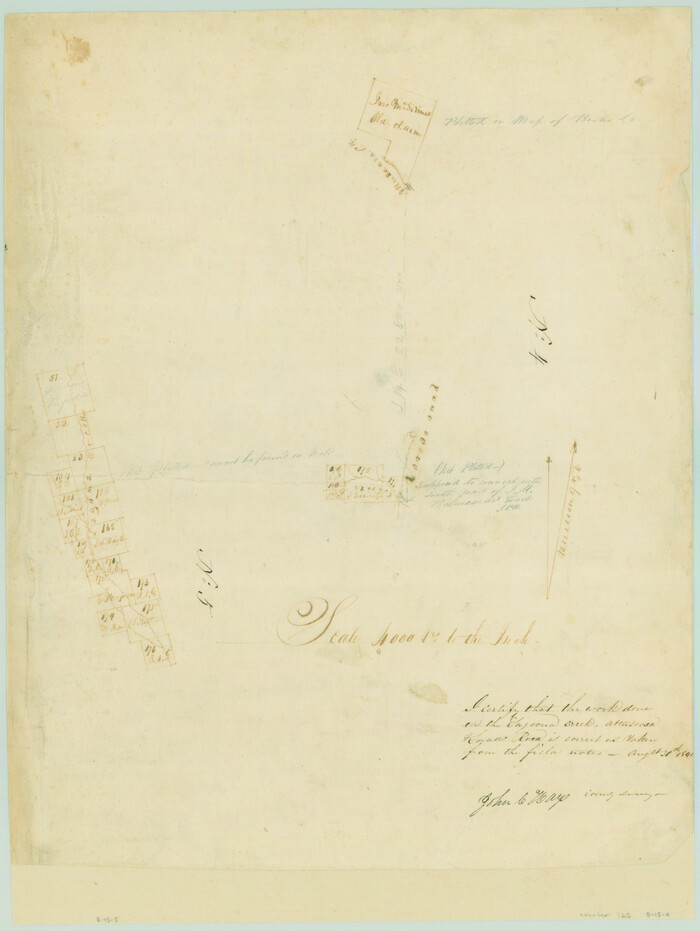
[Sketches on Lagoona (sic) Creek, Attascosa (sic) and Laredo Road]
Print $20.00
- Digital $50.00
[Sketches on Lagoona (sic) Creek, Attascosa (sic) and Laredo Road]
1841
Size: 18.0 x 13.5 inches
126
[Surveys in the Bexar District along the Medina River]
Print $20.00
- Digital $50.00
[Surveys in the Bexar District along the Medina River]
1841
Size: 23.0 x 16.8 inches
128
[Surveys along the Frio River]
Print $20.00
- Digital $50.00
[Surveys along the Frio River]
1841
Size: 12.0 x 16.6 inches
129
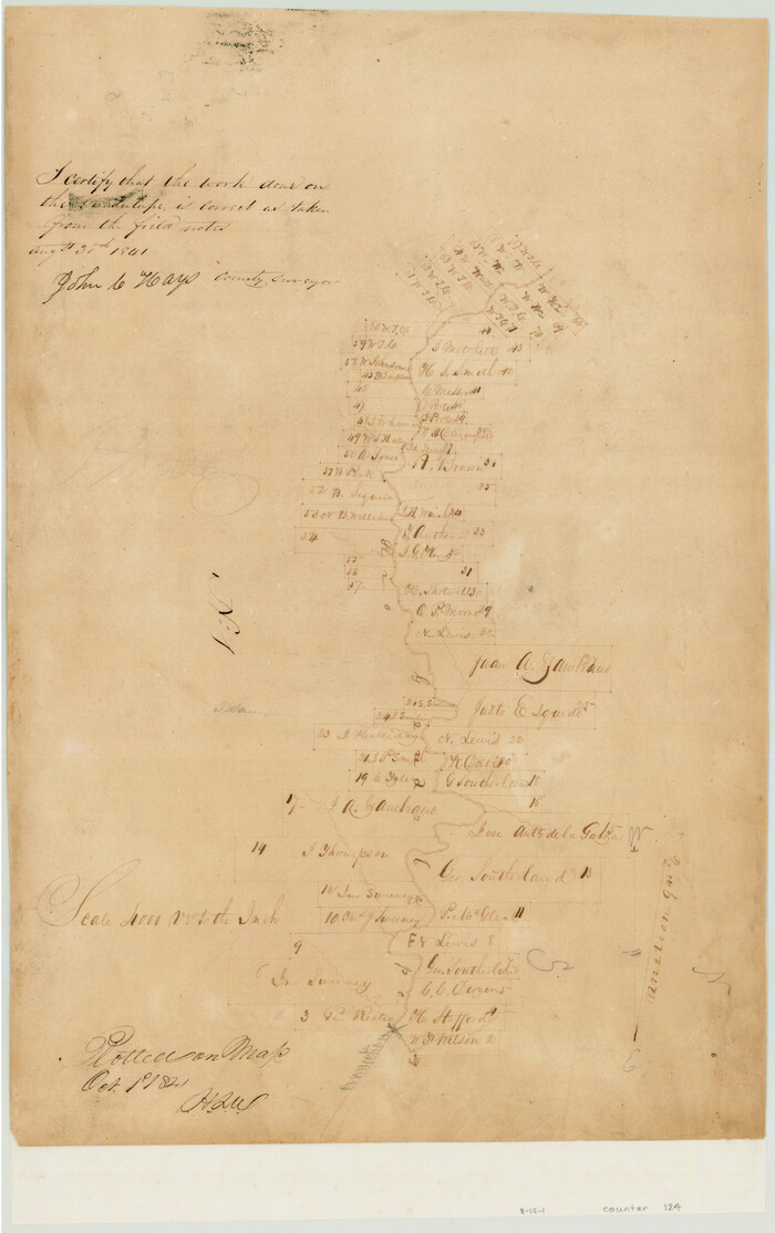
[Surveys in the Bexar District along the Medina River]
Print $20.00
- Digital $50.00
[Surveys in the Bexar District along the Medina River]
1841
Size: 20.7 x 12.8 inches
130
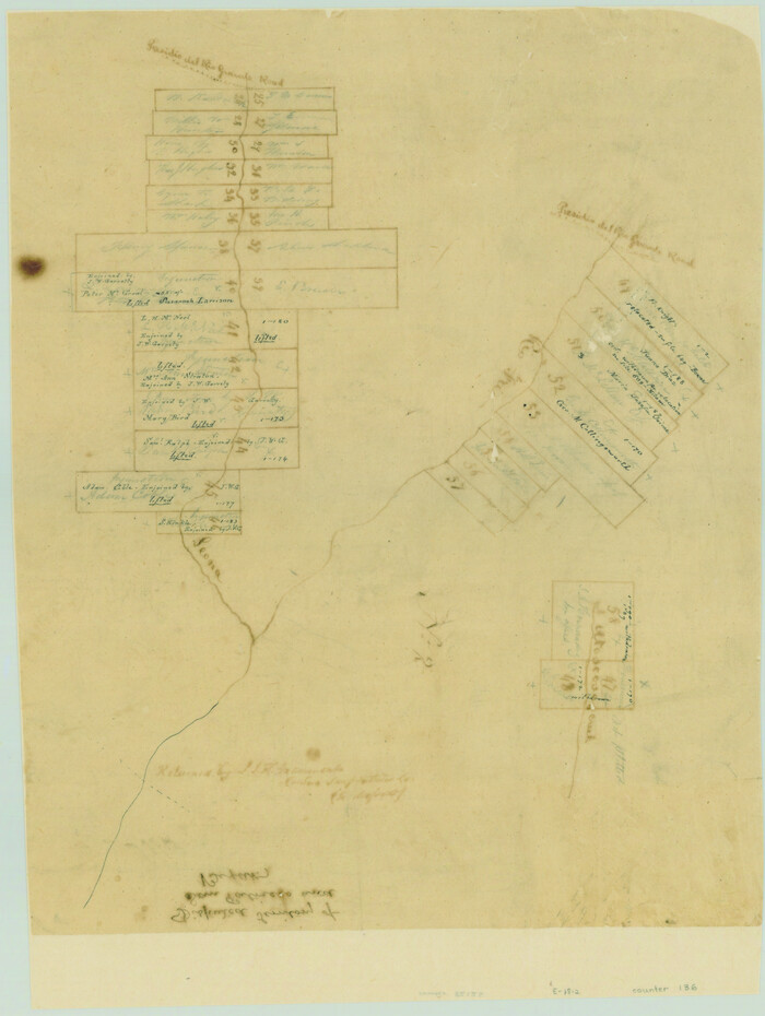
[Surveys in the Bexar District along the Leona River]
Print $20.00
- Digital $50.00
[Surveys in the Bexar District along the Leona River]
1841
Size: 19.9 x 10.9 inches
135
[Surveys in the Bexar District along the Frio and Leona Rivers]
Print $20.00
- Digital $50.00
[Surveys in the Bexar District along the Frio and Leona Rivers]
1842
Size: 16.2 x 12.2 inches
136
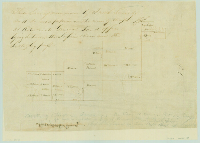
[Surveys between the Sabine River and Little Cypress Creek]
Print $3.00
- Digital $50.00
[Surveys between the Sabine River and Little Cypress Creek]
1840
Size: 9.3 x 13.0 inches
139
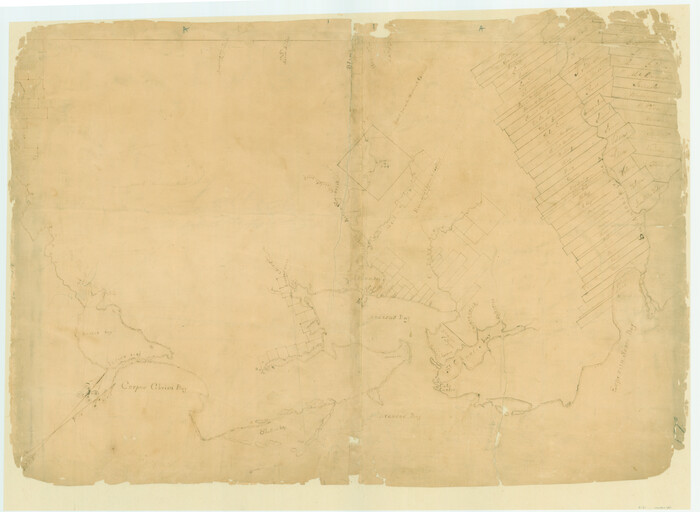
[Surveys on San Antonio River and Aransas Bay area]
Print $20.00
- Digital $50.00
[Surveys on San Antonio River and Aransas Bay area]
1840
Size: 24.1 x 33.0 inches
141
Surveys on the Coleto Creek, Goliad County
Print $20.00
- Digital $50.00
Surveys on the Coleto Creek, Goliad County
1841
-
Size
13.8 x 14.9 inches
-
Map/Doc
10
-
Creation Date
1841
[Surveys in the Jefferson District along Big Sandy Creek]
Print $2.00
- Digital $50.00
[Surveys in the Jefferson District along Big Sandy Creek]
1841
-
Size
9.5 x 8.1 inches
-
Map/Doc
100
-
Creation Date
1841
[Surveys along the Trinity River and below]
Print $20.00
- Digital $50.00
[Surveys along the Trinity River and below]
1840
-
Size
22.6 x 17.6 inches
-
Map/Doc
101
-
Creation Date
1840
[Surveys in the Robertson District along the Trinity River and Richland Creek]
Print $20.00
- Digital $50.00
[Surveys in the Robertson District along the Trinity River and Richland Creek]
1841
-
Size
15.3 x 12.2 inches
-
Map/Doc
104
-
Creation Date
1841
Platts [sic] of S. C. Robertson Surveys
Print $20.00
- Digital $50.00
Platts [sic] of S. C. Robertson Surveys
1841
-
Size
13.6 x 15.7 inches
-
Map/Doc
105
-
Creation Date
1841
[Surveys near the city of Bastrop]
Print $2.00
- Digital $50.00
[Surveys near the city of Bastrop]
1841
-
Size
6.5 x 7.0 inches
-
Map/Doc
107
-
Creation Date
1841
[Map of Nacogdoches County]
Print $40.00
- Digital $50.00
[Map of Nacogdoches County]
1840
-
Size
79.3 x 69.8 inches
-
Map/Doc
10784
-
Creation Date
1840
[Surveys near Onion Creek]
Print $2.00
- Digital $50.00
[Surveys near Onion Creek]
1841
-
Size
11.0 x 7.8 inches
-
Map/Doc
108
-
Creation Date
1841
[Map of the dividing line between Milam and Travis Counties]
Print $20.00
- Digital $50.00
[Map of the dividing line between Milam and Travis Counties]
1841
-
Size
14.2 x 12.8 inches
-
Map/Doc
110
-
Creation Date
1841
[Surveys along Gilleland and Wilbarger Creek in the Travis District]
Print $2.00
- Digital $50.00
[Surveys along Gilleland and Wilbarger Creek in the Travis District]
1841
-
Size
8.1 x 11.2 inches
-
Map/Doc
111
-
Creation Date
1841
[Surveys along the Colorado River]
Print $2.00
- Digital $50.00
[Surveys along the Colorado River]
1841
-
Size
12.2 x 8.3 inches
-
Map/Doc
112
-
Creation Date
1841
[Surveys in the Travis District along the Colorado and Pedernales Rivers]
Print $2.00
- Digital $50.00
[Surveys in the Travis District along the Colorado and Pedernales Rivers]
1841
-
Size
9.9 x 8.2 inches
-
Map/Doc
113
-
Creation Date
1841
[Surveys in the Travis District along the Colorado River]
Print $2.00
- Digital $50.00
[Surveys in the Travis District along the Colorado River]
1840
-
Size
8.0 x 10.2 inches
-
Map/Doc
115
-
Creation Date
1840
Gregg County Sketch File 12
Print $20.00
- Digital $50.00
Gregg County Sketch File 12
-
Size
17.3 x 24.1 inches
-
Map/Doc
11589
[Surveys in the Travis District along the Colorado River]
Print $2.00
- Digital $50.00
[Surveys in the Travis District along the Colorado River]
1840
-
Size
8.9 x 6.3 inches
-
Map/Doc
117
-
Creation Date
1840
Henderson County Sketch File 24
Print $20.00
- Digital $50.00
Henderson County Sketch File 24
1974
-
Size
27.4 x 24.1 inches
-
Map/Doc
11759
-
Creation Date
1974
[Surveys in the Travis District along the Colorado River]
Print $2.00
- Digital $50.00
[Surveys in the Travis District along the Colorado River]
1841
-
Size
8.6 x 15.3 inches
-
Map/Doc
118
-
Creation Date
1841
[Surveys along the Colorado River]
Print $20.00
- Digital $50.00
[Surveys along the Colorado River]
1840
-
Size
23.8 x 17.9 inches
-
Map/Doc
119
-
Creation Date
1840
[Surveys in the Travis District along the Colorado River]
Print $3.00
- Digital $50.00
[Surveys in the Travis District along the Colorado River]
1841
-
Size
7.0 x 16.5 inches
-
Map/Doc
120
-
Creation Date
1841
[Surveys along the Pedernales River and Cypress Creek]
Print $2.00
- Digital $50.00
[Surveys along the Pedernales River and Cypress Creek]
1841
-
Size
8.3 x 7.7 inches
-
Map/Doc
121
-
Creation Date
1841
[Surveys in the Bexar District along the Guadalupe River]
Print $3.00
- Digital $50.00
[Surveys in the Bexar District along the Guadalupe River]
1841
-
Size
17.2 x 10.8 inches
-
Map/Doc
124
-
Creation Date
1841
[Surveys in the Bexar District along the San Antonio River showing the position of the missions]
Print $3.00
- Digital $50.00
[Surveys in the Bexar District along the San Antonio River showing the position of the missions]
1841
-
Size
11.2 x 16.0 inches
-
Map/Doc
125
-
Creation Date
1841
[Sketches on Lagoona (sic) Creek, Attascosa (sic) and Laredo Road]
Print $20.00
- Digital $50.00
[Sketches on Lagoona (sic) Creek, Attascosa (sic) and Laredo Road]
1841
-
Size
18.0 x 13.5 inches
-
Map/Doc
126
-
Creation Date
1841
[Surveys in the Bexar District along the Medina River]
Print $20.00
- Digital $50.00
[Surveys in the Bexar District along the Medina River]
1841
-
Size
23.0 x 16.8 inches
-
Map/Doc
128
-
Creation Date
1841
[Surveys along the Frio River]
Print $20.00
- Digital $50.00
[Surveys along the Frio River]
1841
-
Size
12.0 x 16.6 inches
-
Map/Doc
129
-
Creation Date
1841
[Surveys in the Bexar District along the Medina River]
Print $20.00
- Digital $50.00
[Surveys in the Bexar District along the Medina River]
1841
-
Size
20.7 x 12.8 inches
-
Map/Doc
130
-
Creation Date
1841
[Surveys in the Bexar District along the Leona River]
Print $20.00
- Digital $50.00
[Surveys in the Bexar District along the Leona River]
1841
-
Size
19.9 x 10.9 inches
-
Map/Doc
135
-
Creation Date
1841
[Surveys in the Bexar District along the Frio and Leona Rivers]
Print $20.00
- Digital $50.00
[Surveys in the Bexar District along the Frio and Leona Rivers]
1842
-
Size
16.2 x 12.2 inches
-
Map/Doc
136
-
Creation Date
1842
[Surveys between the Sabine River and Little Cypress Creek]
Print $3.00
- Digital $50.00
[Surveys between the Sabine River and Little Cypress Creek]
1840
-
Size
9.3 x 13.0 inches
-
Map/Doc
139
-
Creation Date
1840
[Surveys on San Antonio River and Aransas Bay area]
Print $20.00
- Digital $50.00
[Surveys on San Antonio River and Aransas Bay area]
1840
-
Size
24.1 x 33.0 inches
-
Map/Doc
141
-
Creation Date
1840