Tom Green County Sketch File 71
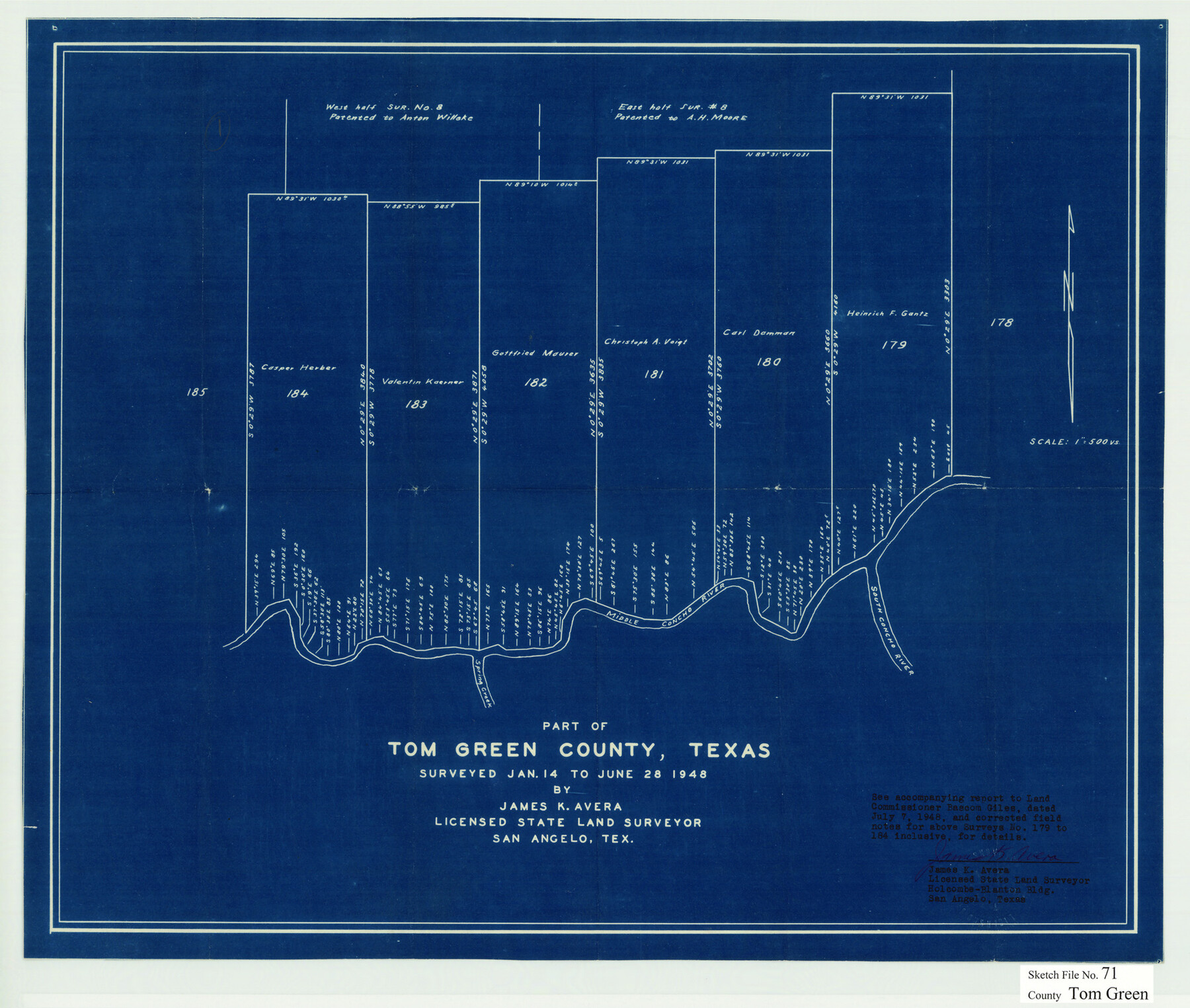
[Sketch of surveys 179-184 on the north bank of the Middle Concho River southwest from San Angelo]
-
Map/Doc
12447
-
Collection
General Map Collection
-
Object Dates
1948 (Creation Date)
7/15/1948 (File Date)
1/14 - 6/28/1948 (Survey Date)
-
People and Organizations
James K. Avera (Surveyor/Engineer)
-
Counties
Tom Green
-
Subjects
Surveying Sketch File
-
Height x Width
17.5 x 20.6 inches
44.5 x 52.3 cm
-
Medium
blueprint/diazo
-
Scale
1" = 500 varas
-
Features
Middle Concho River
South Concho River
Spring Creek
Part of: General Map Collection
Uvalde County Working Sketch 48

Print $20.00
- Digital $50.00
Uvalde County Working Sketch 48
1980
Size 15.6 x 17.9 inches
Map/Doc 72118
Wichita Falls, Wichita County, Texas

Print $20.00
- Digital $50.00
Wichita Falls, Wichita County, Texas
Size 32.0 x 22.6 inches
Map/Doc 96791
Kimble County Working Sketch 40

Print $40.00
- Digital $50.00
Kimble County Working Sketch 40
1948
Size 53.0 x 38.4 inches
Map/Doc 70108
New Map of the State of Texas Compiled from J. De Cordova's large Map

Print $20.00
- Digital $50.00
New Map of the State of Texas Compiled from J. De Cordova's large Map
1856
Size 17.5 x 27.0 inches
Map/Doc 76172
Anderson County Working Sketch 1

Print $20.00
- Digital $50.00
Anderson County Working Sketch 1
Size 24.0 x 19.3 inches
Map/Doc 67000
Val Verde County Working Sketch 5

Print $20.00
- Digital $50.00
Val Verde County Working Sketch 5
1909
Size 13.0 x 29.8 inches
Map/Doc 72140
Jim Hogg County Rolled Sketch 13

Print $65.00
- Digital $50.00
Jim Hogg County Rolled Sketch 13
1913
Size 21.9 x 28.1 inches
Map/Doc 6444
Mason County Working Sketch 11

Print $20.00
- Digital $50.00
Mason County Working Sketch 11
1951
Size 24.7 x 23.7 inches
Map/Doc 70847
Map of Williamson County

Print $20.00
- Digital $50.00
Map of Williamson County
1863
Size 22.7 x 29.7 inches
Map/Doc 4150
Map of Bexar County

Print $20.00
- Digital $50.00
Map of Bexar County
1878
Size 24.5 x 27.6 inches
Map/Doc 3298
Kendall County Working Sketch 27

Print $20.00
- Digital $50.00
Kendall County Working Sketch 27
1994
Size 25.0 x 37.5 inches
Map/Doc 66700

You may also like
Nolan County Working Sketch 7

Print $20.00
- Digital $50.00
Nolan County Working Sketch 7
1954
Size 33.9 x 24.3 inches
Map/Doc 71298

Map of Refugio County

Print $20.00
- Digital $50.00
Map of Refugio County
1875
Size 20.9 x 28.2 inches
Map/Doc 3988
Pecos County Sketch

Print $20.00
- Digital $50.00
Pecos County Sketch
Size 34.2 x 23.5 inches
Map/Doc 91642
The California Case

Print $3.00
- Digital $50.00
The California Case
Size 15.8 x 9.5 inches
Map/Doc 91695
Pecos County Rolled Sketch 161

Print $40.00
- Digital $50.00
Pecos County Rolled Sketch 161
Size 67.1 x 35.2 inches
Map/Doc 9740
Map of Harris County, Texas

Print $20.00
Map of Harris County, Texas
1879
Size 24.8 x 36.0 inches
Map/Doc 88948
General Sketch from Garza, Lynn, Dawson and Borden Counties

Print $20.00
- Digital $50.00
General Sketch from Garza, Lynn, Dawson and Borden Counties
1904
Size 43.3 x 37.4 inches
Map/Doc 89933
Hardeman County Sketch File 5

Print $6.00
- Digital $50.00
Hardeman County Sketch File 5
Size 12.9 x 4.4 inches
Map/Doc 24994
Map of Kendall County

Print $20.00
- Digital $50.00
Map of Kendall County
1862
Size 21.0 x 20.0 inches
Map/Doc 3754
Matagorda County Sketch File 21

Print $6.00
- Digital $50.00
Matagorda County Sketch File 21
1897
Size 14.2 x 8.7 inches
Map/Doc 30782
Hudspeth County Rolled Sketch 59

Print $40.00
- Digital $50.00
Hudspeth County Rolled Sketch 59
Size 69.2 x 42.8 inches
Map/Doc 9224