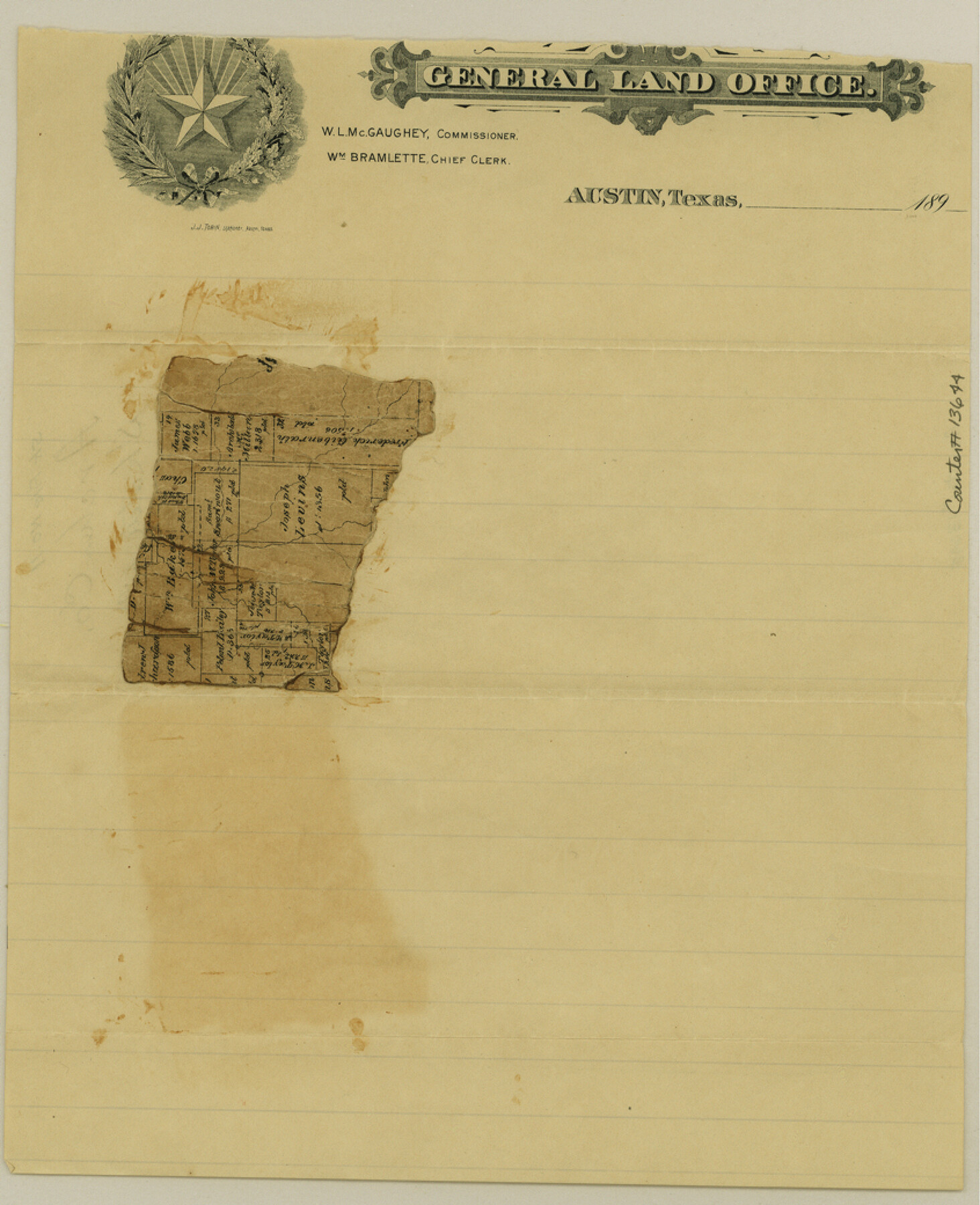
Archer County Sketch File 11
[Fragment of old map showing surveys in Archer County]
-
Map/Doc
13644
-
Collection
General Map Collection
-
Counties
Archer
-
Subjects
Surveying Sketch File
-
Height x Width
10.4 x 8.5 inches
26.4 x 21.6 cm
-
Medium
paper, manuscript
Part of: General Map Collection
Travis County Working Sketch 37
![69421, Travis County Working Sketch 37, General Map Collection](https://historictexasmaps.com/wmedia_w700/maps/69421.tif.jpg)
Print $2.00
- Digital $50.00
Travis County Working Sketch 37
Size 12.5 x 12.1 inches
Map/Doc 69421
Jeff Davis County Sketch File 37
![28050, Jeff Davis County Sketch File 37, General Map Collection](https://historictexasmaps.com/wmedia_w700/pdf_converted_jpg/qi_pdf_thumbnail_12263.jpg)
Print $8.00
- Digital $50.00
Jeff Davis County Sketch File 37
1953
Size 11.3 x 8.7 inches
Map/Doc 28050
Val Verde County Working Sketch 3
![72138, Val Verde County Working Sketch 3, General Map Collection](https://historictexasmaps.com/wmedia_w700/maps/72138.tif.jpg)
Print $20.00
- Digital $50.00
Val Verde County Working Sketch 3
Size 17.5 x 24.1 inches
Map/Doc 72138
Menard County Working Sketch 4
![70951, Menard County Working Sketch 4, General Map Collection](https://historictexasmaps.com/wmedia_w700/maps/70951.tif.jpg)
Print $20.00
- Digital $50.00
Menard County Working Sketch 4
Size 19.8 x 16.2 inches
Map/Doc 70951
Matagorda County Rolled Sketch 37A
![10195, Matagorda County Rolled Sketch 37A, General Map Collection](https://historictexasmaps.com/wmedia_w700/maps/10195.tif.jpg)
Print $40.00
- Digital $50.00
Matagorda County Rolled Sketch 37A
Size 48.7 x 41.1 inches
Map/Doc 10195
Uvalde County Working Sketch 1
![72071, Uvalde County Working Sketch 1, General Map Collection](https://historictexasmaps.com/wmedia_w700/maps/72071.tif.jpg)
Print $5.00
- Digital $50.00
Uvalde County Working Sketch 1
Size 27.3 x 21.0 inches
Map/Doc 72071
PSL Field Notes for Blocks C36 and C37 in Gaines and Terry Counties, Block C38 in Dawson, Gaines, and Terry Counties, Blocks C39 and C41 in Dawson and Terry Counties, Block K in Yoakum and Terry Counties
![81674, PSL Field Notes for Blocks C36 and C37 in Gaines and Terry Counties, Block C38 in Dawson, Gaines, and Terry Counties, Blocks C39 and C41 in Dawson and Terry Counties, Block K in Yoakum and Terry Counties, General Map Collection](https://historictexasmaps.com/wmedia_w700/pdf_converted_jpg/qi_pdf_thumbnail_30437.jpg)
PSL Field Notes for Blocks C36 and C37 in Gaines and Terry Counties, Block C38 in Dawson, Gaines, and Terry Counties, Blocks C39 and C41 in Dawson and Terry Counties, Block K in Yoakum and Terry Counties
Map/Doc 81674
Terrell County Working Sketch 38
![62131, Terrell County Working Sketch 38, General Map Collection](https://historictexasmaps.com/wmedia_w700/maps/62131.tif.jpg)
Print $40.00
- Digital $50.00
Terrell County Working Sketch 38
Size 89.1 x 24.9 inches
Map/Doc 62131
Oldham County Sketch File 7
![33236, Oldham County Sketch File 7, General Map Collection](https://historictexasmaps.com/wmedia_w700/pdf_converted_jpg/qi_pdf_thumbnail_13415.jpg)
Print $86.00
- Digital $50.00
Oldham County Sketch File 7
1885
Size 9.4 x 9.1 inches
Map/Doc 33236
Burnet County Sketch File 39
![11028, Burnet County Sketch File 39, General Map Collection](https://historictexasmaps.com/wmedia_w700/pdf_converted_jpg/qi_pdf_thumbnail_7593.jpg)
Print $40.00
- Digital $50.00
Burnet County Sketch File 39
Size 9.6 x 24.1 inches
Map/Doc 11028
Edwards County Working Sketch 63
![68939, Edwards County Working Sketch 63, General Map Collection](https://historictexasmaps.com/wmedia_w700/maps/68939.tif.jpg)
Print $20.00
- Digital $50.00
Edwards County Working Sketch 63
Size 32.5 x 46.4 inches
Map/Doc 68939
Hardin County Sketch File 6
![25097, Hardin County Sketch File 6, General Map Collection](https://historictexasmaps.com/wmedia_w700/pdf_converted_jpg/qi_pdf_thumbnail_11640.jpg)
Print $4.00
- Digital $50.00
Hardin County Sketch File 6
Size 8.0 x 12.7 inches
Map/Doc 25097
You may also like
Refugio County Sketch File 24
![35283, Refugio County Sketch File 24, General Map Collection](https://historictexasmaps.com/wmedia_w700/pdf_converted_jpg/qi_pdf_thumbnail_13898.jpg)
Print $12.00
- Digital $50.00
Refugio County Sketch File 24
1954
Size 14.4 x 8.9 inches
Map/Doc 35283
Jones County Boundary File 1b
![44359, Jones County Boundary File 1b, General Map Collection](https://historictexasmaps.com/wmedia_w700/pdf_converted_jpg/qi_pdf_thumbnail_15435.jpg)
Print $40.00
- Digital $50.00
Jones County Boundary File 1b
1882
Size 37.5 x 12.6 inches
Map/Doc 44359
Williamson County Sketch File 21
![40350, Williamson County Sketch File 21, General Map Collection](https://historictexasmaps.com/wmedia_w700/pdf_converted_jpg/qi_pdf_thumbnail_15096.jpg)
Print $4.00
- Digital $50.00
Williamson County Sketch File 21
1893
Size 11.3 x 8.7 inches
Map/Doc 40350
Flight Mission No. BRA-6M, Frame 94, Jefferson County
![85437, Flight Mission No. BRA-6M, Frame 94, Jefferson County, General Map Collection](https://historictexasmaps.com/wmedia_w700/pdf_converted_jpg/qi_pdf_thumbnail_32637.jpg)
Print $20.00
- Digital $50.00
Flight Mission No. BRA-6M, Frame 94, Jefferson County
1953
Size 18.6 x 22.4 inches
Map/Doc 85437
Medina County Boundary File 2
![57026, Medina County Boundary File 2, General Map Collection](https://historictexasmaps.com/wmedia_w700/pdf_converted_jpg/qi_pdf_thumbnail_16519.jpg)
Print $11.00
- Digital $50.00
Medina County Boundary File 2
Size 13.0 x 8.1 inches
Map/Doc 57026
Crockett County Sketch File 6
![3457, Crockett County Sketch File 6, General Map Collection](https://historictexasmaps.com/wmedia_w700/pdf_converted_jpg/qi_pdf_thumbnail_1507.jpg)
Print $20.00
- Digital $50.00
Crockett County Sketch File 6
1877
Size 22.2 x 17.2 inches
Map/Doc 3457
Franklin County Sketch File 5
![23017, Franklin County Sketch File 5, General Map Collection](https://historictexasmaps.com/wmedia_w700/pdf_converted_jpg/qi_pdf_thumbnail_11213.jpg)
Print $2.00
- Digital $50.00
Franklin County Sketch File 5
Size 8.2 x 10.7 inches
Map/Doc 23017
Runnels County Sketch File 25
![12259, Runnels County Sketch File 25, General Map Collection](https://historictexasmaps.com/wmedia_w700/pdf_converted_jpg/qi_pdf_thumbnail_8586.jpg)
Print $20.00
Runnels County Sketch File 25
1940
Size 16.5 x 16.7 inches
Map/Doc 12259
Lampasas County Rolled Sketch 2
![6565, Lampasas County Rolled Sketch 2, General Map Collection](https://historictexasmaps.com/wmedia_w700/maps/6565.tif.jpg)
Print $20.00
- Digital $50.00
Lampasas County Rolled Sketch 2
Size 21.0 x 39.2 inches
Map/Doc 6565
Cooke County Working Sketch Graphic Index
![76504, Cooke County Working Sketch Graphic Index, General Map Collection](https://historictexasmaps.com/wmedia_w700/maps/76504.tif.jpg)
Print $20.00
- Digital $50.00
Cooke County Working Sketch Graphic Index
1935
Size 44.7 x 38.2 inches
Map/Doc 76504
Collin County Boundary File 1
![51678, Collin County Boundary File 1, General Map Collection](https://historictexasmaps.com/wmedia_w700/pdf_converted_jpg/qi_pdf_thumbnail_15791.jpg)
Print $8.00
- Digital $50.00
Collin County Boundary File 1
Size 12.7 x 8.1 inches
Map/Doc 51678