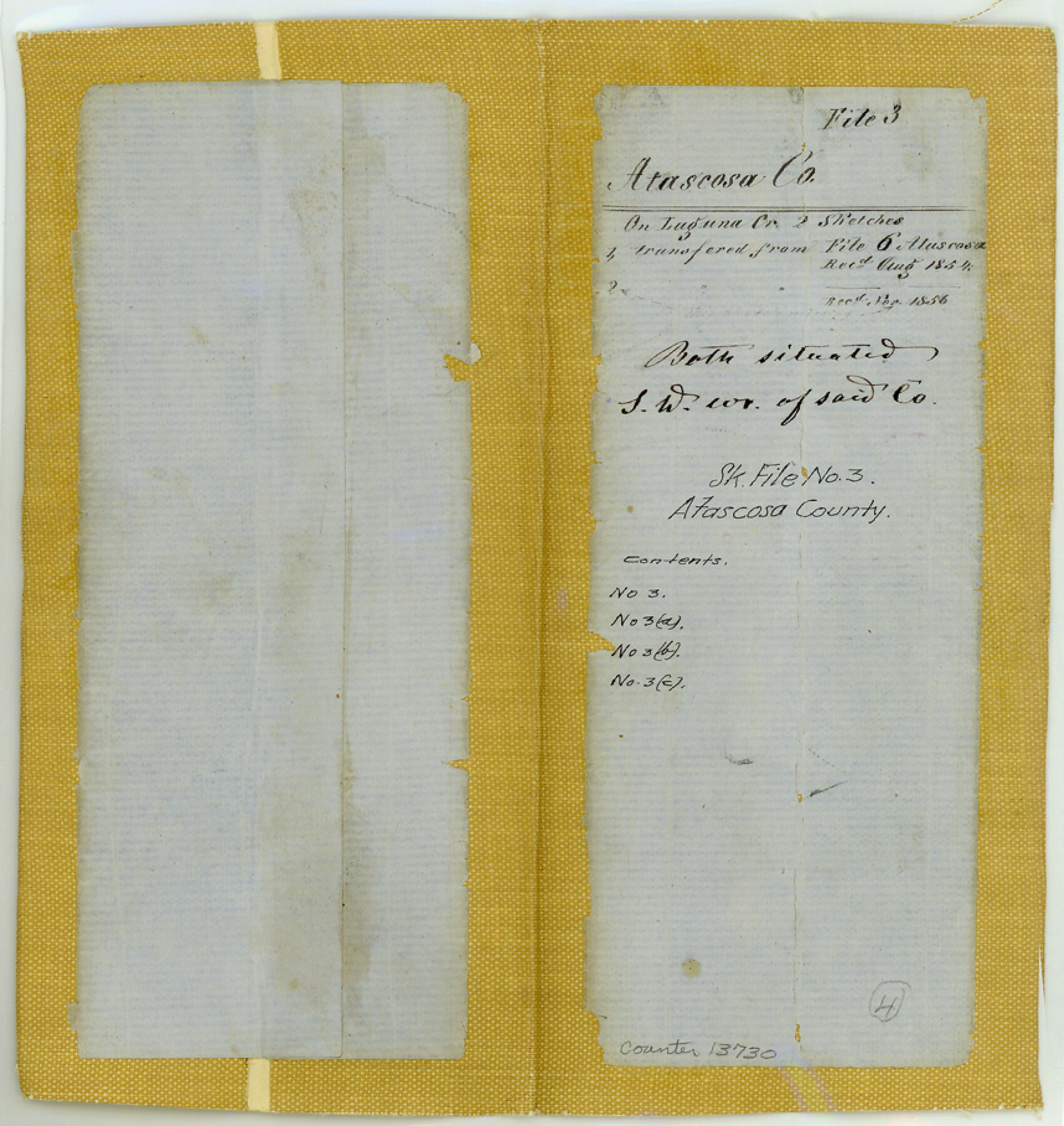
Atascosa County Sketch File 3
[Sketches of surveys on Lagunillas Creek]
-
Map/Doc
13730
-
Collection
General Map Collection
-
Object Dates
1854/5/16 (Creation Date)
-
People and Organizations
J.S. McDonald (Surveyor/Engineer)
-
Counties
Atascosa
-
Subjects
Surveying Sketch File
-
Height x Width
9.1 x 8.6 inches
23.1 x 21.8 cm
-
Medium
paper, manuscript
Part of: General Map Collection
Blanco County Boundary File 6

Print $10.00
- Digital $50.00
Blanco County Boundary File 6
Size 8.5 x 9.6 inches
Map/Doc 50560
Culberson County Sketch File 13

Print $16.00
- Digital $50.00
Culberson County Sketch File 13
1912
Size 11.2 x 8.7 inches
Map/Doc 20146
Kenedy County Rolled Sketch 5

Print $20.00
- Digital $50.00
Kenedy County Rolled Sketch 5
1911
Size 27.9 x 24.4 inches
Map/Doc 6462
Flight Mission No. CLL-1N, Frame 195, Willacy County

Print $20.00
- Digital $50.00
Flight Mission No. CLL-1N, Frame 195, Willacy County
1954
Size 18.5 x 22.3 inches
Map/Doc 87065
Reagan County Sketch File 33

Print $4.00
- Digital $50.00
Reagan County Sketch File 33
1948
Size 8.9 x 14.4 inches
Map/Doc 35028
Cooke County Working Sketch 20

Print $20.00
- Digital $50.00
Cooke County Working Sketch 20
1956
Size 21.1 x 10.4 inches
Map/Doc 68257
Flight Mission No. DQN-6K, Frame 14, Calhoun County

Print $20.00
- Digital $50.00
Flight Mission No. DQN-6K, Frame 14, Calhoun County
1953
Size 18.4 x 22.2 inches
Map/Doc 84436
Flight Mission No. DQN-2K, Frame 24, Calhoun County

Print $20.00
- Digital $50.00
Flight Mission No. DQN-2K, Frame 24, Calhoun County
1953
Size 18.6 x 22.2 inches
Map/Doc 84231
Runnels County Boundary File 2

Print $36.00
- Digital $50.00
Runnels County Boundary File 2
Size 14.4 x 8.8 inches
Map/Doc 58517
Montgomery County Rolled Sketch 42

Print $20.00
- Digital $50.00
Montgomery County Rolled Sketch 42
1939
Size 14.1 x 20.3 inches
Map/Doc 6815
Sabine River, Iron Bridge Crossing Sheet

Print $20.00
- Digital $50.00
Sabine River, Iron Bridge Crossing Sheet
1936
Size 33.0 x 40.6 inches
Map/Doc 65139
Flight Mission No. DQO-2K, Frame 83, Galveston County

Print $20.00
- Digital $50.00
Flight Mission No. DQO-2K, Frame 83, Galveston County
1952
Size 18.8 x 22.5 inches
Map/Doc 85010
You may also like
Brazoria County NRC Article 33.136 Sketch 14

Print $36.00
- Digital $50.00
Brazoria County NRC Article 33.136 Sketch 14
2013
Size 24.0 x 36.0 inches
Map/Doc 95057
[Sketch of Berry Doolittle, C. B. Emmons. R. D. Price and other surveys]
![90213, [Sketch of Berry Doolittle, C. B. Emmons. R. D. Price and other surveys], Twichell Survey Records](https://historictexasmaps.com/wmedia_w700/maps/90213-1.tif.jpg)
Print $20.00
- Digital $50.00
[Sketch of Berry Doolittle, C. B. Emmons. R. D. Price and other surveys]
Size 25.8 x 19.7 inches
Map/Doc 90213
Harrison County Rolled Sketch 2

Print $20.00
- Digital $50.00
Harrison County Rolled Sketch 2
1904
Size 29.9 x 28.0 inches
Map/Doc 6149

Newton County Working Sketch 7

Print $20.00
- Digital $50.00
Newton County Working Sketch 7
1936
Size 32.3 x 37.0 inches
Map/Doc 71253
Chambers County Rolled Sketch 21

Print $20.00
- Digital $50.00
Chambers County Rolled Sketch 21
1940
Size 40.9 x 41.0 inches
Map/Doc 8589
Cass County Rolled Sketch 6

Print $40.00
- Digital $50.00
Cass County Rolled Sketch 6
1957
Size 40.0 x 61.9 inches
Map/Doc 8586
Childress County Working Sketch 4

Print $20.00
- Digital $50.00
Childress County Working Sketch 4
1939
Size 43.4 x 14.5 inches
Map/Doc 68020
General Highway Map, San Jacinto County, Texas

Print $20.00
General Highway Map, San Jacinto County, Texas
1961
Size 24.6 x 18.4 inches
Map/Doc 79646
Coke County Rolled Sketch 16A

Print $20.00
- Digital $50.00
Coke County Rolled Sketch 16A
Size 32.3 x 30.4 inches
Map/Doc 5518
Archer County Sketch File 11

Print $4.00
- Digital $50.00
Archer County Sketch File 11
Size 10.4 x 8.5 inches
Map/Doc 13644
Hartley County Boundary File 4a

Print $38.00
- Digital $50.00
Hartley County Boundary File 4a
Size 14.2 x 9.0 inches
Map/Doc 54505