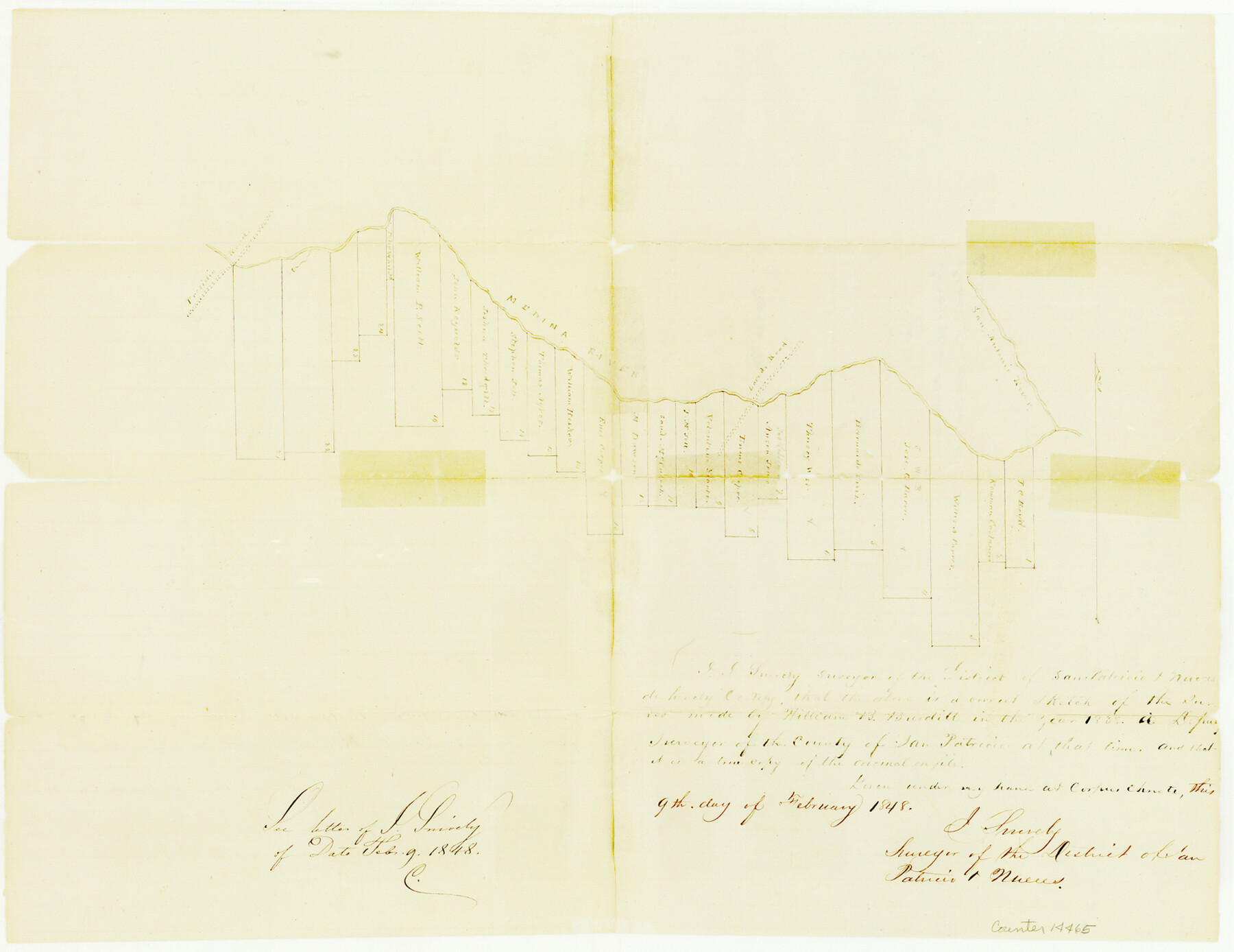
Bexar County Sketch File 1
[Sketch of surveys along the south bank of Medina River, south of San Antonio]
-
Map/Doc
14465
-
Collection
General Map Collection
-
Object Dates
1848/2/21 (File Date)
1848/2/9 (Creation Date)
-
People and Organizations
J. Snively (Surveyor/Engineer)
William B. Burditt (Surveyor/Engineer)
-
Counties
Bexar
-
Subjects
Surveying Sketch File
-
Height x Width
12.5 x 16.2 inches
31.8 x 41.1 cm
-
Medium
paper, manuscript
-
Features
Presidio Road
Medina River
Laredo Road
San Antonio River
Part of: General Map Collection
Liberty County Working Sketch 30

Print $20.00
- Digital $50.00
Liberty County Working Sketch 30
1943
Size 18.5 x 20.6 inches
Map/Doc 70489
Trace of a copy of the map captured at the battle of Resaca de la Palma

Print $20.00
- Digital $50.00
Trace of a copy of the map captured at the battle of Resaca de la Palma
Size 18.3 x 27.3 inches
Map/Doc 73056
Harrison County Working Sketch 26

Print $20.00
- Digital $50.00
Harrison County Working Sketch 26
1986
Size 38.4 x 30.0 inches
Map/Doc 66046
Aransas County NRC Article 33.136 Sketch 13

Print $24.00
- Digital $50.00
Aransas County NRC Article 33.136 Sketch 13
Size 24.0 x 36.0 inches
Map/Doc 94514
Map of Michigan, Wisconsin and part of Iowa to illustrate Olney's school geography

Print $20.00
- Digital $50.00
Map of Michigan, Wisconsin and part of Iowa to illustrate Olney's school geography
1844
Size 9.5 x 12.1 inches
Map/Doc 93542
Map of Northern Boundary Line of Texas and Pacific 80 Mile Reservation

Print $20.00
- Digital $50.00
Map of Northern Boundary Line of Texas and Pacific 80 Mile Reservation
1902
Size 16.8 x 16.7 inches
Map/Doc 65694
Upton County Rolled Sketch 50

Print $20.00
- Digital $50.00
Upton County Rolled Sketch 50
1959
Size 20.8 x 32.7 inches
Map/Doc 8085
The Latest Map of Texas

Print $20.00
- Digital $50.00
The Latest Map of Texas
1889
Size 32.0 x 34.0 inches
Map/Doc 93422
Flight Mission No. DAG-23K, Frame 18, Matagorda County

Print $20.00
- Digital $50.00
Flight Mission No. DAG-23K, Frame 18, Matagorda County
1953
Size 18.5 x 22.2 inches
Map/Doc 86480
Presidio County Working Sketch 58

Print $20.00
- Digital $50.00
Presidio County Working Sketch 58
1956
Size 21.9 x 24.2 inches
Map/Doc 71735
Shelby County Working Sketch 36

Print $20.00
- Digital $50.00
Shelby County Working Sketch 36
2011
Size 35.0 x 36.0 inches
Map/Doc 90093
Reagan County Boundary File 1a

Print $50.00
- Digital $50.00
Reagan County Boundary File 1a
Size 14.4 x 8.7 inches
Map/Doc 58154
You may also like
Blanco County Boundary File 6

Print $10.00
- Digital $50.00
Blanco County Boundary File 6
Size 8.5 x 9.6 inches
Map/Doc 50560
Bastrop County Sketch File 12

Print $12.00
- Digital $50.00
Bastrop County Sketch File 12
1846
Size 12.8 x 8.4 inches
Map/Doc 14064
San Jacinto County Working Sketch 5

Print $20.00
- Digital $50.00
San Jacinto County Working Sketch 5
1934
Size 16.5 x 21.2 inches
Map/Doc 63718
Kinney County Working Sketch 49

Print $20.00
- Digital $50.00
Kinney County Working Sketch 49
1980
Size 19.9 x 25.6 inches
Map/Doc 70231
Fannin County Sketch File 20a

Print $7.00
- Digital $50.00
Fannin County Sketch File 20a
1889
Size 10.4 x 8.4 inches
Map/Doc 22482
[Ector County Line Descriptions]
![92636, [Ector County Line Descriptions], Twichell Survey Records](https://historictexasmaps.com/wmedia_w700/maps/92636-1.tif.jpg)
Print $20.00
- Digital $50.00
[Ector County Line Descriptions]
Size 37.2 x 44.2 inches
Map/Doc 92636
Bosque County Sketch File 3

Print $40.00
- Digital $50.00
Bosque County Sketch File 3
1848
Size 16.1 x 12.4 inches
Map/Doc 14742
Yoakum County Rolled Sketch 5

Print $20.00
- Digital $50.00
Yoakum County Rolled Sketch 5
1992
Size 20.9 x 16.3 inches
Map/Doc 8290
Randall County Sketch File 12

Print $6.00
- Digital $50.00
Randall County Sketch File 12
1945
Size 11.3 x 8.9 inches
Map/Doc 34976
Harris County Working Sketch 123

Print $20.00
- Digital $50.00
Harris County Working Sketch 123
1993
Size 19.5 x 17.0 inches
Map/Doc 66015
[PSL Blks A28 & A29]
![90165, [PSL Blks A28 & A29], Twichell Survey Records](https://historictexasmaps.com/wmedia_w700/maps/90165-1.tif.jpg)
Print $20.00
- Digital $50.00
[PSL Blks A28 & A29]
Size 18.2 x 22.8 inches
Map/Doc 90165
Clay County Sketch File 25

Print $20.00
- Digital $50.00
Clay County Sketch File 25
Size 21.1 x 16.6 inches
Map/Doc 11088