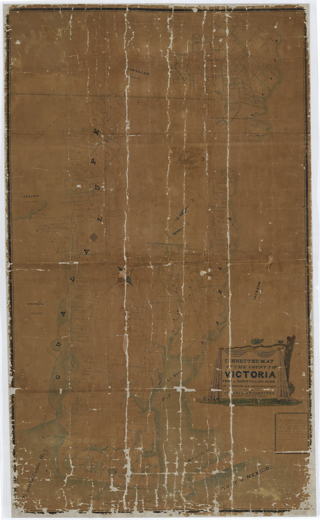
Connected Map of the County of Victoria
T-1-7
-
Map/Doc
1946
-
Collection
General Map Collection
-
Object Dates
1838 (Creation Date)
-
People and Organizations
Edward Linn (Draftsman)
James Kerr (Surveyor/Engineer)
Byrd Lockhart (Surveyor/Engineer)
Jose Maria Jesus Carbajal (Surveyor/Engineer)
-
Counties
Victoria Lavaca DeWitt Calhoun Jackson
-
Subjects
County
-
Height x Width
79.7 x 49.0 inches
202.4 x 124.5 cm
-
Comments
Colorful decorative title with drapery and tree.
Covers portions of present-day Calhoun, DeWitt, Jackson, Lavaca, and Victoria.
Conservation funded in 2002 with donations from Urban Surveying, Inc., Victoria Guadalupe Chapter DAR, Betty J. Bireley,
Part of: General Map Collection
Trinity County Working Sketch 23

Print $20.00
- Digital $50.00
Trinity County Working Sketch 23
2010
Size 23.4 x 33.6 inches
Map/Doc 89259
Lavaca County Sketch File 3

Print $8.00
- Digital $50.00
Lavaca County Sketch File 3
1853
Size 10.1 x 9.8 inches
Map/Doc 29633
Wood County Rolled Sketch 3

Print $20.00
- Digital $50.00
Wood County Rolled Sketch 3
1941
Size 35.2 x 30.8 inches
Map/Doc 8282
Hemphill County Working Sketch 3

Print $40.00
- Digital $50.00
Hemphill County Working Sketch 3
1940
Size 51.8 x 27.4 inches
Map/Doc 66098
Flight Mission No. CRC-2R, Frame 189, Chambers County

Print $20.00
- Digital $50.00
Flight Mission No. CRC-2R, Frame 189, Chambers County
1956
Size 18.6 x 22.4 inches
Map/Doc 84767
Webb County Working Sketch Graphic Index - northwest part

Print $40.00
- Digital $50.00
Webb County Working Sketch Graphic Index - northwest part
1984
Size 42.1 x 51.6 inches
Map/Doc 76736
Motley County Rolled Sketch 1

Print $20.00
- Digital $50.00
Motley County Rolled Sketch 1
1989
Size 39.0 x 47.6 inches
Map/Doc 9552
Uvalde County Working Sketch 30

Print $20.00
- Digital $50.00
Uvalde County Working Sketch 30
1962
Size 27.9 x 40.9 inches
Map/Doc 72100
Montgomery County Sketch File 34

Print $8.00
- Digital $50.00
Montgomery County Sketch File 34
1949
Size 14.4 x 8.7 inches
Map/Doc 31904
Jones County Sketch File 14

Print $4.00
- Digital $50.00
Jones County Sketch File 14
1882
Size 11.7 x 8.8 inches
Map/Doc 28501
Concho County Working Sketch 19

Print $20.00
- Digital $50.00
Concho County Working Sketch 19
1957
Size 27.3 x 24.9 inches
Map/Doc 68201
Flight Mission No. DQN-7K, Frame 8, Calhoun County

Print $20.00
- Digital $50.00
Flight Mission No. DQN-7K, Frame 8, Calhoun County
1953
Size 18.5 x 22.2 inches
Map/Doc 84459
You may also like
Right of Way and Track Map of The Wichita Falls & Southern Railroad Company

Print $40.00
- Digital $50.00
Right of Way and Track Map of The Wichita Falls & Southern Railroad Company
1942
Size 24.6 x 56.1 inches
Map/Doc 64519
Hardin County Sketch File 53

Print $12.00
- Digital $50.00
Hardin County Sketch File 53
Size 11.4 x 8.8 inches
Map/Doc 25213
Map of Africa engraved to illustrate Mitchell's school and family geography (Inset 1: Map of Egypt / Inset 2: Map of Liberia)

Print $20.00
- Digital $50.00
Map of Africa engraved to illustrate Mitchell's school and family geography (Inset 1: Map of Egypt / Inset 2: Map of Liberia)
1839
Size 9.5 x 11.8 inches
Map/Doc 93507
Angelina County Sketch File 21b

Print $6.00
- Digital $50.00
Angelina County Sketch File 21b
1889
Size 13.9 x 8.5 inches
Map/Doc 13044
A Map of Dallas County

Print $20.00
- Digital $50.00
A Map of Dallas County
1855
Size 18.4 x 18.8 inches
Map/Doc 3465
Sterling County Sketch File 27

Print $40.00
- Digital $50.00
Sterling County Sketch File 27
1858
Size 8.0 x 9.2 inches
Map/Doc 82527
Maverick County Sketch File 23

Print $7.00
- Digital $50.00
Maverick County Sketch File 23
Size 9.1 x 8.5 inches
Map/Doc 31142
Potter County Sketch File 21

Print $6.00
- Digital $50.00
Potter County Sketch File 21
1930
Size 14.1 x 9.7 inches
Map/Doc 34413
Working Sketch Dickens and Kent Counties

Print $20.00
- Digital $50.00
Working Sketch Dickens and Kent Counties
1904
Size 16.3 x 20.7 inches
Map/Doc 90862
Zavala County Boundary File 4

Print $42.00
- Digital $50.00
Zavala County Boundary File 4
Size 9.2 x 7.9 inches
Map/Doc 60271
Hood County Working Sketch 11

Print $20.00
- Digital $50.00
Hood County Working Sketch 11
1976
Size 19.7 x 25.2 inches
Map/Doc 66205
Kerr County Sketch File 15

Print $20.00
- Digital $50.00
Kerr County Sketch File 15
Size 23.7 x 16.8 inches
Map/Doc 11919