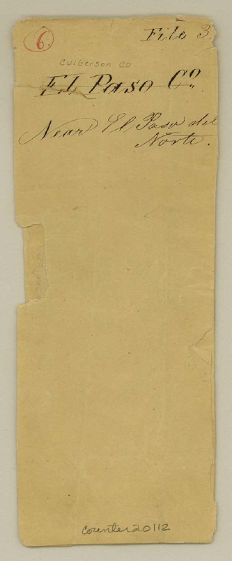
Culberson County Sketch File 3
[Multiple sketches regarding surveys along the Rio Grande]
-
Map/Doc
20112
-
Collection
General Map Collection
-
People and Organizations
Stevenson Archer (Surveyor/Engineer)
Robert B. Hays (Surveyor/Engineer)
E. von Rosenberg (Draftsman)
-
Counties
Culberson
-
Subjects
Surveying Sketch File
-
Height x Width
8.0 x 3.3 inches
20.3 x 8.4 cm
-
Medium
paper, manuscript
-
Scale
1:4000
-
Features
El Paso del Norte
Rio Grande
[Road to] Fort Bliss
Fort Bliss
Old [Rio Grande] River
Rio Viejo
Ysleta
Part of: General Map Collection
Nueces County Rolled Sketch 114

Print $20.00
- Digital $50.00
Nueces County Rolled Sketch 114
1992
Size 18.1 x 24.6 inches
Map/Doc 7125
Travis County State Real Property Sketch 16

Print $20.00
- Digital $50.00
Travis County State Real Property Sketch 16
2009
Size 47.8 x 36.0 inches
Map/Doc 90087
Mills County Sketch File 11

Print $6.00
- Digital $50.00
Mills County Sketch File 11
1876
Size 10.6 x 13.0 inches
Map/Doc 31659
Hutchinson County Sketch File 9

Print $4.00
- Digital $50.00
Hutchinson County Sketch File 9
1900
Size 12.7 x 9.2 inches
Map/Doc 27209
Live Oak County Rolled Sketch 6

Print $20.00
- Digital $50.00
Live Oak County Rolled Sketch 6
1947
Size 43.6 x 25.9 inches
Map/Doc 6634
Hopkins County Sketch File 17

Print $6.00
- Digital $50.00
Hopkins County Sketch File 17
1870
Size 7.8 x 8.0 inches
Map/Doc 26720
Controlled Mosaic by Jack Amman Photogrammetric Engineers, Inc - Sheet 17

Print $20.00
- Digital $50.00
Controlled Mosaic by Jack Amman Photogrammetric Engineers, Inc - Sheet 17
1954
Size 20.0 x 24.0 inches
Map/Doc 83461
Bandera County Sketch File 9

Print $2.00
- Digital $50.00
Bandera County Sketch File 9
Size 8.7 x 4.9 inches
Map/Doc 14009
Jefferson County Rolled Sketch 8

Print $54.00
- Digital $50.00
Jefferson County Rolled Sketch 8
1928
Size 36.0 x 46.6 inches
Map/Doc 9273
Plat Showing Theoretical Original City Limits of Corpus Christi

Print $20.00
- Digital $50.00
Plat Showing Theoretical Original City Limits of Corpus Christi
Size 41.3 x 41.7 inches
Map/Doc 4838
Frio County Rolled Sketch 23

Print $20.00
- Digital $50.00
Frio County Rolled Sketch 23
1962
Size 39.4 x 40.8 inches
Map/Doc 8912
Flight Mission No. DQO-7K, Frame 78, Galveston County

Print $20.00
- Digital $50.00
Flight Mission No. DQO-7K, Frame 78, Galveston County
1952
Size 18.8 x 22.4 inches
Map/Doc 85105
You may also like
Montgomery County Working Sketch 71

Print $20.00
- Digital $50.00
Montgomery County Working Sketch 71
1979
Size 37.2 x 29.8 inches
Map/Doc 71178
[Blocks M8, M9, M11, W1, RC and A. & B. Block A]
![91932, [Blocks M8, M9, M11, W1, RC and A. & B. Block A], Twichell Survey Records](https://historictexasmaps.com/wmedia_w700/maps/91932-1.tif.jpg)
Print $20.00
- Digital $50.00
[Blocks M8, M9, M11, W1, RC and A. & B. Block A]
Size 32.4 x 24.6 inches
Map/Doc 91932
Southern Part of Laguna Madre

Print $20.00
- Digital $50.00
Southern Part of Laguna Madre
1992
Size 44.9 x 35.0 inches
Map/Doc 73549
Flight Mission No. DQN-1K, Frame 120, Calhoun County

Print $20.00
- Digital $50.00
Flight Mission No. DQN-1K, Frame 120, Calhoun County
1953
Size 18.5 x 22.2 inches
Map/Doc 84186
Jefferson County Rolled Sketch 13

Print $20.00
- Digital $50.00
Jefferson County Rolled Sketch 13
Size 18.8 x 27.2 inches
Map/Doc 6385

[Sketch showing Midland and Martin County School Land Leagues]
![90295, [Sketch showing Midland and Martin County School Land Leagues], Twichell Survey Records](https://historictexasmaps.com/wmedia_w700/maps/90295-1.tif.jpg)
Print $20.00
- Digital $50.00
[Sketch showing Midland and Martin County School Land Leagues]
Size 14.0 x 18.0 inches
Map/Doc 90295
Harris County Working Sketch 122

Print $20.00
- Digital $50.00
Harris County Working Sketch 122
1986
Size 30.0 x 40.1 inches
Map/Doc 66014

Hill Ranch, Gaines County, Texas

Print $3.00
- Digital $50.00
Hill Ranch, Gaines County, Texas
1951
Size 11.5 x 14.0 inches
Map/Doc 92676
Limestone County, 1922

Print $40.00
- Digital $50.00
Limestone County, 1922
1922
Size 36.4 x 50.1 inches
Map/Doc 89704
Polk County Sketch File 25a

Print $8.00
- Digital $50.00
Polk County Sketch File 25a
Size 13.3 x 10.0 inches
Map/Doc 34180