Harrison County Sketch File 11
Map showing surveys No. 116, 117, 118 and 119 situated in Harrison County, Texas on the waters of Caddo Lake
-
Map/Doc
26052
-
Collection
General Map Collection
-
Object Dates
1904/11/26 (Creation Date)
-
People and Organizations
Jos. F. Gregg (Draftsman)
Behn Cook (Surveyor/Engineer)
-
Counties
Harrison
-
Subjects
Surveying Sketch File
-
Height x Width
9.2 x 9.3 inches
23.4 x 23.6 cm
-
Medium
blueprint/diazo
-
Scale
1:400
-
Features
Big Cypress Bayou
Caddo Lake
Government Ditch
Big Cypress Bayou
Pine Island Slough
Part of: General Map Collection
Hockley County

Print $20.00
- Digital $50.00
Hockley County
1914
Size 25.8 x 22.4 inches
Map/Doc 66866
Ward County Rolled Sketch 18

Print $20.00
- Digital $50.00
Ward County Rolled Sketch 18
1949
Size 31.6 x 34.0 inches
Map/Doc 10109
Flight Mission No. CGI-4N, Frame 185, Cameron County

Print $20.00
- Digital $50.00
Flight Mission No. CGI-4N, Frame 185, Cameron County
1955
Size 18.6 x 22.3 inches
Map/Doc 84688
Liberty County Working Sketch 4

Print $20.00
- Digital $50.00
Liberty County Working Sketch 4
1901
Size 16.1 x 20.2 inches
Map/Doc 70463

Delta County Sketch File 1a

Print $4.00
- Digital $50.00
Delta County Sketch File 1a
Size 8.3 x 8.9 inches
Map/Doc 20668
Hood County Sketch File 3

Print $4.00
- Digital $50.00
Hood County Sketch File 3
1877
Size 12.7 x 8.1 inches
Map/Doc 26573
City of Washington

Print $20.00
- Digital $50.00
City of Washington
1846
Size 14.1 x 18.0 inches
Map/Doc 95358
Cooke County Working Sketch Graphic Index

Print $20.00
- Digital $50.00
Cooke County Working Sketch Graphic Index
1935
Size 44.7 x 38.2 inches
Map/Doc 76504
Located Line of the Panhandle & Gulf Ry. through State Lands, Public School and University, Right of Way 200 feet wide, in Brewster County, Texas.

Print $40.00
- Digital $50.00
Located Line of the Panhandle & Gulf Ry. through State Lands, Public School and University, Right of Way 200 feet wide, in Brewster County, Texas.
1904
Size 14.8 x 99.1 inches
Map/Doc 64059
Montgomery County Rolled Sketch 36

Print $20.00
- Digital $50.00
Montgomery County Rolled Sketch 36
1956
Size 25.8 x 23.6 inches
Map/Doc 6812
Flight Mission No. CRC-2R, Frame 120, Chambers County

Print $20.00
- Digital $50.00
Flight Mission No. CRC-2R, Frame 120, Chambers County
1956
Size 18.5 x 22.3 inches
Map/Doc 84744
You may also like
Kent County Sketch File 5

Print $26.00
- Digital $50.00
Kent County Sketch File 5
1888
Size 14.2 x 8.7 inches
Map/Doc 28827
Intracoastal Waterway - Laguna Madre - Rincon de San Jose to Chubby Island, Texas

Print $20.00
- Digital $50.00
Intracoastal Waterway - Laguna Madre - Rincon de San Jose to Chubby Island, Texas
1975
Size 15.6 x 37.0 inches
Map/Doc 73517
Flight Mission No. DCL-3C, Frame 106, Kenedy County

Print $20.00
- Digital $50.00
Flight Mission No. DCL-3C, Frame 106, Kenedy County
1943
Size 18.7 x 22.3 inches
Map/Doc 85801
Flight Mission No. DAG-23K, Frame 174, Matagorda County

Print $20.00
- Digital $50.00
Flight Mission No. DAG-23K, Frame 174, Matagorda County
1953
Size 18.5 x 22.3 inches
Map/Doc 86512
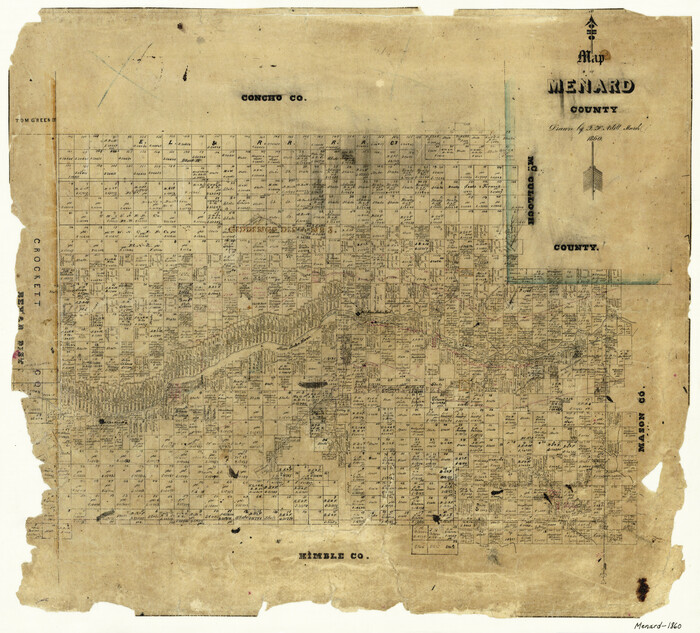
Map of Menard County
Print $20.00
- Digital $50.00
Map of Menard County
1860
Size 20.9 x 23.3 inches
Map/Doc 3874
Williamson County

Print $20.00
- Digital $50.00
Williamson County
1872
Size 18.4 x 28.2 inches
Map/Doc 4151
Gonzales County Working Sketch 14

Print $20.00
- Digital $50.00
Gonzales County Working Sketch 14
1981
Size 18.3 x 20.9 inches
Map/Doc 63230
M. C. Lindsey's Subdivision of Block 20 College Addition to Lamesa, Texas

Print $20.00
- Digital $50.00
M. C. Lindsey's Subdivision of Block 20 College Addition to Lamesa, Texas
1953
Size 9.6 x 18.2 inches
Map/Doc 92589
Northeast Part of Crockett County

Print $20.00
- Digital $50.00
Northeast Part of Crockett County
1976
Size 31.4 x 41.0 inches
Map/Doc 77253
Palo Pinto County Boundary File 2

Print $18.00
- Digital $50.00
Palo Pinto County Boundary File 2
Size 9.1 x 3.9 inches
Map/Doc 57791
Frio County Working Sketch 8

Print $20.00
- Digital $50.00
Frio County Working Sketch 8
1948
Size 26.9 x 21.3 inches
Map/Doc 69282
Gaines County Rolled Sketch 27

Print $20.00
- Digital $50.00
Gaines County Rolled Sketch 27
1983
Size 35.6 x 41.8 inches
Map/Doc 9042