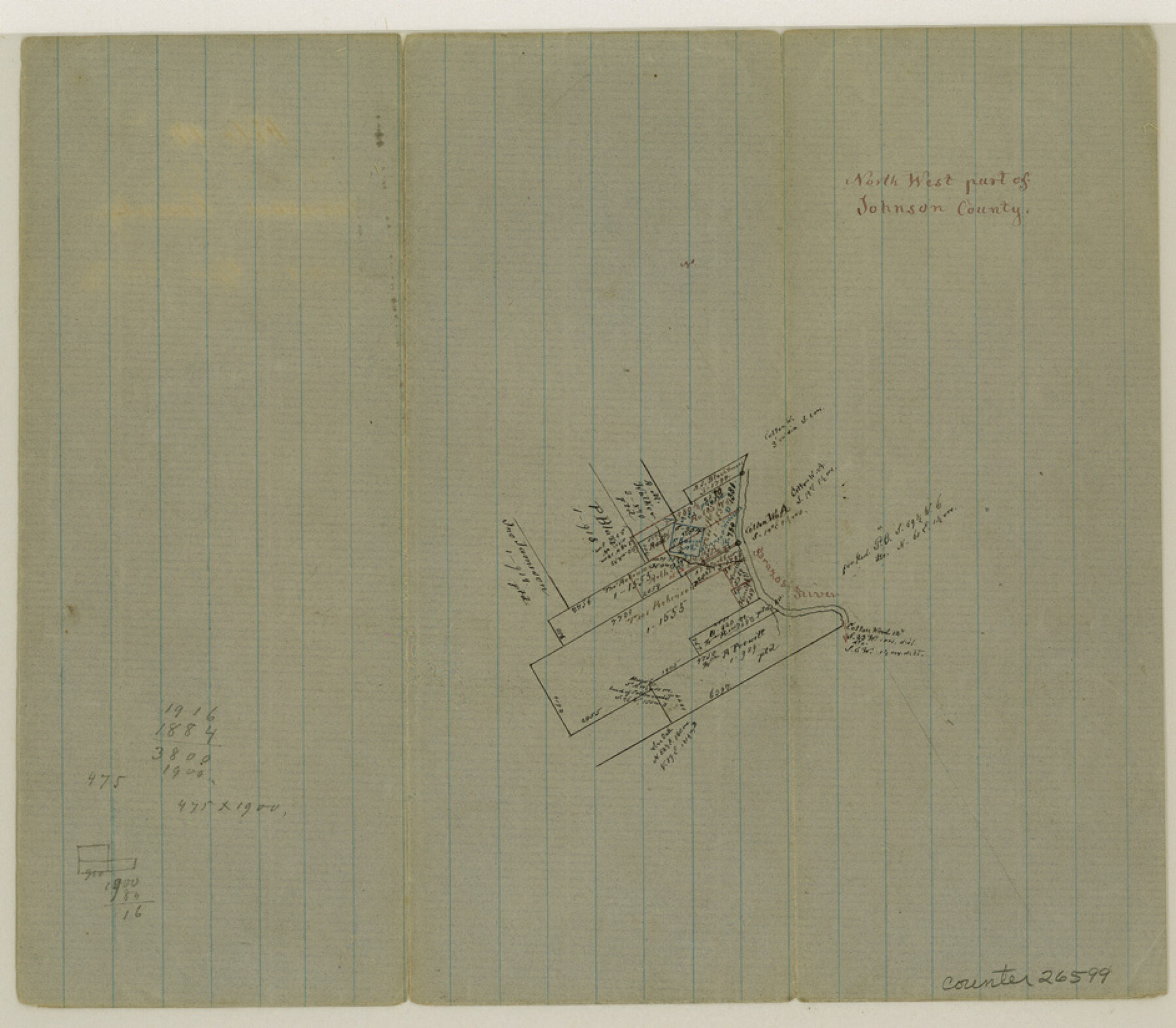
Hood County Sketch File 17
[Sketch north of Comanche Peak]
-
Map/Doc
26599
-
Collection
General Map Collection
-
Object Dates
10/13/1860 (File Date)
10/13/1860 (Creation Date)
-
Counties
Hood
-
Subjects
Surveying Sketch File
-
Height x Width
8.2 x 9.4 inches
20.8 x 23.9 cm
-
Medium
paper, manuscript
-
Features
Brazos River
Part of: General Map Collection
Eastland County Working Sketch 59

Print $20.00
- Digital $50.00
Eastland County Working Sketch 59
1987
Size 19.7 x 37.9 inches
Map/Doc 68840
Aransas County Rolled Sketch 19C

Print $20.00
- Digital $50.00
Aransas County Rolled Sketch 19C
Size 40.9 x 30.6 inches
Map/Doc 5063
Zavala County Sketch File 1

Print $20.00
- Digital $50.00
Zavala County Sketch File 1
Size 28.5 x 22.7 inches
Map/Doc 12725
Flight Mission No. DQN-2K, Frame 32, Calhoun County

Print $20.00
- Digital $50.00
Flight Mission No. DQN-2K, Frame 32, Calhoun County
1953
Size 18.7 x 22.3 inches
Map/Doc 84239
Coryell County Rolled Sketch 1

Print $20.00
- Digital $50.00
Coryell County Rolled Sketch 1
1943
Size 22.7 x 21.4 inches
Map/Doc 5565
Cass County Working Sketch 6

Print $20.00
- Digital $50.00
Cass County Working Sketch 6
1936
Size 19.7 x 23.0 inches
Map/Doc 67909
St. Louis, Brownsville & Mexico Railway Location Map from Mile 0 to Mile 20

Print $40.00
- Digital $50.00
St. Louis, Brownsville & Mexico Railway Location Map from Mile 0 to Mile 20
1906
Size 19.3 x 57.7 inches
Map/Doc 64076
Montgomery County Rolled Sketch 38A

Print $40.00
- Digital $50.00
Montgomery County Rolled Sketch 38A
1962
Size 25.1 x 54.7 inches
Map/Doc 9546
Tarrant County Sketch File 10a

Print $6.00
- Digital $50.00
Tarrant County Sketch File 10a
1860
Size 10.3 x 8.1 inches
Map/Doc 37691
United States Atlantic and Gulf Coasts Including Puerto Rico and the Virgin Islands

Print $40.00
- Digital $50.00
United States Atlantic and Gulf Coasts Including Puerto Rico and the Virgin Islands
1989
Size 20.6 x 60.3 inches
Map/Doc 73553
Working Sketch No. IV in Pecos County

Print $20.00
- Digital $50.00
Working Sketch No. IV in Pecos County
1886
Size 36.7 x 23.6 inches
Map/Doc 3954
Tom Green County

Print $20.00
- Digital $50.00
Tom Green County
1856
Size 23.3 x 27.7 inches
Map/Doc 4089
You may also like
National Parks, Monuments and Shrines of the United States and Canada

National Parks, Monuments and Shrines of the United States and Canada
1958
Size 25.7 x 19.7 inches
Map/Doc 92377
Kleberg County Rolled Sketch 10-33

Print $20.00
- Digital $50.00
Kleberg County Rolled Sketch 10-33
1950
Size 36.5 x 32.1 inches
Map/Doc 9393
Real County Sketch File 17

Print $6.00
- Digital $50.00
Real County Sketch File 17
1942
Size 5.6 x 4.3 inches
Map/Doc 35073
Refugio County Sketch File 11

Print $6.00
- Digital $50.00
Refugio County Sketch File 11
Size 8.0 x 8.2 inches
Map/Doc 35260
Trinity County Sketch File 40

Print $20.00
- Digital $50.00
Trinity County Sketch File 40
1926
Size 16.5 x 21.8 inches
Map/Doc 12494
Harris County Rolled Sketch 95

Print $20.00
- Digital $50.00
Harris County Rolled Sketch 95
1987
Size 34.2 x 27.8 inches
Map/Doc 6134
Location Map of Chicago, Rock Island & Texas Railroad

Print $20.00
- Digital $50.00
Location Map of Chicago, Rock Island & Texas Railroad
Size 21.3 x 45.9 inches
Map/Doc 64473
Oldham County Working Sketch 11

Print $20.00
- Digital $50.00
Oldham County Working Sketch 11
2014
Size 26.6 x 32.7 inches
Map/Doc 93686
Travis County Sketch File 73

Print $4.00
- Digital $50.00
Travis County Sketch File 73
1847
Size 13.0 x 8.3 inches
Map/Doc 38462
Coryell County Sketch File 8

Print $6.00
- Digital $50.00
Coryell County Sketch File 8
1853
Size 16.0 x 10.2 inches
Map/Doc 19357
Crockett County Sketch File 13

Print $22.00
- Digital $50.00
Crockett County Sketch File 13
Size 8.9 x 3.6 inches
Map/Doc 19665
Pecos County Rolled Sketch 26A

Print $40.00
- Digital $50.00
Pecos County Rolled Sketch 26A
1890
Size 19.0 x 55.5 inches
Map/Doc 75934