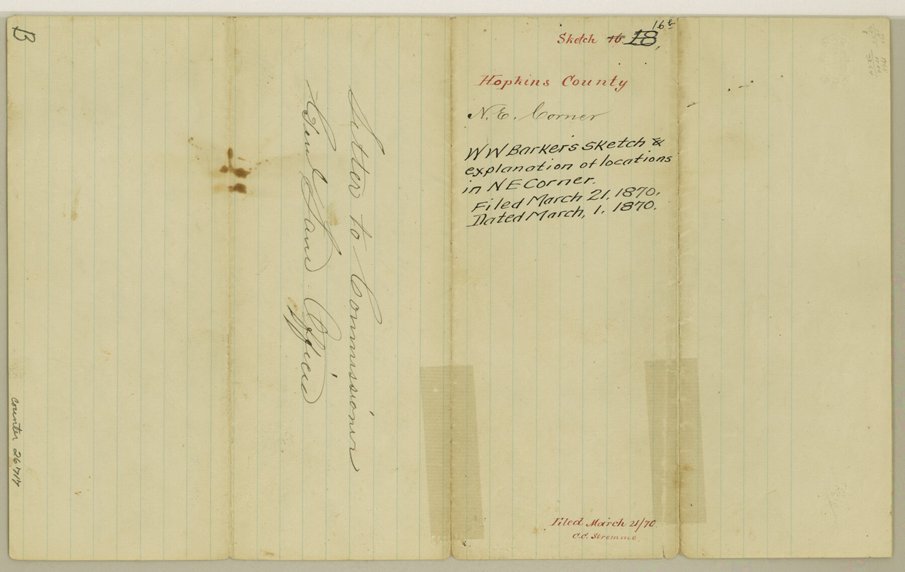
Hopkins County Sketch File 16b
[Sketch and explanation of locations in northeast corner of county]
-
Map/Doc
26717
-
Collection
General Map Collection
-
Object Dates
3/1/1870 (Creation Date)
3/21/1870 (File Date)
3/1/1870 (Correspondence Date)
-
People and Organizations
William W. Barker (Surveyor/Engineer)
Tomlinson (Surveyor/Engineer)
Joseph Spence (GLO Commissioner)
-
Counties
Hopkins Titus
-
Subjects
Surveying Sketch File
-
Height x Width
8.1 x 12.8 inches
20.6 x 32.5 cm
-
Medium
paper, manuscript
-
Features
Mitchell Creek
Part of: General Map Collection

Flight Mission No. CGN-3P, Frame 23, San Patricio County

Print $20.00
- Digital $50.00
Flight Mission No. CGN-3P, Frame 23, San Patricio County
1956
Size 18.6 x 22.2 inches
Map/Doc 86981
Flight Mission No. DAG-21K, Frame 124, Matagorda County

Print $20.00
- Digital $50.00
Flight Mission No. DAG-21K, Frame 124, Matagorda County
1952
Size 18.5 x 22.4 inches
Map/Doc 86450
Texas Coast, No. 17

Print $20.00
- Digital $50.00
Texas Coast, No. 17
Size 18.3 x 27.6 inches
Map/Doc 72712
Jeff Davis County Working Sketch 28

Print $20.00
- Digital $50.00
Jeff Davis County Working Sketch 28
1967
Size 21.2 x 28.6 inches
Map/Doc 66523
Karnes County Boundary File 4

Print $14.00
- Digital $50.00
Karnes County Boundary File 4
Size 12.7 x 8.2 inches
Map/Doc 55698
Erath County Sketch File 12

Print $4.00
- Digital $50.00
Erath County Sketch File 12
1871
Size 10.3 x 8.1 inches
Map/Doc 22281
Map of Hays County

Print $20.00
- Digital $50.00
Map of Hays County
1880
Size 26.0 x 21.8 inches
Map/Doc 4562
Political Essay on the Kingdom of New Spain Vol. 2, Third Edition

Political Essay on the Kingdom of New Spain Vol. 2, Third Edition
1822
Map/Doc 97387
Bailey County

Print $40.00
- Digital $50.00
Bailey County
1956
Size 49.4 x 31.4 inches
Map/Doc 95423

Bee County Boundary File 3

Print $20.00
- Digital $50.00
Bee County Boundary File 3
Size 22.3 x 16.2 inches
Map/Doc 50440
You may also like
Map of Shackelford County, Texas

Print $20.00
- Digital $50.00
Map of Shackelford County, Texas
Size 47.3 x 42.8 inches
Map/Doc 78398
Flight Mission No. BQY-15M, Frame 14, Harris County

Print $20.00
- Digital $50.00
Flight Mission No. BQY-15M, Frame 14, Harris County
1953
Size 18.6 x 22.4 inches
Map/Doc 85312
San Augustine County Sketch File 1

Print $4.00
San Augustine County Sketch File 1
1849
Size 9.3 x 8.2 inches
Map/Doc 35631
Webb County Working Sketch 75

Print $40.00
- Digital $50.00
Webb County Working Sketch 75
1975
Size 59.2 x 46.0 inches
Map/Doc 72442
Map of a part of Laguna Madre showing subdivision for mineral development

Print $20.00
- Digital $50.00
Map of a part of Laguna Madre showing subdivision for mineral development
1950
Size 40.7 x 26.9 inches
Map/Doc 2917
Mapa Geográphico de la Provincia de Tejas

Mapa Geográphico de la Provincia de Tejas
1822
Size 9.8 x 12.7 inches
Map/Doc 94457
Flight Mission No. DAG-22K, Frame 73, Matagorda County

Print $20.00
- Digital $50.00
Flight Mission No. DAG-22K, Frame 73, Matagorda County
1953
Size 18.7 x 22.4 inches
Map/Doc 86460
[Right of Way & Track Map, The Texas & Pacific Ry. Co. Main Line]
![64668, [Right of Way & Track Map, The Texas & Pacific Ry. Co. Main Line], General Map Collection](https://historictexasmaps.com/wmedia_w700/maps/64668.tif.jpg)
Print $20.00
- Digital $50.00
[Right of Way & Track Map, The Texas & Pacific Ry. Co. Main Line]
Size 11.0 x 18.4 inches
Map/Doc 64668
Webb County Rolled Sketch 19

Print $40.00
- Digital $50.00
Webb County Rolled Sketch 19
1928
Size 27.9 x 53.7 inches
Map/Doc 10119
Galveston County NRC Article 33.136 Sketch 46

Print $23.00
- Digital $50.00
Galveston County NRC Article 33.136 Sketch 46
2007
Size 24.6 x 36.0 inches
Map/Doc 87936
Brewster County Working Sketch 93

Print $40.00
- Digital $50.00
Brewster County Working Sketch 93
1975
Size 60.6 x 39.9 inches
Map/Doc 67693
