Presidio County Sketch File 58a
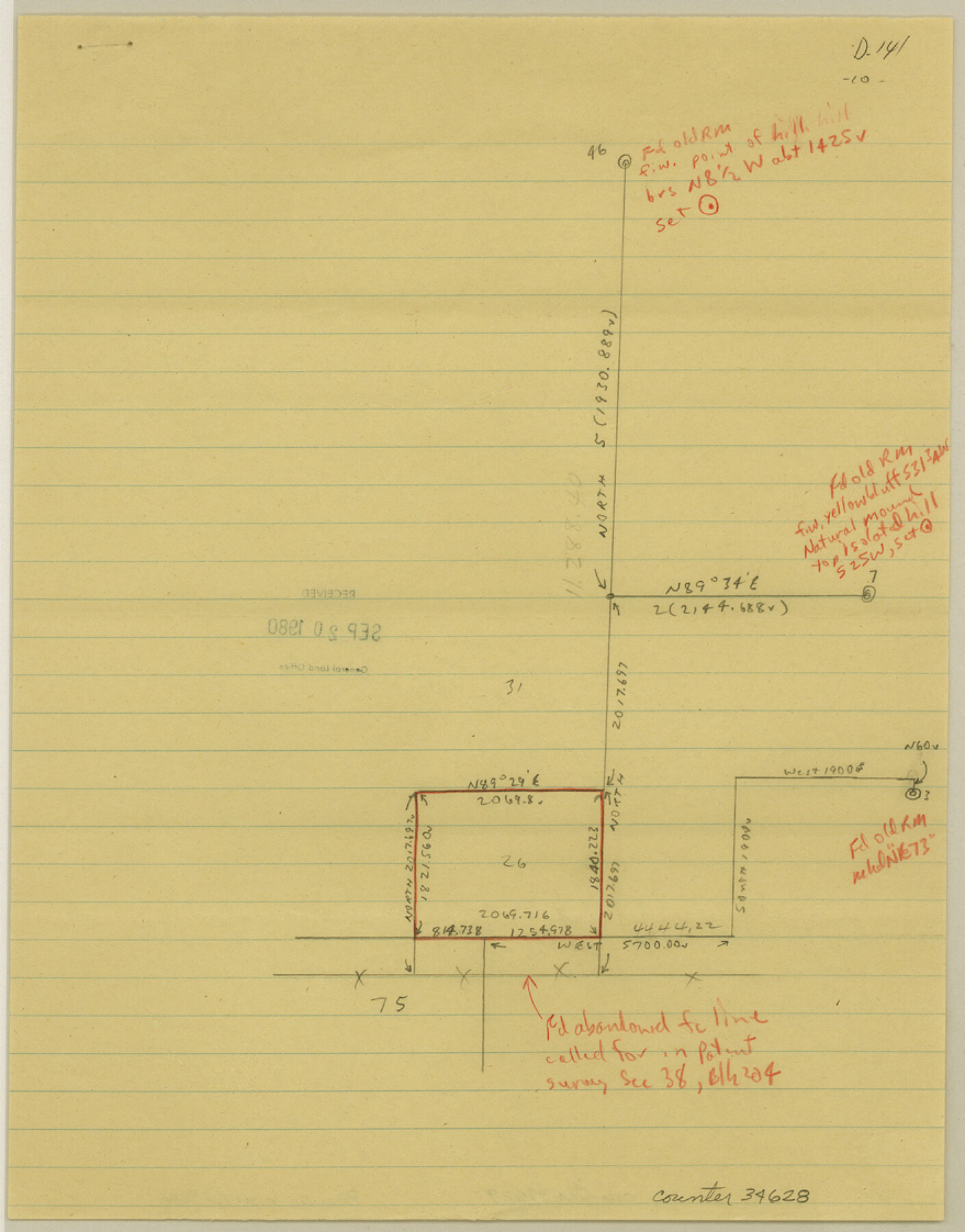
[Report, sketch and letters regarding location of section 26, Block 204, T. & St. L. RR. Co.]
-
Map/Doc
34628
-
Collection
General Map Collection
-
Object Dates
9/19/1980 (Creation Date)
11/5/1980 (File Date)
9/19/1980 (Correspondence Date)
1941 (Survey Date)
1942 (Survey Date)
1943 (Survey Date)
-
People and Organizations
Elbert F. Bassham (Surveyor/Engineer)
H.R. Gard (Surveyor/Engineer)
S.A. Thompson (Surveyor/Engineer)
-
Counties
Presidio
-
Subjects
Surveying Sketch File
-
Height x Width
11.2 x 8.8 inches
28.5 x 22.4 cm
-
Medium
multi-page, multi-format
Part of: General Map Collection
Maps of Gulf Intracoastal Waterway, Texas - Sabine River to the Rio Grande and connecting waterways including ship channels

Print $20.00
- Digital $50.00
Maps of Gulf Intracoastal Waterway, Texas - Sabine River to the Rio Grande and connecting waterways including ship channels
1966
Size 14.5 x 22.1 inches
Map/Doc 61917
El Paso County Boundary File 21

Print $6.00
- Digital $50.00
El Paso County Boundary File 21
Size 15.1 x 9.5 inches
Map/Doc 53214
Matagorda County Rolled Sketch 18A

Print $20.00
- Digital $50.00
Matagorda County Rolled Sketch 18A
1838
Size 35.4 x 30.1 inches
Map/Doc 6686
Zavala County Sketch File 5

Print $4.00
- Digital $50.00
Zavala County Sketch File 5
1876
Size 13.0 x 8.4 inches
Map/Doc 41263
Bexar County Rolled Sketch 1

Print $20.00
- Digital $50.00
Bexar County Rolled Sketch 1
1940
Size 23.1 x 26.2 inches
Map/Doc 5134
Stephens County

Print $20.00
- Digital $50.00
Stephens County
1940
Size 42.5 x 40.4 inches
Map/Doc 73293
San Patricio County Rolled Sketch 20

Print $20.00
- Digital $50.00
San Patricio County Rolled Sketch 20
1920
Size 27.7 x 31.9 inches
Map/Doc 7577
Carte Reduit d'une partie des Côtes des Isles Australes

Print $20.00
- Digital $50.00
Carte Reduit d'une partie des Côtes des Isles Australes
1782
Size 12.7 x 17.3 inches
Map/Doc 97122
Gaines County

Print $40.00
- Digital $50.00
Gaines County
1902
Size 41.8 x 57.2 inches
Map/Doc 16831
Pecos County Working Sketch 112

Print $40.00
- Digital $50.00
Pecos County Working Sketch 112
Size 48.1 x 37.0 inches
Map/Doc 71585
[Cotton Belt, St. Louis Southwestern Railway of Texas, Alignment through Smith County]
![64378, [Cotton Belt, St. Louis Southwestern Railway of Texas, Alignment through Smith County], General Map Collection](https://historictexasmaps.com/wmedia_w700/maps/64378.tif.jpg)
Print $20.00
- Digital $50.00
[Cotton Belt, St. Louis Southwestern Railway of Texas, Alignment through Smith County]
1903
Size 22.3 x 30.1 inches
Map/Doc 64378
Loving County Working Sketch 5

Print $20.00
- Digital $50.00
Loving County Working Sketch 5
1946
Size 29.7 x 39.0 inches
Map/Doc 70637
You may also like
Flight Mission No. BQR-7K, Frame 30, Brazoria County

Print $20.00
- Digital $50.00
Flight Mission No. BQR-7K, Frame 30, Brazoria County
1952
Size 18.6 x 22.3 inches
Map/Doc 84028
Briscoe County Sketch File E

Print $40.00
- Digital $50.00
Briscoe County Sketch File E
Size 26.0 x 33.7 inches
Map/Doc 11003
Uvalde County Working Sketch 5

Print $20.00
- Digital $50.00
Uvalde County Working Sketch 5
1927
Size 13.4 x 18.0 inches
Map/Doc 72075
Red River County Rolled Sketch 9

Print $20.00
- Digital $50.00
Red River County Rolled Sketch 9
Size 27.1 x 18.1 inches
Map/Doc 7475
[H. & G. N. RR. Company, Block 1 and Vicinity]
![91232, [H. & G. N. RR. Company, Block 1 and Vicinity], Twichell Survey Records](https://historictexasmaps.com/wmedia_w700/maps/91232-1.tif.jpg)
Print $20.00
- Digital $50.00
[H. & G. N. RR. Company, Block 1 and Vicinity]
Size 14.1 x 17.7 inches
Map/Doc 91232
Bandera County Sketch File 10

Print $40.00
- Digital $50.00
Bandera County Sketch File 10
Size 15.0 x 17.4 inches
Map/Doc 10892
Leon County Working Sketch 5

Print $20.00
- Digital $50.00
Leon County Working Sketch 5
1905
Size 40.5 x 20.6 inches
Map/Doc 70404
Zavala County Working Sketch 7

Print $20.00
- Digital $50.00
Zavala County Working Sketch 7
1948
Size 19.3 x 17.3 inches
Map/Doc 62082
Parker County Sketch File 32

Print $6.00
- Digital $50.00
Parker County Sketch File 32
Size 11.0 x 12.2 inches
Map/Doc 33574
Controlled Mosaic by Jack Amman Photogrammetric Engineers, Inc - Sheet 27

Print $20.00
- Digital $50.00
Controlled Mosaic by Jack Amman Photogrammetric Engineers, Inc - Sheet 27
1954
Size 20.0 x 24.0 inches
Map/Doc 83478

[Block XR, Capitol Leagues 161, 162, 164, 174, 178, 179, and 180]
![90729, [Block XR, Capitol Leagues 161, 162, 164, 174, 178, 179, and 180], Twichell Survey Records](https://historictexasmaps.com/wmedia_w700/maps/90729-1.tif.jpg)
Print $20.00
- Digital $50.00
[Block XR, Capitol Leagues 161, 162, 164, 174, 178, 179, and 180]
1908
Size 13.1 x 21.6 inches
Map/Doc 90729