![414, [Surveying Sketch of John Poitevent Block 1, Railroad Lands, et al in Knox County, Texas], Maddox Collection](https://historictexasmaps.com/wmedia_w1800h1800/maps/0414.tif.jpg)
[Surveying Sketch of John Poitevent Block 1, Railroad Lands, et al in Knox County, Texas]
-
Map/Doc
414
-
Collection
Maddox Collection
-
Counties
Knox King
-
Height x Width
11.9 x 14.2 inches
30.2 x 36.1 cm
-
Medium
linen, manuscript
-
Features
South Wichita River
Part of: Maddox Collection
Copy of sketch in Nacogdoches Donation 724 on file in GLO

Print $20.00
- Digital $50.00
Copy of sketch in Nacogdoches Donation 724 on file in GLO
1890
Size 18.0 x 10.9 inches
Map/Doc 75803
Official Copy of the Map of Milam County made for the International and G. N. R. R. Co.

Print $20.00
- Digital $50.00
Official Copy of the Map of Milam County made for the International and G. N. R. R. Co.
1877
Size 23.9 x 22.5 inches
Map/Doc 581
Lynn County, Texas

Print $20.00
- Digital $50.00
Lynn County, Texas
1883
Size 19.0 x 18.3 inches
Map/Doc 739
[Sketch of surveys in Knox County]
![555, [Sketch of surveys in Knox County], Maddox Collection](https://historictexasmaps.com/wmedia_w700/maps/555.tif.jpg)
Print $20.00
- Digital $50.00
[Sketch of surveys in Knox County]
Size 27.1 x 31.1 inches
Map/Doc 555
Survey of a Portion of Lot. No. 1 of Spear League

Print $20.00
- Digital $50.00
Survey of a Portion of Lot. No. 1 of Spear League
1911
Size 12.2 x 24.2 inches
Map/Doc 477
Skeleton Map of Nueces County

Print $20.00
- Digital $50.00
Skeleton Map of Nueces County
Size 35.5 x 39.4 inches
Map/Doc 592
Collingsworth County, Texas

Print $20.00
- Digital $50.00
Collingsworth County, Texas
Size 18.3 x 16.6 inches
Map/Doc 465
Guadalupe County, Texas

Print $20.00
- Digital $50.00
Guadalupe County, Texas
1880
Size 24.7 x 22.5 inches
Map/Doc 491
Map of Surveys 6, 7, & 8, Block 1, D.B. Gardner 7 1/2, Block L, D.B. Gardner 7, Block T, J.P. Goen
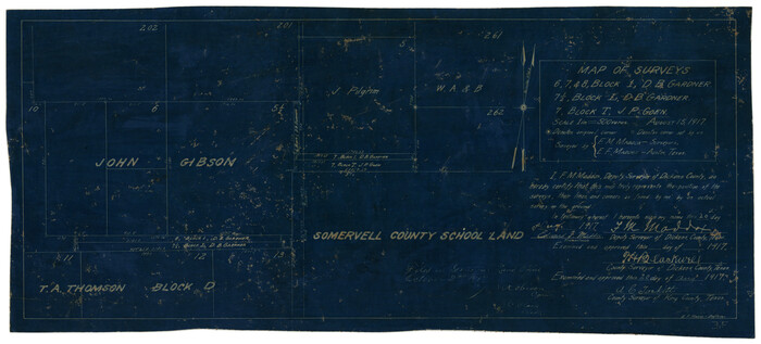
Print $20.00
- Digital $50.00
Map of Surveys 6, 7, & 8, Block 1, D.B. Gardner 7 1/2, Block L, D.B. Gardner 7, Block T, J.P. Goen
1917
Size 11.0 x 22.6 inches
Map/Doc 10762
[Surveying Sketch of W.B. Tatum, Wm. B. Jordan, et al]
![428, [Surveying Sketch of W.B. Tatum, Wm. B. Jordan, et al], Maddox Collection](https://historictexasmaps.com/wmedia_w700/maps/0428.tif.jpg)
Print $2.00
- Digital $50.00
[Surveying Sketch of W.B. Tatum, Wm. B. Jordan, et al]
Size 8.9 x 10.8 inches
Map/Doc 428
Schleicher County

Print $20.00
- Digital $50.00
Schleicher County
1898
Size 23.1 x 36.3 inches
Map/Doc 615
Capitol Land Reservation

Print $40.00
- Digital $50.00
Capitol Land Reservation
1882
Size 51.4 x 18.0 inches
Map/Doc 76175
You may also like
Runnels County Working Sketch 22

Print $20.00
- Digital $50.00
Runnels County Working Sketch 22
1951
Size 16.2 x 28.1 inches
Map/Doc 63618
Ward County Working Sketch 44

Print $40.00
- Digital $50.00
Ward County Working Sketch 44
1973
Size 50.8 x 34.6 inches
Map/Doc 72350
Flight Mission No. CUG-1P, Frame 54, Kleberg County

Print $20.00
- Digital $50.00
Flight Mission No. CUG-1P, Frame 54, Kleberg County
1956
Size 18.5 x 22.3 inches
Map/Doc 86132
Sterling County Boundary File 1

Print $56.00
- Digital $50.00
Sterling County Boundary File 1
Size 9.0 x 8.7 inches
Map/Doc 58919
Menard County Working Sketch 3

Print $20.00
- Digital $50.00
Menard County Working Sketch 3
1913
Size 15.2 x 13.2 inches
Map/Doc 70950
Official Copy of the Map of Milam County made for the International and G. N. R. R. Co.
Print $20.00
- Digital $50.00
Official Copy of the Map of Milam County made for the International and G. N. R. R. Co.
1877
Size 23.9 x 22.5 inches
Map/Doc 581
Shackelford County Sketch File 11

Print $20.00
- Digital $50.00
Shackelford County Sketch File 11
1914
Size 16.8 x 17.0 inches
Map/Doc 12317
Hays County Working Sketch 21

Print $40.00
- Digital $50.00
Hays County Working Sketch 21
1980
Size 42.7 x 65.6 inches
Map/Doc 66095
Flight Mission No. CRC-2R, Frame 138, Chambers County

Print $20.00
- Digital $50.00
Flight Mission No. CRC-2R, Frame 138, Chambers County
1956
Size 18.7 x 22.4 inches
Map/Doc 84754
Flight Mission No. BQR-5K, Frame 72, Brazoria County

Print $20.00
- Digital $50.00
Flight Mission No. BQR-5K, Frame 72, Brazoria County
1952
Size 18.9 x 22.4 inches
Map/Doc 84017
Wheeler County Working Sketch 2

Print $40.00
- Digital $50.00
Wheeler County Working Sketch 2
1957
Size 35.2 x 58.5 inches
Map/Doc 72491
Cameron County Rolled Sketch 33

Print $20.00
- Digital $50.00
Cameron County Rolled Sketch 33
1996
Size 40.2 x 21.9 inches
Map/Doc 5396