Webb County Rolled Sketch 53
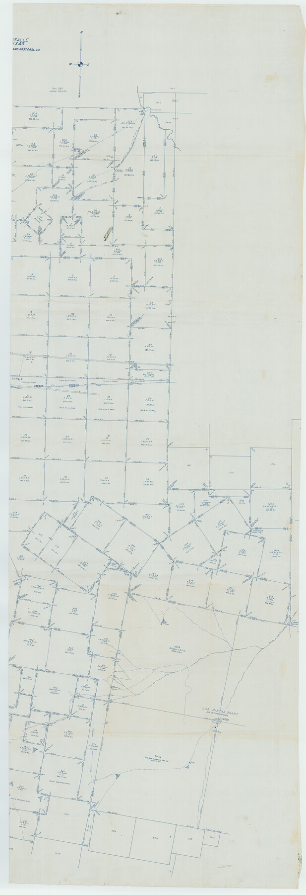
[Map showing surveys in La Salle and Webb Counties, Texas surveyed for the Callaghan Land and Pastoral Co.]
-
Map/Doc
49483
-
Collection
General Map Collection
-
Object Dates
1944/6/10 (Survey Date)
1944/8/28 (File Date)
1944/7/6 (Creation Date)
-
People and Organizations
E.J. Foster (Surveyor/Engineer)
-
Counties
Webb La Salle
-
Subjects
Surveying Rolled Sketch
-
Height x Width
83.5 x 28.6 inches
212.1 x 72.6 cm
-
Medium
blueprint/diazo
-
Scale
1" = 500 varas
-
Comments
East half of map. See Webb County Sketch File 53 (63914) for west half of map. See Webb County Sketch File 61 (39859) for surveyor's statement. See La Salle Rolled Sketch 9 (6572) for related sketch.
Related maps
Webb County Sketch File 61

Print $6.00
- Digital $50.00
Webb County Sketch File 61
1944
Size 14.5 x 8.8 inches
Map/Doc 39859
Webb County Rolled Sketch 53

Print $40.00
- Digital $50.00
Webb County Rolled Sketch 53
1944
Size 84.0 x 32.3 inches
Map/Doc 63914
La Salle County Rolled Sketch 9

Print $20.00
- Digital $50.00
La Salle County Rolled Sketch 9
1944
Size 32.7 x 27.7 inches
Map/Doc 6572
Part of: General Map Collection
Val Verde County Working Sketch 3

Print $20.00
- Digital $50.00
Val Verde County Working Sketch 3
Size 17.5 x 24.1 inches
Map/Doc 72138
Kleberg County Rolled Sketch 10-9

Print $20.00
- Digital $50.00
Kleberg County Rolled Sketch 10-9
1952
Size 37.1 x 33.1 inches
Map/Doc 9387
Coryell County

Print $20.00
- Digital $50.00
Coryell County
1880
Size 25.6 x 25.6 inches
Map/Doc 3444
Colorado County Sketch File 29

Print $6.00
- Digital $50.00
Colorado County Sketch File 29
1842
Size 11.2 x 9.0 inches
Map/Doc 18974
Edwards County Working Sketch 19

Print $20.00
- Digital $50.00
Edwards County Working Sketch 19
1934
Size 24.1 x 24.6 inches
Map/Doc 68895

Hidalgo County Sketch File 2

Print $14.00
- Digital $50.00
Hidalgo County Sketch File 2
1877
Size 10.1 x 8.1 inches
Map/Doc 26394

Bowie County Sketch File 5

Print $4.00
- Digital $50.00
Bowie County Sketch File 5
Size 10.1 x 7.5 inches
Map/Doc 14837
Flight Mission No. CLL-3N, Frame 39, Willacy County

Print $20.00
- Digital $50.00
Flight Mission No. CLL-3N, Frame 39, Willacy County
1954
Size 18.3 x 22.0 inches
Map/Doc 87097
Cass County Sketch File 12

Print $4.00
- Digital $50.00
Cass County Sketch File 12
1851
Size 8.2 x 12.3 inches
Map/Doc 17414
Harris County Working Sketch 36

Print $20.00
- Digital $50.00
Harris County Working Sketch 36
1938
Size 23.8 x 23.8 inches
Map/Doc 65928
You may also like
Kerr County Rolled Sketch 19

Print $20.00
- Digital $50.00
Kerr County Rolled Sketch 19
1954
Size 43.4 x 28.4 inches
Map/Doc 6501
Flight Mission No. CGI-2N, Frame 153, Cameron County

Print $20.00
- Digital $50.00
Flight Mission No. CGI-2N, Frame 153, Cameron County
1954
Size 18.8 x 22.3 inches
Map/Doc 84535
Red River County Sketch File 17

Print $26.00
- Digital $50.00
Red River County Sketch File 17
1868
Size 12.8 x 8.2 inches
Map/Doc 35141
Kinney County Working Sketch 12

Print $20.00
- Digital $50.00
Kinney County Working Sketch 12
1941
Size 26.7 x 32.1 inches
Map/Doc 70194
Edwards County Rolled Sketch 17

Print $20.00
- Digital $50.00
Edwards County Rolled Sketch 17
1945
Size 27.6 x 19.4 inches
Map/Doc 5806
[H. & G. N. Block B3]
![89982, [H. & G. N. Block B3], Twichell Survey Records](https://historictexasmaps.com/wmedia_w700/maps/89982-1.tif.jpg)
Print $3.00
- Digital $50.00
[H. & G. N. Block B3]
Size 17.4 x 8.1 inches
Map/Doc 89982

Young County Sketch File 9a

Print $4.00
- Digital $50.00
Young County Sketch File 9a
1875
Size 12.9 x 8.3 inches
Map/Doc 40866
Bandera County Sketch File 4

Print $4.00
- Digital $50.00
Bandera County Sketch File 4
Size 9.3 x 8.3 inches
Map/Doc 14001
Map of Bowie County

Print $20.00
- Digital $50.00
Map of Bowie County
1884
Size 19.4 x 23.7 inches
Map/Doc 3319
Crockett County Sketch File 47

Print $6.00
- Digital $50.00
Crockett County Sketch File 47
1882
Size 14.3 x 8.8 inches
Map/Doc 19789
Zapata County Rolled Sketch 19

Print $20.00
- Digital $50.00
Zapata County Rolled Sketch 19
1955
Size 29.0 x 20.9 inches
Map/Doc 8316