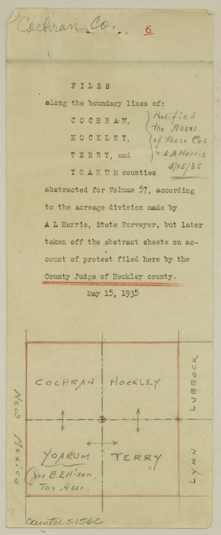
Cochran County Boundary File 6
Files along the boundary lines of: Cochran, Hockley, Terry, and Yoakum counties abstracted for Volume 57, according to the acreage division made by A. L. Harris, State Surveyor, but later taken off the abstract sheets on account of protest filed here by
-
Map/Doc
51562
-
Collection
General Map Collection
-
Counties
Cochran
-
Subjects
County Boundaries
-
Height x Width
10.4 x 4.3 inches
26.4 x 10.9 cm
Part of: General Map Collection
Flight Mission No. BRE-1P, Frame 29, Nueces County

Print $20.00
- Digital $50.00
Flight Mission No. BRE-1P, Frame 29, Nueces County
1956
Size 18.4 x 22.5 inches
Map/Doc 86625
Val Verde County Working Sketch 98

Print $20.00
- Digital $50.00
Val Verde County Working Sketch 98
1980
Size 26.5 x 31.8 inches
Map/Doc 72233
Fannin County Boundary File 4

Print $10.00
- Digital $50.00
Fannin County Boundary File 4
Size 8.5 x 8.6 inches
Map/Doc 53304
Map of Matagorda Bay & Vicinity in Matagorda & Calhoun Counties Showing Subdivision for Mineral Development

Print $40.00
- Digital $50.00
Map of Matagorda Bay & Vicinity in Matagorda & Calhoun Counties Showing Subdivision for Mineral Development
1939
Size 46.1 x 55.5 inches
Map/Doc 2927
Abandoned and Canceled Surveys - Volume 2 of 3, Counties E-K

Abandoned and Canceled Surveys - Volume 2 of 3, Counties E-K
Map/Doc 83249
Hood County Rolled Sketch 4

Print $20.00
- Digital $50.00
Hood County Rolled Sketch 4
Size 33.4 x 43.1 inches
Map/Doc 6220
Nacogdoches County Sketch File 5

Print $4.00
- Digital $50.00
Nacogdoches County Sketch File 5
1859
Size 12.6 x 8.1 inches
Map/Doc 32243
Midland County Working Sketch 20

Print $20.00
- Digital $50.00
Midland County Working Sketch 20
1953
Size 22.0 x 14.9 inches
Map/Doc 71001
Lubbock County Boundary File 3

Print $2.00
- Digital $50.00
Lubbock County Boundary File 3
Size 11.3 x 8.8 inches
Map/Doc 56490
Andrews County Rolled Sketch 46

Print $40.00
- Digital $50.00
Andrews County Rolled Sketch 46
2013
Size 52.0 x 36.0 inches
Map/Doc 93641
Right of Way and Track Map of The Missouri, Kansas & Texas Railway of Texas

Print $40.00
- Digital $50.00
Right of Way and Track Map of The Missouri, Kansas & Texas Railway of Texas
1918
Size 25.6 x 52.6 inches
Map/Doc 64525
Flight Mission No. DQN-5K, Frame 51, Calhoun County

Print $20.00
- Digital $50.00
Flight Mission No. DQN-5K, Frame 51, Calhoun County
1953
Size 18.6 x 22.2 inches
Map/Doc 84396
You may also like

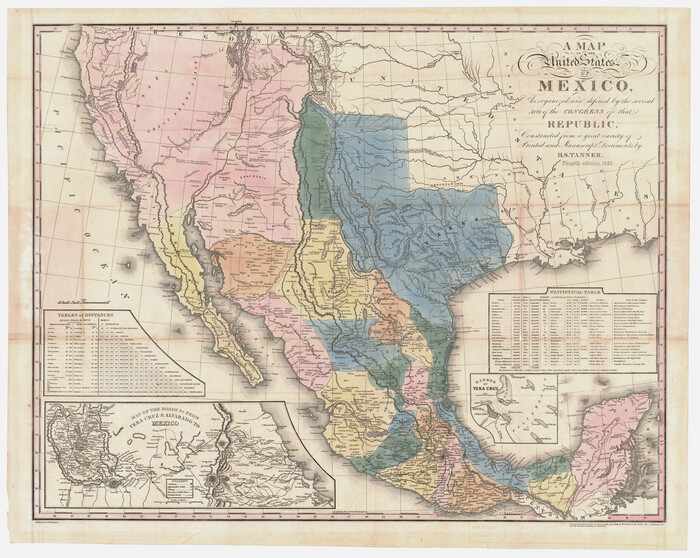
A Map of the United States of Mexico as organized and defined by the several Acts of the Congress of that Republic
Print $20.00
- Digital $50.00
A Map of the United States of Mexico as organized and defined by the several Acts of the Congress of that Republic
1847
Size 25.3 x 31.8 inches
Map/Doc 95913
[Sketch of PSL Blocks A21-A24, A33, A34, A36, A42, A43, A46]
![89741, [Sketch of PSL Blocks A21-A24, A33, A34, A36, A42, A43, A46], Twichell Survey Records](https://historictexasmaps.com/wmedia_w700/maps/89741-1.tif.jpg)
Print $40.00
- Digital $50.00
[Sketch of PSL Blocks A21-A24, A33, A34, A36, A42, A43, A46]
Size 23.1 x 63.1 inches
Map/Doc 89741
Flight Mission No. DAG-21K, Frame 30, Matagorda County

Print $20.00
- Digital $50.00
Flight Mission No. DAG-21K, Frame 30, Matagorda County
1952
Size 18.5 x 22.4 inches
Map/Doc 86397
Calhoun County Aerial Photograph Index Sheet 2

Print $20.00
- Digital $50.00
Calhoun County Aerial Photograph Index Sheet 2
1953
Size 24.1 x 19.8 inches
Map/Doc 83671
Gillespie County Boundary File 5

Print $10.00
- Digital $50.00
Gillespie County Boundary File 5
Size 14.2 x 9.0 inches
Map/Doc 53764
Dawson County Working Sketch 18

Print $40.00
- Digital $50.00
Dawson County Working Sketch 18
1963
Size 41.2 x 58.3 inches
Map/Doc 68562

Motley County Sketch File 1 (S)

Print $22.00
- Digital $50.00
Motley County Sketch File 1 (S)
1879
Size 9.0 x 14.3 inches
Map/Doc 32139
Hudspeth County Rolled Sketch 26

Print $20.00
- Digital $50.00
Hudspeth County Rolled Sketch 26
1909
Size 19.3 x 18.0 inches
Map/Doc 6247
Martin County Working Sketch 2

Print $20.00
- Digital $50.00
Martin County Working Sketch 2
1944
Size 27.5 x 20.9 inches
Map/Doc 70820
Map of the Southwest Railway System

Print $20.00
- Digital $50.00
Map of the Southwest Railway System
1883
Size 16.0 x 28.8 inches
Map/Doc 93287