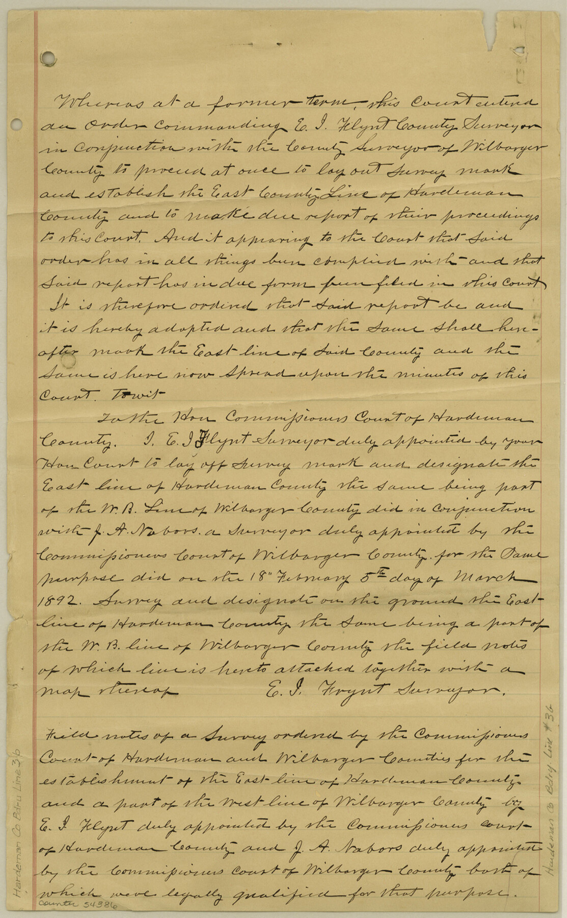
Hardeman County Boundary File 3b
[Plat of Boundary line between Childress and Hardeman Counties]
-
Map/Doc
54386
-
Collection
General Map Collection
-
Counties
Hardeman
-
Subjects
County Boundaries
-
Height x Width
14.1 x 8.7 inches
35.8 x 22.1 cm
Part of: General Map Collection
Hopkins County Sketch File 8

Print $6.00
- Digital $50.00
Hopkins County Sketch File 8
1856
Size 11.8 x 8.6 inches
Map/Doc 26695
Crane County Sketch File 28

Print $6.00
- Digital $50.00
Crane County Sketch File 28
1953
Size 11.5 x 9.1 inches
Map/Doc 19605
Starr County Working Sketch 3

Print $20.00
- Digital $50.00
Starr County Working Sketch 3
1920
Size 35.6 x 23.0 inches
Map/Doc 63919
Map of Tom Green County

Print $20.00
- Digital $50.00
Map of Tom Green County
1892
Size 42.9 x 46.2 inches
Map/Doc 78390
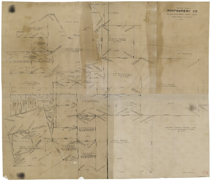
Montgomery County Working Sketch 5
Print $20.00
- Digital $50.00
Montgomery County Working Sketch 5
1932
Size 31.6 x 37.0 inches
Map/Doc 71111
[Galveston, Harrisburg & San Antonio Railroad from Cuero to Stockdale]
![64195, [Galveston, Harrisburg & San Antonio Railroad from Cuero to Stockdale], General Map Collection](https://historictexasmaps.com/wmedia_w700/maps/64195.tif.jpg)
Print $20.00
- Digital $50.00
[Galveston, Harrisburg & San Antonio Railroad from Cuero to Stockdale]
1907
Size 14.0 x 34.1 inches
Map/Doc 64195
Crockett County Sketch File 10

Print $20.00
- Digital $50.00
Crockett County Sketch File 10
Size 14.0 x 12.7 inches
Map/Doc 75924
Jefferson County Rolled Sketch 23

Print $20.00
- Digital $50.00
Jefferson County Rolled Sketch 23
1938
Size 45.9 x 33.3 inches
Map/Doc 9289
Red River County Working Sketch 46

Print $20.00
- Digital $50.00
Red River County Working Sketch 46
Size 34.3 x 38.9 inches
Map/Doc 72029
Duval County Rolled Sketch 48

Print $20.00
- Digital $50.00
Duval County Rolled Sketch 48
Size 21.8 x 18.5 inches
Map/Doc 5762
Dallas County Rolled Sketch 4

Print $20.00
- Digital $50.00
Dallas County Rolled Sketch 4
1954
Size 13.1 x 24.2 inches
Map/Doc 5687

You may also like
Lynn County Rolled Sketch WR

Print $20.00
- Digital $50.00
Lynn County Rolled Sketch WR
Size 14.7 x 23.8 inches
Map/Doc 6656
Eastland County Rolled Sketch 25

Print $20.00
- Digital $50.00
Eastland County Rolled Sketch 25
1990
Size 36.9 x 47.7 inches
Map/Doc 8831
Parker County Rolled Sketch 2

Print $20.00
- Digital $50.00
Parker County Rolled Sketch 2
Size 32.4 x 19.6 inches
Map/Doc 7203
Pecos County Sketch File 107

Print $4.00
- Digital $50.00
Pecos County Sketch File 107
Size 14.4 x 8.7 inches
Map/Doc 34035
History of Texas from its First Settlement in 1685 to its Annexation to the United States in 1846 (Vol. 2)

History of Texas from its First Settlement in 1685 to its Annexation to the United States in 1846 (Vol. 2)
1856
Map/Doc 97391
Williamson County

Print $40.00
- Digital $50.00
Williamson County
1888
Size 39.3 x 57.1 inches
Map/Doc 16929
Runnels County Working Sketch 15

Print $20.00
- Digital $50.00
Runnels County Working Sketch 15
1950
Size 22.8 x 18.5 inches
Map/Doc 63611
Proceedings of the International Boundary Commission, United States and Mexico, American Section, Elimination of Fifty-Seven Old Bancos Specifically Described in the Treaty of 1905

Proceedings of the International Boundary Commission, United States and Mexico, American Section, Elimination of Fifty-Seven Old Bancos Specifically Described in the Treaty of 1905
Size 12.2 x 9.3 inches
Map/Doc 83124
Origin of Exports and Destination of Imports at Galveston during 1921

Print $20.00
- Digital $50.00
Origin of Exports and Destination of Imports at Galveston during 1921
1921
Size 13.7 x 19.9 inches
Map/Doc 97168
Anderson County Working Sketch 7

Print $20.00
- Digital $50.00
Anderson County Working Sketch 7
1920
Size 27.3 x 30.2 inches
Map/Doc 67006
Parker County Sketch File 15

Print $4.00
- Digital $50.00
Parker County Sketch File 15
1861
Size 8.3 x 8.0 inches
Map/Doc 33548
[North Part of T. A. Thomson, Block T]
![91075, [North Part of T. A. Thomson, Block T], Twichell Survey Records](https://historictexasmaps.com/wmedia_w700/maps/91075-1.tif.jpg)
Print $20.00
- Digital $50.00
[North Part of T. A. Thomson, Block T]
Size 17.6 x 14.3 inches
Map/Doc 91075