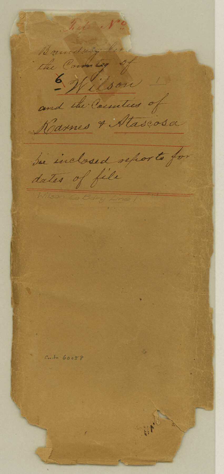
Wilson County Boundary File 1
Boundary line [words torn off] the County of Wilson and the Counties of Karnes & Atascosa
-
Map/Doc
60058
-
Collection
General Map Collection
-
Counties
Wilson
-
Subjects
County Boundaries
-
Height x Width
9.6 x 4.5 inches
24.4 x 11.4 cm
Part of: General Map Collection
Matagorda County Working Sketch 27

Print $20.00
- Digital $50.00
Matagorda County Working Sketch 27
1979
Size 19.0 x 14.3 inches
Map/Doc 70885
Foard County Working Sketch 10

Print $20.00
- Digital $50.00
Foard County Working Sketch 10
1977
Size 32.0 x 43.7 inches
Map/Doc 69201
Nacogdoches County Boundary File 1

Print $36.00
- Digital $50.00
Nacogdoches County Boundary File 1
Size 6.7 x 4.4 inches
Map/Doc 57562
Concho County Sketch File 8 1/2

Print $8.00
- Digital $50.00
Concho County Sketch File 8 1/2
1887
Size 8.4 x 10.6 inches
Map/Doc 19134
Right of Way and Track Map - Houston & Texas Central R.R. operated by the T. and N. O. R.R. Co. - Main Line

Print $40.00
- Digital $50.00
Right of Way and Track Map - Houston & Texas Central R.R. operated by the T. and N. O. R.R. Co. - Main Line
1918
Size 25.0 x 57.5 inches
Map/Doc 82857
Hopkins County Sketch File 15

Print $4.00
- Digital $50.00
Hopkins County Sketch File 15
Size 10.6 x 7.3 inches
Map/Doc 26711
Leon County Rolled Sketch 26A

Print $20.00
- Digital $50.00
Leon County Rolled Sketch 26A
1988
Size 21.5 x 34.4 inches
Map/Doc 6611
Cass County Working Sketch 29

Print $20.00
- Digital $50.00
Cass County Working Sketch 29
1979
Size 38.4 x 23.5 inches
Map/Doc 67932
Jefferson County Sketch File 41

Print $58.00
- Digital $50.00
Jefferson County Sketch File 41
1957
Size 14.2 x 8.7 inches
Map/Doc 28236
Webb County Working Sketch 32

Print $20.00
- Digital $50.00
Webb County Working Sketch 32
1937
Size 34.5 x 36.0 inches
Map/Doc 72397
Leon County Working Sketch 34

Print $20.00
- Digital $50.00
Leon County Working Sketch 34
1978
Size 45.1 x 41.9 inches
Map/Doc 70433
Stephens County Working Sketch 16

Print $20.00
- Digital $50.00
Stephens County Working Sketch 16
1968
Size 21.4 x 30.4 inches
Map/Doc 63959
You may also like
Hardin County Working Sketch 24

Print $20.00
- Digital $50.00
Hardin County Working Sketch 24
1950
Size 15.3 x 11.9 inches
Map/Doc 63422
Hutchinson County Working Sketch 37

Print $20.00
- Digital $50.00
Hutchinson County Working Sketch 37
1978
Size 27.5 x 23.0 inches
Map/Doc 66397
Garza County Rolled Sketch 3

Print $2.00
- Digital $50.00
Garza County Rolled Sketch 3
Size 10.0 x 8.1 inches
Map/Doc 75940
Ellis County Sketch File 14

Print $40.00
- Digital $50.00
Ellis County Sketch File 14
1861
Size 12.9 x 16.1 inches
Map/Doc 21854
Hill County Boundary File 1

Print $20.00
- Digital $50.00
Hill County Boundary File 1
Size 12.8 x 8.3 inches
Map/Doc 54722
Crockett County Sketch File 64

Print $20.00
- Digital $50.00
Crockett County Sketch File 64
1927
Size 17.0 x 21.3 inches
Map/Doc 11229
Ward County Working Sketch 50

Print $20.00
- Digital $50.00
Ward County Working Sketch 50
1976
Size 31.1 x 29.1 inches
Map/Doc 72356
Laneer vs. Bivins, Potter County, Texas

Print $20.00
- Digital $50.00
Laneer vs. Bivins, Potter County, Texas
Size 21.7 x 19.0 inches
Map/Doc 93103
Red River County Working Sketch 59

Print $20.00
- Digital $50.00
Red River County Working Sketch 59
1972
Size 31.1 x 47.2 inches
Map/Doc 72042
Lynn County Boundary File 6

Print $4.00
- Digital $50.00
Lynn County Boundary File 6
Size 10.9 x 8.8 inches
Map/Doc 56639
Working Sketch Cochran and Yoakum Co's.

Print $40.00
- Digital $50.00
Working Sketch Cochran and Yoakum Co's.
1919
Size 54.2 x 14.5 inches
Map/Doc 89678
General Highway Map, Young County, Texas

Print $20.00
General Highway Map, Young County, Texas
1961
Size 18.3 x 24.8 inches
Map/Doc 79720