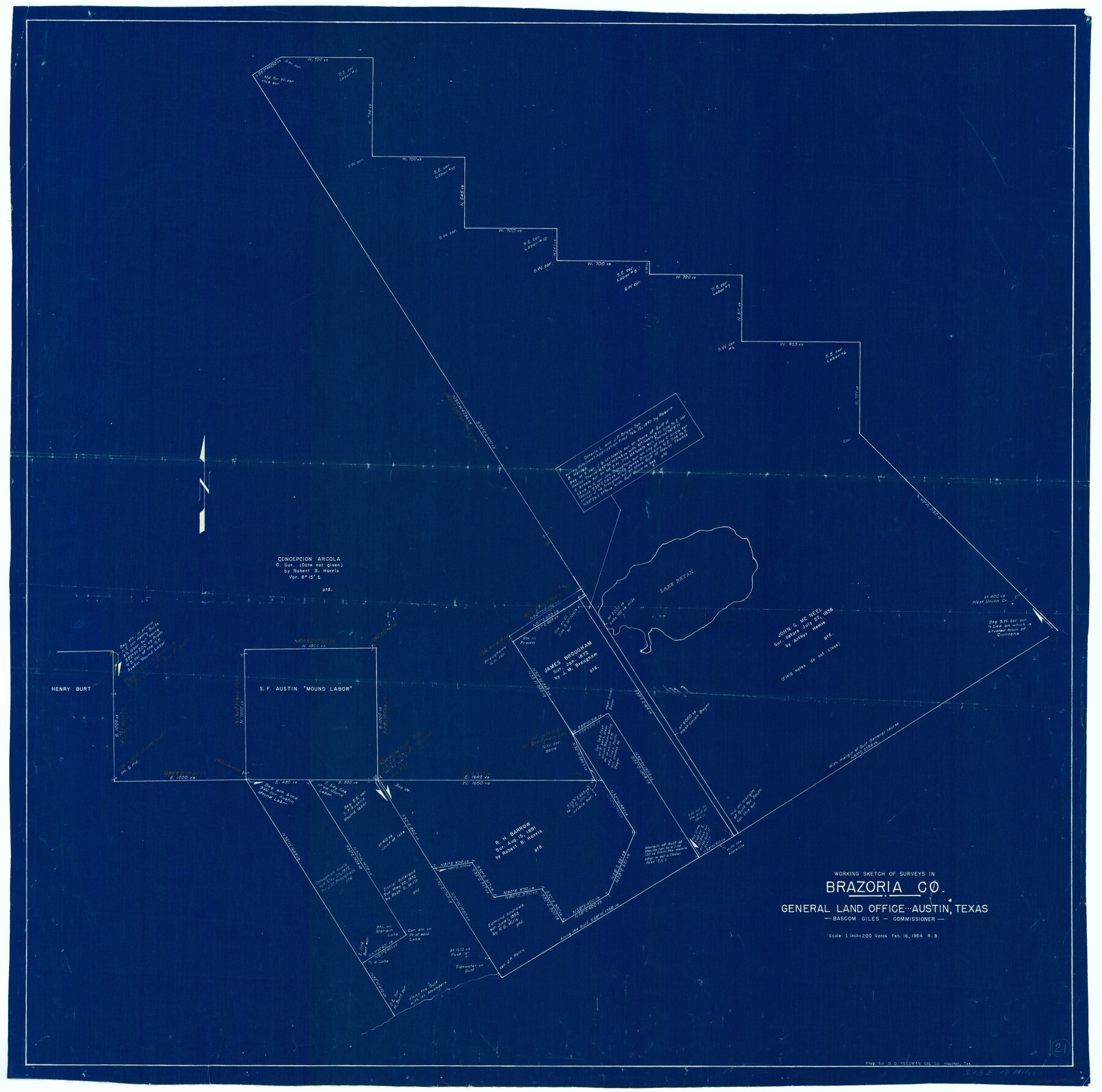
Brazoria County Working Sketch 21
-
Map/Doc
67506
-
Collection
General Map Collection
-
Object Dates
2/16/1954 (Creation Date)
-
People and Organizations
Roy Buckholts (Draftsman)
Bascom Giles (GLO Commissioner)
-
Counties
Brazoria
-
Subjects
Surveying Working Sketch
-
Height x Width
41.5 x 41.8 inches
105.4 x 106.2 cm
-
Scale
1" = 200 varas
-
Comments
Surveys located about 18 miles South 18 degrees East of Angleton, Texas.
Part of: General Map Collection
Edwards County Working Sketch 107

Print $40.00
- Digital $50.00
Edwards County Working Sketch 107
1972
Size 54.5 x 38.8 inches
Map/Doc 68983
Map of a part of the North Portion of Harris County

Print $40.00
- Digital $50.00
Map of a part of the North Portion of Harris County
Size 34.5 x 57.0 inches
Map/Doc 2049
Brewster County Sketch File A

Print $40.00
- Digital $50.00
Brewster County Sketch File A
1910
Size 18.6 x 19.9 inches
Map/Doc 10974
Sabine and Neches Rivers

Print $20.00
- Digital $50.00
Sabine and Neches Rivers
1973
Size 19.7 x 44.6 inches
Map/Doc 69818
Glasscock County Rolled Sketch 2

Print $20.00
- Digital $50.00
Glasscock County Rolled Sketch 2
1906
Size 19.6 x 14.8 inches
Map/Doc 6013
Flight Mission No. DAG-17K, Frame 63, Matagorda County

Print $20.00
- Digital $50.00
Flight Mission No. DAG-17K, Frame 63, Matagorda County
1952
Size 18.6 x 22.3 inches
Map/Doc 86325
Flight Mission No. CRK-8P, Frame 103, Refugio County

Print $20.00
- Digital $50.00
Flight Mission No. CRK-8P, Frame 103, Refugio County
1956
Size 18.4 x 22.1 inches
Map/Doc 86964
Harris County Sketch File 13

Print $40.00
- Digital $50.00
Harris County Sketch File 13
Size 14.4 x 12.2 inches
Map/Doc 25355
Nueces County NRC Article 33.136 Sketch 16

Print $68.00
- Digital $50.00
Nueces County NRC Article 33.136 Sketch 16
2012
Size 22.0 x 17.0 inches
Map/Doc 94804
Real County Rolled Sketch 20

Print $20.00
- Digital $50.00
Real County Rolled Sketch 20
2004
Size 24.6 x 35.8 inches
Map/Doc 82573
Stonewall County Working Sketch 12

Print $20.00
- Digital $50.00
Stonewall County Working Sketch 12
1950
Size 27.9 x 27.9 inches
Map/Doc 62319
Burleson County Working Sketch 45

Print $20.00
- Digital $50.00
Burleson County Working Sketch 45
1993
Size 20.3 x 23.0 inches
Map/Doc 67764
You may also like
Coast Chart No. 212 - From Latitude 26° 33' to the Rio Grande, Texas

Print $20.00
- Digital $50.00
Coast Chart No. 212 - From Latitude 26° 33' to the Rio Grande, Texas
1886
Size 30.5 x 24.1 inches
Map/Doc 73504
Jasper County Working Sketch 27

Print $20.00
- Digital $50.00
Jasper County Working Sketch 27
1954
Size 38.3 x 19.4 inches
Map/Doc 66489
Guadalupe County Working Sketch 3

Print $20.00
- Digital $50.00
Guadalupe County Working Sketch 3
1980
Size 17.1 x 16.5 inches
Map/Doc 63312
Texas Gulf Coast from Sabine River to Rio Grande As Subdivided for Mineral Development - Obsolete

Print $40.00
- Digital $50.00
Texas Gulf Coast from Sabine River to Rio Grande As Subdivided for Mineral Development - Obsolete
1948
Size 42.0 x 70.8 inches
Map/Doc 2946
San Patricio County Sketch File 32

Print $20.00
- Digital $50.00
San Patricio County Sketch File 32
Size 13.7 x 30.3 inches
Map/Doc 12287
Lampasas County Boundary File 16

Print $14.00
- Digital $50.00
Lampasas County Boundary File 16
Size 8.9 x 8.2 inches
Map/Doc 56216
Parker County Sketch File 40

Print $4.00
- Digital $50.00
Parker County Sketch File 40
Size 8.1 x 12.7 inches
Map/Doc 33585
Tarrant County Sketch File 3

Print $4.00
- Digital $50.00
Tarrant County Sketch File 3
Size 11.8 x 8.2 inches
Map/Doc 37676
Map of Chicago, Rock Island & Texas Railway through Wise and Tarrant County, Texas

Print $40.00
- Digital $50.00
Map of Chicago, Rock Island & Texas Railway through Wise and Tarrant County, Texas
1893
Size 19.4 x 121.0 inches
Map/Doc 64428
Map of the State of Coahuila and Texas

Print $20.00
Map of the State of Coahuila and Texas
1833
Size 16.1 x 20.2 inches
Map/Doc 76246
Falls County Sketch File 32

Print $20.00
- Digital $50.00
Falls County Sketch File 32
Size 36.3 x 24.7 inches
Map/Doc 11468
Flight Mission No. DQN-7K, Frame 4, Calhoun County

Print $20.00
- Digital $50.00
Flight Mission No. DQN-7K, Frame 4, Calhoun County
1953
Size 18.9 x 22.1 inches
Map/Doc 84455