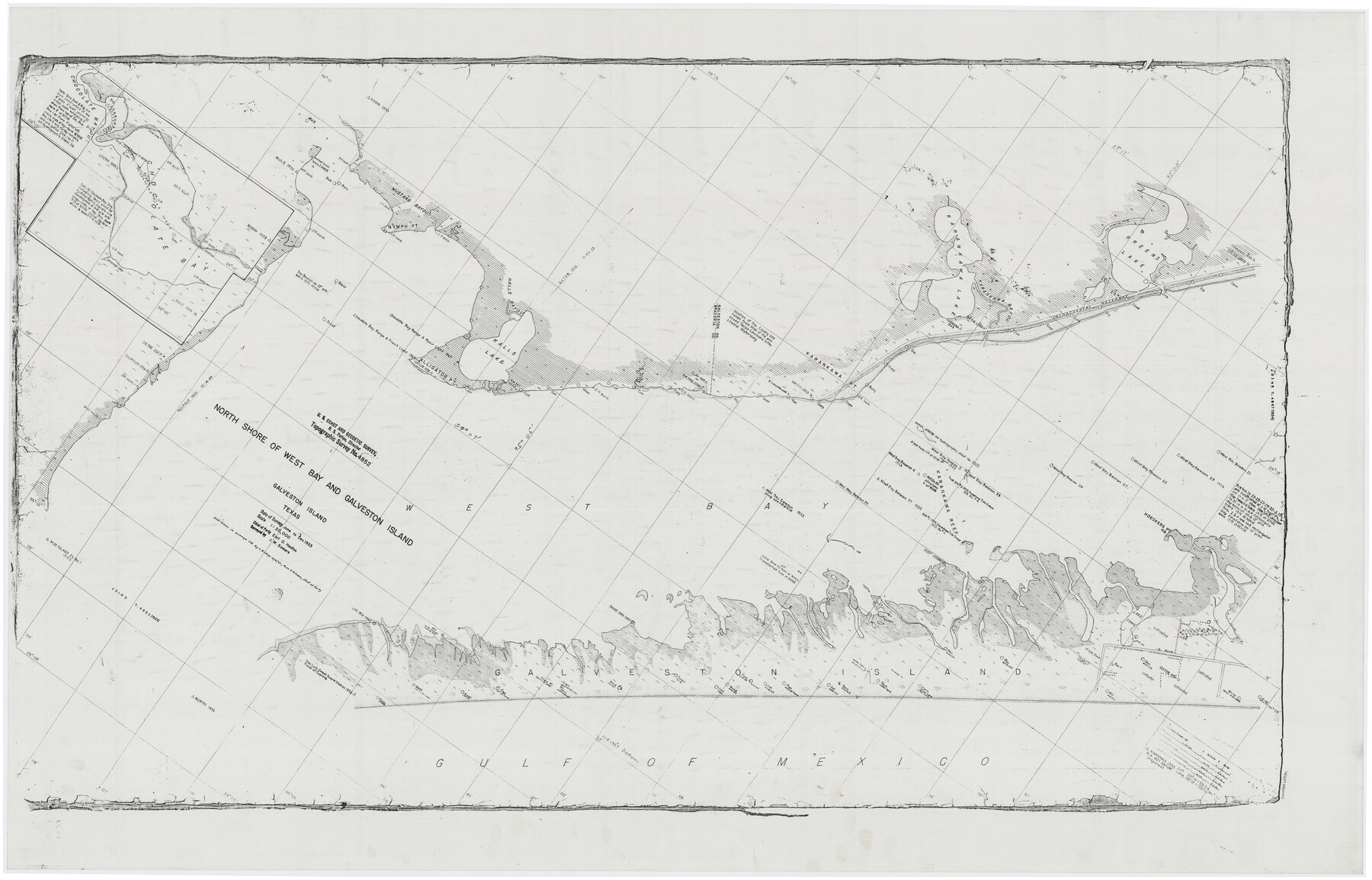
North Shore of West Bay and Galveston Island
-
Map/Doc
69930
-
Collection
General Map Collection
-
Object Dates
12/1933 (Creation Date)
-
Counties
Galveston Brazoria
-
Subjects
Energy Offshore Submerged Area
-
Height x Width
37.4 x 57.7 inches
95.0 x 146.6 cm
Part of: General Map Collection
Wharton County Sketch File 9

Print $4.00
- Digital $50.00
Wharton County Sketch File 9
1884
Size 9.1 x 11.7 inches
Map/Doc 39929
Lynn County Sketch File A2

Print $6.00
- Digital $50.00
Lynn County Sketch File A2
1903
Size 12.7 x 8.0 inches
Map/Doc 30470
Freestone County Sketch File 1

Print $7.00
- Digital $50.00
Freestone County Sketch File 1
1857
Size 10.6 x 8.6 inches
Map/Doc 23034
Henderson County Working Sketch 10

Print $20.00
- Digital $50.00
Henderson County Working Sketch 10
1925
Size 29.7 x 18.8 inches
Map/Doc 66143

Brewster County Rolled Sketch 22A

Print $20.00
- Digital $50.00
Brewster County Rolled Sketch 22A
1910
Size 33.0 x 24.8 inches
Map/Doc 5202
Presidio County Working Sketch 66
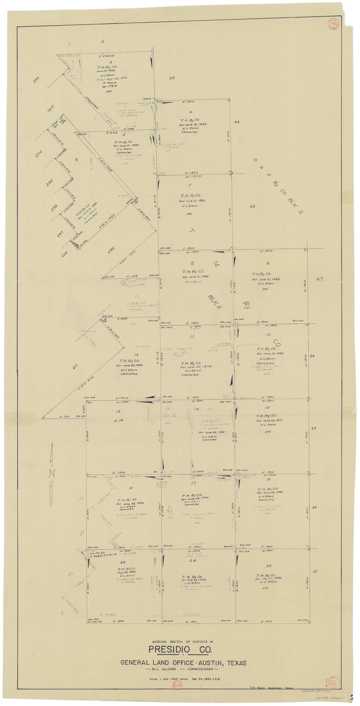
Print $20.00
- Digital $50.00
Presidio County Working Sketch 66
1960
Size 44.9 x 22.8 inches
Map/Doc 71743
Liberty County Rolled Sketch OB-1

Print $40.00
- Digital $50.00
Liberty County Rolled Sketch OB-1
1934
Size 70.7 x 25.1 inches
Map/Doc 9564
Crockett County Working Sketch Graphic Index - northwest part - sheet B

Print $20.00
- Digital $50.00
Crockett County Working Sketch Graphic Index - northwest part - sheet B
1983
Size 36.2 x 47.7 inches
Map/Doc 76510
Travis County Rolled Sketch 61

Print $20.00
- Digital $50.00
Travis County Rolled Sketch 61
2023
Size 36.0 x 24.0 inches
Map/Doc 97184

Sabine Bank to East Bay including Heald Bank

Print $20.00
- Digital $50.00
Sabine Bank to East Bay including Heald Bank
1925
Size 44.2 x 34.8 inches
Map/Doc 69844
You may also like
Mills County Sketch File 1A

Print $20.00
- Digital $50.00
Mills County Sketch File 1A
1852
Size 33.6 x 20.1 inches
Map/Doc 12092
Runnels County Rolled Sketch 30

Print $20.00
- Digital $50.00
Runnels County Rolled Sketch 30
Size 26.8 x 30.6 inches
Map/Doc 7518
Angelina County Working Sketch 28

Print $20.00
- Digital $50.00
Angelina County Working Sketch 28
1954
Size 28.9 x 26.0 inches
Map/Doc 67110

Map of Bee County

Print $20.00
- Digital $50.00
Map of Bee County
1879
Size 25.3 x 22.8 inches
Map/Doc 3288
Bowie County Sketch File 6d

Print $4.00
- Digital $50.00
Bowie County Sketch File 6d
1927
Size 11.4 x 9.0 inches
Map/Doc 14850
Reagan County Working Sketch 8

Print $20.00
- Digital $50.00
Reagan County Working Sketch 8
1939
Size 37.8 x 23.3 inches
Map/Doc 71848
Flight Mission No. BRA-8M, Frame 73, Jefferson County

Print $20.00
- Digital $50.00
Flight Mission No. BRA-8M, Frame 73, Jefferson County
1953
Size 18.7 x 22.3 inches
Map/Doc 85593
Map illustrating the general geological features of the country west of the Mississippi River compiled from the surveys of W.H. Emory and from the Pacific Railroad surveys & other sources

Print $20.00
- Digital $50.00
Map illustrating the general geological features of the country west of the Mississippi River compiled from the surveys of W.H. Emory and from the Pacific Railroad surveys & other sources
1857
Size 21.2 x 24.7 inches
Map/Doc 95172
Maps of Gulf Intracoastal Waterway, Texas - Sabine River to the Rio Grande and connecting waterways including ship channels

Print $20.00
- Digital $50.00
Maps of Gulf Intracoastal Waterway, Texas - Sabine River to the Rio Grande and connecting waterways including ship channels
1966
Size 14.5 x 22.3 inches
Map/Doc 61977
Flight Mission No. CRC-4R, Frame 182, Chambers County

Print $20.00
- Digital $50.00
Flight Mission No. CRC-4R, Frame 182, Chambers County
1956
Size 18.5 x 22.1 inches
Map/Doc 84933
McMullen County Sketch File 8

Print $4.00
- Digital $50.00
McMullen County Sketch File 8
1876
Size 8.6 x 8.8 inches
Map/Doc 31349