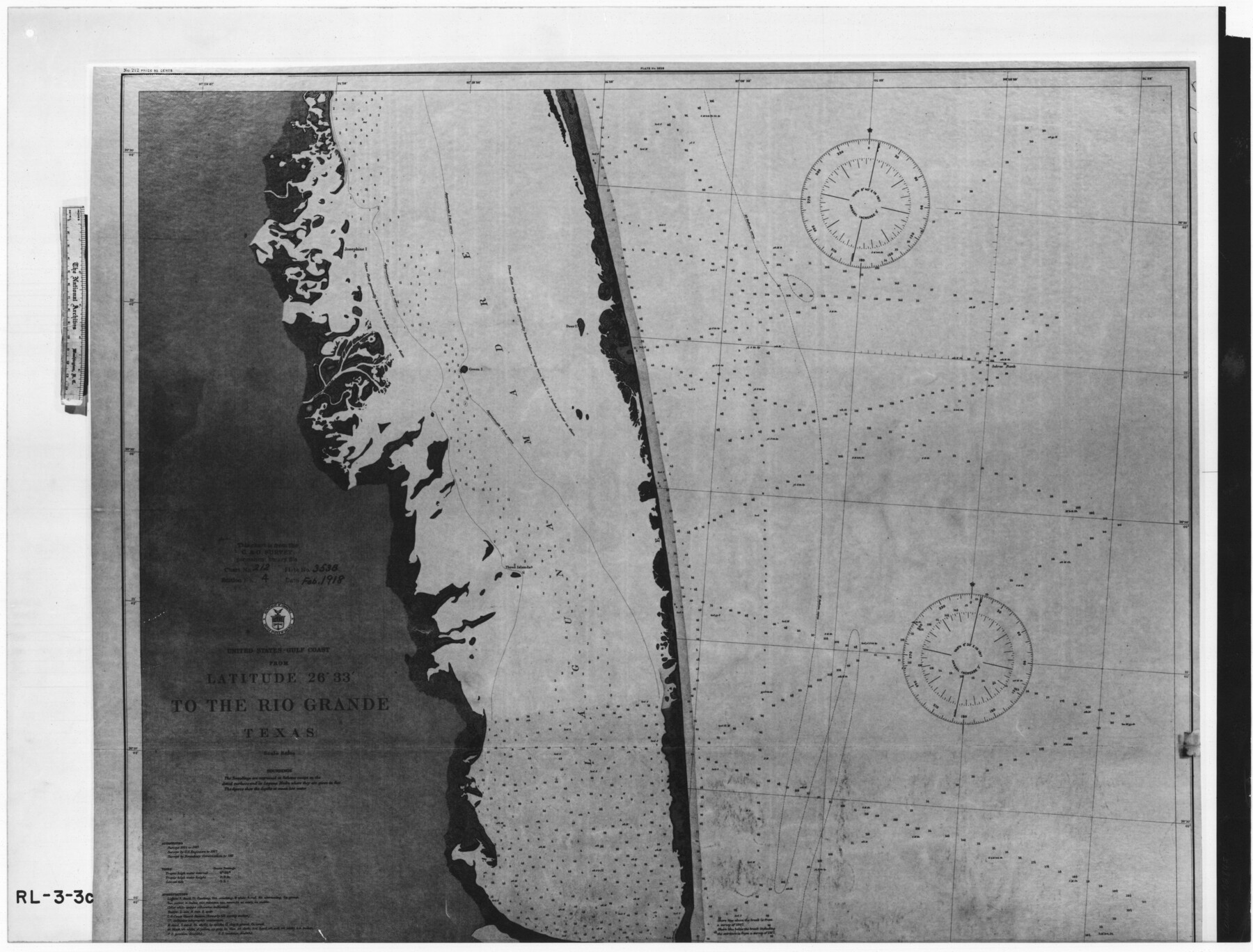
United States - Gulf Coast - From Latitude 26° 33' to the Rio Grande Texas
RL-3-3c
-
Map/Doc
72845
-
Collection
General Map Collection
-
Object Dates
1918 (Creation Date)
-
People and Organizations
U. S. Coastal and Geodetic Survey (Publisher)
-
Subjects
Nautical Charts
-
Height x Width
18.3 x 24.1 inches
46.5 x 61.2 cm
-
Comments
B/W photostat copy from National Archives in multiple pieces.
Part of: General Map Collection
Val Verde County Sketch File AA3

Print $20.00
- Digital $50.00
Val Verde County Sketch File AA3
1924
Size 19.5 x 20.6 inches
Map/Doc 12540
Kendall County Sketch File 13

Print $4.00
- Digital $50.00
Kendall County Sketch File 13
1860
Size 10.1 x 8.0 inches
Map/Doc 28699
San Augustine and Sabine Counties

Print $20.00
- Digital $50.00
San Augustine and Sabine Counties
1881
Size 23.7 x 26.3 inches
Map/Doc 4012
Flight Mission No. BRA-16M, Frame 72, Jefferson County

Print $20.00
- Digital $50.00
Flight Mission No. BRA-16M, Frame 72, Jefferson County
1953
Size 18.5 x 22.4 inches
Map/Doc 85689
Padre Island National Seashore

Print $4.00
- Digital $50.00
Padre Island National Seashore
Size 16.0 x 21.8 inches
Map/Doc 60527
Flight Mission No. DCL-7C, Frame 52, Kenedy County

Print $20.00
- Digital $50.00
Flight Mission No. DCL-7C, Frame 52, Kenedy County
1943
Size 16.7 x 16.4 inches
Map/Doc 86040
Moore County Sketch File 7

Print $20.00
- Digital $50.00
Moore County Sketch File 7
Size 24.6 x 45.8 inches
Map/Doc 10553
Kimble County Working Sketch 23

Print $20.00
- Digital $50.00
Kimble County Working Sketch 23
1930
Size 21.6 x 18.2 inches
Map/Doc 70091
Map of Hamilton County

Print $20.00
- Digital $50.00
Map of Hamilton County
1872
Size 14.6 x 21.7 inches
Map/Doc 3620
Intracoastal Waterway, Houma, LA to Corpus Christi, TX

Print $5.00
- Digital $50.00
Intracoastal Waterway, Houma, LA to Corpus Christi, TX
Size 30.0 x 22.0 inches
Map/Doc 61911

Shelby County Rolled Sketch 16

Print $20.00
- Digital $50.00
Shelby County Rolled Sketch 16
1935
Size 33.0 x 43.8 inches
Map/Doc 9925
You may also like
Current Miscellaneous File 27

Print $4.00
- Digital $50.00
Current Miscellaneous File 27
1952
Size 10.8 x 8.3 inches
Map/Doc 73909
2016 Official Travel Map, Texas

2016 Official Travel Map, Texas
Size 33.3 x 36.2 inches
Map/Doc 94298
Lee County Working Sketch 5

Print $20.00
- Digital $50.00
Lee County Working Sketch 5
1975
Size 38.5 x 36.2 inches
Map/Doc 70384
General Highway Map, Shelby County, Texas

Print $20.00
General Highway Map, Shelby County, Texas
1940
Size 18.3 x 24.8 inches
Map/Doc 79242
Brewster County Rolled Sketch 50

Print $20.00
- Digital $50.00
Brewster County Rolled Sketch 50
1932
Size 21.0 x 26.6 inches
Map/Doc 5226
[Cemetary, Unknown Location]
![75552, [Cemetary, Unknown Location], Maddox Collection](https://historictexasmaps.com/wmedia_w700/maps/75552.tif.jpg)
Print $20.00
- Digital $50.00
[Cemetary, Unknown Location]
Size 30.6 x 14.9 inches
Map/Doc 75552
Castro County Sketch File 4f

Print $4.00
- Digital $50.00
Castro County Sketch File 4f
Size 13.8 x 8.9 inches
Map/Doc 17475

Hale County Rolled Sketch 8

Print $20.00
- Digital $50.00
Hale County Rolled Sketch 8
1910
Size 38.0 x 25.9 inches
Map/Doc 6046

Marion County Working Sketch 30

Print $20.00
- Digital $50.00
Marion County Working Sketch 30
1979
Size 31.7 x 38.3 inches
Map/Doc 70806
Map of that part of the boundary between the Republic of Texas and the United States, comprised between Logan's Ferry on the Sabine River and the 36th Mile Mound on the Meridian Line (Sheet No. 1)
![4671, Map of that part of the boundary between the Republic of Texas and the United States, comprised between Logan's Ferry on the Sabine River and the [3]6th Mile Mound on the [Meridian Line] (Sheet No. 1), General Map Collection](https://historictexasmaps.com/wmedia_w700/maps/4671-GC.tif.jpg)
Print $20.00
- Digital $50.00
Map of that part of the boundary between the Republic of Texas and the United States, comprised between Logan's Ferry on the Sabine River and the 36th Mile Mound on the Meridian Line (Sheet No. 1)
1842
Size 34.6 x 26.4 inches
Map/Doc 4671