![72971, [Aransas Bay], General Map Collection](https://historictexasmaps.com/wmedia_w1800h1800/maps/72971.tif.jpg)
[Aransas Bay]
RL-4-5d
-
Map/Doc
72971
-
Collection
General Map Collection
-
Object Dates
1846/3/10 (Creation Date)
-
People and Organizations
Board of Engineers (Publisher)
-
Subjects
Gulf of Mexico
-
Height x Width
18.2 x 24.7 inches
46.2 x 62.7 cm
-
Comments
B/W photostat copy from National Archives in multiple pieces.
Part of: General Map Collection
Clay County Working Sketch 14

Print $20.00
- Digital $50.00
Clay County Working Sketch 14
1984
Size 46.9 x 34.5 inches
Map/Doc 68037
Lamb County Sketch File 11

Print $6.00
- Digital $50.00
Lamb County Sketch File 11
1913
Size 11.5 x 8.8 inches
Map/Doc 29360
Pecos County Rolled Sketch 44A

Print $20.00
- Digital $50.00
Pecos County Rolled Sketch 44A
1912
Size 19.7 x 34.6 inches
Map/Doc 7223
Hall County Rolled Sketch 8

Print $20.00
- Digital $50.00
Hall County Rolled Sketch 8
1942
Size 24.7 x 41.6 inches
Map/Doc 6052
Comanche County Sketch File 7

Print $6.00
- Digital $50.00
Comanche County Sketch File 7
1852
Size 9.9 x 8.1 inches
Map/Doc 19063
Hansford County Rolled Sketch 1

Print $20.00
- Digital $50.00
Hansford County Rolled Sketch 1
1979
Size 22.3 x 17.6 inches
Map/Doc 6064
Flight Mission No. CLL-1N, Frame 19, Willacy County

Print $20.00
- Digital $50.00
Flight Mission No. CLL-1N, Frame 19, Willacy County
1954
Size 18.3 x 22.1 inches
Map/Doc 87006
Calcasieu Pass to Sabine Pass

Print $20.00
- Digital $50.00
Calcasieu Pass to Sabine Pass
1961
Size 44.6 x 35.7 inches
Map/Doc 69809
DeWitt County Working Sketch 9

Print $20.00
- Digital $50.00
DeWitt County Working Sketch 9
1979
Size 15.7 x 23.4 inches
Map/Doc 68599
Rusk County Working Sketch 37c

Print $20.00
- Digital $50.00
Rusk County Working Sketch 37c
2007
Size 21.2 x 36.0 inches
Map/Doc 87498
Upton County Working Sketch 22

Print $40.00
- Digital $50.00
Upton County Working Sketch 22
1951
Size 37.5 x 48.7 inches
Map/Doc 69518
Kimble County Working Sketch 35

Print $20.00
- Digital $50.00
Kimble County Working Sketch 35
1946
Size 24.7 x 32.0 inches
Map/Doc 70103
You may also like
Plan of Brooklyn

Print $20.00
- Digital $50.00
Plan of Brooklyn
1909
Size 42.7 x 31.5 inches
Map/Doc 2192
Kaufman County Sketch File 16

Print $4.00
- Digital $50.00
Kaufman County Sketch File 16
Size 10.1 x 8.1 inches
Map/Doc 28655
Trinity County Working Sketch 10

Print $20.00
- Digital $50.00
Trinity County Working Sketch 10
1948
Size 25.7 x 24.6 inches
Map/Doc 69459
Travis County State Real Property Sketch 9

Print $20.00
- Digital $50.00
Travis County State Real Property Sketch 9
2002
Size 30.6 x 42.5 inches
Map/Doc 82560
[Block V and surrounding surveys]
![90293, [Block V and surrounding surveys], Twichell Survey Records](https://historictexasmaps.com/wmedia_w700/maps/90293-1.tif.jpg)
Print $20.00
- Digital $50.00
[Block V and surrounding surveys]
Size 12.0 x 12.6 inches
Map/Doc 90293
Flight Mission No. CRC-5R, Frame 37, Chambers County

Print $20.00
- Digital $50.00
Flight Mission No. CRC-5R, Frame 37, Chambers County
1956
Size 18.6 x 22.4 inches
Map/Doc 84956
Medina County Working Sketch Graphic Index

Print $40.00
- Digital $50.00
Medina County Working Sketch Graphic Index
1976
Size 52.8 x 42.8 inches
Map/Doc 76639
Padre Island National Seashore, Texas - Dependent Resurvey

Print $4.00
- Digital $50.00
Padre Island National Seashore, Texas - Dependent Resurvey
2001
Size 18.3 x 24.4 inches
Map/Doc 60545
Real County Sketch File 12

Print $20.00
- Digital $50.00
Real County Sketch File 12
1932
Size 13.9 x 19.2 inches
Map/Doc 12231
Dawson County Rolled Sketch 7
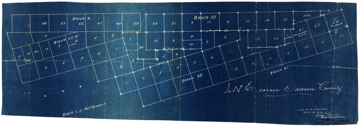
Print $20.00
- Digital $50.00
Dawson County Rolled Sketch 7
Size 14.1 x 38.1 inches
Map/Doc 5693
Culberson County Working Sketch 22

Print $20.00
- Digital $50.00
Culberson County Working Sketch 22
1938
Size 23.0 x 18.7 inches
Map/Doc 68474
Val Verde County Working Sketch 53

Print $20.00
- Digital $50.00
Val Verde County Working Sketch 53
1956
Size 42.8 x 47.7 inches
Map/Doc 72188