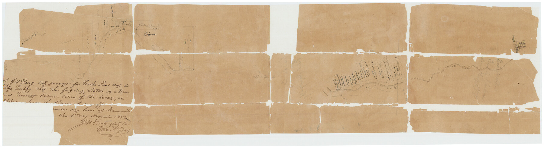
Wichita County Sketch File 4
[Sketch of surveys along the Red River from the Big Wichita River to the Pease River]
-
Map/Doc
76764
-
Collection
General Map Collection
-
Object Dates
11/1/1856 (Creation Date)
1/30/1857 (File Date)
-
People and Organizations
J.M. Peery (Surveyor/Engineer)
-
Counties
Wilbarger Clay Wichita
-
Subjects
Surveying Sketch File
-
Height x Width
9.8 x 33.2 inches
24.9 x 84.3 cm
-
Medium
paper, manuscript
Part of: General Map Collection
Flight Mission No. DCL-6C, Frame 176, Kenedy County

Print $20.00
- Digital $50.00
Flight Mission No. DCL-6C, Frame 176, Kenedy County
1943
Size 18.6 x 22.2 inches
Map/Doc 85988
Wilson County Rolled Sketch 2

Print $20.00
- Digital $50.00
Wilson County Rolled Sketch 2
1941
Size 30.4 x 26.1 inches
Map/Doc 8368
Hopkins County Sketch File 28

Print $20.00
- Digital $50.00
Hopkins County Sketch File 28
Size 24.8 x 34.0 inches
Map/Doc 11786
Chambers County Working Sketch 12

Print $20.00
- Digital $50.00
Chambers County Working Sketch 12
1954
Size 35.2 x 33.8 inches
Map/Doc 67995
Flight Mission No. CRK-3P, Frame 177, Refugio County

Print $20.00
- Digital $50.00
Flight Mission No. CRK-3P, Frame 177, Refugio County
1956
Size 18.6 x 22.4 inches
Map/Doc 86924
Val Verde County Working Sketch 9

Print $20.00
- Digital $50.00
Val Verde County Working Sketch 9
1917
Size 19.4 x 30.9 inches
Map/Doc 72144
Map of north end of Brazos Island

Print $20.00
- Digital $50.00
Map of north end of Brazos Island
Size 27.6 x 18.2 inches
Map/Doc 72908
[Sketch for Mineral Application 1112 - Colorado River, H. E. Chambers]
![65642, [Sketch for Mineral Application 1112 - Colorado River, H. E. Chambers], General Map Collection](https://historictexasmaps.com/wmedia_w700/maps/65642.tif.jpg)
Print $20.00
- Digital $50.00
[Sketch for Mineral Application 1112 - Colorado River, H. E. Chambers]
1918
Size 17.1 x 28.4 inches
Map/Doc 65642
Denton County Sketch File 25

Print $4.00
- Digital $50.00
Denton County Sketch File 25
1863
Size 8.0 x 7.4 inches
Map/Doc 20752
Crockett County Sketch File 88

Print $3.00
- Digital $50.00
Crockett County Sketch File 88
1958
Size 19.3 x 15.8 inches
Map/Doc 11237
Montgomery County Sketch File 37

Print $6.00
- Digital $50.00
Montgomery County Sketch File 37
Size 12.6 x 8.2 inches
Map/Doc 31916
Burnet County Working Sketch 4

Print $20.00
- Digital $50.00
Burnet County Working Sketch 4
1956
Size 18.3 x 33.1 inches
Map/Doc 67847
You may also like
Coke County Working Sketch 23

Print $20.00
- Digital $50.00
Coke County Working Sketch 23
1954
Size 42.4 x 35.7 inches
Map/Doc 68060
Duval County Rolled Sketch 20

Print $20.00
- Digital $50.00
Duval County Rolled Sketch 20
Size 33.2 x 42.0 inches
Map/Doc 8811
Morris County Boundary File 2

Print $6.00
- Digital $50.00
Morris County Boundary File 2
Size 14.1 x 8.7 inches
Map/Doc 57482
Nueces County Rolled Sketch 60

Print $40.00
- Digital $50.00
Nueces County Rolled Sketch 60
Size 95.5 x 32.3 inches
Map/Doc 9607
Kendall County Working Sketch 25

Print $40.00
- Digital $50.00
Kendall County Working Sketch 25
1978
Size 39.4 x 56.8 inches
Map/Doc 66697
Reagan County Sketch File 16

Print $8.00
- Digital $50.00
Reagan County Sketch File 16
1932
Size 11.1 x 7.7 inches
Map/Doc 35002
Liberty County Working Sketch 83

Print $40.00
- Digital $50.00
Liberty County Working Sketch 83
1981
Size 68.4 x 37.8 inches
Map/Doc 70543
Freestone County Sketch File 4

Print $6.00
- Digital $50.00
Freestone County Sketch File 4
1848
Size 10.8 x 8.2 inches
Map/Doc 23044
Armstrong County Sketch File A-10

Print $40.00
- Digital $50.00
Armstrong County Sketch File A-10
Size 22.6 x 35.6 inches
Map/Doc 10852
Freestone County Working Sketch 17

Print $20.00
- Digital $50.00
Freestone County Working Sketch 17
1980
Size 44.8 x 31.0 inches
Map/Doc 69259
Howard County Boundary File 2a

Print $9.00
- Digital $50.00
Howard County Boundary File 2a
Size 14.6 x 11.3 inches
Map/Doc 55118
[John Walker and vicinity]
![90914, [John Walker and vicinity], Twichell Survey Records](https://historictexasmaps.com/wmedia_w700/maps/90914-1.tif.jpg)
Print $20.00
- Digital $50.00
[John Walker and vicinity]
Size 27.0 x 27.3 inches
Map/Doc 90914