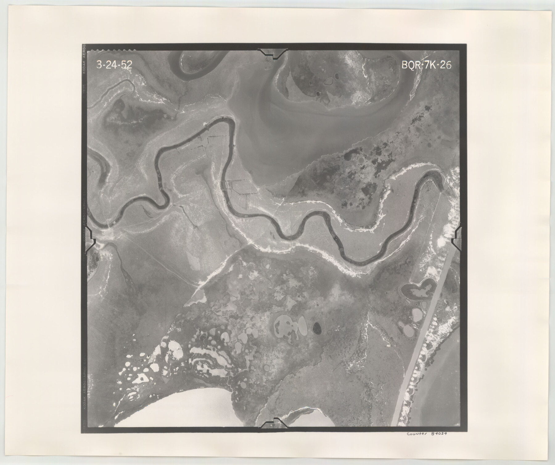
Flight Mission No. BQR-7K, Frame 26, Brazoria County
BQR-7K-26
-
Map/Doc
84024
-
Collection
General Map Collection
-
Object Dates
1952/3/24 (Creation Date)
-
People and Organizations
U. S. Department of Agriculture (Publisher)
-
Counties
Brazoria
-
Subjects
Aerial Photograph
-
Height x Width
18.7 x 22.3 inches
47.5 x 56.6 cm
-
Comments
Flown by Aero Exploration Company of Tulsa, Oklahoma.
Part of: General Map Collection
Flight Mission No. DIX-8P, Frame 90, Aransas County

Print $20.00
- Digital $50.00
Flight Mission No. DIX-8P, Frame 90, Aransas County
1956
Size 18.6 x 22.4 inches
Map/Doc 83915
Sutton County Sketch File 42

Print $6.00
- Digital $50.00
Sutton County Sketch File 42
1940
Size 11.2 x 8.8 inches
Map/Doc 37509
[Gulf, Colorado & Santa Fe Railway Company]
![64411, [Gulf, Colorado & Santa Fe Railway Company], General Map Collection](https://historictexasmaps.com/wmedia_w700/maps/64411.tif.jpg)
Print $20.00
- Digital $50.00
[Gulf, Colorado & Santa Fe Railway Company]
1893
Size 20.1 x 41.5 inches
Map/Doc 64411
Marion County

Print $20.00
- Digital $50.00
Marion County
1943
Size 30.3 x 47.9 inches
Map/Doc 95579
Erath County Sketch File 2

Print $20.00
- Digital $50.00
Erath County Sketch File 2
Size 13.2 x 15.5 inches
Map/Doc 11463
Floyd County Sketch File 10

Print $12.00
- Digital $50.00
Floyd County Sketch File 10
1912
Size 11.6 x 8.9 inches
Map/Doc 22701
Flight Mission No. DCL-6C, Frame 116, Kenedy County

Print $20.00
- Digital $50.00
Flight Mission No. DCL-6C, Frame 116, Kenedy County
1943
Size 18.6 x 22.2 inches
Map/Doc 85946
Anderson County

Print $40.00
- Digital $50.00
Anderson County
1942
Size 52.9 x 47.9 inches
Map/Doc 66702
Map Showing Part of the Blue Ridge Farm of the Texas Prison System, Fort Bend County, Texas

Print $20.00
- Digital $50.00
Map Showing Part of the Blue Ridge Farm of the Texas Prison System, Fort Bend County, Texas
Size 22.2 x 36.2 inches
Map/Doc 62979
Kendall County Working Sketch 12

Print $20.00
- Digital $50.00
Kendall County Working Sketch 12
1966
Size 27.2 x 33.2 inches
Map/Doc 66684
Fannin County Sketch File 17

Print $22.00
- Digital $50.00
Fannin County Sketch File 17
1874
Size 8.0 x 12.9 inches
Map/Doc 22471
Mills County Sketch File 14a

Print $4.00
- Digital $50.00
Mills County Sketch File 14a
Size 13.0 x 8.2 inches
Map/Doc 31663
You may also like
Armstrong County Boundary File 3

Print $14.00
- Digital $50.00
Armstrong County Boundary File 3
Size 11.3 x 8.8 inches
Map/Doc 50141
[Map of North Carolina and South Carolina]
![96621, [Map of North Carolina and South Carolina], Cobb Digital Map Collection](https://historictexasmaps.com/wmedia_w700/maps/96621.tif.jpg)
Print $20.00
- Digital $50.00
[Map of North Carolina and South Carolina]
1869
Size 8.9 x 9.2 inches
Map/Doc 96621
Flight Mission No. DAH-17M, Frame 30, Orange County

Print $20.00
- Digital $50.00
Flight Mission No. DAH-17M, Frame 30, Orange County
1953
Size 18.7 x 22.5 inches
Map/Doc 86893
Kerr County Working Sketch 15

Print $20.00
- Digital $50.00
Kerr County Working Sketch 15
1953
Size 36.2 x 38.6 inches
Map/Doc 70046
San Saba County Working Sketch 8

Print $20.00
- Digital $50.00
San Saba County Working Sketch 8
1979
Size 13.3 x 17.2 inches
Map/Doc 63796
Jefferson County Working Sketch 11

Print $20.00
- Digital $50.00
Jefferson County Working Sketch 11
1943
Size 46.6 x 43.0 inches
Map/Doc 66554
Orange County Working Sketch 51

Print $20.00
- Digital $50.00
Orange County Working Sketch 51
1992
Size 29.6 x 22.0 inches
Map/Doc 71383
Sabine County Sketch File 3

Print $2.00
Sabine County Sketch File 3
1874
Size 12.7 x 8.0 inches
Map/Doc 35604
Flight Mission No. DQN-2K, Frame 46, Calhoun County

Print $20.00
- Digital $50.00
Flight Mission No. DQN-2K, Frame 46, Calhoun County
1953
Size 18.5 x 22.1 inches
Map/Doc 84251
General Highway Map, Kenedy County, Texas

Print $20.00
General Highway Map, Kenedy County, Texas
1940
Size 18.5 x 24.9 inches
Map/Doc 79154
Flight Mission No. BQR-12K, Frame 50, Brazoria County

Print $20.00
- Digital $50.00
Flight Mission No. BQR-12K, Frame 50, Brazoria County
1952
Size 18.7 x 22.4 inches
Map/Doc 84065
Parker County Sketch File 40

Print $4.00
- Digital $50.00
Parker County Sketch File 40
Size 8.1 x 12.7 inches
Map/Doc 33585