Aransas County Rolled Sketch 27G
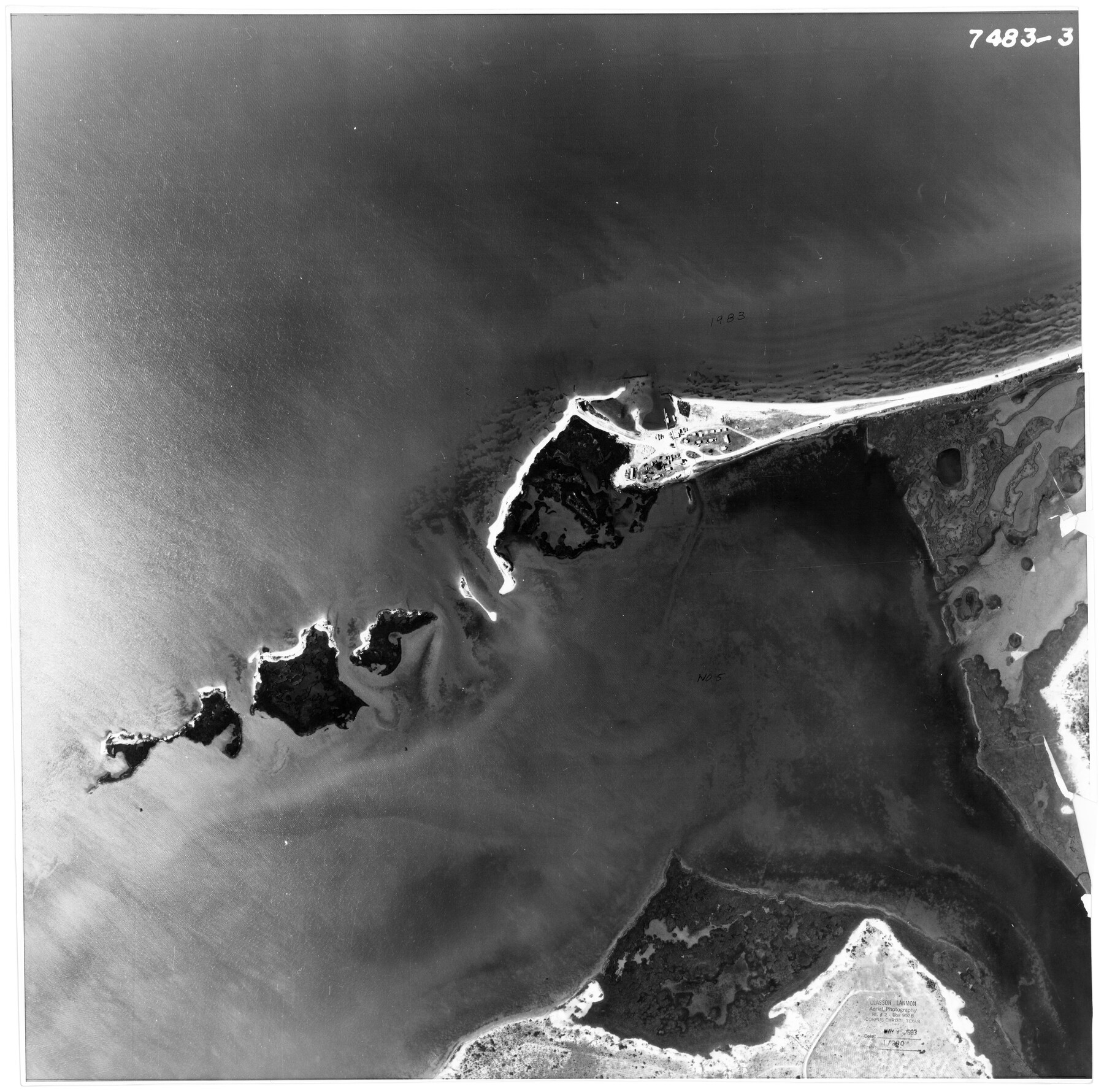
[1983 Aerial photograph of part of A-14 and A-93, northwest of Rockport]
-
Map/Doc
8421
-
Collection
General Map Collection
-
Object Dates
1983 (Creation Date)
10/6/1983 (File Date)
-
Counties
Aransas
-
Subjects
Aerial Photograph Surveying Rolled Sketch
-
Height x Width
32.8 x 33.0 inches
83.3 x 83.8 cm
-
Medium
photograph
-
Comments
See Aransas County Rolled Sketches 27 (5059), 27A (5058), 27B (5057), 27C (5056), 27D (8418), and 27E (8419) for related sketch and other aerial photographs.
Related maps
Aransas County Rolled Sketch 27C

Print $20.00
- Digital $50.00
Aransas County Rolled Sketch 27C
1979
Size 17.3 x 19.3 inches
Map/Doc 5056
Aransas County Rolled Sketch 27B

Print $2.00
- Digital $50.00
Aransas County Rolled Sketch 27B
1958
Size 9.1 x 9.1 inches
Map/Doc 5057
Aransas County Rolled Sketch 27A

Print $2.00
- Digital $50.00
Aransas County Rolled Sketch 27A
1930
Size 8.9 x 7.2 inches
Map/Doc 5058
Aransas County Rolled Sketch 27

Print $20.00
- Digital $50.00
Aransas County Rolled Sketch 27
1983
Size 24.9 x 35.4 inches
Map/Doc 5059
Aransas County Rolled Sketch 27D

Print $20.00
- Digital $50.00
Aransas County Rolled Sketch 27D
1930
Size 40.5 x 40.2 inches
Map/Doc 8418
Aransas County Rolled Sketch 27E

Print $20.00
- Digital $50.00
Aransas County Rolled Sketch 27E
1958
Size 30.2 x 30.9 inches
Map/Doc 8419
Part of: General Map Collection
Duval County Sketch File 35

Print $24.00
- Digital $50.00
Duval County Sketch File 35
Size 14.4 x 8.8 inches
Map/Doc 21359
Flight Mission No. DCL-4C, Frame 146, Kenedy County

Print $20.00
- Digital $50.00
Flight Mission No. DCL-4C, Frame 146, Kenedy County
1943
Size 18.6 x 22.3 inches
Map/Doc 85824
Jack County Sketch File 18a

Print $4.00
- Digital $50.00
Jack County Sketch File 18a
Size 8.0 x 12.8 inches
Map/Doc 27555
Hudspeth County Rolled Sketch 58

Print $20.00
- Digital $50.00
Hudspeth County Rolled Sketch 58
Size 31.4 x 32.6 inches
Map/Doc 6258
Orange County Sketch File 9a

Print $4.00
- Digital $50.00
Orange County Sketch File 9a
1873
Size 8.1 x 7.5 inches
Map/Doc 33313
Henderson County Working Sketch 16

Print $40.00
- Digital $50.00
Henderson County Working Sketch 16
1937
Size 49.9 x 30.9 inches
Map/Doc 66149

Plan of the Battle of Buena-Vista fought February 22nd and 23rd, 1847

Print $20.00
- Digital $50.00
Plan of the Battle of Buena-Vista fought February 22nd and 23rd, 1847
1847
Size 17.6 x 21.6 inches
Map/Doc 95829

Aransas County Rolled Sketch 28

Print $20.00
- Digital $50.00
Aransas County Rolled Sketch 28
1987
Size 24.5 x 30.9 inches
Map/Doc 77496
Right of Way and Track Map, The Missouri, Kansas and Texas Ry. of Texas operated by the Missouri, Kansas and Texas Ry. of Texas, Henrietta Division

Print $40.00
- Digital $50.00
Right of Way and Track Map, The Missouri, Kansas and Texas Ry. of Texas operated by the Missouri, Kansas and Texas Ry. of Texas, Henrietta Division
1918
Size 25.5 x 57.0 inches
Map/Doc 64071
Brazoria County Sketch File 16

Print $16.00
- Digital $50.00
Brazoria County Sketch File 16
1893
Size 9.4 x 4.3 inches
Map/Doc 14981
You may also like

Kinney County Sketch File 23

Print $40.00
- Digital $50.00
Kinney County Sketch File 23
1901
Size 17.6 x 15.3 inches
Map/Doc 29162
Archer County Sketch File 17

Print $4.00
- Digital $50.00
Archer County Sketch File 17
1901
Size 11.3 x 8.6 inches
Map/Doc 13653
Hemphill County Working Sketch 21

Print $40.00
- Digital $50.00
Hemphill County Working Sketch 21
1973
Size 79.0 x 32.6 inches
Map/Doc 66116
Flight Mission No. DAG-21K, Frame 106, Matagorda County

Print $20.00
- Digital $50.00
Flight Mission No. DAG-21K, Frame 106, Matagorda County
1952
Size 18.6 x 22.5 inches
Map/Doc 86434
Travels to the source of the Missouri River and across the American Continent to the Pacific Ocean - Vol. 1

Travels to the source of the Missouri River and across the American Continent to the Pacific Ocean - Vol. 1
1815
Map/Doc 97411
Polk County Sketch File 11

Print $4.00
- Digital $50.00
Polk County Sketch File 11
Size 9.2 x 8.1 inches
Map/Doc 34142
Karnes County Boundary File 5

Print $32.00
- Digital $50.00
Karnes County Boundary File 5
Size 12.7 x 8.2 inches
Map/Doc 55705
Refugio County Sketch File 17a

Print $2.00
- Digital $50.00
Refugio County Sketch File 17a
1916
Size 11.4 x 9.0 inches
Map/Doc 35275
Flight Mission No. DQO-14T, Frame 65, Galveston County

Print $20.00
- Digital $50.00
Flight Mission No. DQO-14T, Frame 65, Galveston County
1958
Size 17.6 x 17.4 inches
Map/Doc 85216
Brewster County Sketch File 39

Print $4.00
- Digital $50.00
Brewster County Sketch File 39
Size 12.8 x 8.9 inches
Map/Doc 16300
Edward K. Warren Subdivision No. 1 Block-W Situated in Bailey, Lamb, Parmer, and Castro Counties, Texas

Print $20.00
- Digital $50.00
Edward K. Warren Subdivision No. 1 Block-W Situated in Bailey, Lamb, Parmer, and Castro Counties, Texas
1913
Size 17.6 x 14.5 inches
Map/Doc 92163