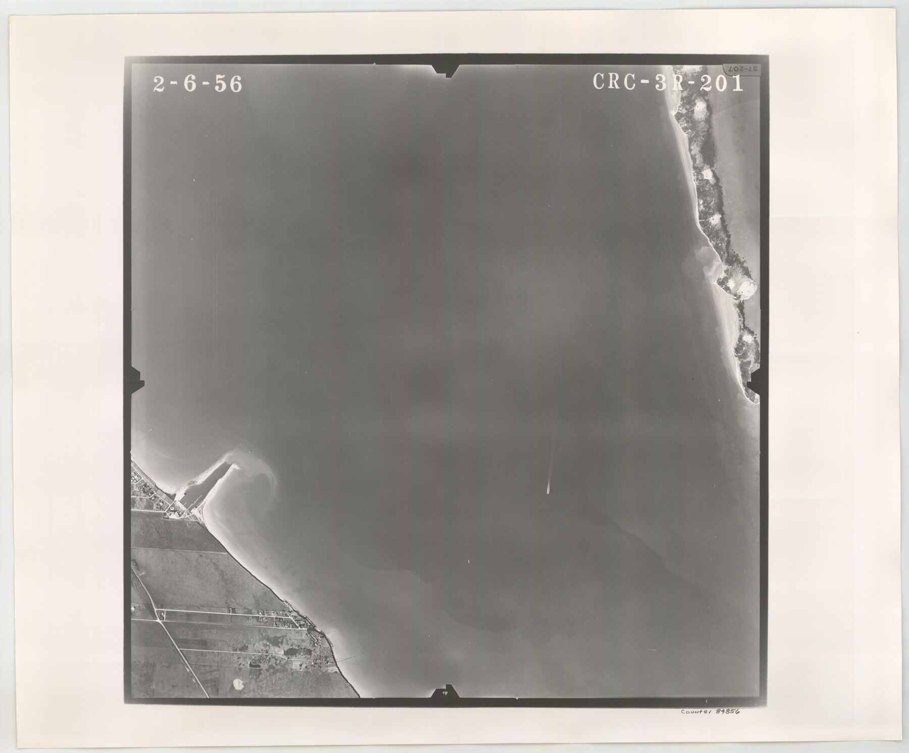
Flight Mission No. CRC-3R, Frame 201, Chambers County
CRC-3R-201
-
Map/Doc
84856
-
Collection
General Map Collection
-
Object Dates
1956/2/6 (Creation Date)
-
People and Organizations
U. S. Department of Agriculture (Publisher)
-
Counties
Chambers
-
Subjects
Aerial Photograph
-
Height x Width
18.6 x 22.4 inches
47.2 x 56.9 cm
-
Comments
Flown by Jack Ammann Photogrammetric Engineers, Inc. of San Antonio, Texas.
Part of: General Map Collection
Bailey County Sketch File 13

Print $40.00
- Digital $50.00
Bailey County Sketch File 13
1912
Size 19.2 x 20.6 inches
Map/Doc 10888
Hidalgo County Working Sketch 4

Print $20.00
- Digital $50.00
Hidalgo County Working Sketch 4
1938
Size 43.1 x 39.6 inches
Map/Doc 66181
Trinity County Sketch File 40

Print $20.00
- Digital $50.00
Trinity County Sketch File 40
1926
Size 16.5 x 21.8 inches
Map/Doc 12494
Connected Map of Austin's Colony (1892 tracing)

Print $40.00
- Digital $50.00
Connected Map of Austin's Colony (1892 tracing)
1837
Size 90.8 x 46.7 inches
Map/Doc 93358
Ward County Working Sketch 52

Print $20.00
- Digital $50.00
Ward County Working Sketch 52
1980
Size 36.3 x 37.0 inches
Map/Doc 72358
Brazos River, Brazos River Sheet 1

Print $20.00
- Digital $50.00
Brazos River, Brazos River Sheet 1
1926
Size 20.7 x 25.3 inches
Map/Doc 69665
Flight Mission No. DIX-5P, Frame 145, Aransas County

Print $20.00
- Digital $50.00
Flight Mission No. DIX-5P, Frame 145, Aransas County
1956
Size 17.8 x 18.1 inches
Map/Doc 83806
Flight Mission No. BRE-1P, Frame 102, Nueces County

Print $20.00
- Digital $50.00
Flight Mission No. BRE-1P, Frame 102, Nueces County
1956
Size 18.5 x 22.4 inches
Map/Doc 86673
Polk County Working Sketch 24

Print $20.00
- Digital $50.00
Polk County Working Sketch 24
1957
Size 24.8 x 25.3 inches
Map/Doc 71640
Kleberg County Sketch File 1

Print $36.00
- Digital $50.00
Kleberg County Sketch File 1
1994
Size 8.8 x 11.3 inches
Map/Doc 29192
Flight Mission No. CRC-3R, Frame 8, Chambers County

Print $20.00
- Digital $50.00
Flight Mission No. CRC-3R, Frame 8, Chambers County
1956
Size 18.6 x 22.2 inches
Map/Doc 84782
Map of Stephens County

Print $20.00
- Digital $50.00
Map of Stephens County
1897
Size 43.2 x 37.6 inches
Map/Doc 16818
You may also like
Jim Hogg County Rolled Sketch EJ

Print $40.00
- Digital $50.00
Jim Hogg County Rolled Sketch EJ
1933
Size 50.7 x 37.0 inches
Map/Doc 9321
Flight Mission No. CLL-1N, Frame 195, Willacy County

Print $20.00
- Digital $50.00
Flight Mission No. CLL-1N, Frame 195, Willacy County
1954
Size 18.5 x 22.3 inches
Map/Doc 87065
Sketch of Bull Pasture

Print $3.00
- Digital $50.00
Sketch of Bull Pasture
Size 9.3 x 12.1 inches
Map/Doc 91450
Topographical Map of the Rio Grande, Sheet No. 5

Print $20.00
- Digital $50.00
Topographical Map of the Rio Grande, Sheet No. 5
1912
Map/Doc 89529
Crosby County Sketch File 27

Print $20.00
- Digital $50.00
Crosby County Sketch File 27
Size 8.8 x 23.0 inches
Map/Doc 11256
Louisiana and Texas Intracoastal Waterway - Sabine River-Galveston Bay Section, Steel Sheet Pile Dyke at Galveston Bay Entrance

Print $20.00
- Digital $50.00
Louisiana and Texas Intracoastal Waterway - Sabine River-Galveston Bay Section, Steel Sheet Pile Dyke at Galveston Bay Entrance
1933
Size 31.4 x 40.9 inches
Map/Doc 61818

Bowie County Rolled Sketch 2

Print $40.00
- Digital $50.00
Bowie County Rolled Sketch 2
Size 37.8 x 51.3 inches
Map/Doc 8454
Liberty County Rolled Sketch N

Print $20.00
- Digital $50.00
Liberty County Rolled Sketch N
1954
Size 45.1 x 39.1 inches
Map/Doc 10721
[Right of Way and Track Map, the Missouri, Kansas and Texas Ry. of Texas - Henrietta Division]
![64757, [Right of Way and Track Map, the Missouri, Kansas and Texas Ry. of Texas - Henrietta Division], General Map Collection](https://historictexasmaps.com/wmedia_w700/maps/64757.tif.jpg)
Print $20.00
- Digital $50.00
[Right of Way and Track Map, the Missouri, Kansas and Texas Ry. of Texas - Henrietta Division]
1918
Size 11.8 x 26.9 inches
Map/Doc 64757
Concho County

Print $20.00
- Digital $50.00
Concho County
1947
Size 46.8 x 36.9 inches
Map/Doc 73115
Stonewall County Sketch File 15a

Print $2.00
- Digital $50.00
Stonewall County Sketch File 15a
Size 7.6 x 12.1 inches
Map/Doc 37265