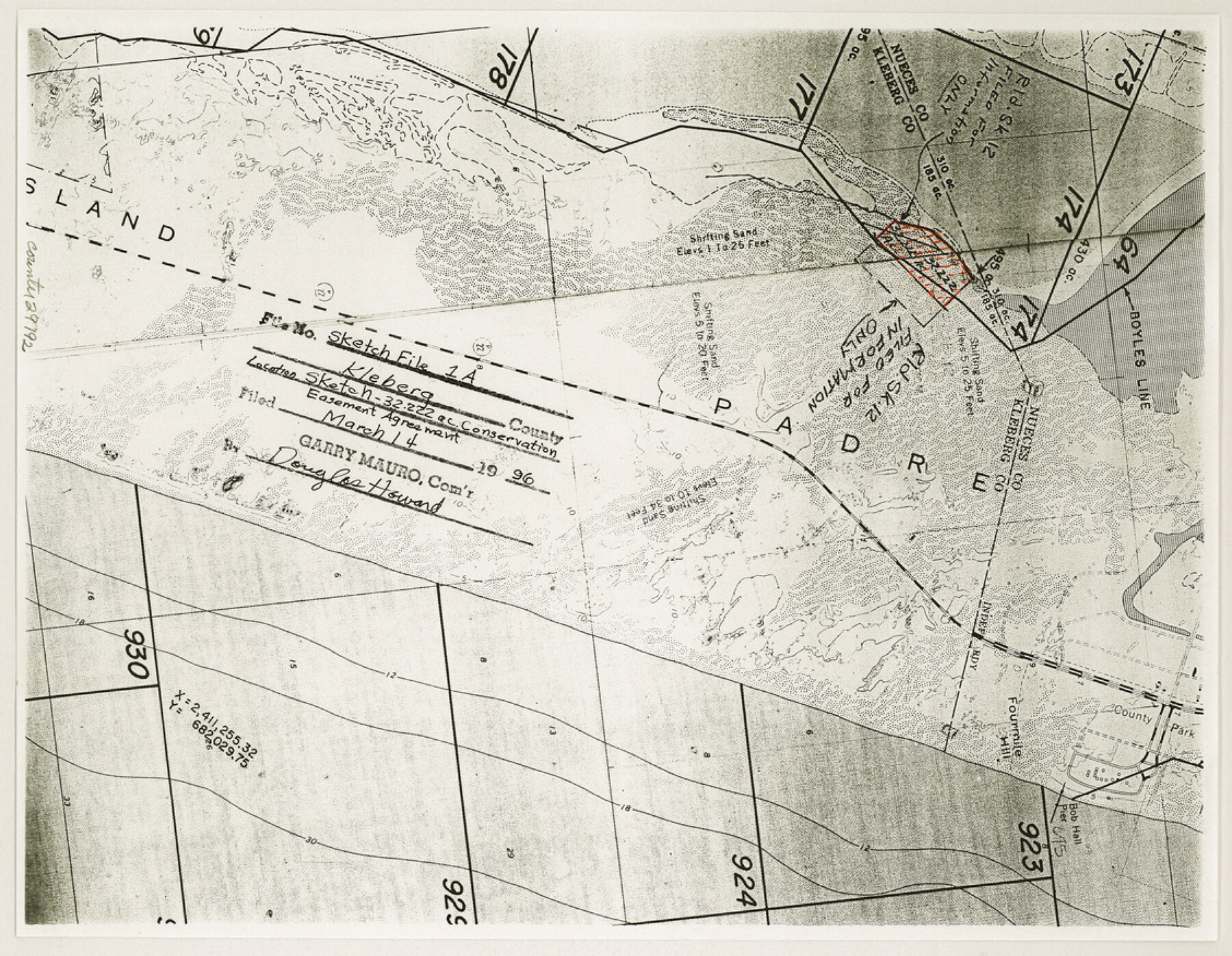
Kleberg County Sketch File 1
[Conservation easement agreement covering 32.222 acres near Kleberg-Nueces County line on bay side of Padre Island]
-
Map/Doc
29192
-
Collection
General Map Collection
-
Object Dates
1994 (Creation Date)
-
Counties
Kleberg Nueces
-
Subjects
Surveying Sketch File
-
Height x Width
8.8 x 11.3 inches
22.4 x 28.7 cm
-
Medium
paper, print
-
Features
Fourmite Hill
County Park
Bob Hall Pier
Laguna Madre
Padre Island
Part of: General Map Collection
Flight Mission No. DQO-8K, Frame 8, Galveston County

Print $20.00
- Digital $50.00
Flight Mission No. DQO-8K, Frame 8, Galveston County
1952
Size 18.8 x 22.5 inches
Map/Doc 85131
Calcasieu Pass to Sabine Pass

Print $20.00
- Digital $50.00
Calcasieu Pass to Sabine Pass
1976
Size 44.6 x 35.3 inches
Map/Doc 69813
Gregg County Sketch File 1C

Print $6.00
- Digital $50.00
Gregg County Sketch File 1C
1847
Size 7.8 x 11.6 inches
Map/Doc 24540
Pecos County Rolled Sketch 28

Print $20.00
- Digital $50.00
Pecos County Rolled Sketch 28
1890
Size 18.9 x 38.5 inches
Map/Doc 7213
Stonewall County Rolled Sketch 29

Print $20.00
- Digital $50.00
Stonewall County Rolled Sketch 29
Size 39.8 x 40.0 inches
Map/Doc 9968
Coleman County Sketch File 24a

Print $6.00
- Digital $50.00
Coleman County Sketch File 24a
1872
Size 10.2 x 15.9 inches
Map/Doc 18708
Howard County Sketch File 1

Print $34.00
- Digital $50.00
Howard County Sketch File 1
1903
Size 8.9 x 8.6 inches
Map/Doc 26839
The Oil and Gas Journal's Oil Map of Texas

Print $20.00
- Digital $50.00
The Oil and Gas Journal's Oil Map of Texas
1938
Size 38.3 x 39.4 inches
Map/Doc 96970
Houston County Sketch File 9

Print $4.00
- Digital $50.00
Houston County Sketch File 9
1857
Size 12.7 x 8.1 inches
Map/Doc 26771
Map of Texas with population and location of principal towns and cities according to latest reliable statistics

Print $20.00
- Digital $50.00
Map of Texas with population and location of principal towns and cities according to latest reliable statistics
1908
Size 19.6 x 21.6 inches
Map/Doc 94068
Flight Mission No. CGI-3N, Frame 147, Cameron County

Print $20.00
- Digital $50.00
Flight Mission No. CGI-3N, Frame 147, Cameron County
1954
Size 18.8 x 22.4 inches
Map/Doc 84620
Kinney County Working Sketch 47

Print $20.00
- Digital $50.00
Kinney County Working Sketch 47
1979
Size 40.5 x 39.1 inches
Map/Doc 70229
You may also like
General Highway Map, Martin County, Texas

Print $20.00
General Highway Map, Martin County, Texas
1961
Size 18.1 x 24.6 inches
Map/Doc 79583
Frio County Rolled Sketch 15

Print $20.00
- Digital $50.00
Frio County Rolled Sketch 15
1949
Size 26.1 x 39.0 inches
Map/Doc 5922
Les costes aux environs de la Riviere de Misisipi decouvertes par M. de la Salle en 1683 et reconnues par M. le Chevallier d'Iberville en 1698 et 1699

Print $20.00
- Digital $50.00
Les costes aux environs de la Riviere de Misisipi decouvertes par M. de la Salle en 1683 et reconnues par M. le Chevallier d'Iberville en 1698 et 1699
1701
Size 10.4 x 14.9 inches
Map/Doc 93756
Bexar County Working Sketch 13

Print $20.00
- Digital $50.00
Bexar County Working Sketch 13
1968
Size 43.5 x 43.7 inches
Map/Doc 67329
Chambers County Sketch File 11

Print $40.00
- Digital $50.00
Chambers County Sketch File 11
Size 13.7 x 12.6 inches
Map/Doc 17554
Panorama of the seat of war - Birds eye view of Texas and part of Mexico

Print $20.00
Panorama of the seat of war - Birds eye view of Texas and part of Mexico
1861
Size 21.6 x 28.9 inches
Map/Doc 93360
General Highway Map. Detail of Cities and Towns in Bexar County, Texas. City Map of San Antonio, Alamo Heights, Olmos Park, Terrell Hills, Castle Hills, Balcones Heights, and vicinity, Bexar County, Texas

Print $20.00
General Highway Map. Detail of Cities and Towns in Bexar County, Texas. City Map of San Antonio, Alamo Heights, Olmos Park, Terrell Hills, Castle Hills, Balcones Heights, and vicinity, Bexar County, Texas
1961
Size 25.1 x 18.2 inches
Map/Doc 79372
Pecos County Working Sketch 47

Print $20.00
- Digital $50.00
Pecos County Working Sketch 47
1947
Size 19.2 x 21.9 inches
Map/Doc 71519
Map of Briscoe County

Print $20.00
- Digital $50.00
Map of Briscoe County
1885
Size 24.4 x 20.1 inches
Map/Doc 3334
Kent County Working Sketch 10

Print $20.00
- Digital $50.00
Kent County Working Sketch 10
Size 34.1 x 43.0 inches
Map/Doc 70017
Carter Estate, North Half 77, Block A, Lubbock County

Print $20.00
- Digital $50.00
Carter Estate, North Half 77, Block A, Lubbock County
1941
Size 9.8 x 18.4 inches
Map/Doc 92751
Howard County Rolled Sketch 5

Print $20.00
- Digital $50.00
Howard County Rolled Sketch 5
Size 19.6 x 16.5 inches
Map/Doc 6234